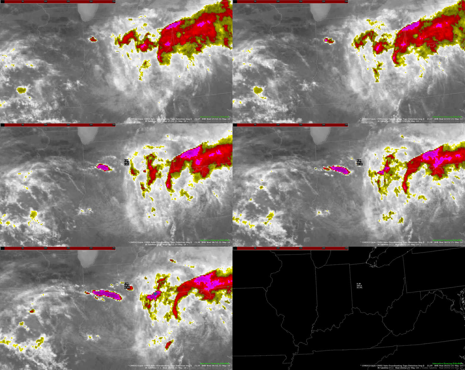
Below, I overlaid IR satellite with the NSSL-WRF simulated IR imagery and there seems to be a spatial difference in the placement of the building convection across central Indiana. If you adjust for this, the product is otherwise trustworthy and allows for me to gain confidence in using it for forecasting in the near-term. With that being said and given the environment, it appears that these smaller clusters of storms will coagulate into an overall larger, mutlicellular convective event that will continue to drop south and east throughout the afternoon/evening.
Prob. Severe Today
To tornado warn or not, using MRMS rotation tracks to help
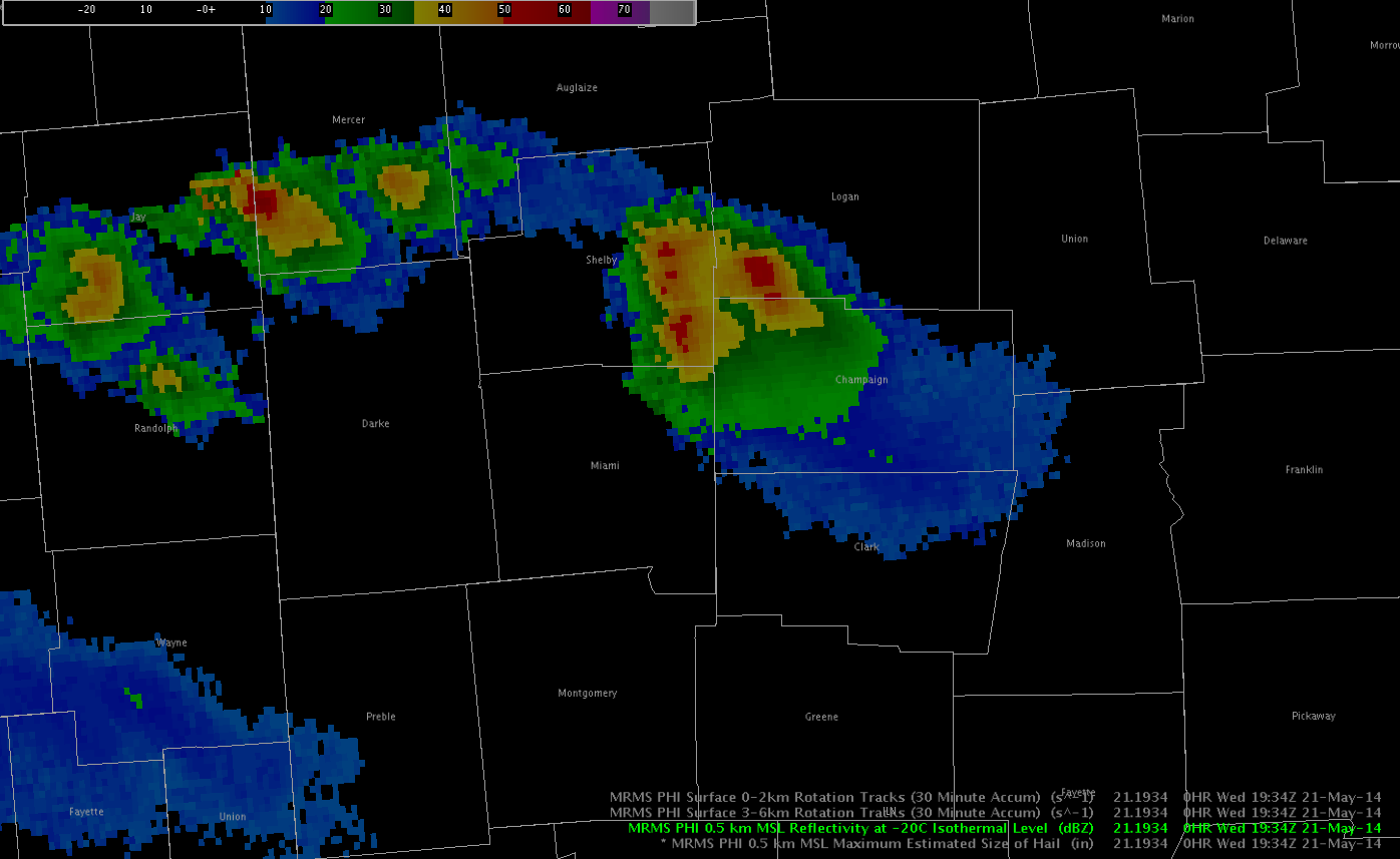
Storm in Champaign County OH gained supercelluar structure and showed signs of low level rotation on velocity. However, I kept the warning as a severe warning because MRMS low level rotation tracks never seemed to indicate strong low level rotation (at least as of 2010Z). I wrote up tornado warning text when area of interest was north of the town of St. Paris but had yet to issue the TOR. 
Meteogram Tracking Want
I was using the Tracking Tool Meteogram and it was very useful to track the changes in the lightning density and jumps, but when i closed out of the tool by clicking on the X it didn’t take away the rings. It would be nice if you excited out of the tool it also removed the Tracking Meteogram circles from the panel as well.
-JB
How’s the overshooting top detecting doing?
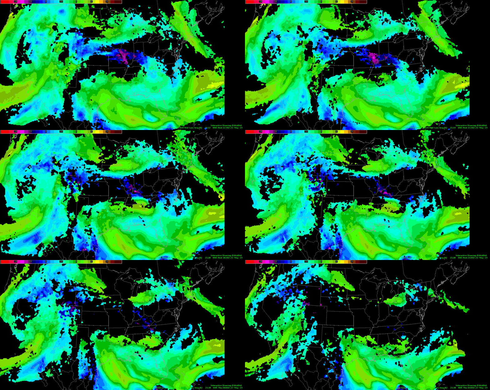
I was looking at the NearCast Theta E Diff Mid-Low and unfortunately there was a lot of black on this map in the area where I am looking for the potential for convection. I was able to go back in time and see more data and based on the movement I would say that the area on instability is moving in the same area of the convection so the environment is good to sustain the storms that have formed in Indiana. However, I wish we could have more data instead of the blank areas because I never like to assume things. One thing we discussed is using model data that is contoured to fill in the blanks and I do like that idea. ~Vollmar
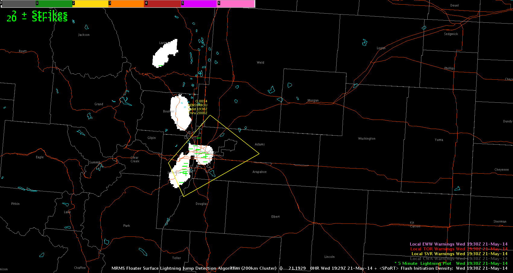
First Warning of the day. Using lightning Products.
The first warning of the day based on the surface lightning jump detection algorithm
Effectively, looking at the sigma increase 3 to 4 was a reason for the warning decision along with the fact that the environment is favourable. . We got 1 inch hail just after the warning went out. LEAD TIME!
Grant H.
3..2..1..INITIATION – EWP Operations Update – Wednesday 5/21 – 2:10pm
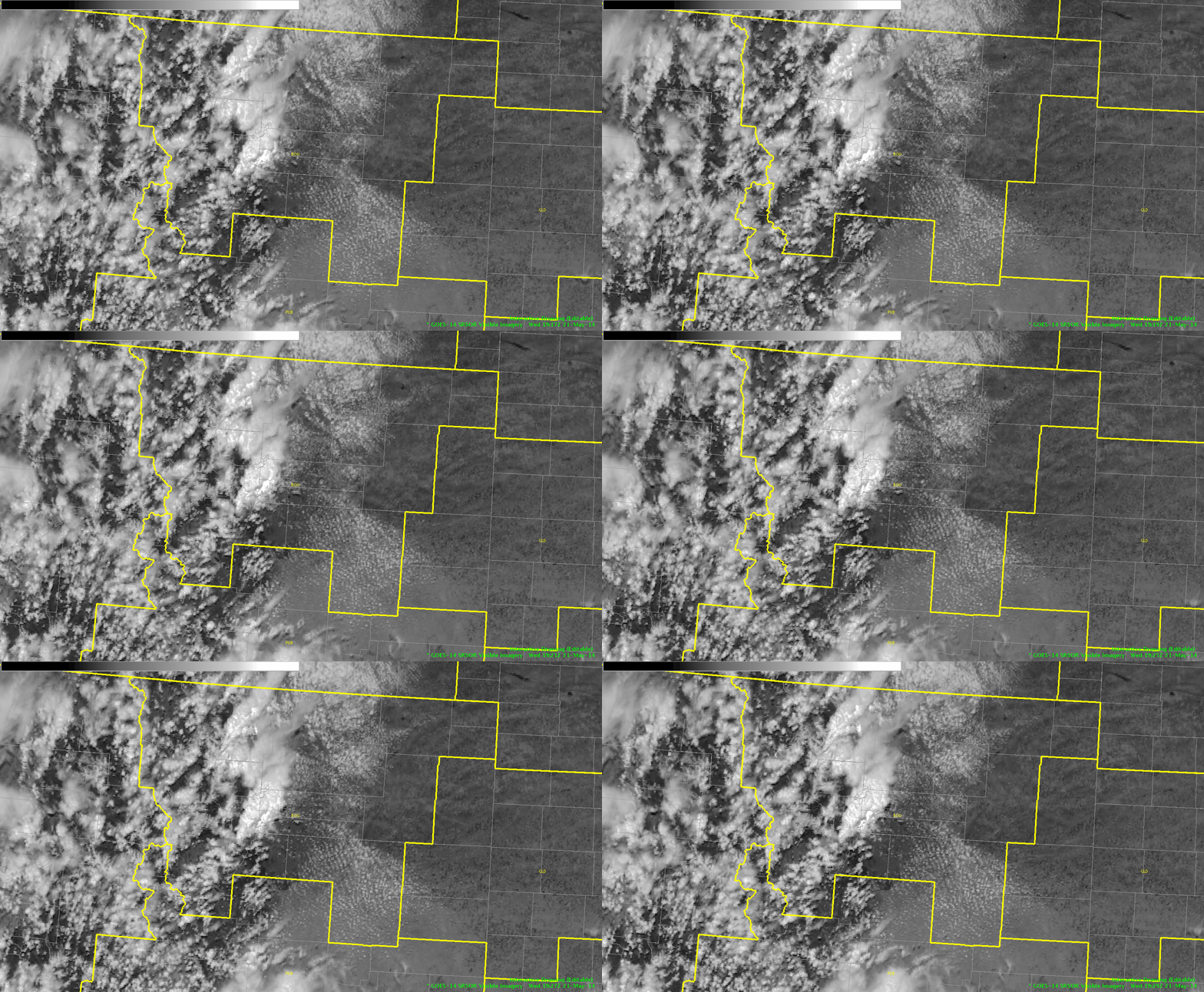
We were greeted post-EFP briefing with an explosion of development across across the Ohio Valley and out west in Colorado. Forecasters were quickly allocated to work out of the Indianapolis, IN (IND) to diagnose the rapidly developing cumulus field from Montgomery Country westward.

Our second team is working out of the Boulder/Denver, CO (BOU) CWA diagnosing the rapidly developing convection from N/S near the Front Range Mountains.

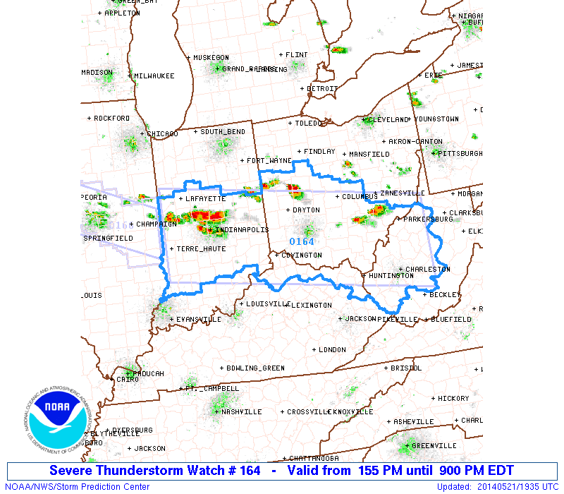
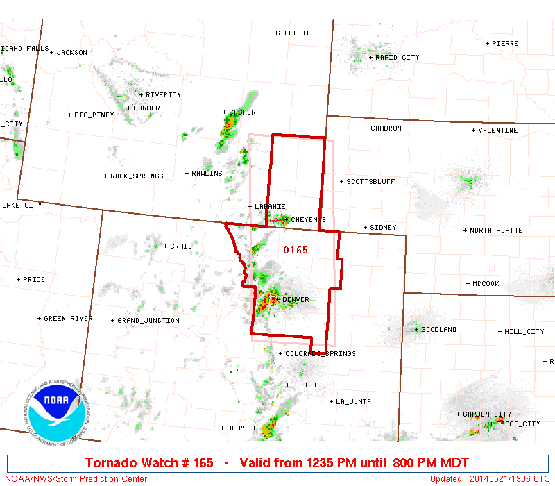
With a Severe Thunderstorm Watch issued for the Ohio Valley and a Tornado Watch issued in CO/WY region until 9pm, it looks like a busy afternoon ahead.


-Darrel Kingfield
EWP Week 3 Coordinator
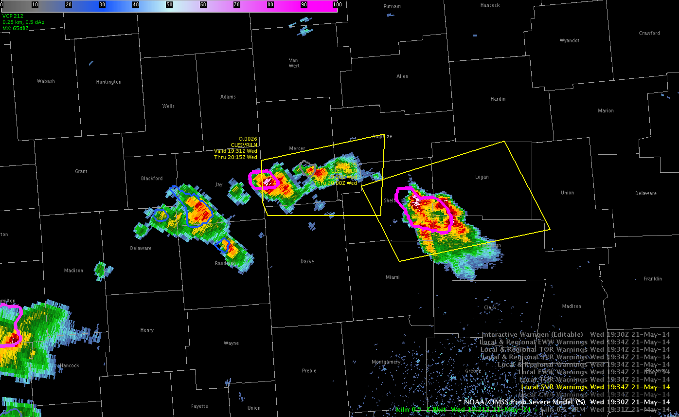
PROB-SVR and MRMS Products in Western Ohio
Two early severe thunderstorm warnings have been issued based on MEHS, Reflectivity Above -20C, and Probability of Severe Products. MEHS increased rapidly with each storm increasing confidence that storm was rapidly developing. Used previous analysis of LAPS information to increase confidence that storms in this area could be supercellular.
– JRM
Convection Initiating Across N. IND
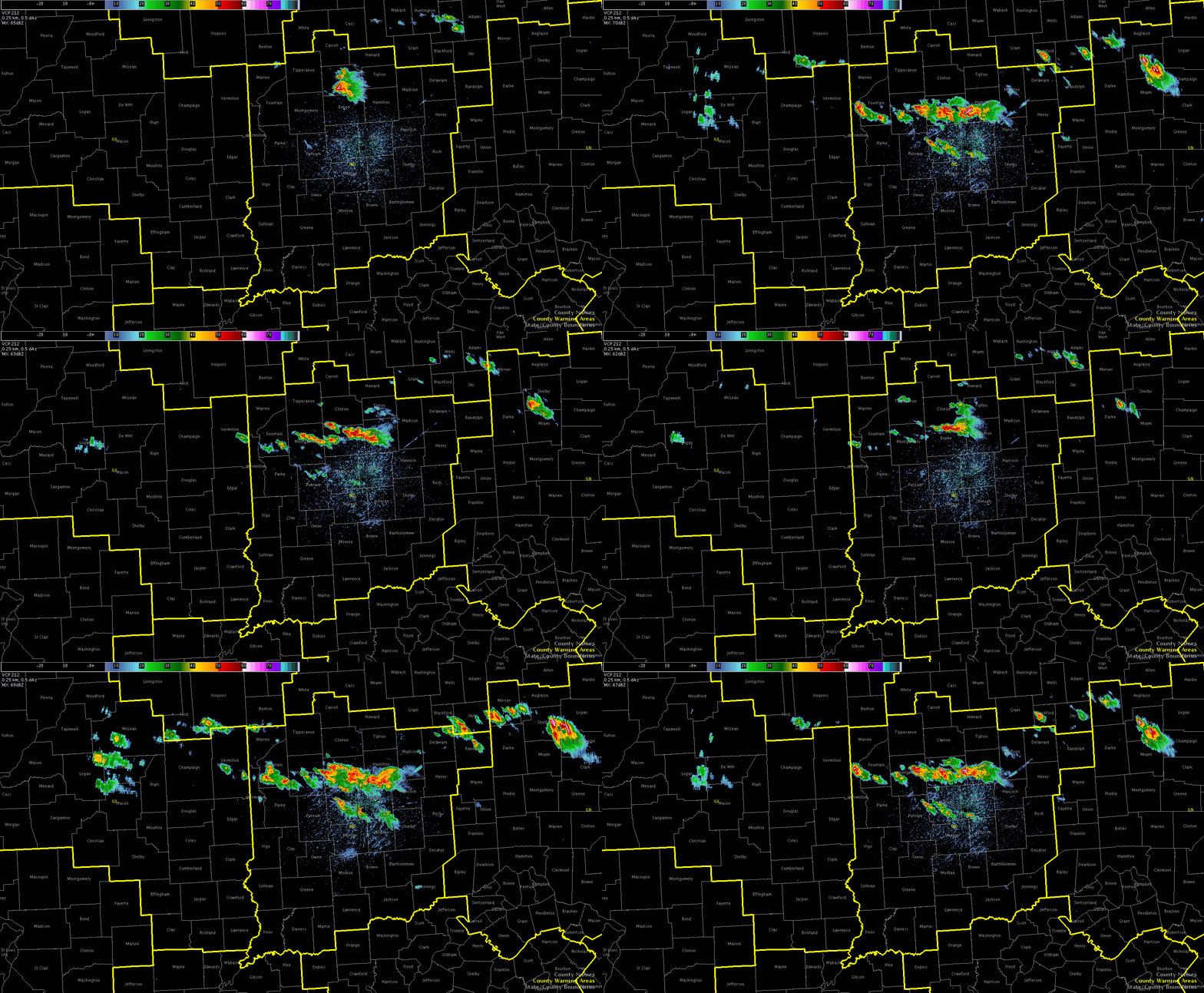
The convective initiation product is performing much better today as compared to what I was looking at yesterday. At 1815Z, 50% probs began to appear across the northern portions of IND’s CWA with a 60% area appearing at the intersection of the LOT/IWX/IND CWAs. At 1825Z & 1830Z, 70% CI probs had appeared just to the west of the supercell that was already underway and by 1837Z, the probabilities maxed out over 90%. Check out the loop below.
In the next still image, I outlined the area that my partner and I are watching this afternoon, which matches exactly with where the CI product is highlighting (1837Z).
Below is a KIND radar loop between 1832Z and 1910Z, again outlining where convection is firing up across the northern CWA.