AzShear catches eye better than a velocity feature early on in tornado life

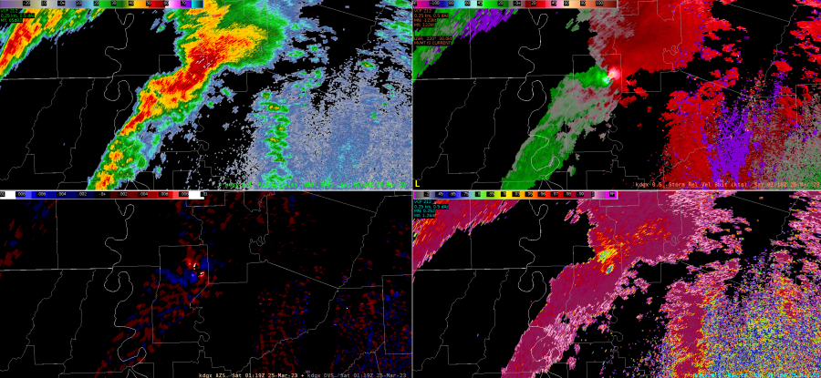
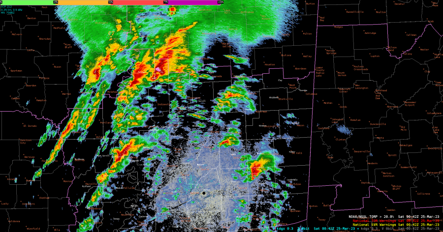
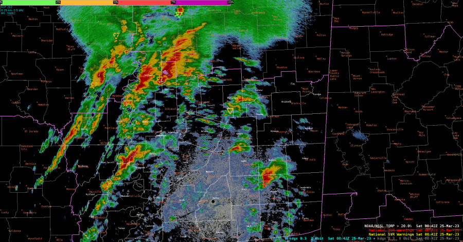
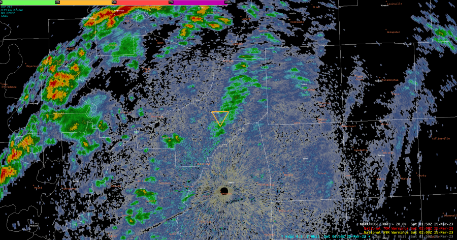
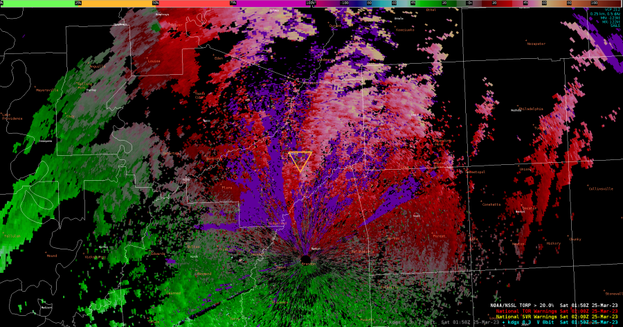
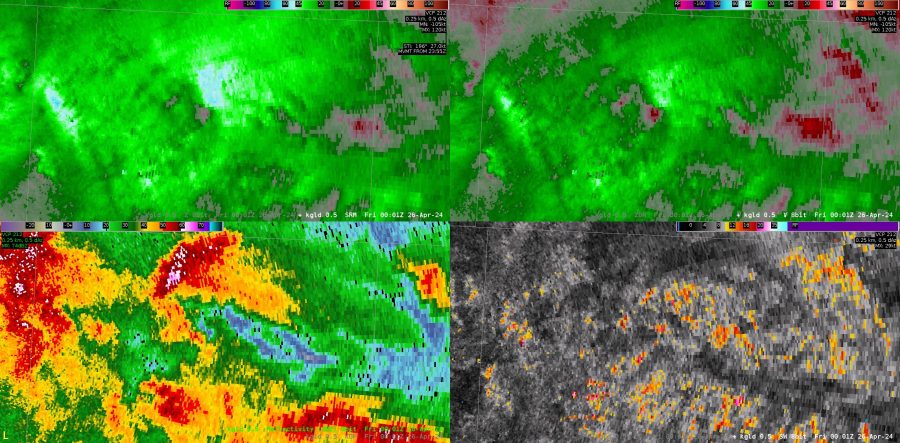
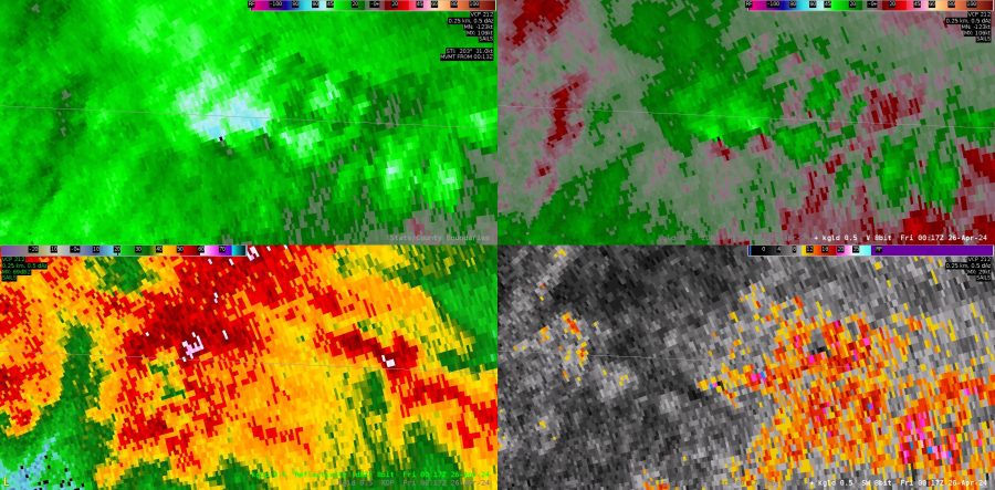
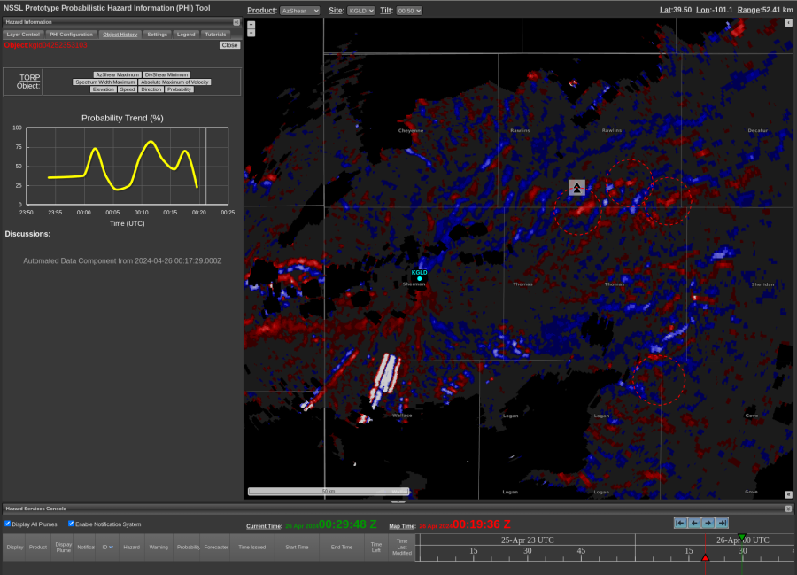
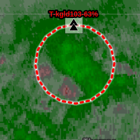
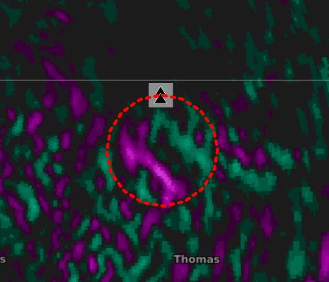
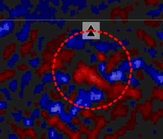
First thing I realized when analyzing AzShear side bye side with Velocity is that the AzShear feature catches the eye much better than a weaker rotation signature in Velocity. Here is an example: 
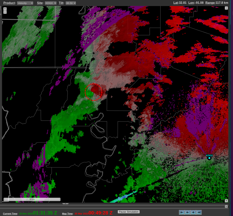
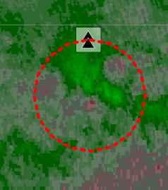
If a forecaster was looking at a lot of activity going on around the CWA, a weaker velocity signature can be missed, but AzShear jumps out with the high (white) values. This circulation went on to strengthen quickly and to me the AzShear did a better job at showing that earlier in the tornadoes life.


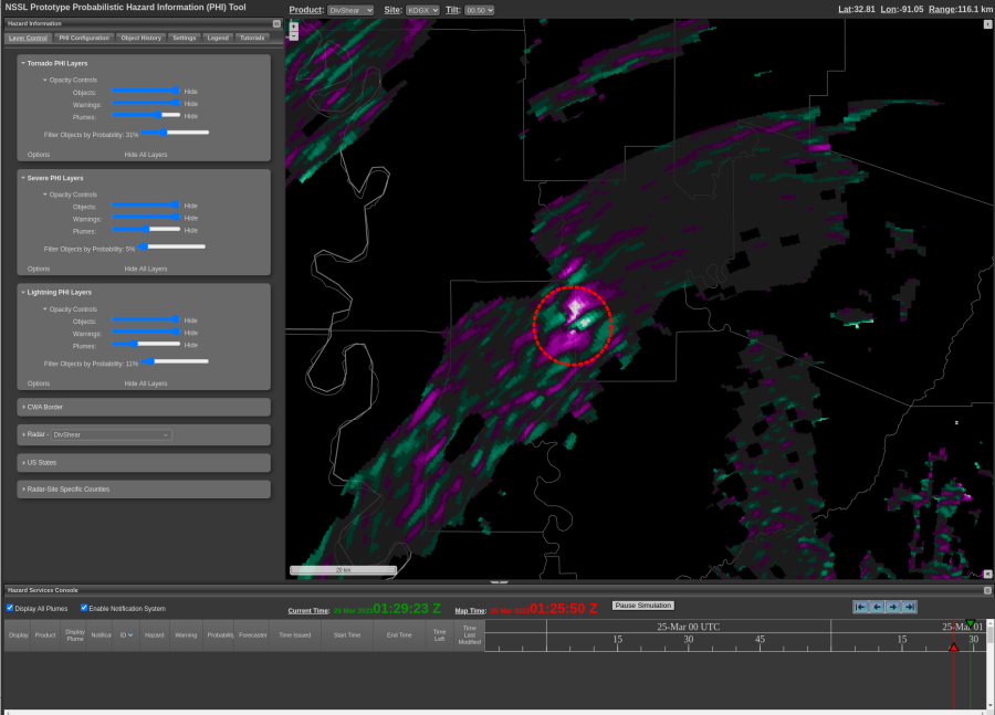
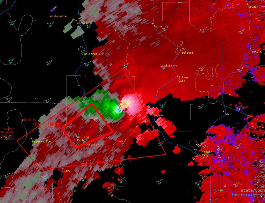
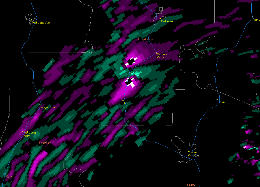
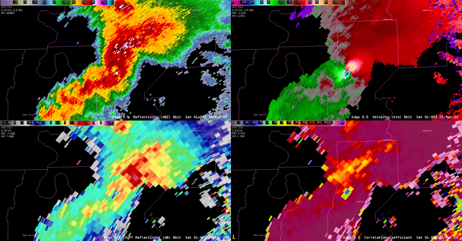
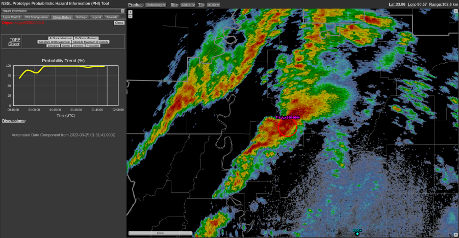
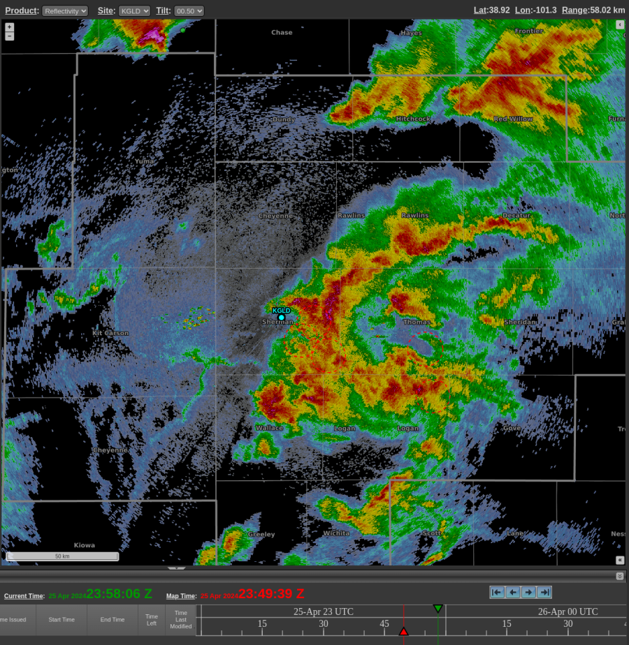
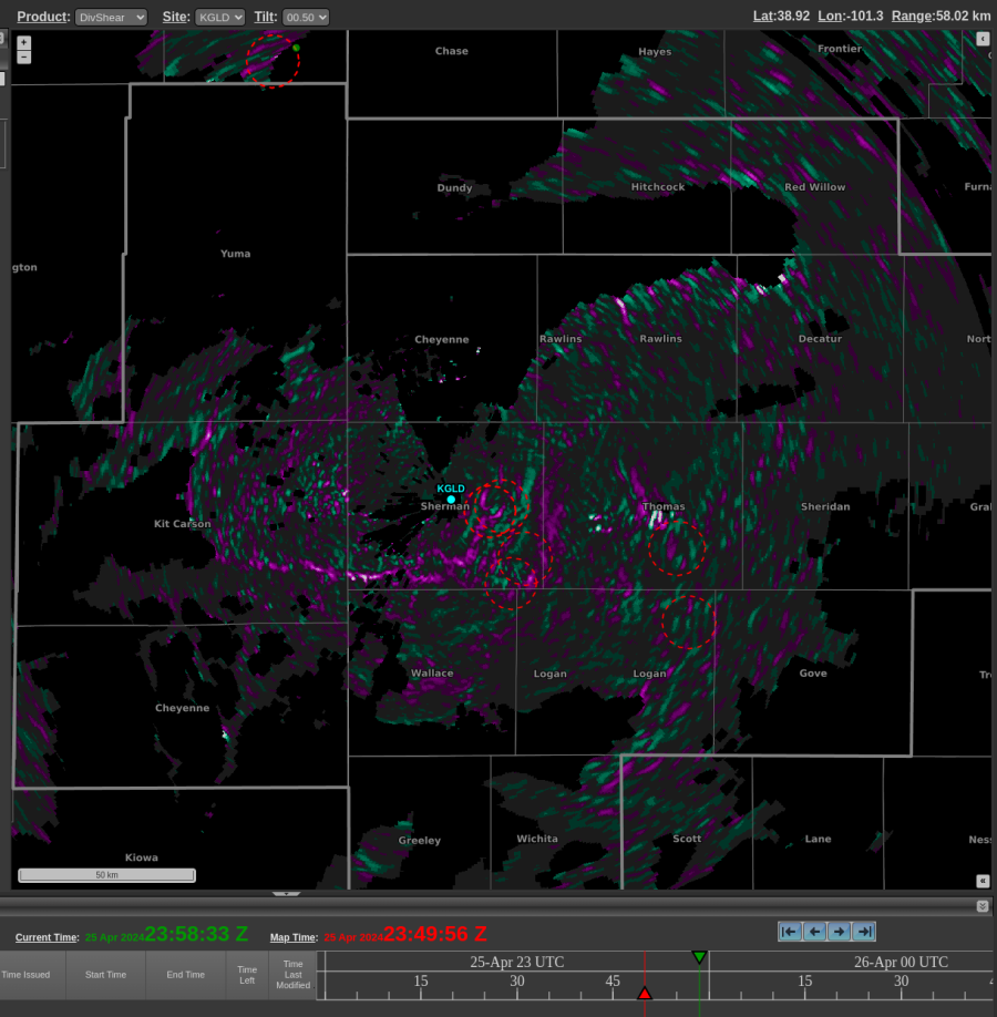
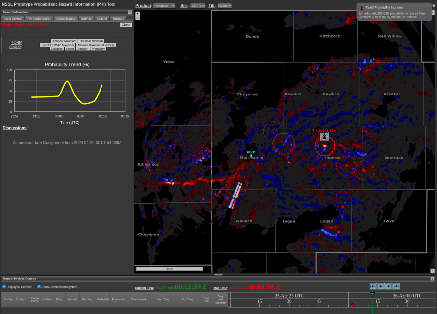
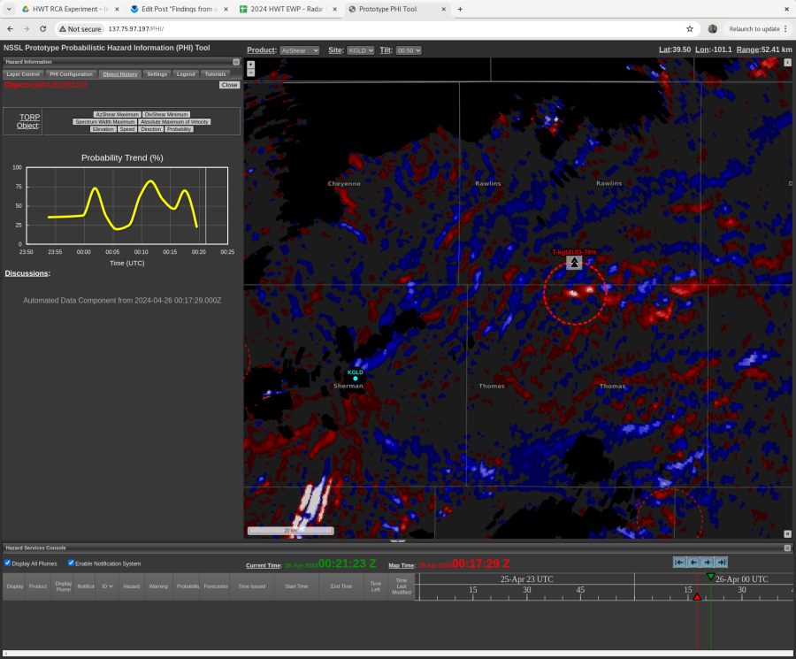
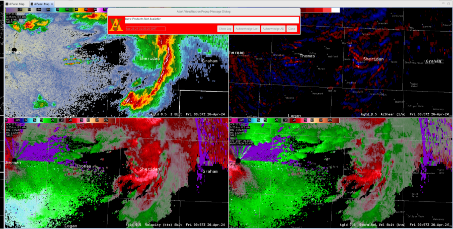
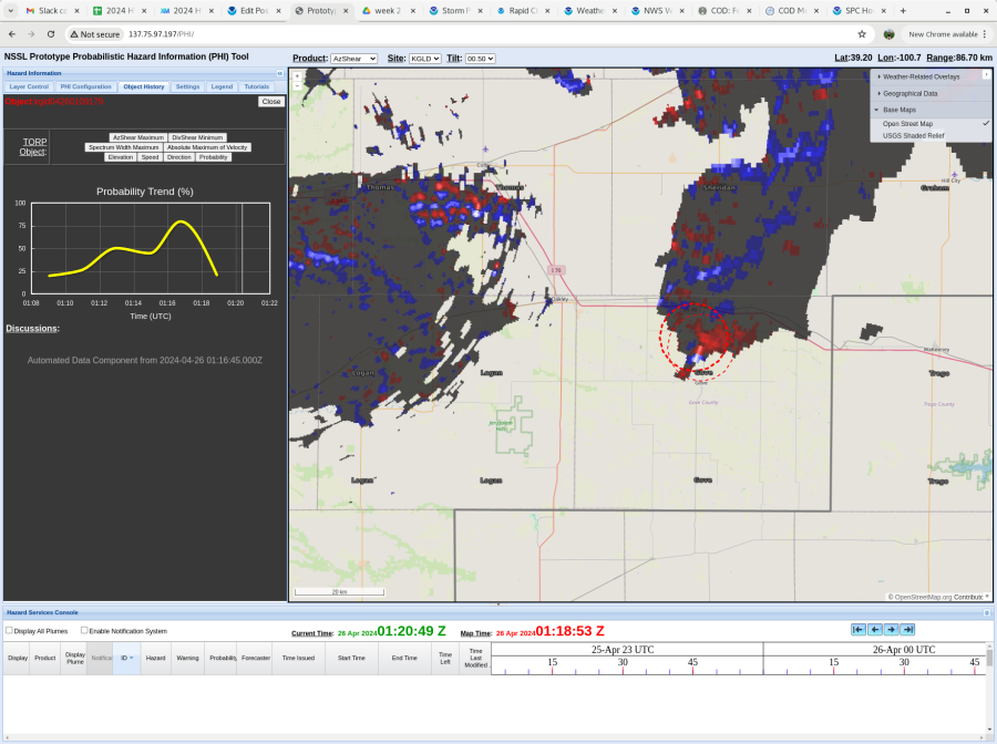
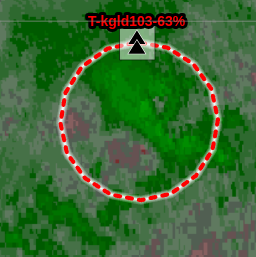
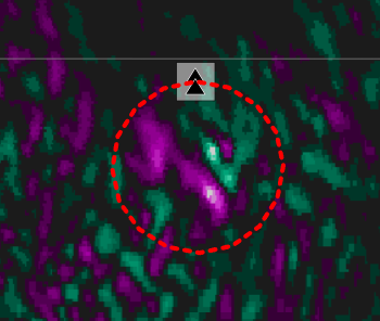
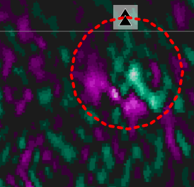
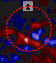
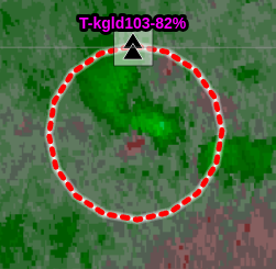
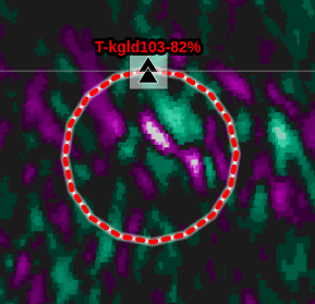
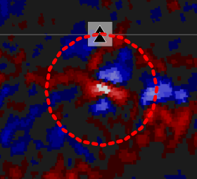
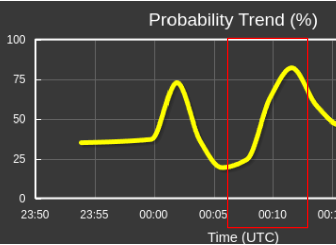
Another example, also involving TORP: Focusing on the weaker circulation in the following images, which is outlined by the TORP circle that is farther southwest. 0.5 Velocity again shows a weaker rotation that could be overlooked. That same scan though, AzShear is lit up along with TORP of 48%. This allowed me to look closer at that feature and I found a weak echo region and a higher reflectivity core aloft. Once again showing AzShear and TORP are good for situational awareness.
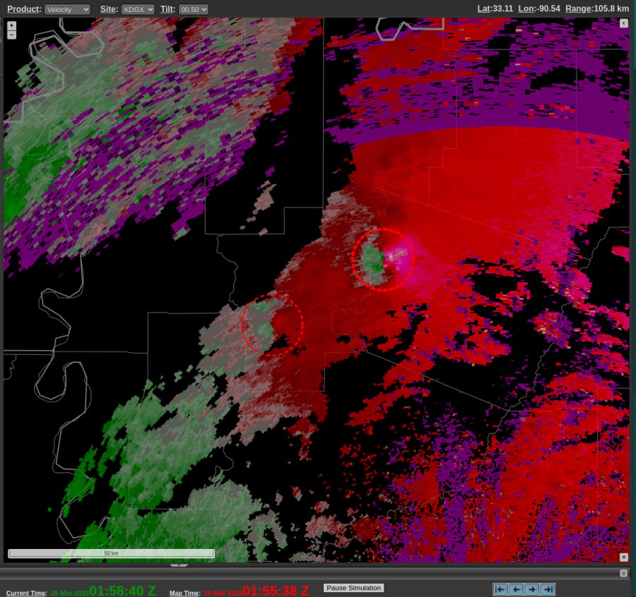
-Gary

Tags: None

AZ Shear imagery

So far, I am finding this tool very helpful. However, I am wondering where I will put this on my typical setup. Add it to my 9 panel? Or make a whole new procedure? I think it may be repetitive to flip across procedures when I have SRM, ZDR, etc suggesting a TOR. Not sure it would be helpful enough to make a whole new procedure for.

Interested to see how it handles weaker tornadoes as well.

Tags: None

First Impressions of TORP, AzShear, and DivShear

Right off the bat, I notice that the icons for TORP, even when loaded with maximum line thickness, can easily get lost if the brightness of your loaded radar reflectivity is too high (top image below). By reducing the brightness to 75%, the TORP icons became more noticeable (bottom image below).


It was reassuring to see TORP perform well with the knockout cases. I would have been concerned if it missed a tornado signature this prominent. This increased my confidence in using it at the very least as a situational awareness tool. An example below:

It’s evident that TORP maintained very high probabilities the entire track of this confirmed violent tornado (>99%).

However, the limitations were still glaringly apparent at times, with a >20% probability for a tornado being shown in an area of noise (below)

– Mr. Peanut


Tags: None

Using PHS to analyze an area of surface based convective potential

The potential for surface based convection will be important for the severe weather coverage in the CYS CWA this afternoon/evening. The 19Z PHS model is forecasting a northwesterly push of instability which is depicted above in the left panel moving into the far southwest counties of the CWA. To the north of that instability axis the PHS is depicting still elevated convection that is going on this afternoon. Additionally it is depicting surface based convection in northern Colorado, which may impact the moisture feed further north into the CYS CWA. I would highlight the far southeastern portion of the CYS CWA for a severe thunderstorm potential in my DSS/public messaging, with more uncertainty further north.

-Joaq
Tags: None

Findings from a Real-Time Product Evaluation over GLD CWA

Here are some interesting examples from the perspective of northwest KS on April 25, 2024. This first example shows two boundaries southwest of the radar. The east-west oriented boundary shows up in DivShear, while the SW-NE oriented boundary does not really show up in DivShear. Radar velocity (not pictured) was showing 50-70 knots north of the northern boundary, while the velocity was not as strong on either side of the SW-NE oriented boundary.

A reflectivity plot at 2349z on Apr 25, 2024.
A DivShear plot from 2349z at 25 Apr, 2024.

This circulation spun up quickly, but the TORP probs seemed to respond in kind, showing a sharp increase to near 70%. The circulation weakened briefly in subsequent scans (not pictured) before tightening again. A storm chaser reported there was “almost a tornado touchdown” north of Colby, KS around 0015z. Mesoanalysis (not pictured) seemed to suggest that this storm may have been north of a boundary, and perhaps lacked sufficient low-level instability for tornadogenesis.

An AWIPS 4-Panel with SRM, V, Z, and SW at 0001z on Apr 26, 2024.
AzShear plot at 0001z on Apr 26 2024

At 0017z, there appeared to be two circulations – shown below in both velocity products and AzShear:

AWIPS 4-Panel at 0017z on Apr 26 2024
AzShear Plot at 0017z on Apr 26 2024

Here is an example that caught my eye where beam blockage was significantly impacting the velocity field (not pictured) and resulting in sharp columns of alternating AzShear minima/maxima. However, TORP was NOT creating detections along these areas, even after turning off all of the auto filters.

AzShear plot at 0019z on Apr 26 2024.

Here is a look at how the DivShear field appeared along a line of storms which had a tightening reflectivity gradient. Images were from 0057z on Apr 26 2024:

AWIPS 4 Panel with Z, AzShear, V and SRM.
DivShear plot at the same time as the AWIPS 4-Panel pictured above.

-Orange Lightning

Tags: None

Did Torp Have a False Alarm?

At 0005 UTC a weak velocity signature was evident on base velocity and DivShear showed a convergent signal.

Two minutes later at 0007 UTC, the velocity looked a little better but remained weak while the DivShear began showing a much better signal while AzShear began showing a signal but not as strong as the DivShear.


Another two minutes later at 0009 UTC, a weak velocity couplet developed while DivShear was beginning to develop that “cloverleaf” look and AzShear continued to increase.


By 0011 UTC, a stronger velocity couplet was evident with near gate to gate values, and both DivShear and AzShear showed very nice signatures. These are all factors indicating the potential for tornadic development and the AzShear and to a greater degree DivShear (picking up on the development a bit earlier) did a good job in this example despite relatively weak velocity couplet.


The Torp during this time frame also showed a significant increase from below 25% to up to 82% during this 5 min period.


Given all of this information, one would feel pretty confident in going with a tornado warning with the DivShear and AzShear products adding confidence. However, looking at the environment, a backdoor cold front pushed southeastward through this area about an hour earlier and surface temps dropped into the 50s with northeast winds stabilized the near surface layer and prevented anything from happening with this storm, although there was a storm report mentioning an almost tornado touchdown in this area.  So this brings the question about whether this was a Torp false alarm or not. It appeared to work as expected and likely would have been correct if the front hadn’t moved through.  It does give confidence that these new products bring value to the warning forecaster and would be beneficial to operations.

Flash

Tags: None