
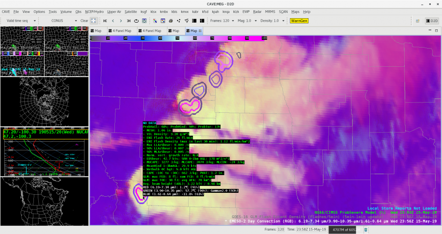
Tight couplet on cell in NE Oklahoma but significantly displaced AzShear bullseye. This resulted in a misplaced MDA algorithm detection as well.
CPTI performed well with a 26% of a strong tornado. -Atlanta Braves
Official websites use .gov
A
.gov website belongs to an official government
organization in the United States.
Secure .gov websites use HTTPS
A
lock (
) or https:// means you’ve safely connected to
the .gov website. Share sensitive information only on official,
secure websites.

Tight couplet on cell in NE Oklahoma but significantly displaced AzShear bullseye. This resulted in a misplaced MDA algorithm detection as well.
CPTI performed well with a 26% of a strong tornado. -Atlanta Braves
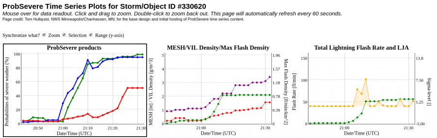
There were 2 adjacent supercells heading into the Tulsa CWA and ProbSevere kept them as separate objects (correctly) despite their proximity. This is a great sign. Additionally, the ProbTor product effectively differentiated between a tight couplet (north, 70% ProbTor) and a weaker couplet (south, 34% ProbTor).
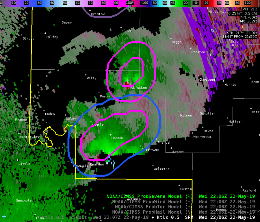
This case shows the ability of ProbSevere to differentiate storms with distinct features despite close proximity. It also shows that ProbTor is doing what we think it should based on velocity features. -Atlanta Braves
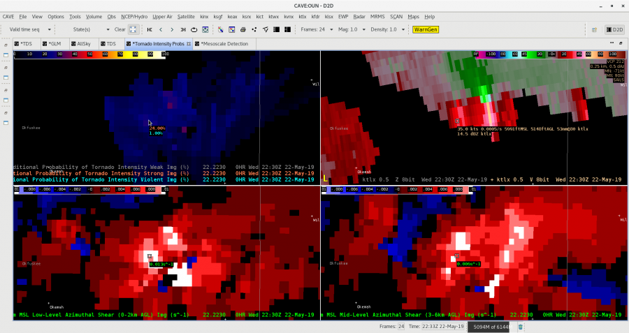
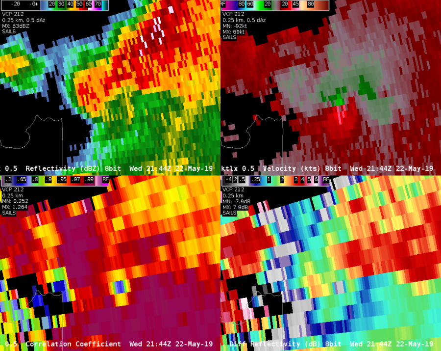
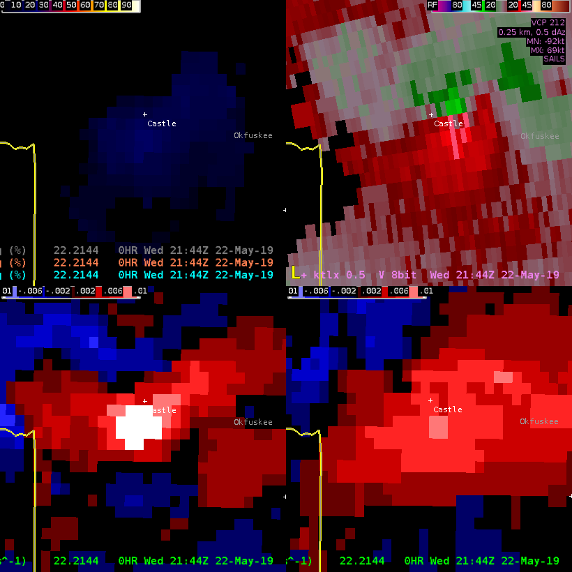
A tornado produced a TDS in the SW part of the Tulsa WFO CWA at 21:44Z. Maximum TDS height was ~6kft.
The CPTI adequately represented an increase chance of a strong tornado (18-20%, top left).
It appears this CPTI did not have the same issues with effective STP like yesterday’s St. Louis tornado did. I like this product a lot! -Atlanta Braves
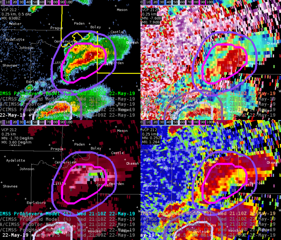
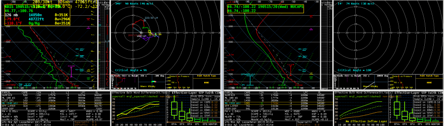
The new MDA seems to be missing out an area of obvious rotation in central OK Wednesday afternoon. The new MDA (upper right) has no storm ID on the couplet, but the digital MDA (bottom right) has correctly identified the mesocyclone. The problems may be due to quality control within new MDA, as the rotation is occurring within an area of low reflectivity (upper left) and high spectrum width.

Dave Grohl
The best storm so far went up in the far NE part of the OUN CWA and the ProbSevere model handled it well:
Note the lightning jump that occurs shortly after 21Z as well.
This is a nice supercell case! -Atlanta Braves
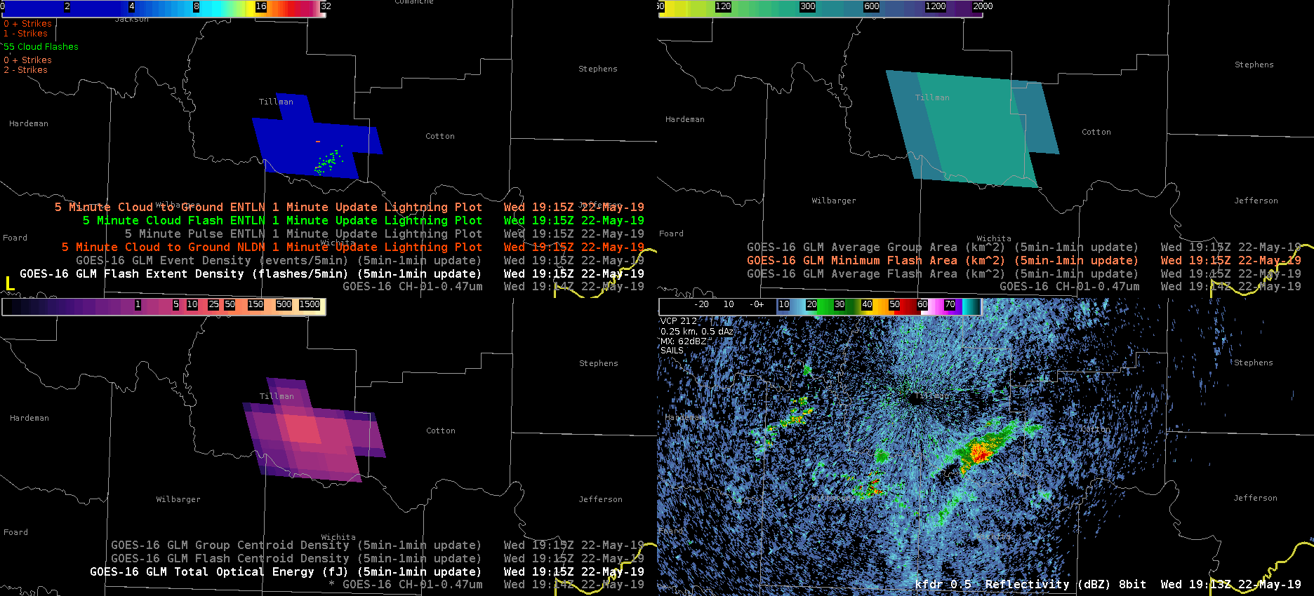
The first CI of the day occurred just after 19Z. The radar appearance of the storm remains healthy and the ground-based lightning networks are as strong as they’ve been, but the GLM strength has (erroneously) dropped off dramatically.
-Atlanta Braves
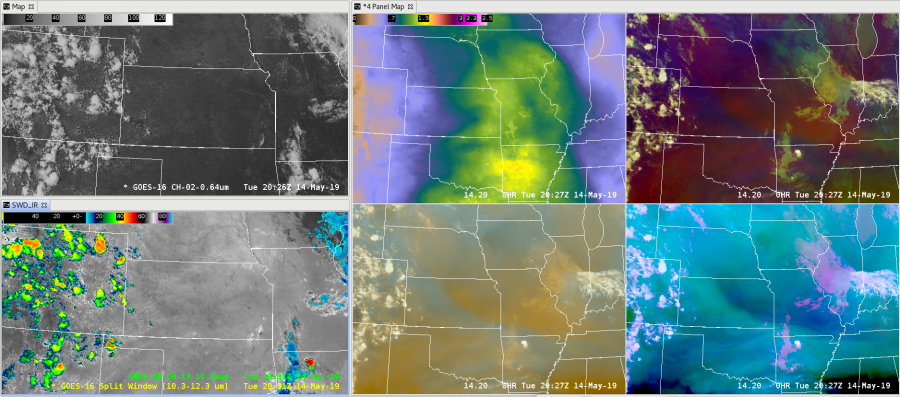
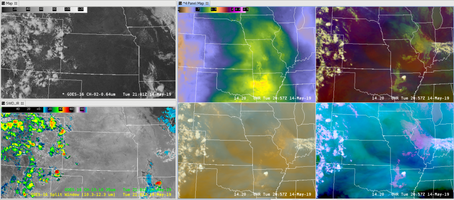
The AllSky Layer Precipitable Water clearly shows the moisture return this morning into southern Texas and Central Oklahoma. PWATs across the Red River were ~0.5 inches early this morning and have now increased to ~1.5 inches this afternoon.
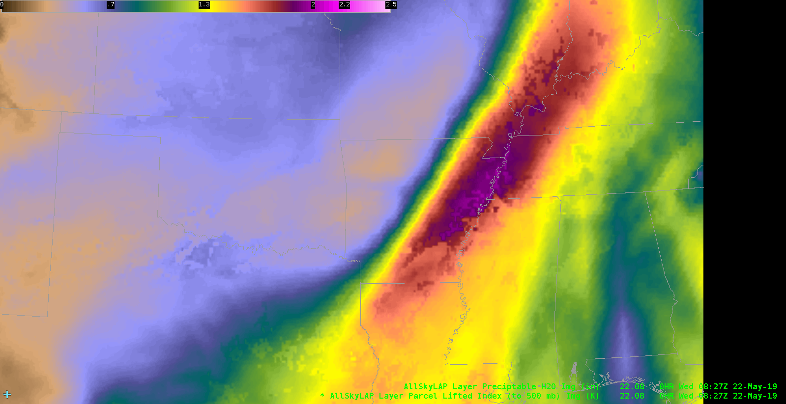
This product is a great situational awareness tool to survey the pre-storm environment. -Atlanta Braves
Trying to see how well AllSkyLAP Precipitable Water (upper middle pane) responds to subtle changes in low level moisture. The lower left is Split Window Difference (SWD) and upper left is visible imagery as a sanity check for no cloud cover. Also have airmass RGB (upper right) and differential WV RGB (bottom center) for comparison.
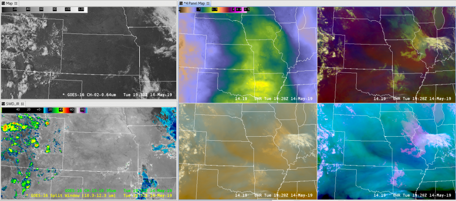
Note some slight darkening over KS possibly associated with some deeper subsidence seen on the diff W/V RGB.
Mid afternoon into early evening saw a bretty good bloom of supercells along a SSW-NNE Cold Fronf in North Dakota…
 Thru the period the SVRProb and SVRtor seemed to regularly over warn during this outbreak, BUT SVRHail was spot on, a little False Alarm-y, but it sure didn’t miss the Large Hail reports, with %s >90 both instances. The RGB Day Convection GOES product seemed to respond pretty well with the hail instances as well.
Afternoon NUCAPS over forecast the CAPEs by ~ 500, PW by 0.2″, did well with the Downrush temp and DCAPE tho.
This post will ask more questions than make assertions 🙂 We currently see evidence of a weak above anvil cirrus plume (AACP) based on the GOES-16 Sandwich RGB (upper left) and CH02 visible (upper right). Total Optical Energy from GOES-16 (GOES-17) is plotted on the lower left (right). For reference, three of the four frames have 5 minute ENTLN data.
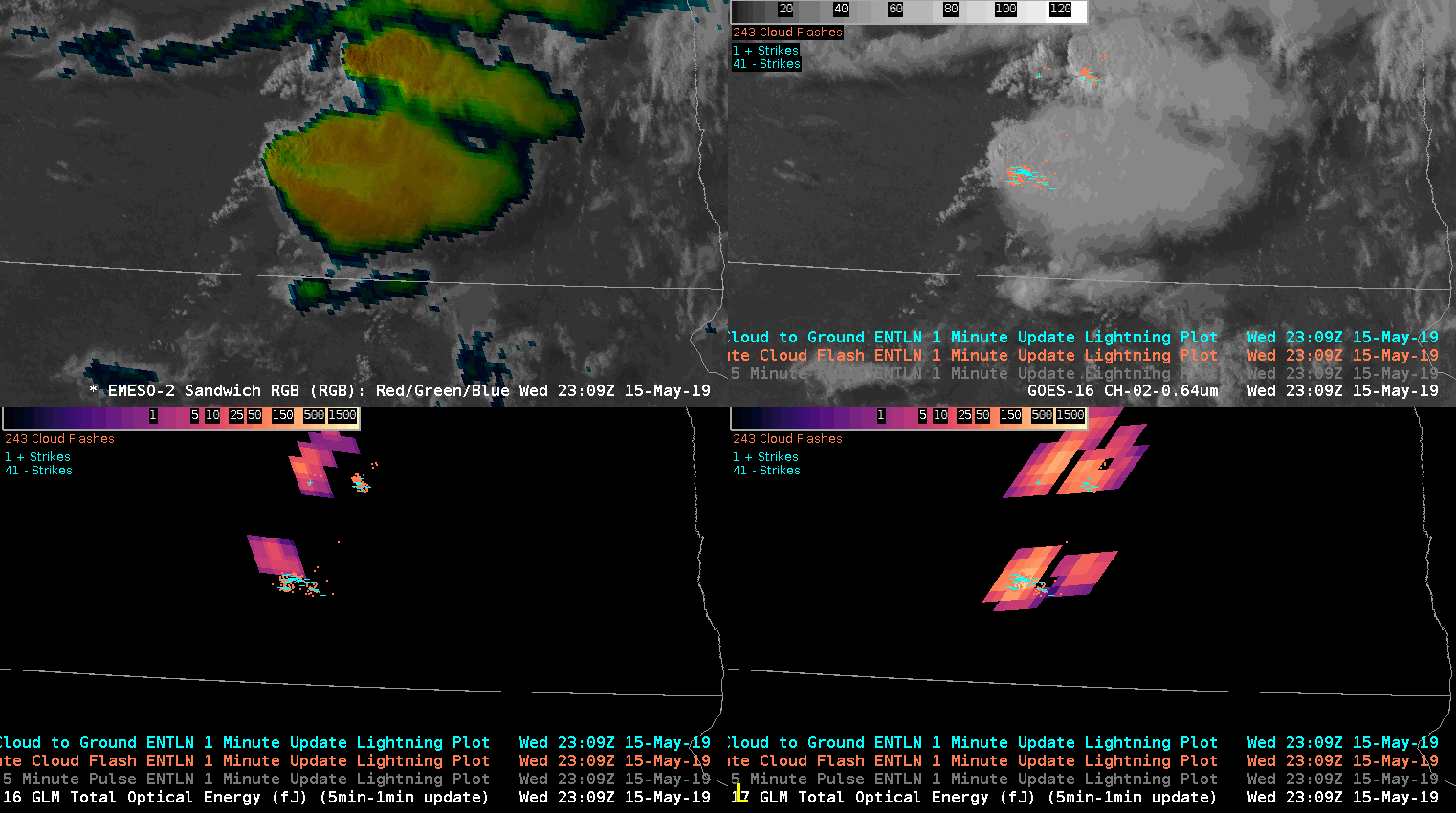
I’ve wondered if an AACP could extinguish a significant amount of Total Optical Energy (TOE) if lightning was occurring underneath. There are too many caveats here to draw any conclusions, such as:
So, with all of that being said, what we see here is interesting. ENTLN does show two areas of lightning. GOES-16 picks up on the western area but not the area under the plume (at least not at first). GOES-17, on the other hand, has a better grasp on there being two areas throughout.
I hypothesize that GOES-16 is struggling more in this particular scene because of the large reflectance and possible forward scattering issues that GOES-17 is not as susceptible to at this particular time of day.
Again, this is not a great setting to test any hypothesis about how much an AACP is able to throw a blanket over GLM detections. However, I’m confident that next week will provide many opportunities to test this with extremely stout AACPs at far more optimal latitudes.
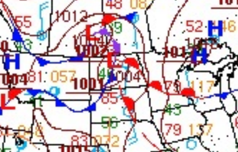
#MarfaFront