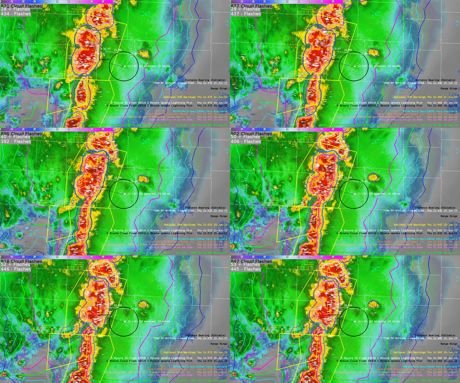
While providing (fictitious) DSS for a grass fire near Meade, KS on June 15, 2023, LightningCast was utilized in notifying the onset of lightning within 10 miles of the DSS site as a line of severe thunderstorms approached. Additionally, consideration was given to the potential for lightning cessation over the site in an effort to give information on potential for the “all clear.”

Figure 1.
LightningCast within the trailing anvil portion of the squall line steadily dropped off within the trailing stratiform region. However, these probabilities decreased when cloud to ground lightning was still being observed, with even some strikes occurring in probabilities less than 10%. This can be seen in Figure 1 in the far left hand portion of the animation with CG icons occurring within and outside of the lower contours of LightningCast.
This significantly lowered confidence in tracking the lower probability contours to give an estimated time of cessation.
Here was the DSS message sent at around 21:45 UTC:
As of 4:45 pm CDT, severe thunderstorms are 20 miles west of your site, and continue to approach your site. There is a very high chance these storms remain severe by the time they reach your site, currently expected between 5:15 pm and 5:45 pm CDT, bringing very strong winds over 70 mph out of a direction ranging between northerly to westerly, heavy rainfall, and frequent lightning. We still cannot rule out the potential for a brief tornado and large hail, although the chance for a tornado and hail is much lower than previous hazards mentioned.
Because of the approaching thunderstorms, the chance for lightning to occur within 10 miles of your site within the next hour (5:45 pm CDT) is over 99%.
It is worth noting that even after severe hazards associated with this line of thunderstorms have ended, there will remain over 75% chance of lightning over your site for an additional 1-2 hours, along with the potential for continued gusty winds over 20 mph ranging out of the southeast to northeast.
– 0SMBLSN
