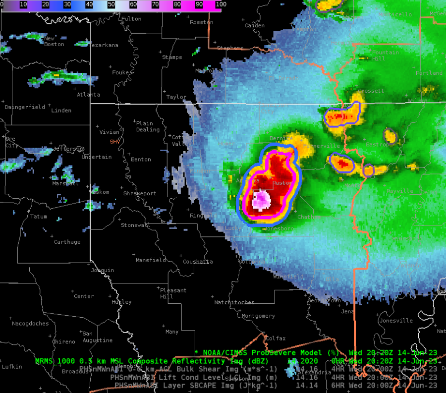
I took on the warning forecaster role during the operational period today. A supercell was underway at the start of the period, so I began by issuing a Severe Thunderstorm Warning. ProbSevere was (unsurprisingly) indicating a slam dunk for severe wind and large hail (Figure 1) but I noticed when sampling the ProbSevere data that MESH was slow to pick up on just how large the hail was with this storm. A broadcast meteorologist passed along a report of 5-inch hail at 2000z, but MESH did not indicate 4+ inch hail until 2020z.

Figure 1
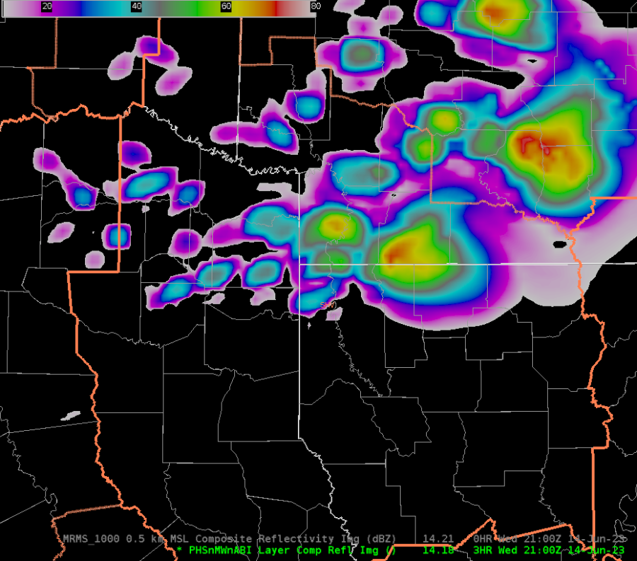
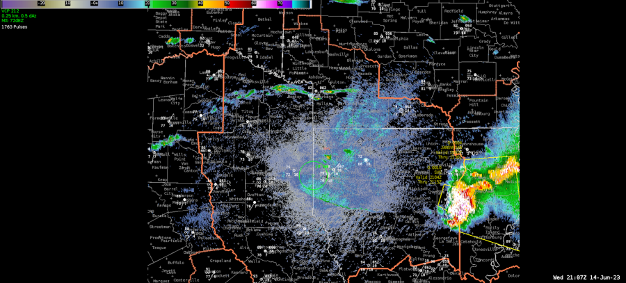
I also noticed that PHS composite reflectivity was much too slow with the progression of convection across the SHV CWA. Below are a screenshot of PHS progged composite reflectivity at 21z and a screenshot of the radar 0.3 degree reflectivity at 21z. PHS expected the supercell of interest to still be located over the northeast portion of SHV (Figure 2) while in reality the supercell was about to exit the easternmost fringes of the CWA (Figure 3).

Figure 2

Figure 3
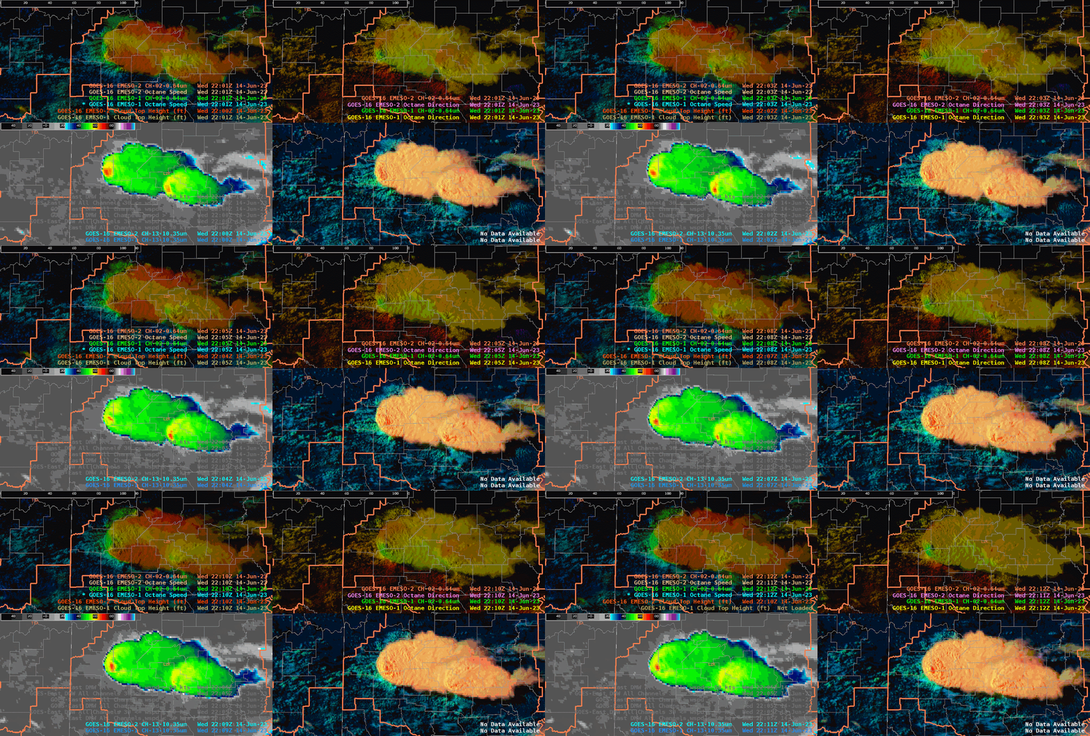
Once the aforementioned supercell exited the SHV CWA, we pivoted to the LZK CWA to monitor the ongoing convection there. I decided to interrogate the OCTANE products because I hadn’t looked at much satellite imagery thus far.
OCTANE was especially useful in two ways today:
- OCTANE Speed indicated a storm split underway as two speed maxima can be seen in the red-orange hues (Figure 4, top left panel)
- I tweaked the AWIPS colormap for OCTANE Direction to better depict the storm-top divergence occurring (Figure 4, top right panel)

Figure 4
– Vort Max

