
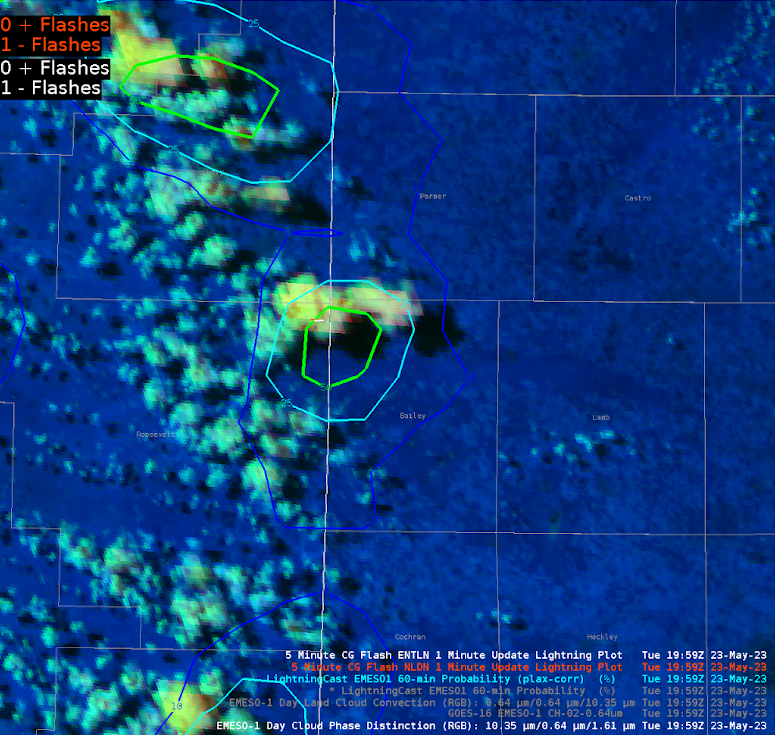
Thunderstorms were expected to develop in northern TX on May 23rd. Using Day Cloud Phase Distinction, a specific cell seemed to be quickly forming. Minutes after this trend was noticed on satellite, Lightningcast started tracking it. A 10% area was forecasted at 1927Z, followed by 25% at 1930Z, 50% at 1933Z, and finally 75% at 1942Z. While the 75% forecast dropped off for a brief time, it still was predicting lightning over the next hour. What happened? NLDN and ENTLN detected a CG strike at 1959Z (extreme northeast Roosevelt County). The storm went on to continue producing lightning.

– Champion