
PHS CAPE values increase from north to south over Fort Stockton. This correlated well with RAP mesoanalyzed SB CAPE on SPC webpage. Storms actively going up along this gradient as an outflow boundary pushed south during the early afternoon from overnight convection over Oklahoma.
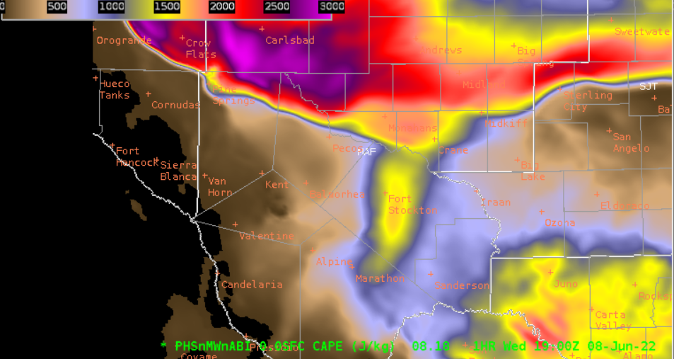
PHS CAPE 18Z 1 hour forecast for 19Z
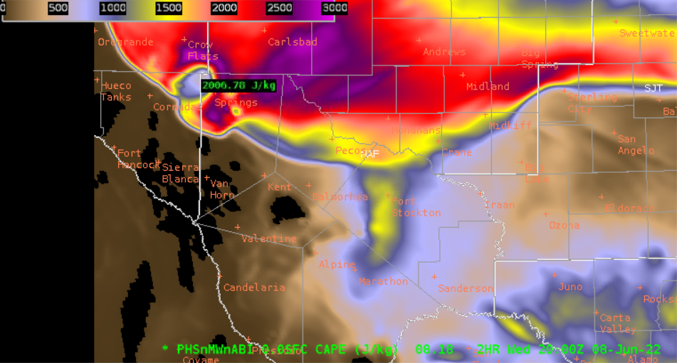
PHS CAPE 18Z 2 hour forecast for 20Z.
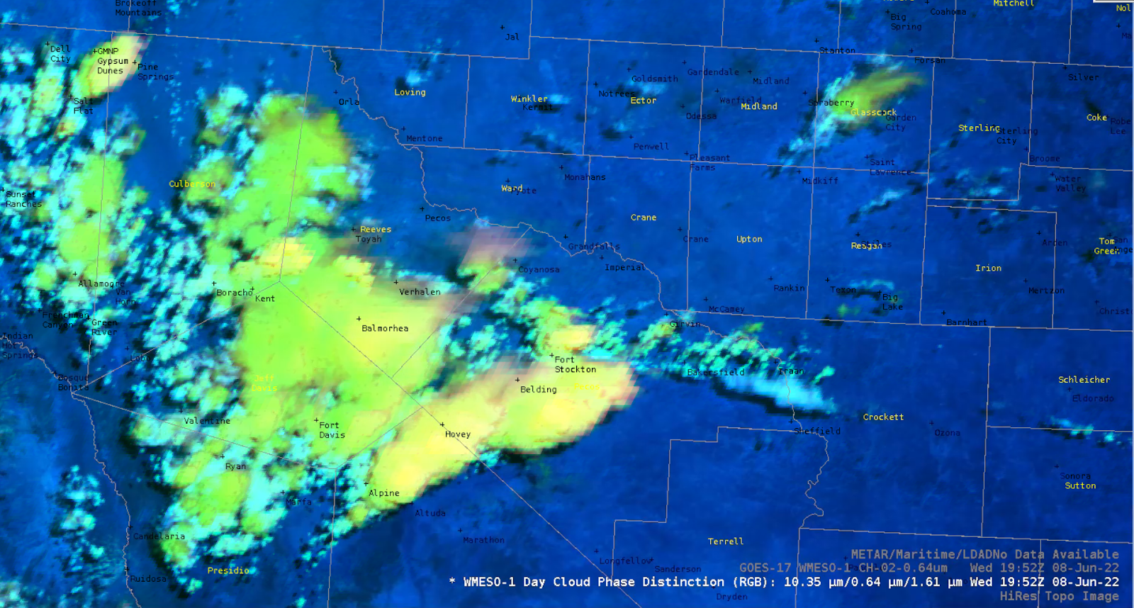
Storms developing over Fort Stockton via Day Cloud Phase Distinction on GOES 17 Mesosector
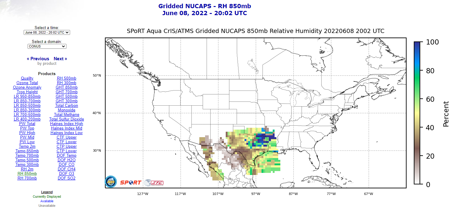
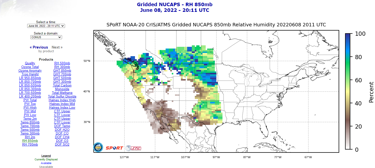
We showed above that the north side of the outflow would contain more instability – which is directly related to the moisture from the morning MCS outflow. The Gridded NUCAPS provides additional insight using the 850mb moisture fields from both AQUA and NOAA20 respectively – validating our hypothesis.
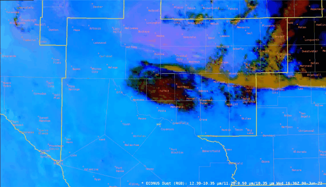
We double checked since there was a dust advisory/dust in the forecast and yes – Dust
Don’t warn if pop = 0
Convection was skirting the northeast portion of the CWA so we’ll use the recent pass of NOAA-20 to view the potential for convection redevelopment to the west and affecting the forecast in our CWA. Here are the Modified NUCAPS soundings:

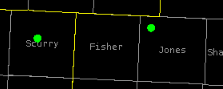
The top image is for the sounding in Jones county, below is Scurry – which shows a capping inversion still in place.
Storm Motion
Weak winds aloft and throughout the atmosphere have contributed to very little in the way of storm motion. Hence, locally heavy rainfall may begin to evolve, even over an area that has received very little rainfall in the last 6 months.
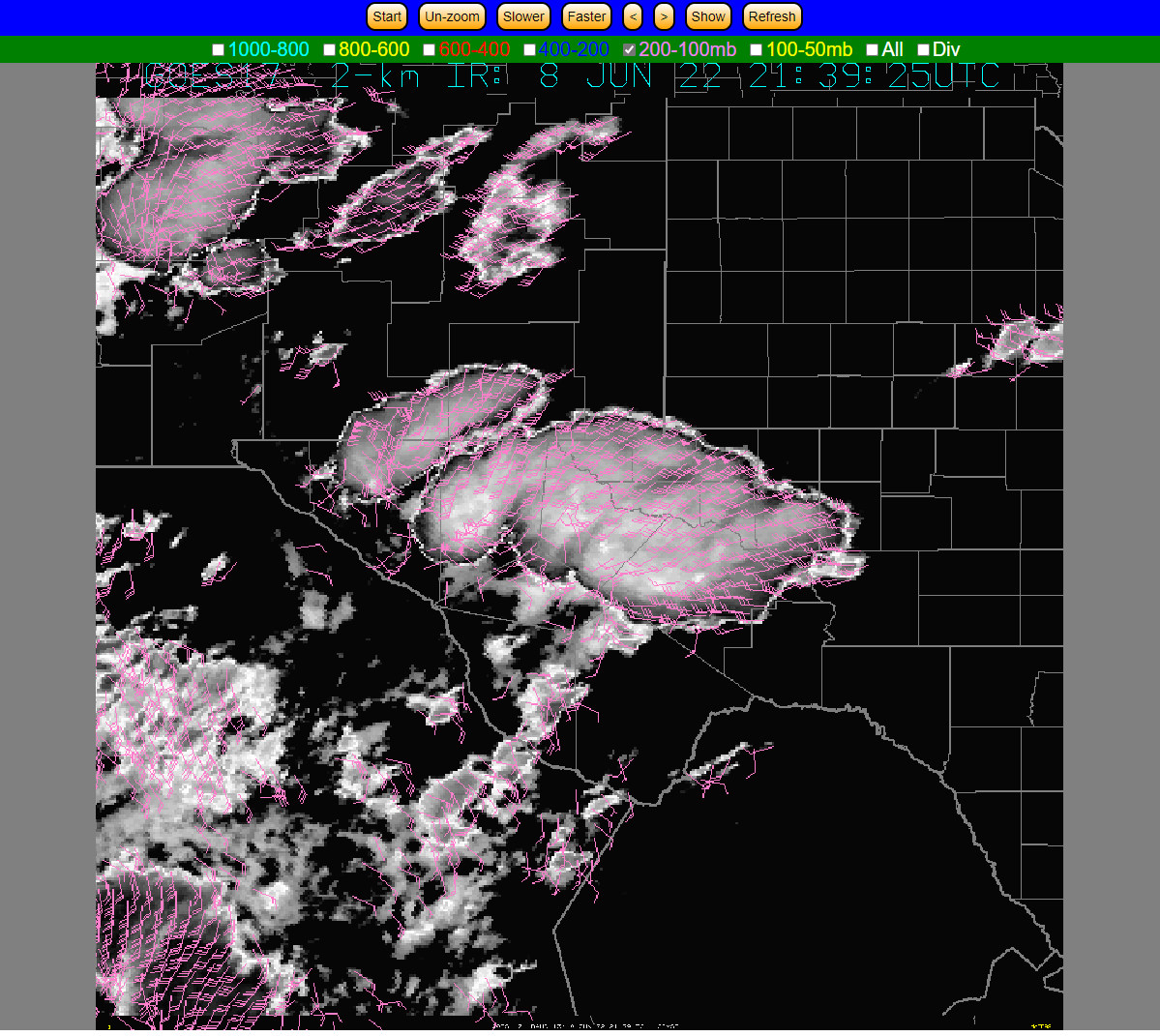
Optical Flow Winds in the 200-100 mb level.
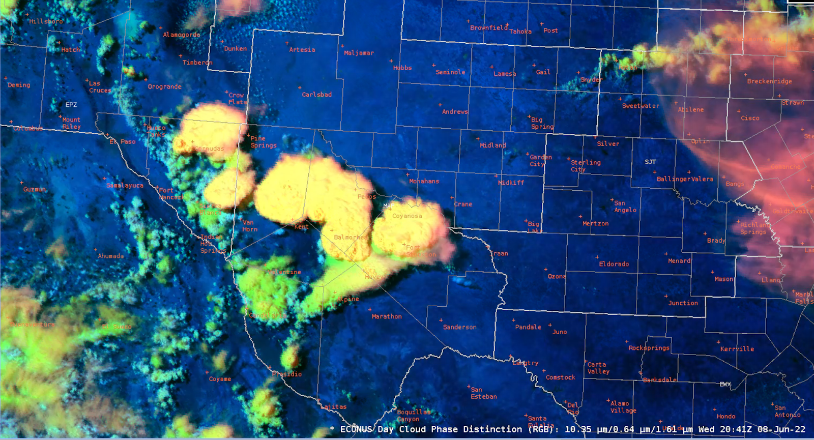
Day Cloud Phase valid 2041Z.
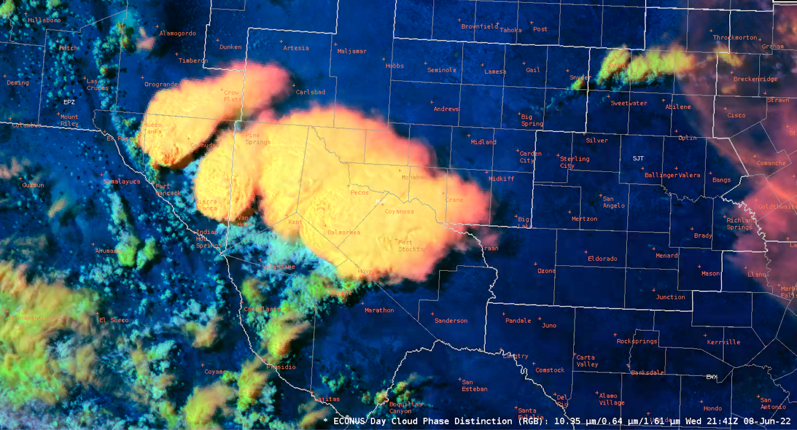
Day Cloud Phase valid 2141Z.
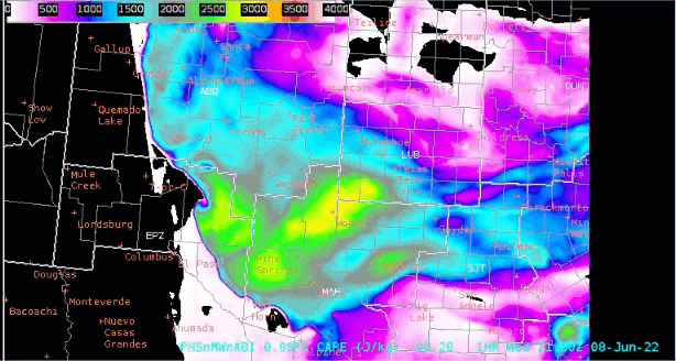
PHS depicts this plume of moisture and associated instability will back into New Mexico this evening. Could it play a part in tomorrow’s severe weather risk?
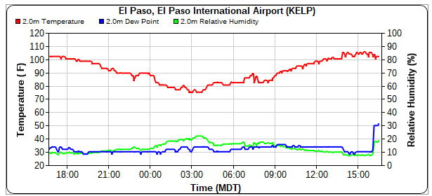
Here is what happened at El Paso when the front backed into the area – Dewpoint jumped from 30F to 50F
– David Spritz
– Mr. Bean