
The GLM data, specifically the FED data, was used to provide DSS to the Riverfest in La Crosse, WI. After my first contact with the event POC, I noticed that the FED data was off by roughly a county from the ground-based lightning data. This was my first time witnessing the parallax issue from the GLM and why ground-based lightning networks are a key component in confirming that the GLM location is accurate. In Figure 1, notice the intense concentration of the lightning just southwest of the event (20 mile and 5 mile radius rings) depicted by the GLM while the ENTLN/NLDN say that concentration is about a county south. The parallax is evident in other lightning concentrations in and around the event circle. I know it’s something being worked on to have the GLM data corrected to avoid this parallax issue, but it would be nice to have a map of the locations where the parallax is more evident in case you may not need the corrected version. Obviously, the further north, the larger the parallax, but not quite sure at what latitudes it really starts to show its hand. On a side note, for aviation purposes, the parallax could become problematic if the GLM lightning data is off by a factor of a county or two, especially if re-routing aircraft is occurring.
Figure 1: GLM Flash Extent Density compared with ENTLN data on June 15, 2022.
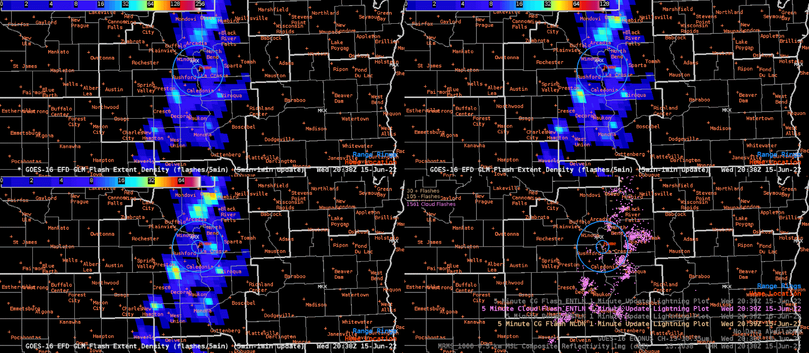
Figure 2: FED and ENTLN animation showing the GLM parallax.
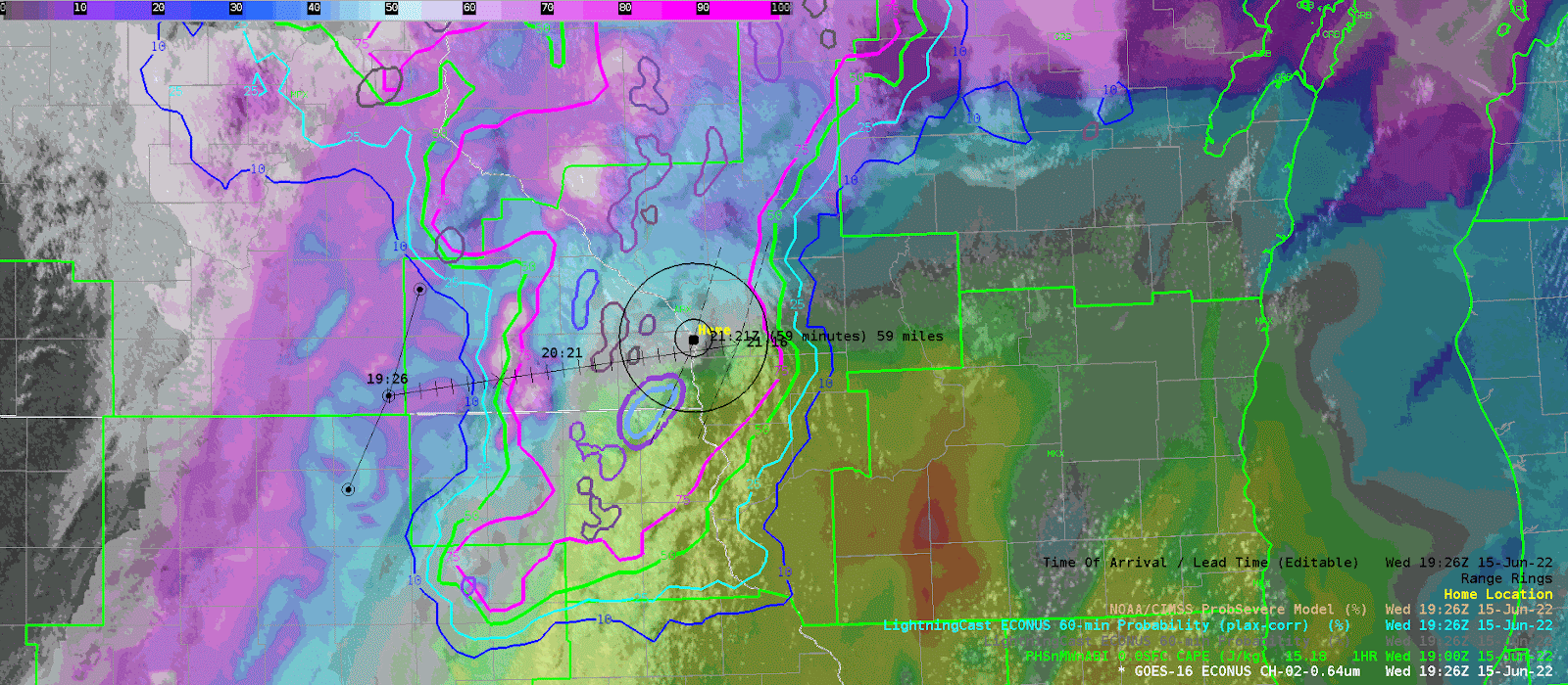
I utilized the Lightning Cast to provide a probable end time of the lightning threat for the Riverfest event in La Crosse, WI. This was a valuable tool as it provided some added confidence when the storms would exit the event area. I did my best to line up the TOA tool with the 25 percentile contour. Once I got my estimated time that the end of the lightning threat would reach the event, then I added about 30 minutes to ensure it was well east of the event circle.
– PODIUM