

Assessing the various GLM lightning products, I found the MFA and FED particularly useful in correlating the more active thunderstorm core / updraft areas. TOE was useful, but maybe a slight change in color scale may help to better identify those very active convective areas. (perhaps the sharper color gradient change could start at a slightly higher value than currently)
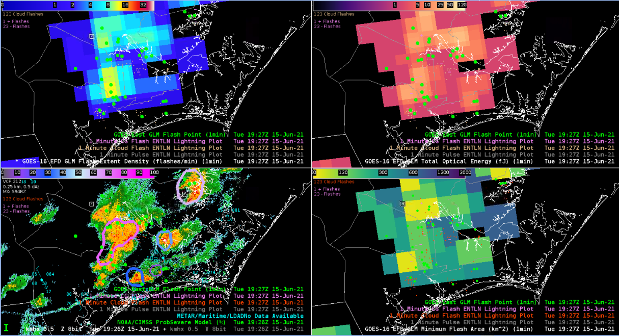
The GLM flash point data didn’t show as much ‘clustering’ as I had expected to see, as compared to other surface-based data sources (ENTLN). Is this related to a data display density or a more sensitive surface-based lightning detection? However, due to the parallax correction, the flash point data did line up with fairly well with active convection, although there were a few flash point detections well displaced from any radar reflectivities (see bottom left)–perhaps related to stratiform lightning?
– Guillermo