

An approaching short wave trough as well as a remnant MCV moving through the area helped trigger thunderstorms over the upper Midwest. Convection developed over Minnesota during the afternoon and evening hours. Storms did not become severe near the Grand Forks, ND CWA until late in the afternoon.
The upper Midwest is near the extent of coverage for both GOES 17 West and GOES 16 East. This made it a good chance to compare how the GLM lightning products were affected by this issue. Research has shown flash densities for both satellites diminish in this area, well away from the nadir of both satellites.
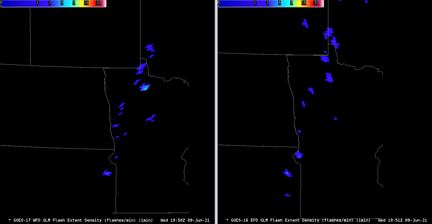
The character and quality of the Flash Extent Density (FED) returns from each of the satellites can be seen, with GOES 17 showing a slightly westward tilt, and an eastward tilt in the returned grids for GOES 16. The strongest storm in north central Minnesota has a higher and possibly better return on 17 than on 16.

Values of Minimum Flash Areas from the satellites were quite different in some cases, and were also skewed as a result of the distance from the nadir of each satellite. Placement of the flash areas also differed from “viewing” angle.

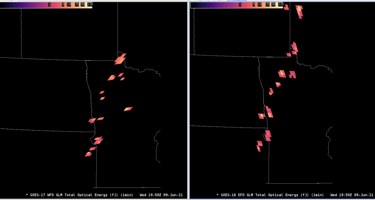
Total Optical Imagery (TOE) was also skewed. It is interesting to note that the pixels of TOE in far southeastern ND change from minute to minute, as seen in Images 3 and 4. At 1958Z, GOES 17 had an area of TOE returns along the ND/SD/MN borders, while GOES 16 had 2 separate areas, one in southern ND and one in west central MN. By 1959Z, both GOES 17 and 16 agreed that there were 2 separate TOE returns in this region.
– Dana Scully