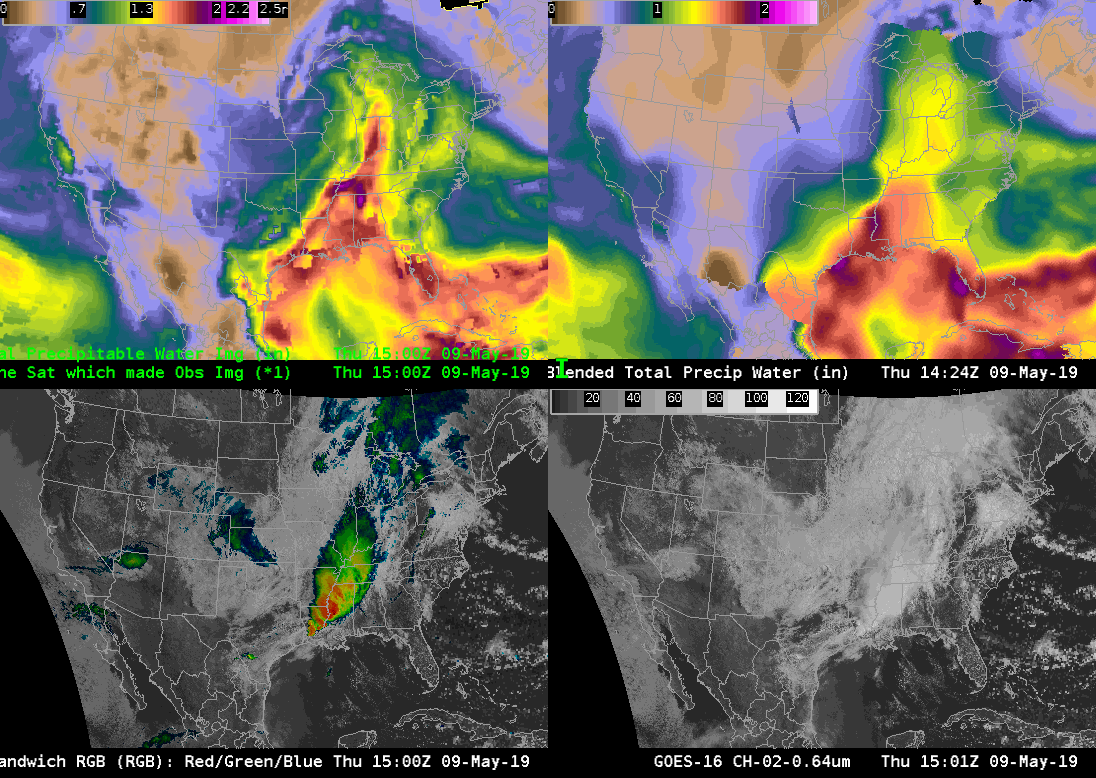
I was finally able to take a look the ATPW (top left) and compare it with the operational blended TPW (top right). My first impression was that both products show similar large scale patterns with a large plume of moisture extending from the Gulf of Mexico into the Ohio River Valley. The ATPW also tends to show a little more detail in the moisture field compared to the blended TPW.
At 15Z ATPW shows an area of lower moisture over the Texas Gulf coast which is sort of fills in by 17Z, likely due to upstream moisture being advected into the area. In contrast, this moisture is continuously present in the blended TPW. ATPW generally had PWATs around 1.5 in, while the blended TPW had PWATs around 1.7-1.8 in. In contrast, 12Z RAOBs along the coast had PWATs that ranged from 1.6 inches at KBRO to around 1.8 at KLCH. These values seems to match better with the blended TPW product. I suspect that the upstream convection over Louisiana and lingering clouds over the coast impacted the ATPW that was corrected in the blended TPW.
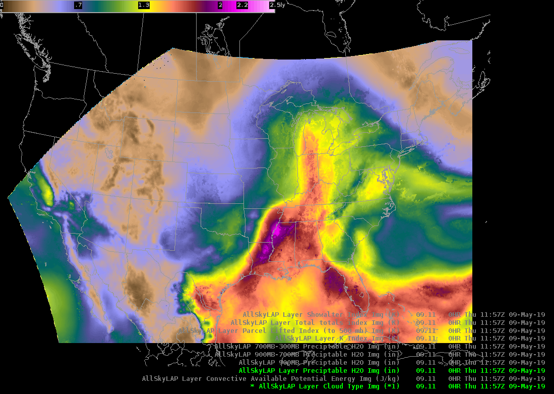
Update…Below is a loop of the LAP All Sky T PW. This loop shows a similar pattern to the ATPW and Blended TPW with a large are of gulf moisture moving into the Ohio River Valley. It is interesting/good to see that the LAP All Sky TPW is picked up on the sea breeze kicking in along the Gulf Coast. Despite the subtle differences among the three products the fact that they show similar patterns gives increase confidences that we will likely see a large area of flash flooding across portions of the south if storms are able to develop.