The 3 March 2019 Case for AzShear

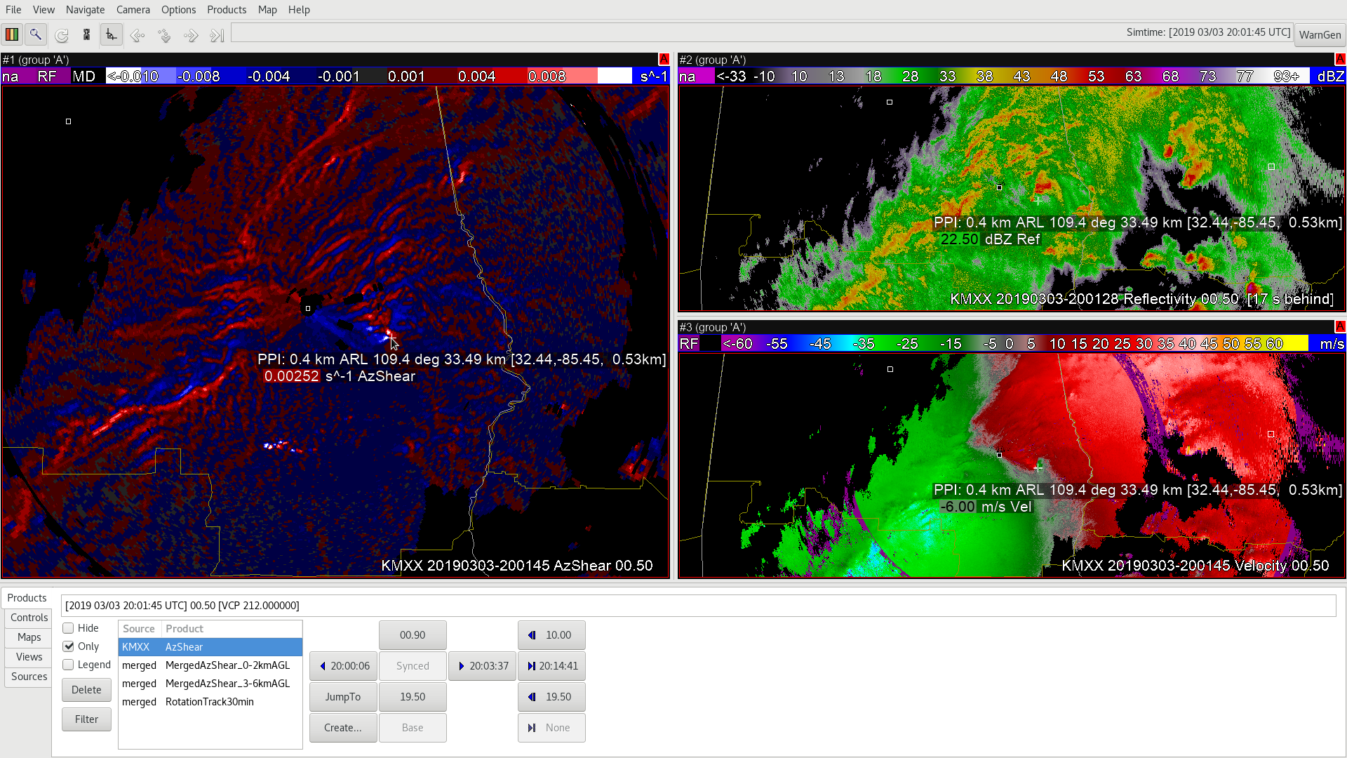
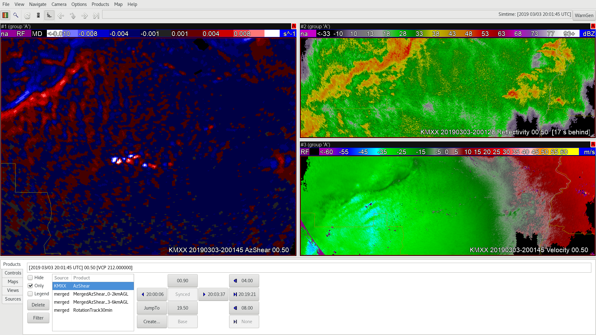
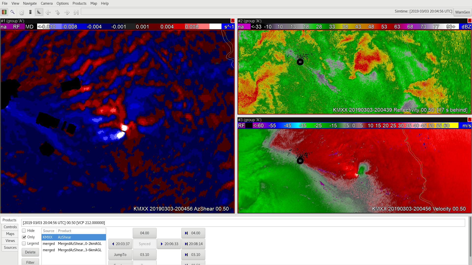
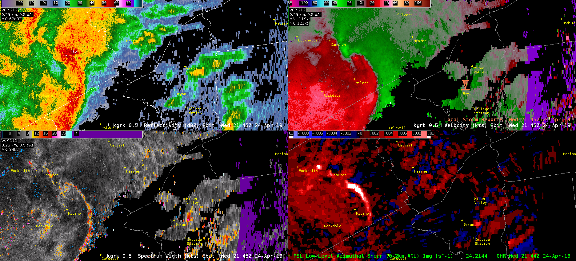
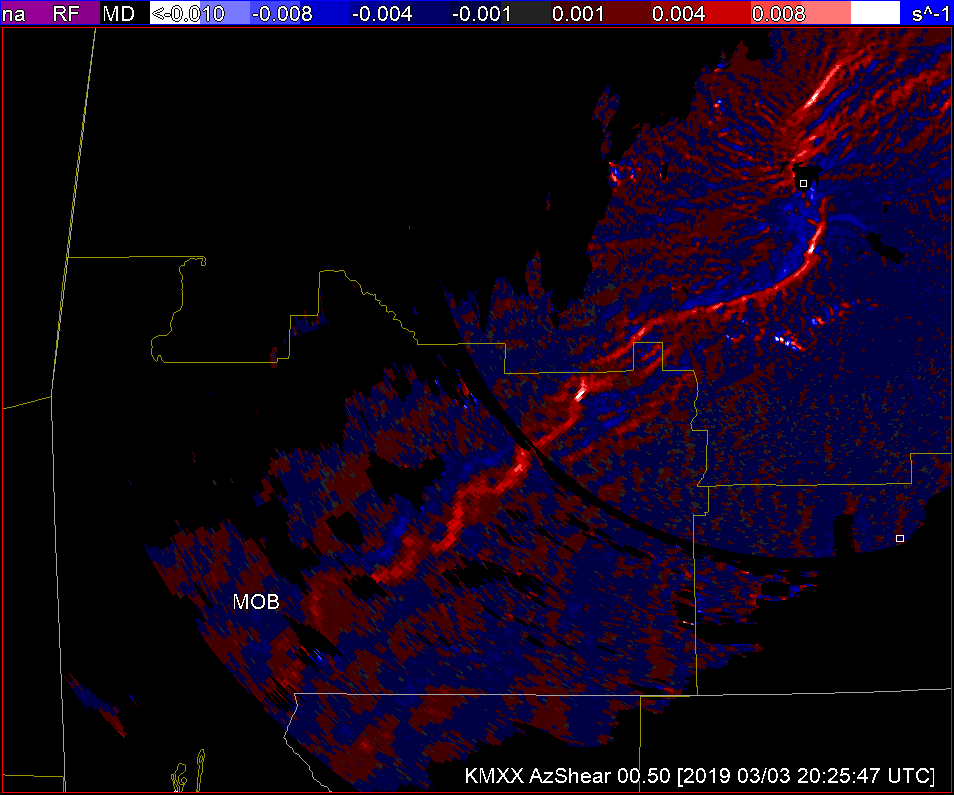
The single radar AzShear product made a rapidly developing tornado very apparent, forcing my attention to be pulled to it (first image, below). Additionally, it was very interesting to see the RFD so clearly (second image, below). However, as noted previously, I do have some reservations about the number of false alarms that it may be picking up, as seen in the last image (below). But, there is a lot of promise for this product to serve as an enhanced SA tool and/or increase confidence in the warning decision-making process.

~Gritty

Single Radar AzShear 3/03 Case

A

Seconds into this simulation it’s apparent that an embedded supercell is about to wreak havoc. It’s incredible how well you can examine the anatomy of the thunderstorm using the Single Radar AzShear product. It’s still apparent in the merged products that there’s an area of concern, but you can’t quiet examine the anatomy of the thunderstorm like you can in single radar.

B

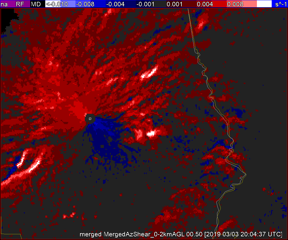
In B, the merged 0-2km  it’s clear where we should be paying attention, but trying to diagnose the structure of or the maturity of the thunderstorm is much more difficult.


-lakeeffect

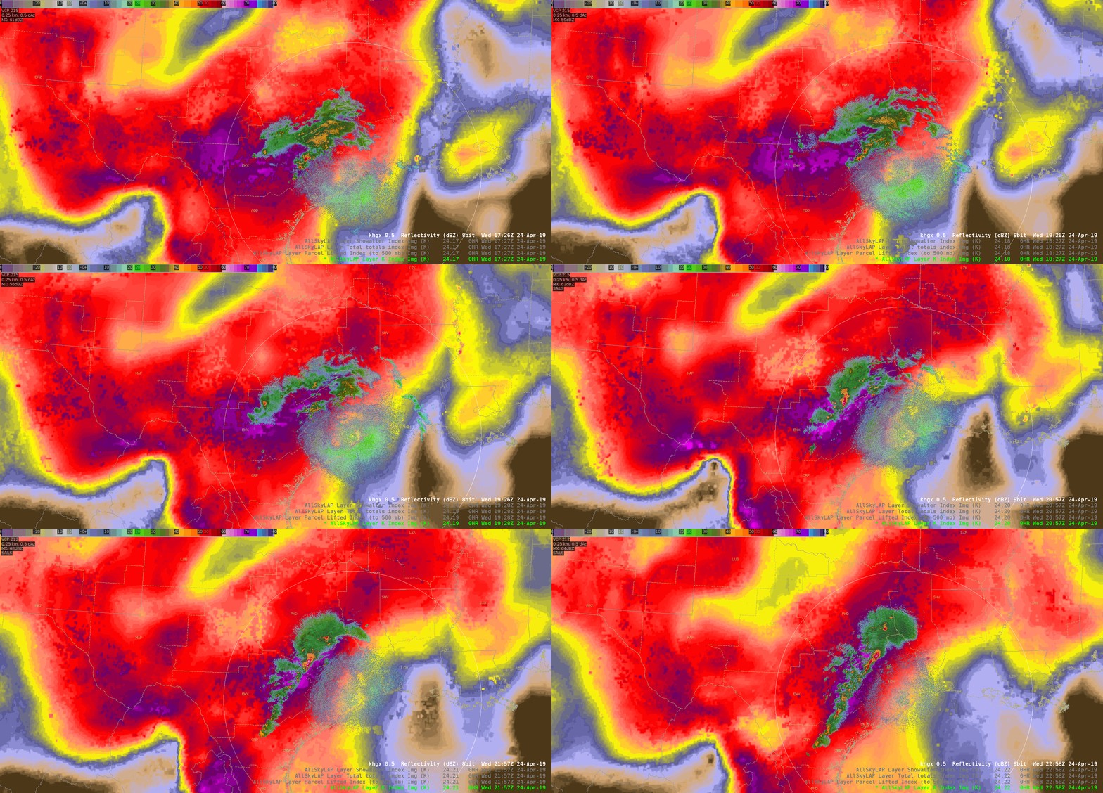
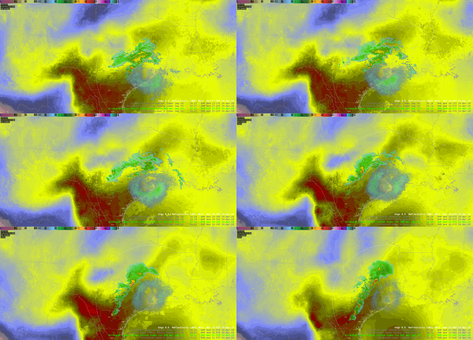
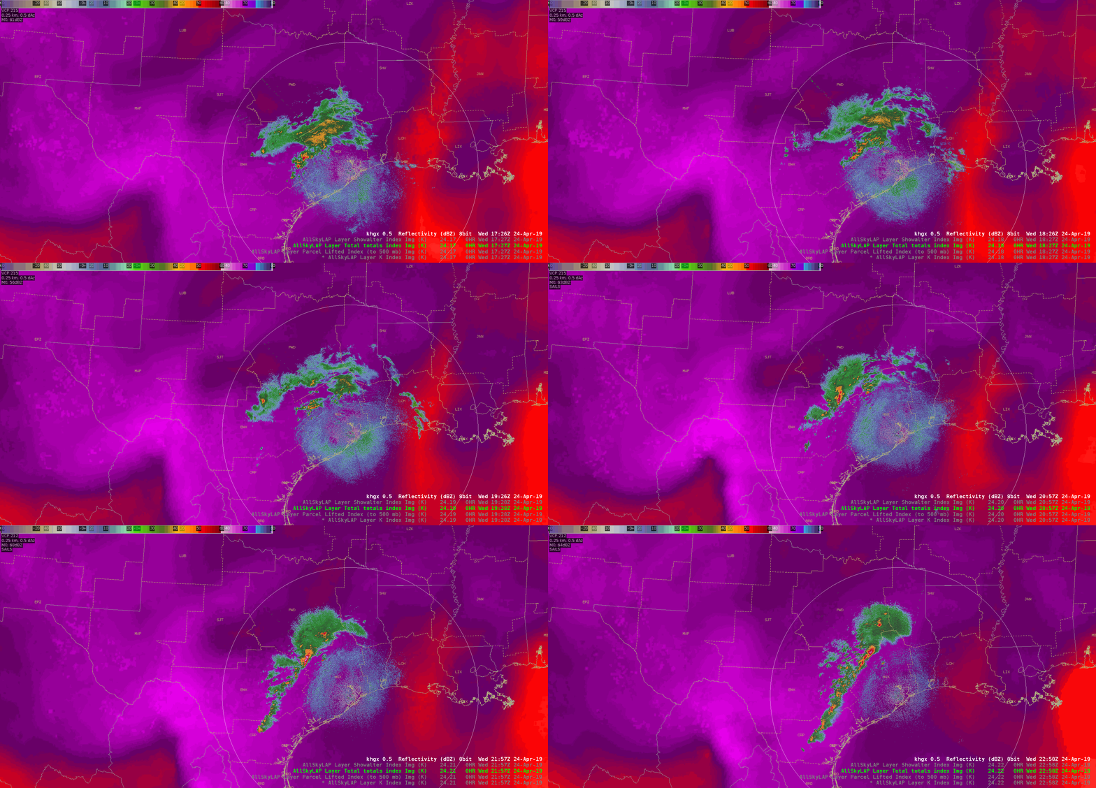
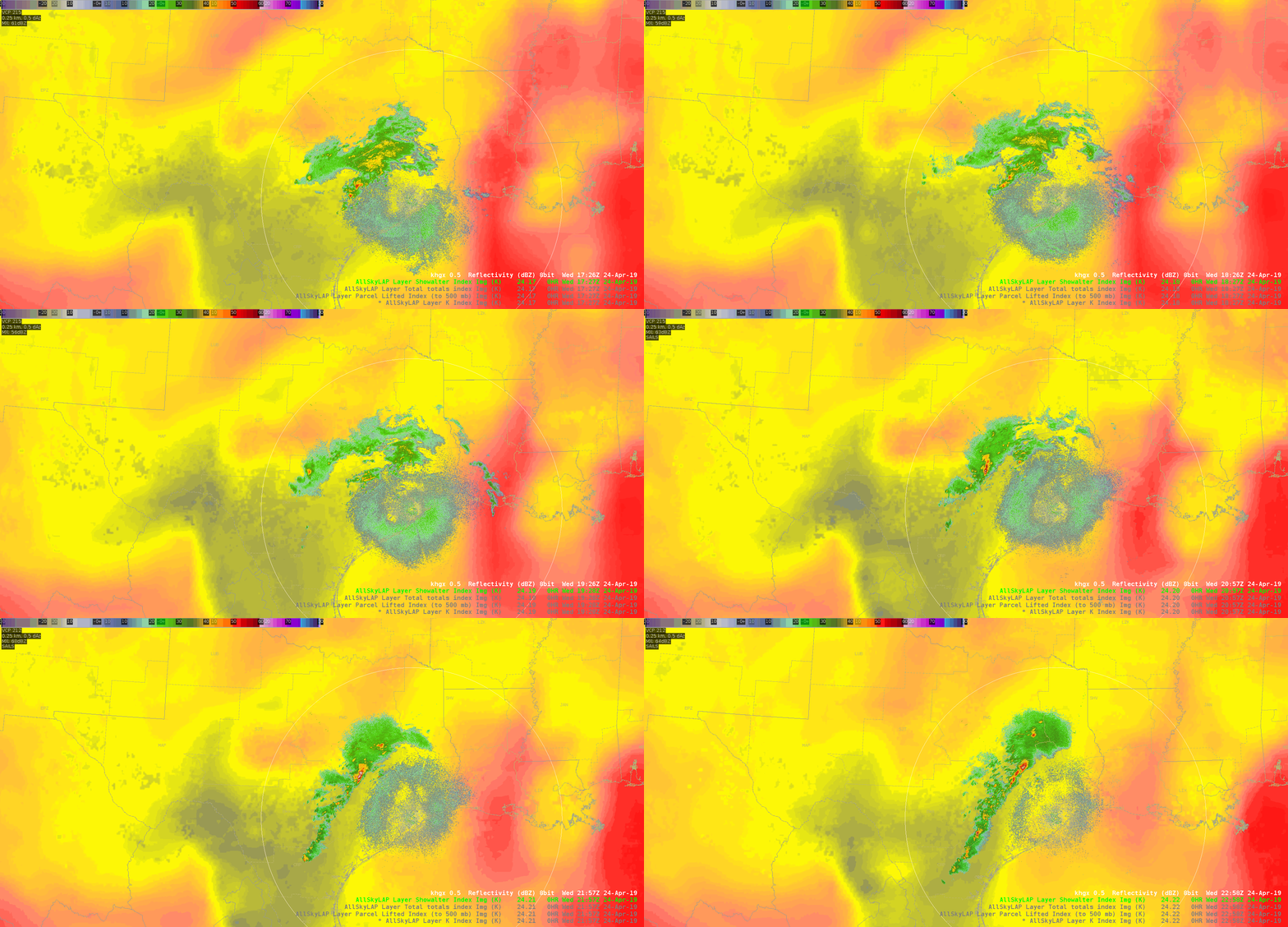
AllSky Indices

Of the indices below, there is some utility in these products, although did not find the Total Totals Index to be of much use considering there were warned storms with verification within HGX’s CWA. The K Index seemed to be the most useful, with the Lifted Index product showing the storms once again riding along a gradient.

~Gritty

The Aggie Tornado From a Shower

PRIOR to the Milam/Burleson County tornado warnings that you can read about below in other blog posts there was a tornado near the Texas A&M Campus in College Station. See these tweets:

  • https://twitter.com/cgar1999/status/1121171711855034370
  • https://twitter.com/jeanette_wx/status/1121171983633350661
  • https://twitter.com/KAGSnews/status/1121205013236391938

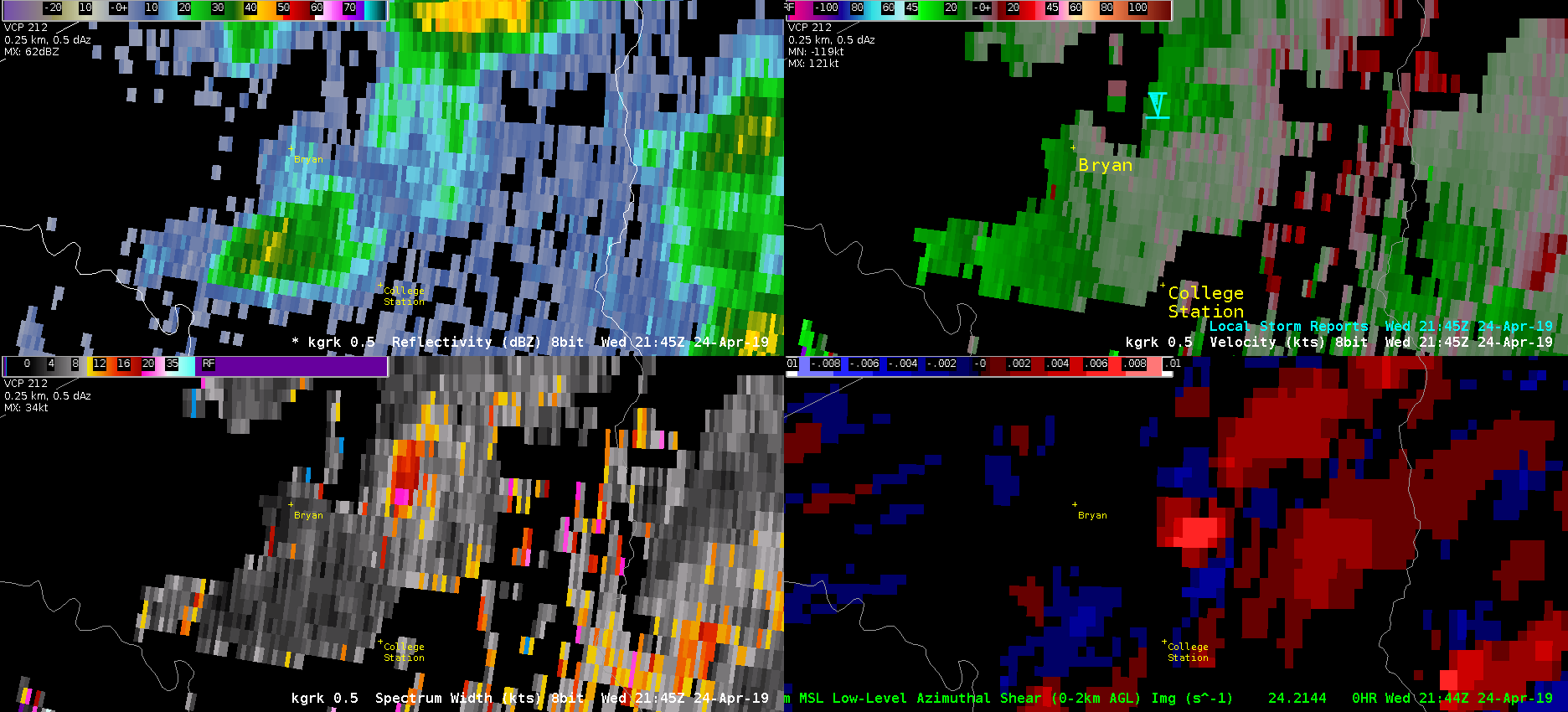
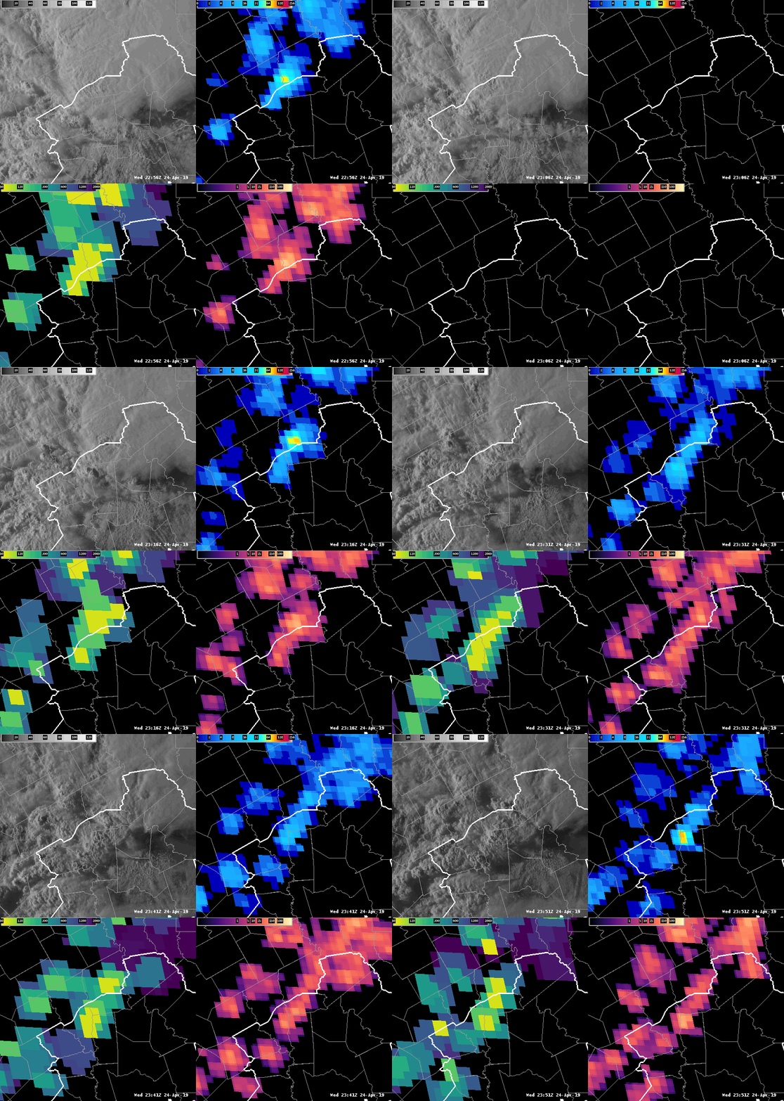
If you looked at the image below you would not really be concentrating on the storm (I use the term ‘storm’ loosely) near College Station on the right side of each panel. Based on velocity, AzShear, Reflectivity your focus would be the bowing line segment to the west that would soon produce gate-to-gate velocity signatures south of Hearne.

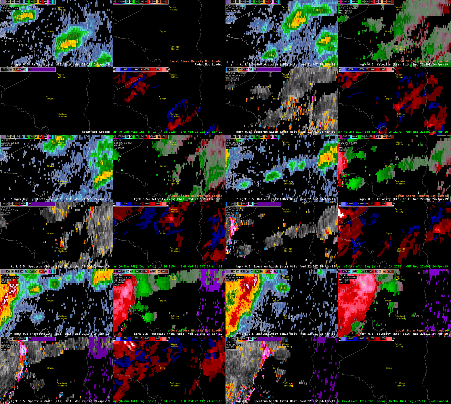
If you were to zoom into Bryan-College Station though a few things begin to jump out at you. Mainly the high Spectrum Width, the relative maxima in AzShear, and a VERY weak couplet looking signature in velocity (look near the blue Tornado Icon). This is the time that the tornado was reported. The good news is that Spectrum Width picked up on the turbulence in the storm, and AzShear does have a local max, but the values are only 0.007 s^-1 compared to 0.014 s^-1 at the bookend vortex to the west. This scale only goes from 0 to .01 s^-1.

The velocity signature does get slightly better in the 2149z. This is probably a quick spin up due to boundary interaction, but it is shocking that this little SHOWER produce the tornado when the larger storms to the west produced NO reports as of  now (0026z). The good news is that there were local maxes in the AzShear and SW, but not enough that these would be your focus of course.

ProbSevere never pinged the storm…and there were other indications in velocity, AzShear, and SW with other showers that were similar to the tornadic College Station storm. Oh the joys of quick spin up tornadoes due to boundary interactions in Central Texas!

-Alexander T.


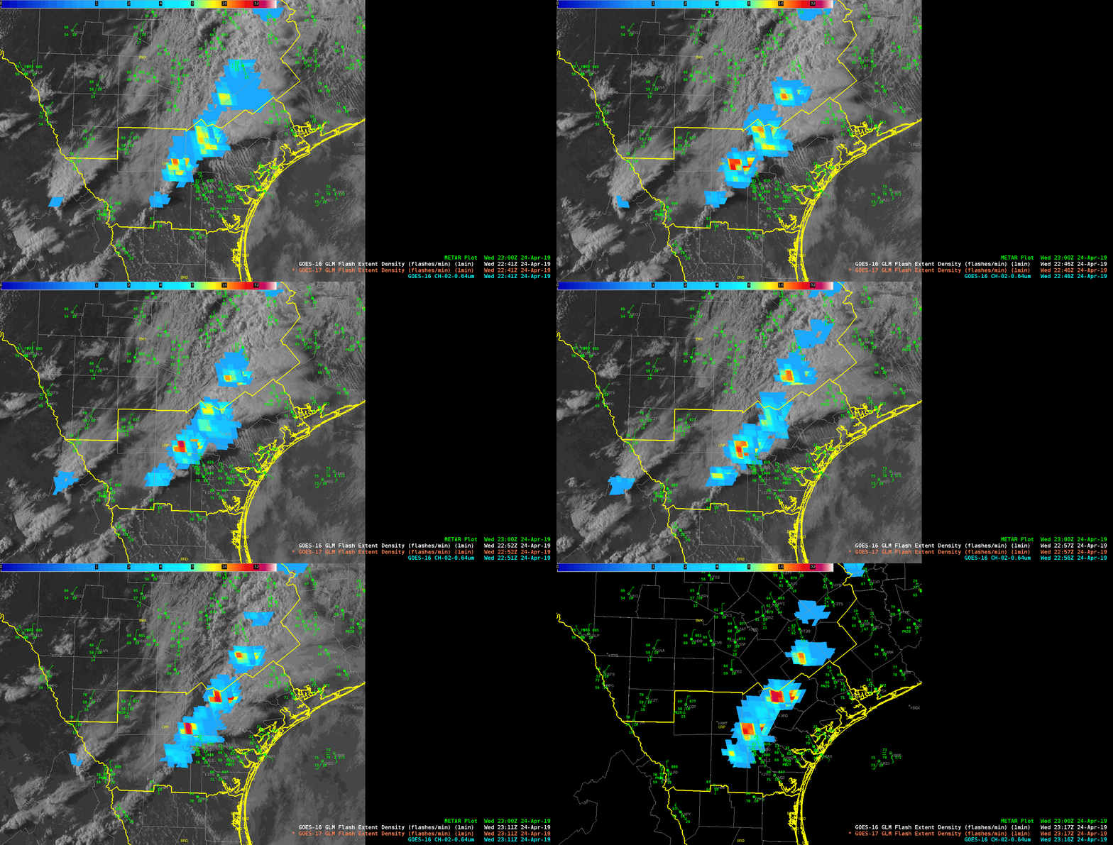
G16 and G17 Flash Extent Comparison

Showing a quick comparison of G16  and G17 Flash Extent Density over srn Texas.

Takeaways – some “minor” changes in Flash Extent absolute values but trends are similar.  Quick look – had higher values than G17.  Also, parallax is different – but to be expected.  Overall – think both products could be used interchangeably across TX.

The Evolution of an Intensifying Cluster

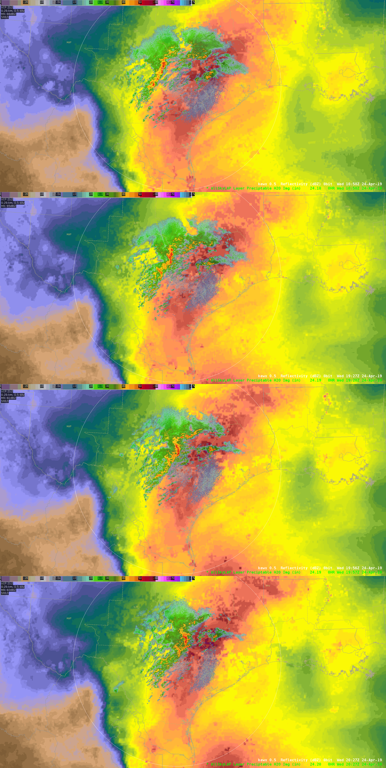
Storms in the EWX CWA early in the shift were generally remaining sub-severe, with what looked to be heavy rain as the dominant threat. The first two loops (below), the storms were riding right along the gradient of the PWATs and CAPE. (continues below)
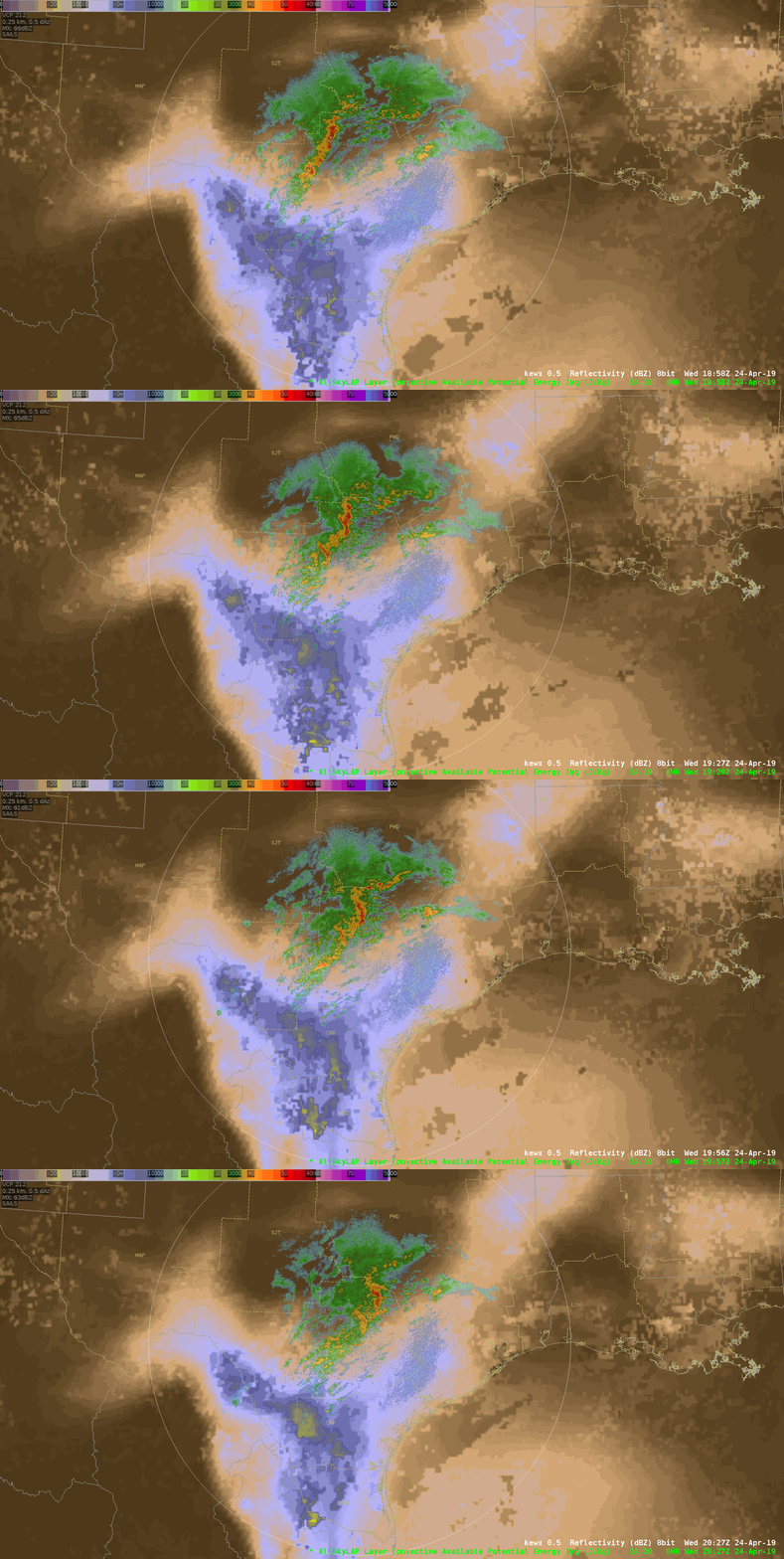
As the cluster of storms reached the eastern edge of a greater area of instability (below), the concern then turned to how much of the instability would be tapped into and how storms would react, with the thought that they’d likely become more robust. (continues below)
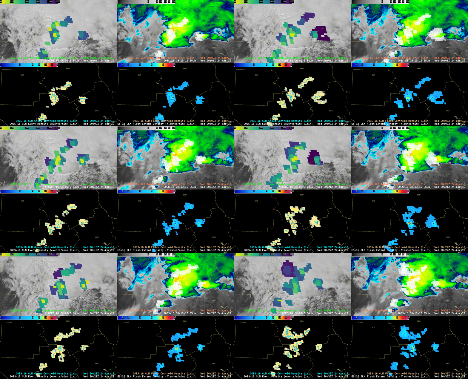
Attention was then turned to how the GLM was observing the evolution of the stronger cluster of storms within the northeastern portion of the CWA. I created a four-panel display, with MFA overlaid onto the mesosector visby imagery (upper left, below), clean IR with TOE overlaid (upper right; I had blinking enabled to capture the highest fJ, but is unseen in this GIF), Event Density with Group Centroid Density overlaid (bottom right, below), and FED with Flash Centroid Density overlaid (bottom right, below). It was fascinating to watch how the lightning unfolded with this particular cluster, and the MFA in particular immediately drew my eye to the storms moving toward the FWD CWA border. The smaller flashes began to blossom and expand out, which then had me look at the TOE and density products. The density products ramped up, but what I found the most interesting is that the MFA seemed to give me that initial clue that this storm was in fact tapping into some of the higher instability and allowing for the updraft(s) to intensify.
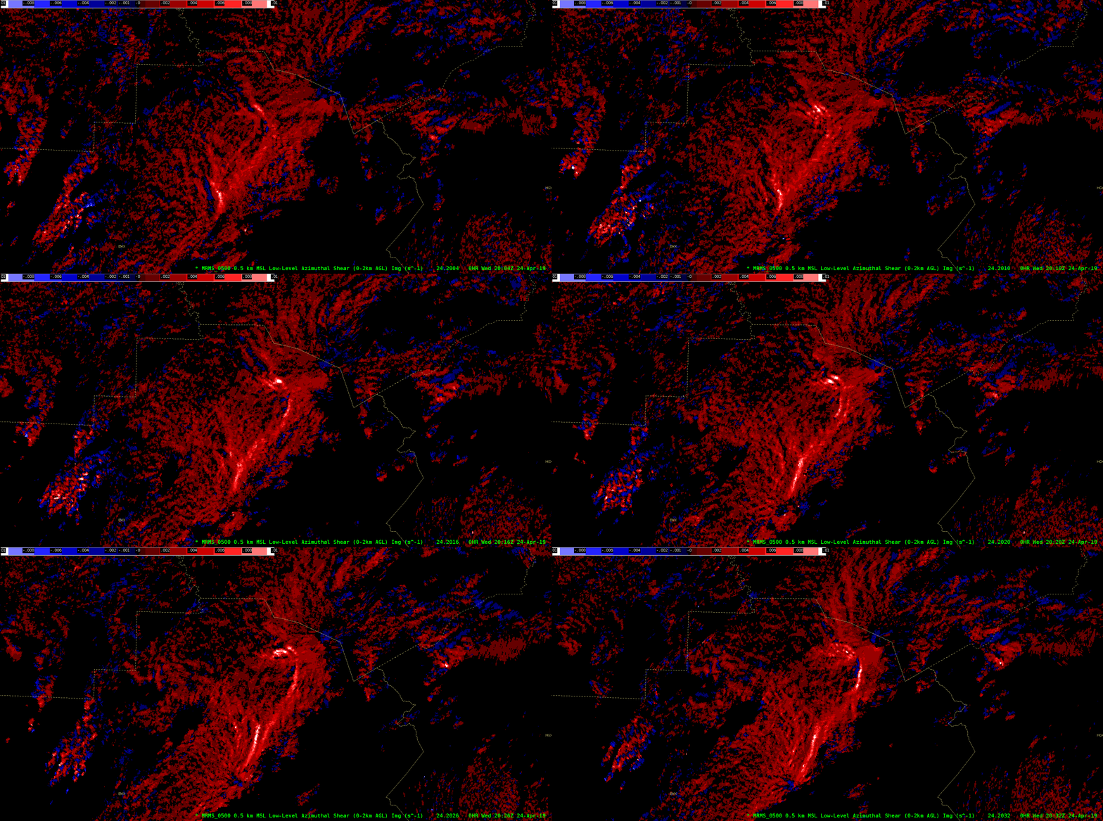
I then proceeded to take a look at the MRMS LL AzShear product (below), wistfully wishing I could look at the single radar version of this product. Sure enough, a clear signature developed, highlighting the amplifying wind within this cluster.
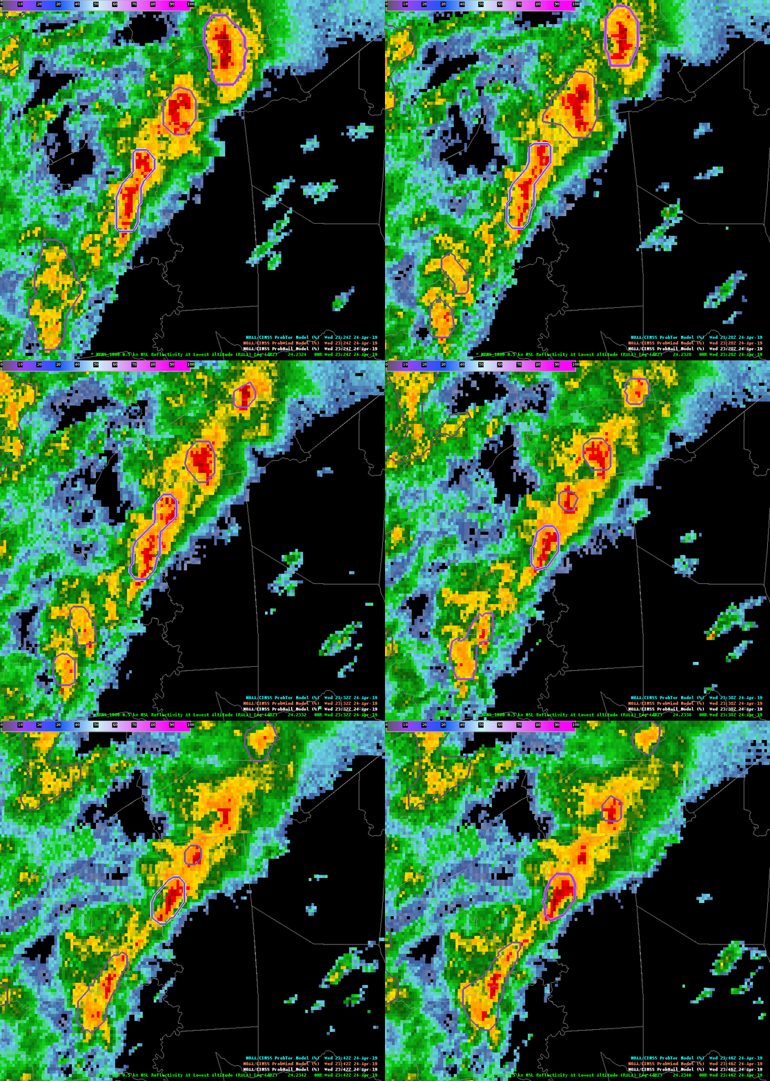
Last but not least, looking at ProbSevere, the ProbWind product picked up well on this signature, highlighted below.
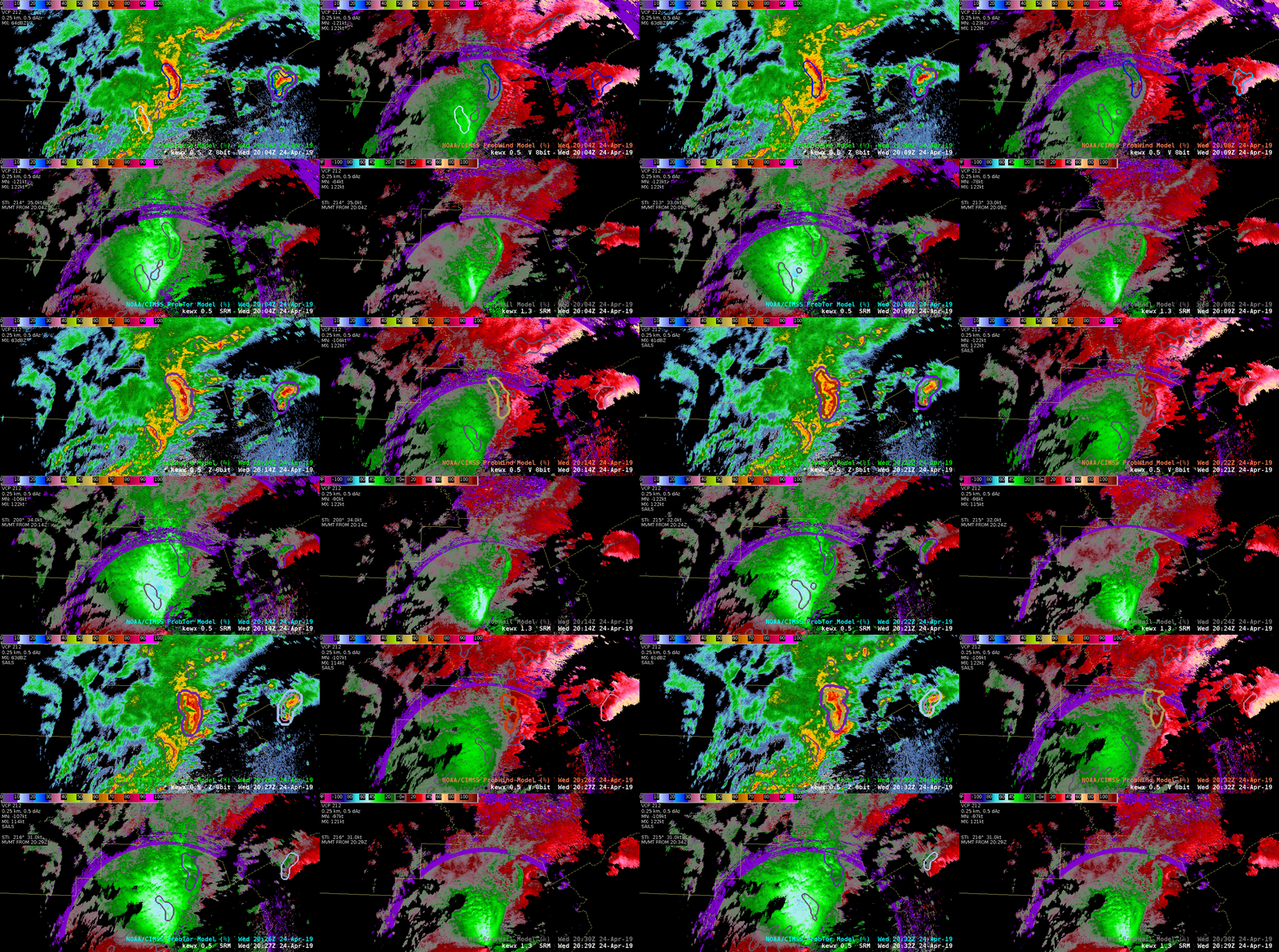
Conclusion: I’m continuing to see some promise that there’s something to look deeper into with respect to these additional lightning products, particularly the MFA when used in combination of something like the Event or Flash Extend Density products. There seemed to be a good correlation with the TOE, as anticipated, but I’m still unsure about its utility as a stand-alone product. As for the Average Flash Area, I didn’t even pull it up given the limited amount of screen space I had and what I saw yesterday, with the AFA in particular not giving me hope of being able to gather good info/lead time in comparison to the MFA.

~Gritty

Side note: Had some excellent conversation with the GLM expert in the room and as we were talking and analyzing some of these products, it was noticed that there was quite an extensive channel, lightning that shot out well to the north of this cluster of focus. These GLM products could provide beneficial information when providing DSS to partners, such as letting partners and the public know not to go back outside just because there’s either light rain or the storm had already passed.
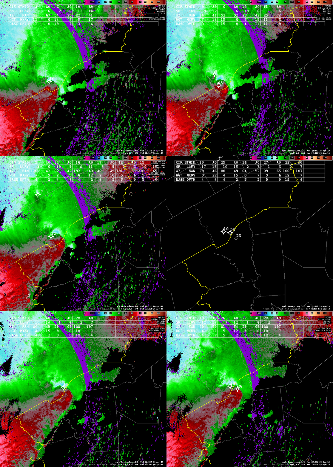
NMDA Struggles To ID Mesocyclones On QLCS

A severe thunderstorm pushed through the northern portion of the CWA and I had a tornado warning in effect in anticipation of tornadoes along the eastern most portion of the bowing line. Unfortunately, the NMDA was not initially identifying mesocyclones along that portion of that line. It was only until well after the warning was issued that the NMDA identified anything along that portion of the line.Sandor Clegane

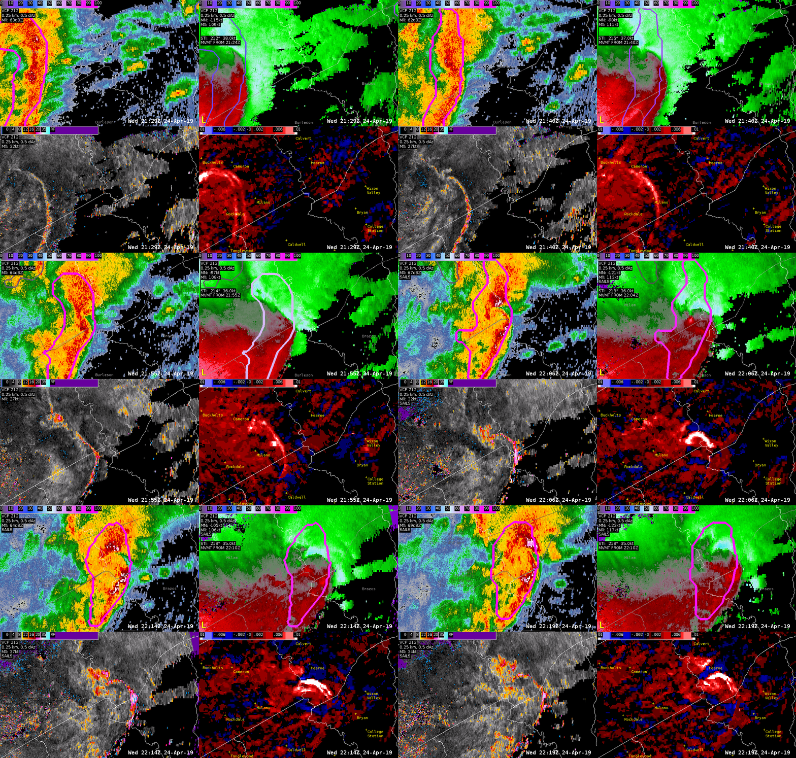
Tornadic Supercell and AzShear and ProbTor Ramp-Up

The storm along the Milam/Burleson county line began to wrap up showing increasing Merged 0-2km AzShear and a stronger velocity signature. From 2204z – 2208z there was a brief couplet from this storm and the FWD and HGX offices, and the HWT forecasters all tornado warned this storm. You can see the Spectrum Width maxima at the point of the couplet and along the leading edge of the bowing segment to the south of the couplet. There is also an inflow notch as well all situation near the bookend vortex. The big thing to note is how the AzShear Merged product ramped up from 2154z to 2204z. This also impacted ProbTor. The trend went from:

  • 2149z: ProbTor 11%
  • 2154z: ProbTor 60%
  • 2159z-2206z: ProbTor 84%
  • 2208z-2212z: ProbTor 86% (2207z is when WFO FWD issued their warning)

ProbTor maxed out at 87% from 2216z-2218z while the couplet became less gate-to-gate. If you used a ProbTor threshhold of 60% that would have given 15 minute additional minutes of lead time, while a threshold of 80% would have given approximately 8 more minutes of lead time. As of writing this blog (2240z) there are no LSRs reporting anything in terms of damage or tornadoes with this storm.

-Alexander T.