

The storm along the Milam/Burleson county line began to wrap up showing increasing Merged 0-2km AzShear and a stronger velocity signature. From 2204z – 2208z there was a brief couplet from this storm and the FWD and HGX offices, and the HWT forecasters all tornado warned this storm. You can see the Spectrum Width maxima at the point of the couplet and along the leading edge of the bowing segment to the south of the couplet. There is also an inflow notch as well all situation near the bookend vortex. The big thing to note is how the AzShear Merged product ramped up from 2154z to 2204z. This also impacted ProbTor. The trend went from:
- 2149z: ProbTor 11%
- 2154z: ProbTor 60%
- 2159z-2206z: ProbTor 84%
- 2208z-2212z: ProbTor 86% (2207z is when WFO FWD issued their warning)
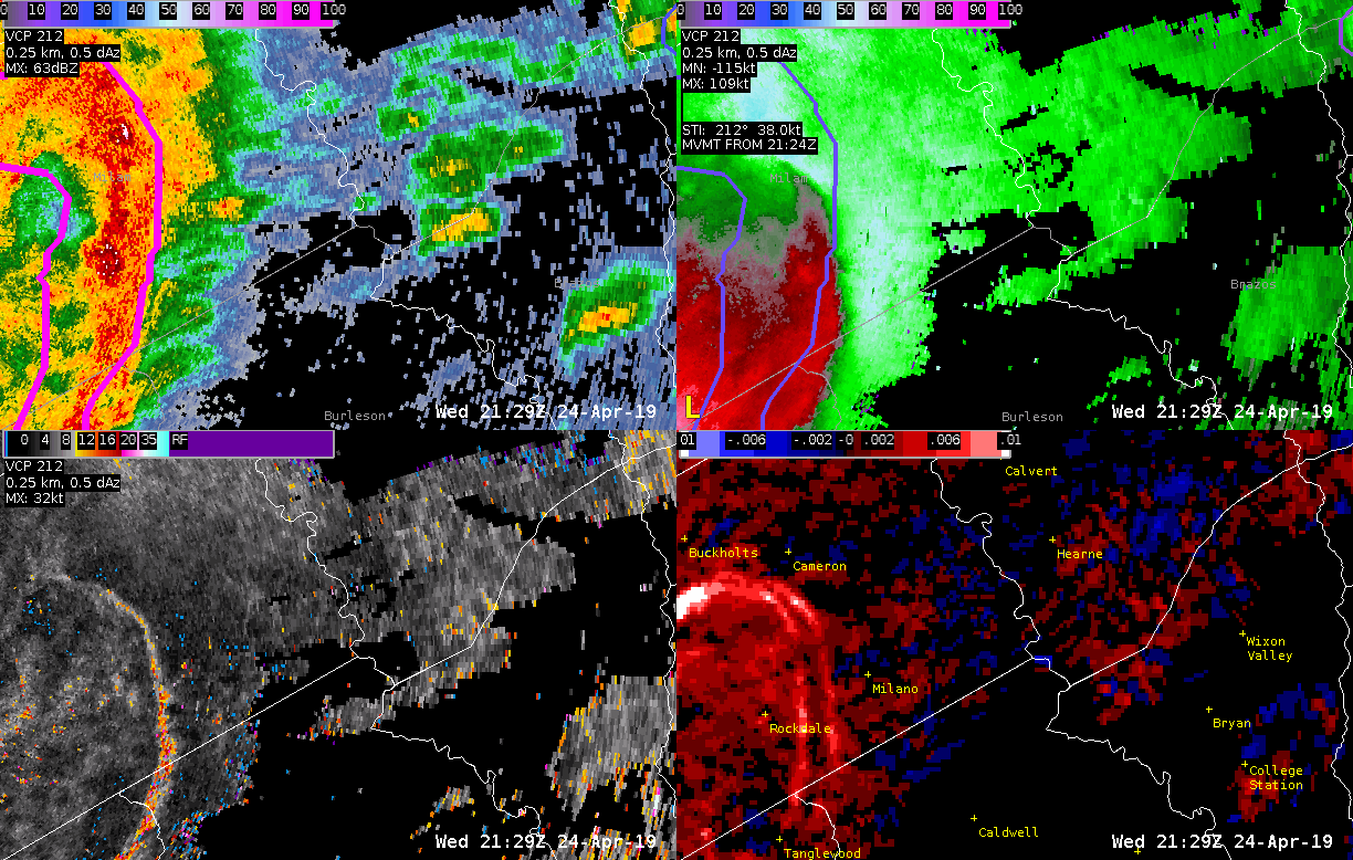
ProbTor maxed out at 87% from 2216z-2218z while the couplet became less gate-to-gate. If you used a ProbTor threshhold of 60% that would have given 15 minute additional minutes of lead time, while a threshold of 80% would have given approximately 8 more minutes of lead time. As of writing this blog (2240z) there are no LSRs reporting anything in terms of damage or tornadoes with this storm.
-Alexander T.