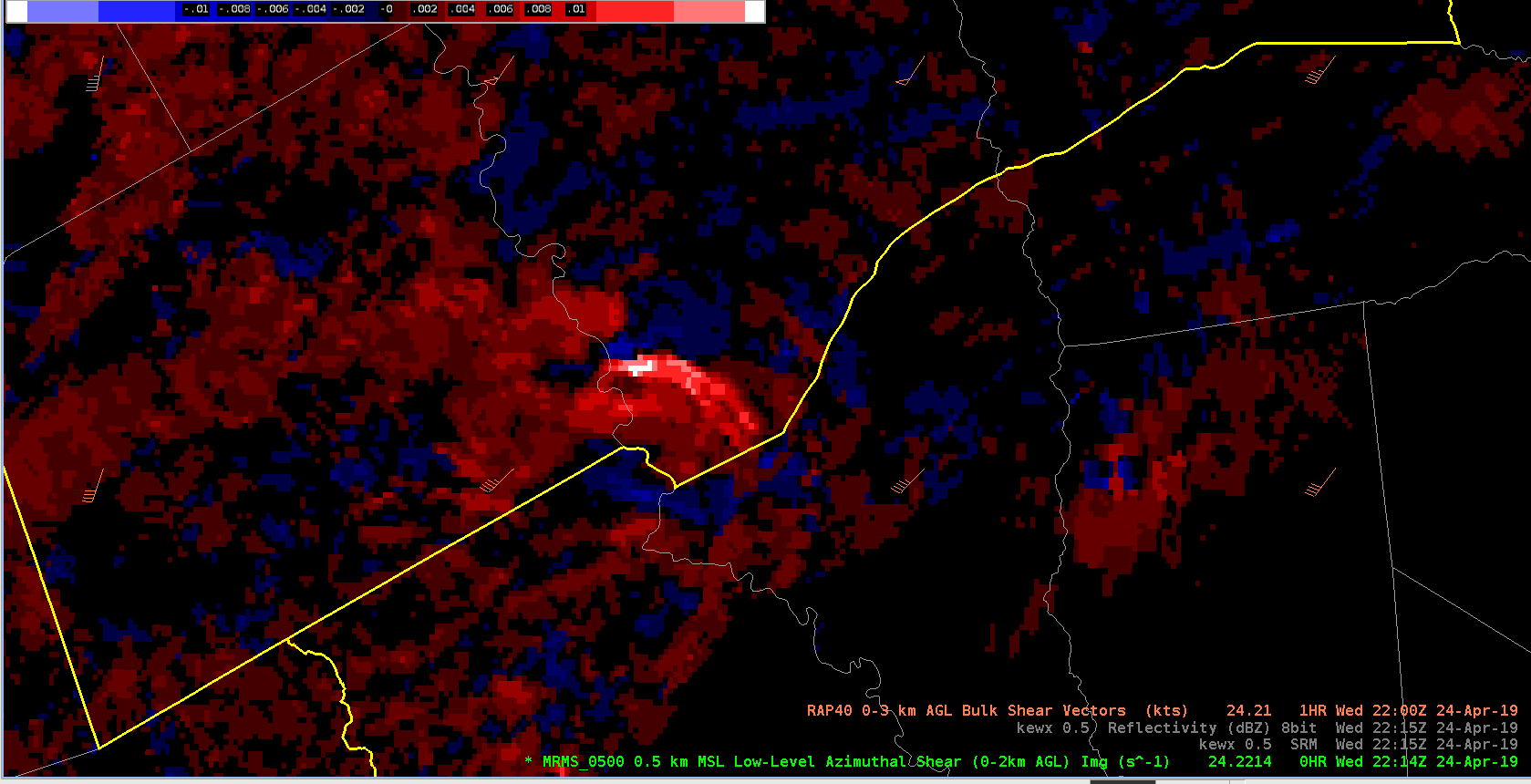
Watched the trend in CPTI on the storm in the far southern section of WFO FWD. This was associated with a cell that straddled the FWD and HGX CWA. Velocity data showed broad cyclonic rotation that tightened up periodically – including decent GTG.
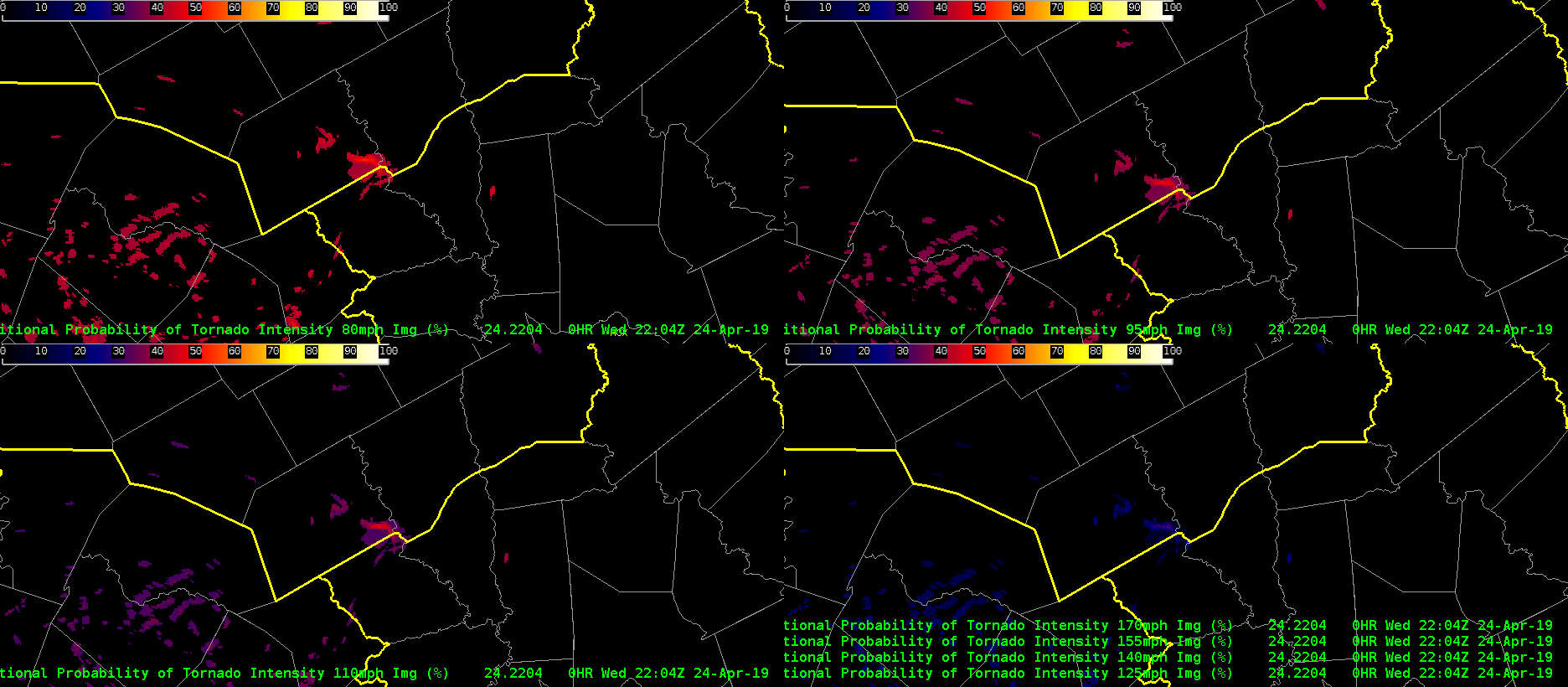
In terms of CPTI – the probability of the lowest range (80 mph) ranged from 40 to 50% between 2015Z and 2230Z. As wind speed thresholds increased, the values at 95 and 110mph did not differ much from 80 mph – generally around 40 to 45%. The highest values of CPTI also remained higher than I might have thought in this case with even the 170mph+ as high as 25%. This seemed a bit high to me (did not like like an EF4 event) – but maybe statistically this is true???
The merged 0-2km AzShear highlighted this area nicely. Note, I adjusted the default color table – to cooler colors – e.g. bright white is > 0.015 s-1. I wouldve loved to view the single radar AzShear product as well!
See AzShear plot at the trends in CPTI below.