Warning Issued for SJT CWA

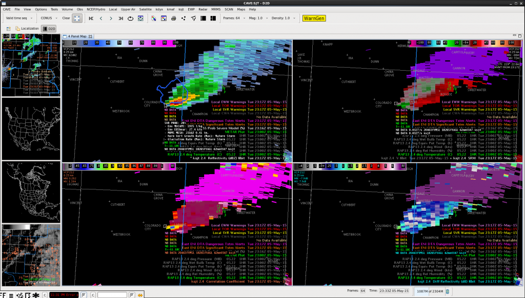
The cell that was diminishing as it crossed the border, started to show an increase aloft while finishing my previous post. That can be seen in the 2.4 degree scan from the SJT radar at 2317Z. That increase was noted before the ProbSevere began to increase and at this time it was showing 28%.

20150505_2317Z_SJT_Radar_2_4

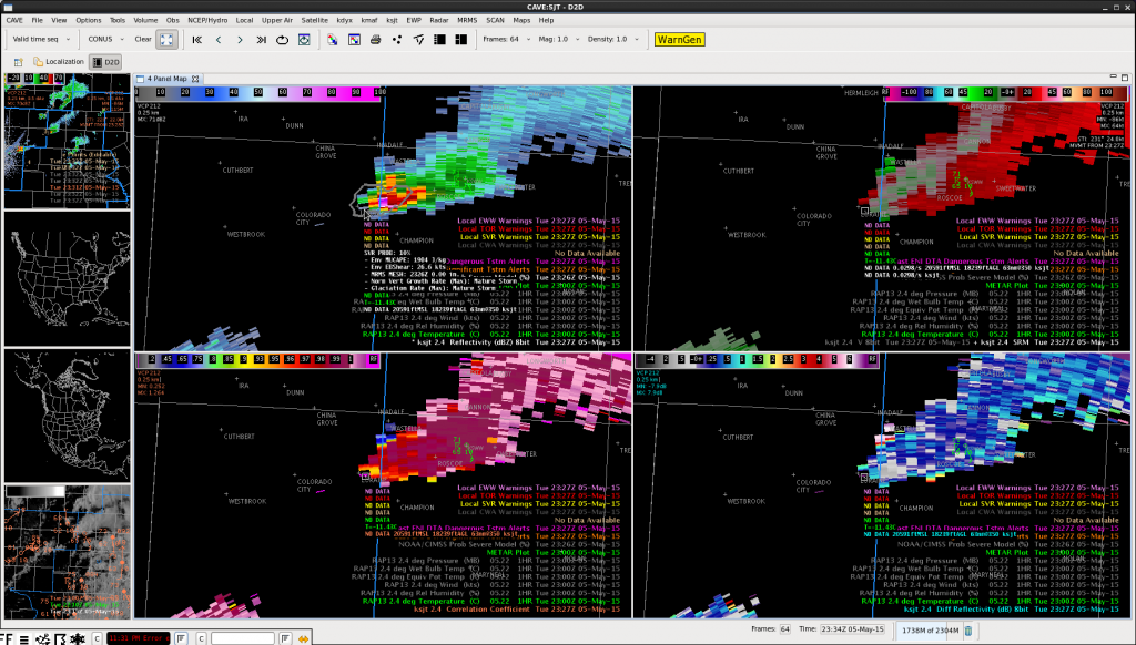
That increase continued over the next couple of scans, but unfortunately a data issue with the MESH product (value dropped to 0.00″) caused the ProbSevere to plummet to 10% at 2327Z (after rising to 50% at 2322Z).

20150505_2327Z_SJTRadar_ProbSevere_DropOut

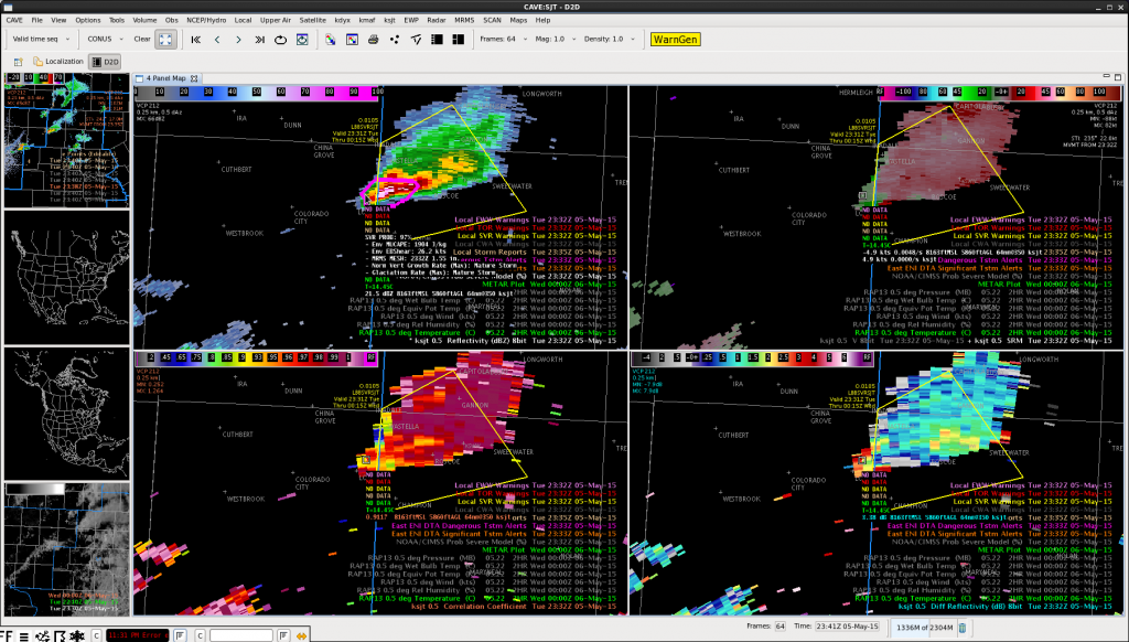
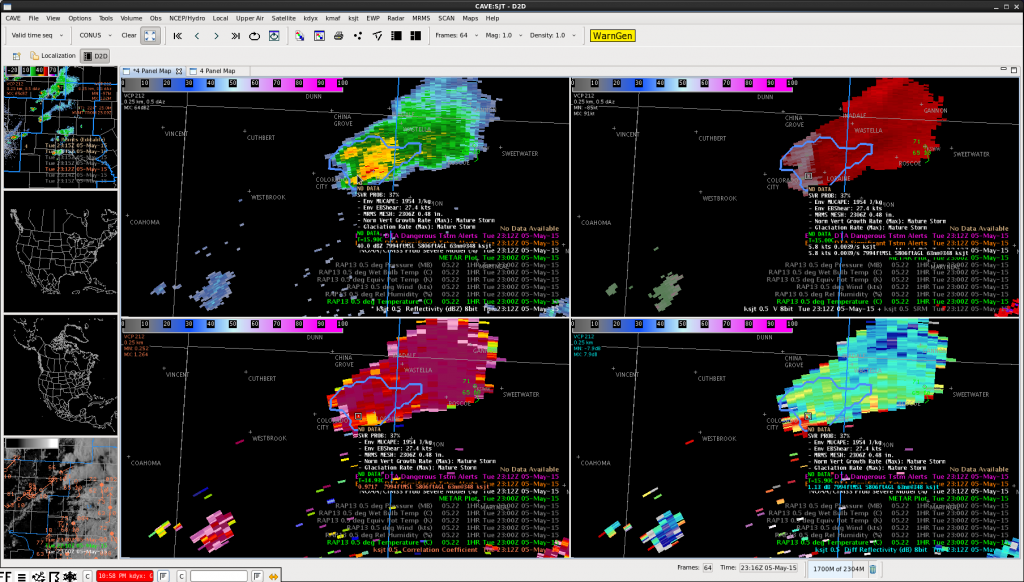
Even with that issue, the continued increase in the radar signature prompted me to issue a SVR for the storm at 2331Z. Right around the time the warning was issued, the ProbSevere quickly jumped to 94% and then 97%.

20150505_2332Z_SJTRadar_SVR

While the ProbSevere data dropped out around the warning issuance time, its arrival with high values right after the warning issuance supported the thoughts I had from the radar data. -SRF

Tags: None

DTA Polygons

If two or more DTA polygons are displayed for the same cell, only display the highest level DTA. This will eliminate some of the clutter due to numerous DTAs.

Multiple polygonsLynford

Tags: None

Surprising Lack of CGs

There has been quite a lack of CG lightning today. This slow moving cell that we have been tracking for hours (just go into our CWA already!) has been producing very little CG flashes. Even during the large lightning jump, there would be a CG flash rate of about 1/min, while IC was over 30 flashes/min.

Flash rate time series
0.5 deg reflectivity and 5 min lightning at 2212Z

Since then the cell has split. The left mover has pretty much dissipated. The right mover began to weaken, but has strengthened again and is finally going to move into the SJT forecast area.

SJT almost here
0.5 deg reflectivity at 2317Z

Maybe we’ll finally get to issue a warning!

-V. Darkbloom

Tags: None

SJT Force Field in Affect

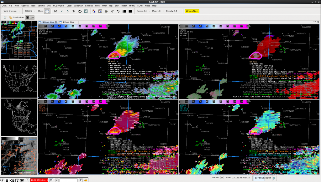
After monitoring the cell over Mitchell County Texas for the last 1.5hrs, it has finally neared the SJT border. Unfortunately, over the last 15 minutes the cell has been quickly diminishing on radar. The first image below is from 2256Z and the second is from 2312Z. Note the drop in ProbSevere from 83% to 37%.

20150505_2256Z_SJT_Radar

20150505_2312Z_RadarSJT

While writing this post, starting to see some growth aloft so we’ll see if we are able to issue a warning on it. -SRF

Tags: None

Suggestion for Cell Flash Rates

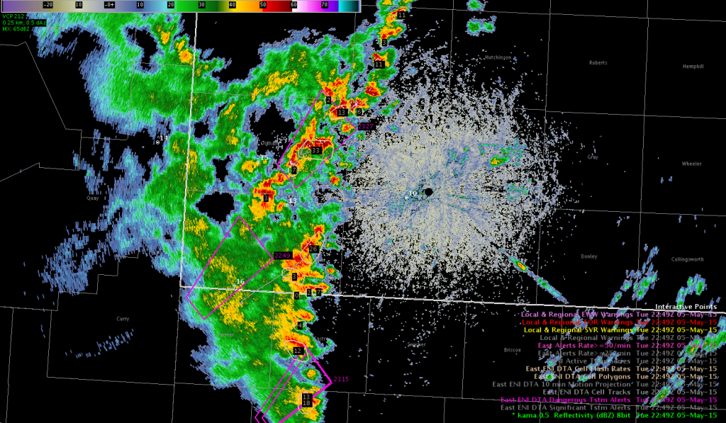
We have been watching numerous cell along a line in the western CWA. The display would be less cluttered if the flash rates displayed were above a configurable threshold, for example do not display cells with a rate less than 10.

cluttered flash ratesLynford

Tags: None

PGLM/Prob Severe associated with Storm Merger

An isolated convective cell just ahead of a line of thunderstorms became overrun by the line of storm and was absorbed by the line which resulted in an increase in the updraft and storm intensity.

Radar_merger
KLBB radar image at 2212 UTC just before the storm merger.

The ProbSvr was showing increasing probabilities around 30% by 2216 UTC outlining an area that encompassed the storm merger as well as another cell to the north.

Radar_2216By 2220 UTC the ProbSvr had increased to 73% and now encompassed the merger as well as the storm to the north.  The base radar data was not very impressive and I had no thought for a severe thunderstorm warning despite the increased values of the ProbSvr.  This is another case where the ProbSvr has limitations and shows higher values when you have storm mergers and in these situations it should be used with caution.

Radar_2220_probsvr
ProbSvr showing values exceeding 70%.

The PGLM data began to increase at 2215 UTC and continued to to a max density around 31 flashes at 2218 UTC before slowly diminishing back to below 10 flashes by 2224 UTC.

PGLM_2215UTC
PGLM data at 2215 UTC.
PGLM_2218UTC
PGLM data at 2218 UTC

I felt the PGLM data did provide me with improved situational awareness and help focus my attention to this area as these storms had been quite weak in the several scans leading up to this event.  I also can see where the one minute resolution of the PGLM data could provide an advantage to show a rapid increase in storm intensity between radar scans.

Jack Bauer

Tags: None

Zero Cell Flash??

We have been tracking a multicell line of storms through the western CWA. Cell Flash rates and Cell Polygons were overlayed on radar data as well as DTA Alerts. Algorithm gave a zero flash rate?? zero flash rate May 5Lynford

Tags: None

Svr T Warning

Issued warning for the sw CWA. Based on high dBZ well past the -20 level. Warning was issued at 2213z. Prob of svr increased to 51-53% from 2208z to 2216z.

SVRwarningMay5ProbSvr May5.Lynford

Tags: None