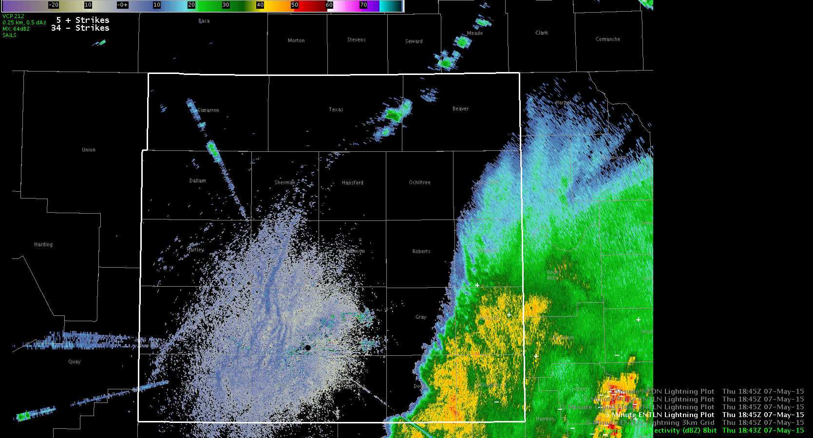
Have issued another warning to the northeast of the initial warning. The southeast storm is the strongest with a large hail core aloft, but lightning cell data shows lower lightning than the storm to the northwest that is starting to merge with the existing line. Opted to keep the warning farther to the northwest from the strongest cell due to the amount of lightning (and a 100 flash/min alert).
Month: May 2015
GOES CI in Amarillo CWA
Morning MCS over the southeastern Texas panhandle has resulted in a north-westward propagating outflow boundary. This boundary has merged with a loosely defined dryline in northern parts of the CWA, with the dryline then extending further to the south. More elevated values of GOES CI (30-60%) has focused very well along these boundaries. An area of 75% probability was indicated at 1937 UTC. By 1956, a weak echo was apparent in the AMA radar reflectivity. By 2008 UTC, the intensity had increased to 50-60 dBz.
ALEXANDERS DARK BAND/LYNFORD
LBB Prob Severe and Lightning Jump
Looking at prob severe and the lightning jump associated with a particularly nasty looking storm.


A severe thunderstorm warning was issued at 1932Z. No reports yet.
-V. Darkbloom
Warning issued for Storms over SW OUN CWA
Rapidly intensifying storms entering the OUN cwa where picked up well on ProbSevere, with them quickly rising to 90%. Based of the reflectivity cores aloft, broad rotation, and the rapid increase in ProbSevere, have issued warnings for multiple storms in the SW corner of the cwa (at 1922 and 1924Z).
While the ProbSevere and cores aloft support the warnings, lightning data has been struggling so far with the peak lightning cell data only around the mid 20s.

Finally, here is a look at the time series for the strongest cell, with a few jumps but overall limited flash amounts.
Will be monitoring the lightning trends and see if the data catches up with the radar and ProbSevere appearance.
-SRF
ENI Time Series and Storm Merger
While looking at the ENI cell polygons and flash rate data on a storm near the border of Greer and Jackson counties I noticed a significant jump in the values from below 20 up to well over 100 in about a 10 minute period. The cell polygons at 1821 UTC on the image below showed two separate storms, one with a flash rate of 12 and another to the north with a flash rate of 54. During the following 10 minute period the southern storm merged with the northern storm.
The radar data at 1832 UTC showed the two storms had merged and there was one large cell polygon now (111 flashs) which encompassed both of the previous cells. The base radar data at this time did not support a warning and this is a case where the lightning data should not be used alone and it yet another tool in the storm interrogation and warning process.
Below is the ENI time series showing the large jump in the lightning flashes. It is important to note that the cell area can be a valuable piece of information for forecasters to look at in situations like this as it can be an indicator of the cell merger that took place.
Jack Bauer
Comparison of ProbSevere and Custom DTA
After setting up the custom Thunderstorm Alerts (75/min and 100/min), there were a couple areas of focus on the 100/min alerts (to the west-southwest and southwest of KTLX).
But when comparing to the ProbSevere data, we are seeing different representations on the strength of the storms. The storm to the WSW only had a ProbSevere around 11% (that had the greatest flash rate around 149 per min), while the storm to the SW had a ProbSevere of 88%, but a weaker flash rate (87 per min).
These differences highlights the need for analyzing multiple data sources and comparing to radar.
-SRF
Lubbock Today – Initial Look
This morning iin the TX panhandle there was an existing west-east line of thunderstorms stretched across the northern portion of the LBB CWA. A warm front was aligned SW-NE across the AMA CWA, with a dryline across the southern panhandle and a nice dryline bulge south of the CWA.


CI has tended to be more of a “now”cast as opposed to a forecast.


By the time the CI was high, convection was already ongoing in that area. More frequent satellite data would definitely help in these rapid development situations!
CI ahead of shower development
Initial Analysis localized as OUN
Water vapor imagery early this afternoon is showing a deep closed upper low over CA with broad southwesterly flow across the southern plains with a weak disturbance moving through the flow which seems to be enhancing/sustaining convection moving through the western portion of the forecast area. Visible imagery shows well the ongoing convection as well as a boundary situated across KS southwestward into the OK/TX panhandle.
A quick look at the GOES-R CAPE showed values generally in the 1000-1500 J/kg except along the Red River where lower values were shown below 1000 J/kg. There definitely appears to be some influence of cirrus and mid level clouds associated with the ongoing convection affecting the output.
Comparing the GOES-R CAPE to the SPC mesoanalysis mixed layer CAPE it appears the values are too low, especially in the Red River area where values close to 2000 J/kg were noted.
The continued moist southeasterly flow into the region today south of the ongoing convection should interact with outflow boundary from ongoing convection and initiate new convection across the southern portion of the forecast area.
Jack Bauer
Rapid Increase in ProbSevere
While we were writing up a previous blog post, we noticed rapid increase in the ProbSevere for a storm to the west of the OUN radar. The ProbSevere quickly ramped up from 9% to 94% as seen in the two images below.

Seeing that rapid increase was noticeable to both of us as were were typing up other blog posts and prompted us the interrogate the radar data. While the core looked small initially, the idea shown by the ProbSevere was right on.
Finally, with the location of the cell being right under the clouds from upstream convection (see image below), it led to N/A values on the satellite data.


-SRF