

image
Month: May 2015
CI Prob and Coastal/Sea Breeze Thunderstorms
There is a dominant southeasterly flow across southern Florida. This dominant flow will interact with a sea breeze developing early afternoon along the Gulf Coast. Forecasters struggle daily with where exactly these sea breeze storms will develop (close to the coast or a bit inland?). Once initial cumulus clouds start developing, the CI Probability placements seem right on target. One can follow cloud development from satellite to shower and thunderstorm development on radar (note the radar data is off in the thumbnail, but subsequent rain development was tracked and monitored) verifying CI Prob in this instance. Thunderstorms have formed right alone the coast (along and west of I-75). This is very helpful and pretty specific given how close I-75 is to the coast in this area.

UFFSU
Watching Cu Field
Nothing going on still in the mid Atlantic! Currently monitoring the cumulus field that has been developing over much of the area, much of it along the front through the western LWX CWA. I like this display because these are the days as a forecaster where you just “wait” to see if anything can happen- if something does develop, it could be strong but will it? Sometimes it is tedious looking at all the Cu and wondering which will develop. Having this display up helps me quickly see what CU is developing more than others. I also have ProbSvr overlaid but since nothing is showing up on reflectivity yet, this won’t help.
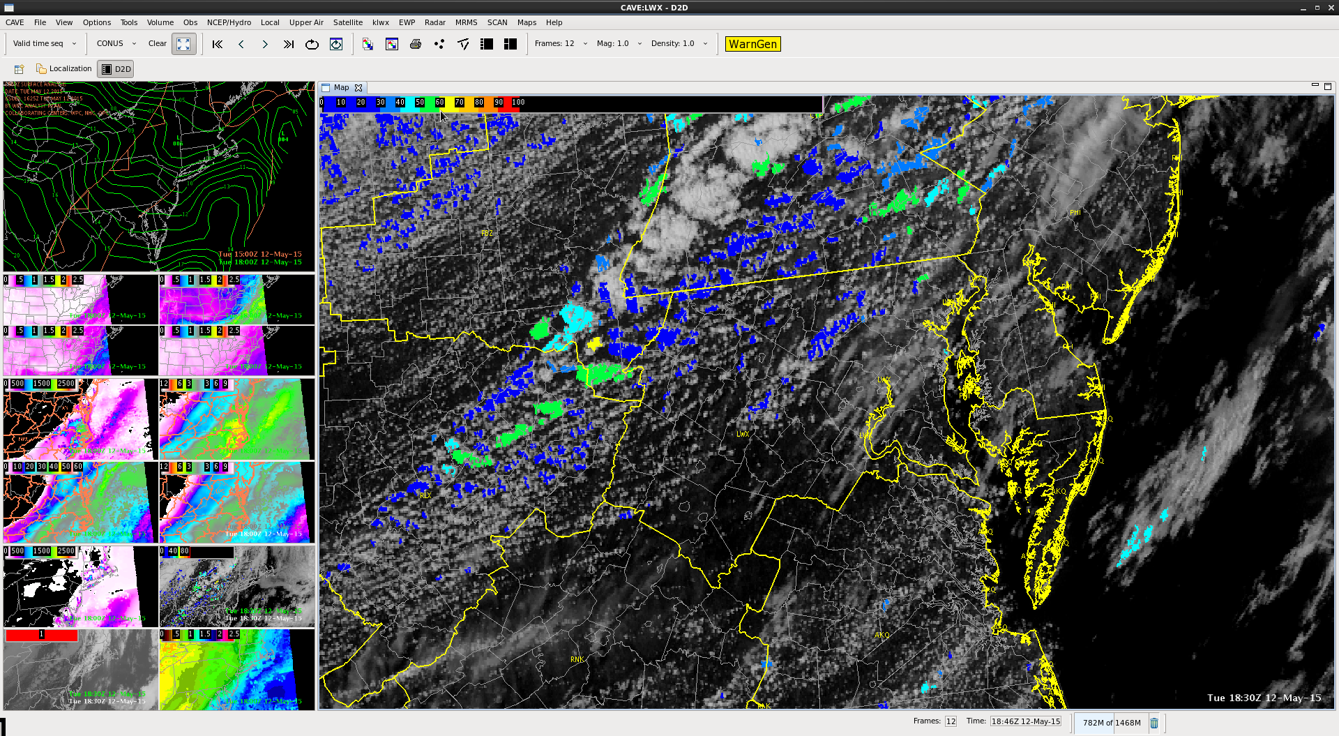
Lauren13
Pocatello, ID 1830 UTC
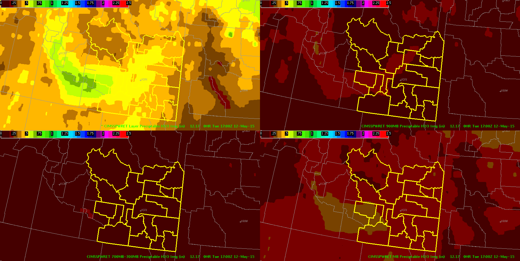
Current conditions over the PIH CWA appear to be only marginally favorable for severe convection as region comes under the influence of large upper level low. Instability is the main limiting factor with CAPE values remaining AOB 500 J/KG…with current CAPE values based on the GOES sounder AOB 200 J/KG, although they have been increasing.
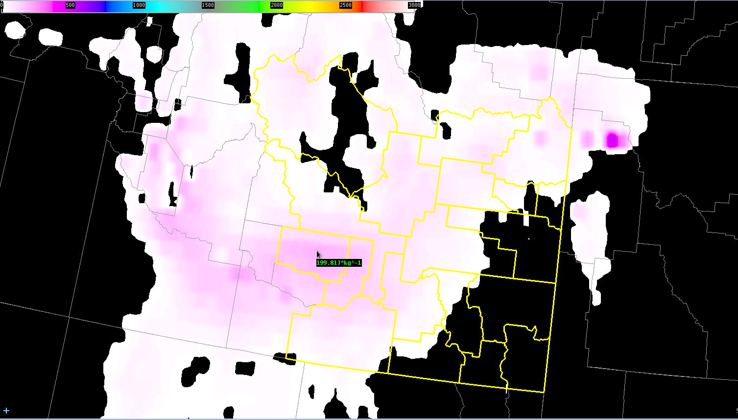
Deep layer shear is generally b/w 30-40 kts, which could allow for any storms that do form to become briefly organized. Layer PWATs (based on the GOES product) in the western portion of the CWA are near the 75% (~0.6 in) and are mostly confined in the 900-700 mb layer.
Overall, expect marginally severe wind gusts to be the main threat with any stronger storms that develop.
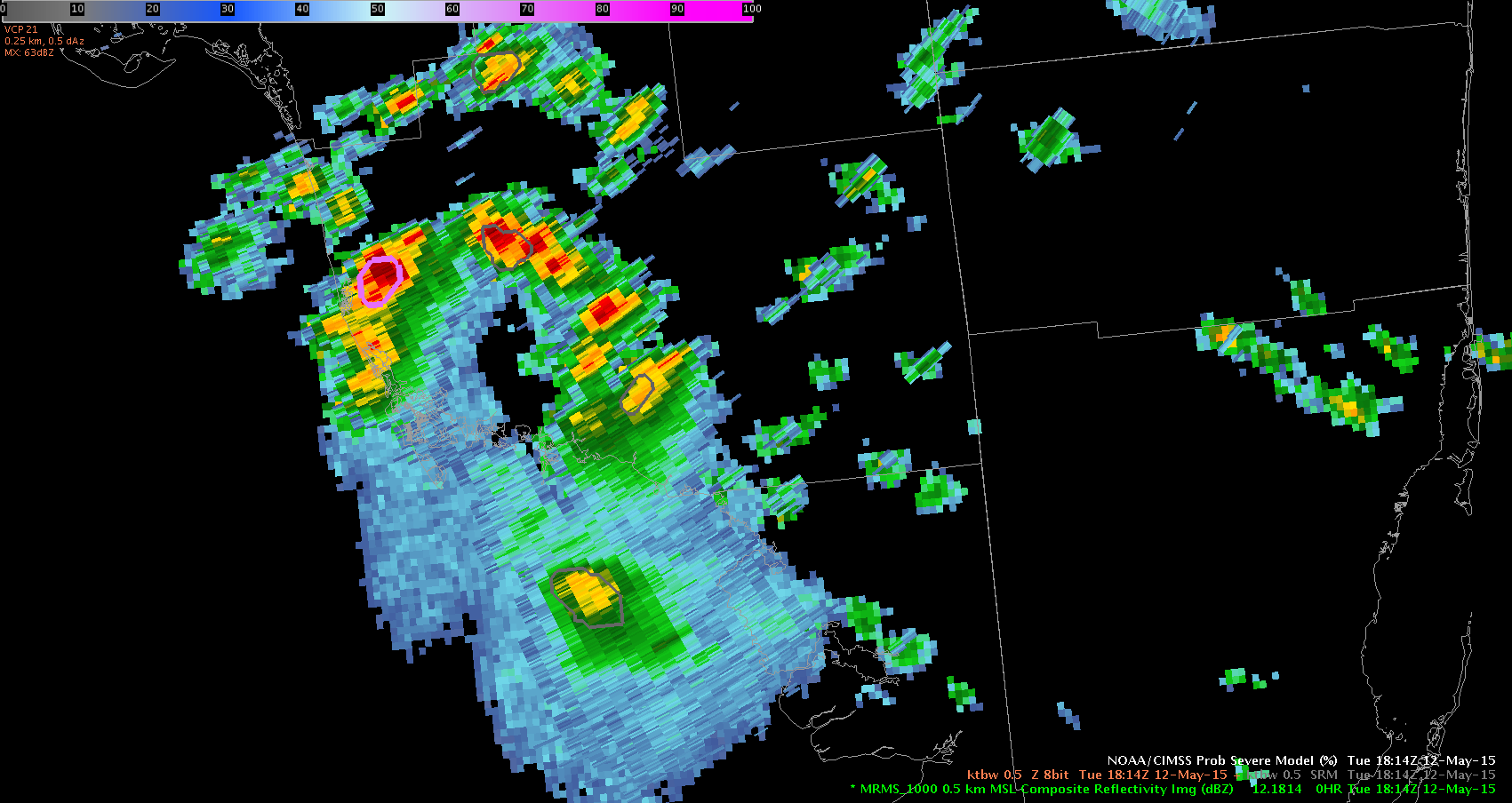
Ertel
Storm Growth, Evolution in Prob Severe
There are coastal thunderstorms in Monroe and Collier counties in southwest Florida indicating low severe probability initially.
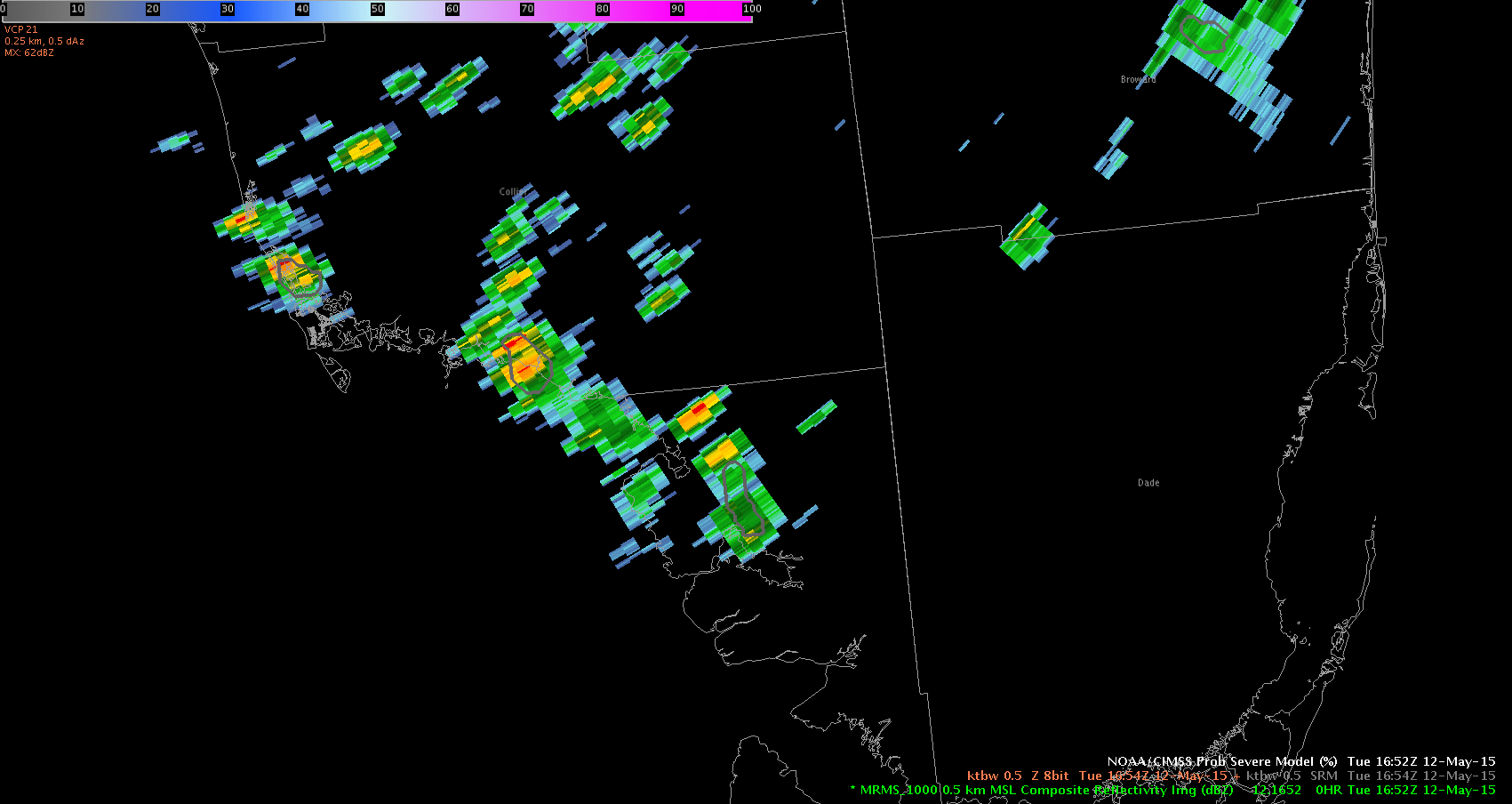
Interestingly enough, the sample indicated extremely high cape, low shear, but the qualitative descriptor for storm growth indicated ‘strong.’ I followed this storm from approx 1652z and watched storm development. Even though severe limits might have been low, the storm did continue to grow (which was indicated). By 1820Z you can see the storm has remained onshore moving NNW into nw Collier County. The thunderstorm continued to grow indicated by the qualitative descriptor. This hit a 72% probability of going severe at it’s height, before subsequently pulsing down. Still, the descriptor was accurate and helpful in identifying storm growth. Interestingly enough, these cape values do not come close to matching interpolated cape values from the other GOES product (much lower).
UFFSU
Sterling, VA Initial Environment
Overall, a large area of high pressure dominates the central United States with a surface cold front draped across the Appalachian Mountains through Pennsylvania, West Virginia and eastern Kentucky and Tennessee. A small trough was also centered over Virginia and North Carolina. A decent cu field accompanied the cold front with GOES CI values mostly 30% or less as of 1830Z.
All the CAPE was concentrated over eastern North Carolina, with values of 500 J/kg or less over Maryland and eastern Virginia. A fairly steep PW gradient cut through central Maryland with .75-1 inch in the northeast part of the state, up to just over 1.5 inches in the southeast portion.
Any storms that do form over the CWA will be in the next few hours as the cold front moves through , but likely not severe.
~ Regina Phalange
Thoughts on LWX Convection Today
After a brief look at guidance for convection chances in LWX today, it isn’t looking too great. There are some surface features with the latest analysis showing a trough stretching from central NJ down to central VA. A cold front is stretching through the entire country from north of Vermont to southern Mississippi. 17z GOES-R products shows the CAPE to the south in AKQ’s CWA as well as the highest LI/K index and PW values. Looking at the latest satellite imagery shows skies clearing after 16z over the CWA and cumulus fields developing. It looks like the latest satellite CAPE “may” be creeping west with the clearing and some storms showing some CI potential but nothing higher than 50-60% so far. RAP guidance doesn’t have the cold front moving through the region until after 21-22z. It also shows convective indices decreasing after that.
Summary? If we get any storms it will likely be before 22-23z moving west to east along the front. I don’t think the instability/shear is strong enough to get any significant initiation along the pre-frontal trough. I have highest confidence that areas to the south will get convection with the trough and/or the cold front.
Prob Severe Storm Growth
I am watching ongoing thunderstorms move west through CWA MLB. Radar indicate cells that could contain small hail, below severe limits. Severe Prob indicates low percentages of turning severe. However, when sampling this data the north vert growth rate indicators read N/A. Glaciation rate also read N/A. Is this data missing? The problem with using N/A is that it is inconsistent with the weak/medium/strong qualitative descriptors. You can see Severe Prob using proper qualitative descriptors starting in the 1645z period, but as we progress toward 1745z those qualitative descriptors are gone.

UFFSU
Daily Summary: Week 2, Day 1
New week, new participants, and a very different convective setup compared to last week. Today our forecasters were exposed to all that the EWP has to offer while operating in Wilmington, OH (ILN), Louisville, KY (LMK) and Houston, TX (HGX) ahead of a cold front that spanned from southern Michigan into central Texas. Forecasters quickly spun up on utilizing ProbSevere as a quick diagnostic tool to prioritize which storms to interrogate first. Forecasters were able to establish their first impressions, build procedures, and ask questions on the entire suite of products thrown at them. The established large squall line that dominated most of the country, while not helpful from the CI perspective, gave forecasters the ability to put the various diagnostic tools to work and compare outputs between mature and developing convection.
Overall, another “Day 1” in the books, here’s hoping for some interesting cases this week (fingers crossed and prayers needed).

-Darrel Kingfield, CIMMS/NSSL Research Associate & Week 2 EWP Coordinator