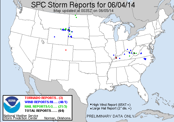
 Today, we operated in 4 county warning areas:
Team 1 (Fowle & Anderson)
- Louisville, KY
- Springfield, MO
- Cheyenne, WY
Team 2 (Pelczynski & Satterfield)
- Boulder, CO
Early in the day, it appeared that the greatest severe threat would exist in the MS/OH valley region. Additionally, there were enough breaks in the high-level clouds to allow for use of the GOES-R satellite products. However, as the day progressed, it became apparent that the region would not destabilize as much, so we moved Team 1 to Springfield, MO (based on a favorable mesoscale discussion). As it turns out, the capping inversion would hold over that area. Thus, we moved Team 1 to Cheyenne, WY – hoping that we could catch some lightning data from the LMA in Denver. A few marginally-severe storms did develop.
Team 2 remained in Boulder all day. There, they used the GOES-R products extensively, including the NearCast, UAH CI, Probability of Severe, and lightning data. Several severe storms developed, though only one severe report was officially logged (for a landspout tornado).
-G. Garfield
Week 4 Coordinator

