

Destabilization continues to occur further north into the southwestern portions of the OUN CWA. Surface CAPE values are approaching 3000 J/kg and CIN values are near zero. One severe storm has developed along the surface boundary and additional thunderstorms should develop.
In the SJT CWA, thunderstorms continue along the cold front/dryline. Thunderstorms should continue to build southward into the instability axis to the south. CAPE values remain in the 2500 to 3000 j/kg range with little CIN.
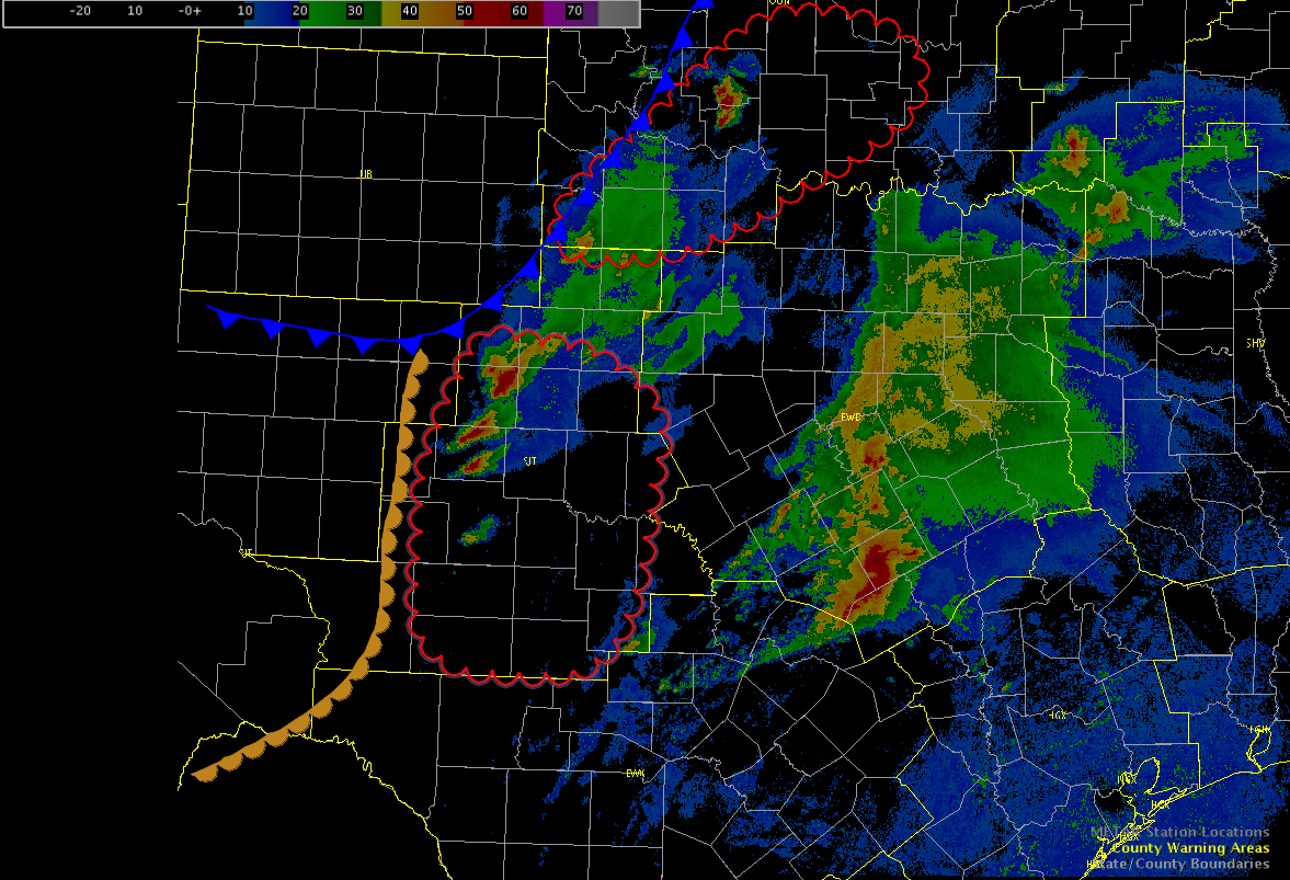
The severe storms in the southern FWD CWA continues to track ESE, but with no additional severe activity expected in the near-term, the FWD team has no moved into the OUN CWA where additional storms are expected and the pGLM data can be utilized.
Hampshire