
Our forecasters have documented examples of how CTC has performed in areas that are generally clear (aside from cumulus/cumulonimbus development), and we are getting a good feel for how the product behaves. We also understand that areas completely shrouded by high clouds will likely show little to no CI/CTC indications at all.
An “in between” example was found in the SE part of the San Angleo TX CWA near 1930Z this afternoon. This area was west of the enormous cirrus shield in central Texas, but still had some scattered to broken high cloud cover in place. As thunderstorm updrafts developed, CTC signals were indicated on two occasions (pictured below).
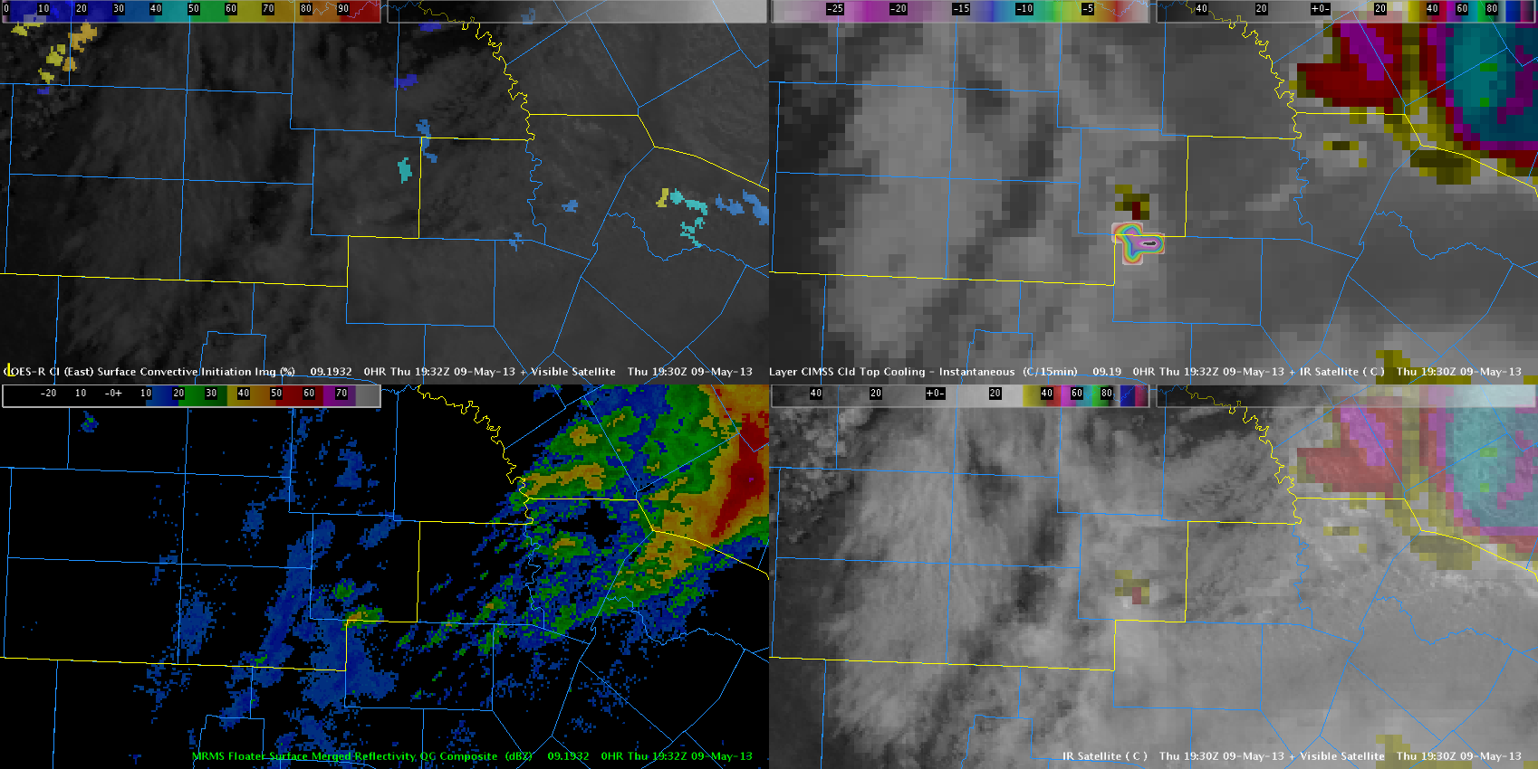
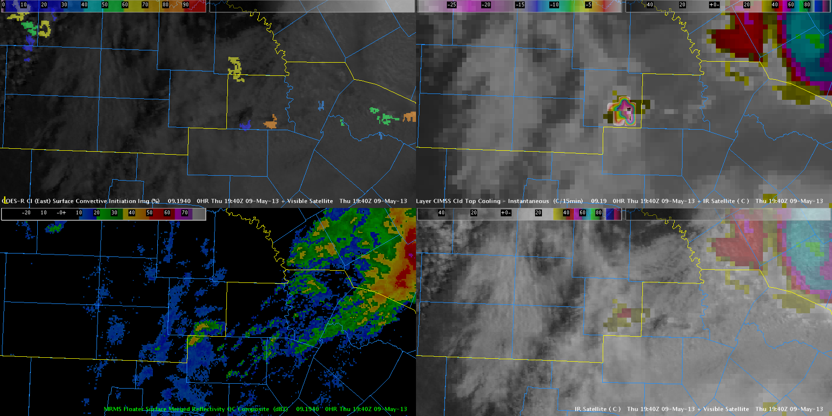
The CT values generated here are extremely (and unrealistically) high. Unlike the “off the charts” error documented in an earlier blog entry, these values appear to be co-located with the actual development of the updraft, and not due to spatial or temporal displacement
At least from this example, we can see how differing cloud environments (clear vs. sct/bkn vs. overcast) will lead to different ways in which the CTC product behaves. It will definitely be useful to learn these differences, and if is determined to be more than just a localized problem here, find ways to separate the developing updraft from the incipient cloud cover in a way that will generate more reasonable and useful CTC values.
–Hatzos