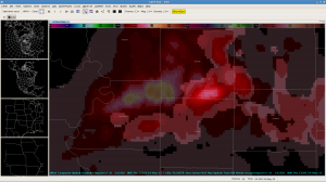
The 3DVAR output showed strong increases in storm top divergence, updraft helicity, and maximum updraft speed in the 2245z image associated with a thunderstorm in Buchanan County in northwest Missouri. Subsequent to these increases the thunderstorm updraft split (left mover died quickly) and the storm turned to the right over the next several images, as shown in this image of the maximum updraft composite. The brightest image represents the current image while a history of previous images is shown in subdued colors.

