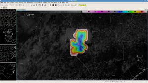
The CIMSS-CTC algorithm showed cloud top cooling rates of between -10 to -15 C/15min on several images with a thunderstorm developing across Sampson county in North Carolina. The CTC first appeared on the 1715z image and continued to highlight this cell through the 1815z image. As the algorithm continued to show moderate cooling rates with the cell the radar presentation became more impressive and a three body scatter spike developed with the cell. A report of penny sized hail was received with this cell 1823z 5 miles WSW of Newton Grove, NC.

