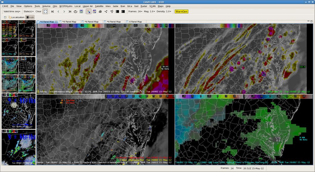
Being LWX today for another rather quiet day. Nearcast products and simulated satellite (and HRRR and 3dVAR) both showed marginal instability and a few air mass sort of thunderstorms and that is what has been happening. It has let us see a few flashes on the pGLM products but not really enough to evaluate usefulness in warning situation. Image below shows nearcast theta e product in lower right (showing not much) and simulated IR in upper right showing spotty but unimpressive convection. Left two panels are real IR & Vis sat showing that the simulated stuff not bad. The CI products seem to be hitting areas that do end up as the small thunderstorms but not sure they are showing more than can be diagnosed by looking at the satellite imagery so not sure if I would warn on this product any more often than the satellite and radar alone but good quick check to make sure I am not missing anywhere I should be watching.

