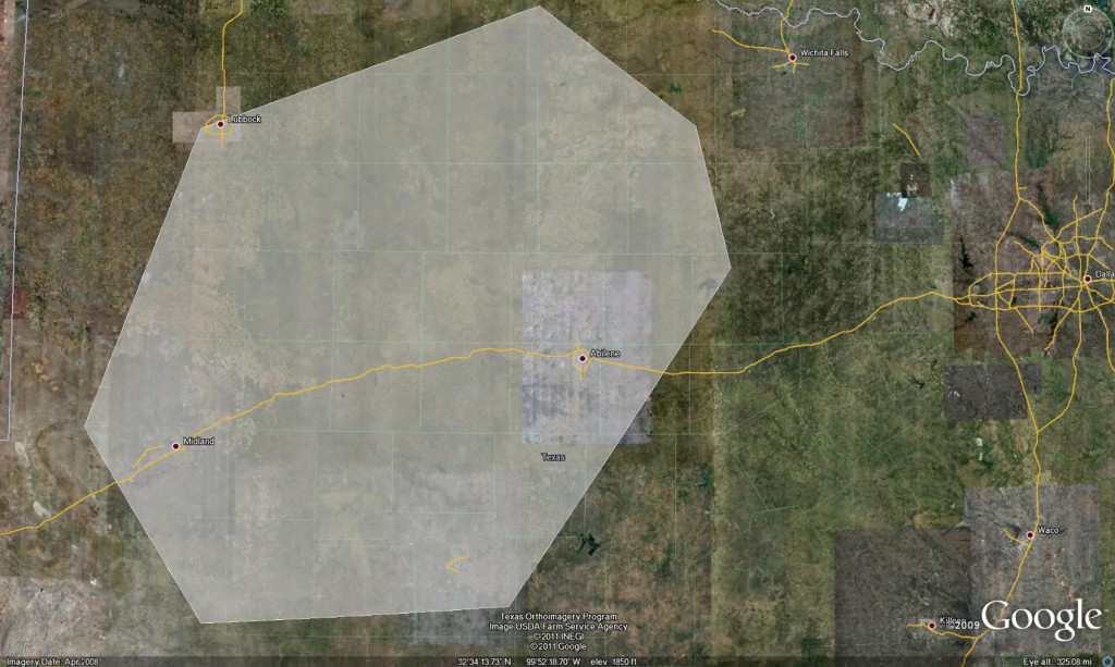
Daily Summary: 10 May 2011

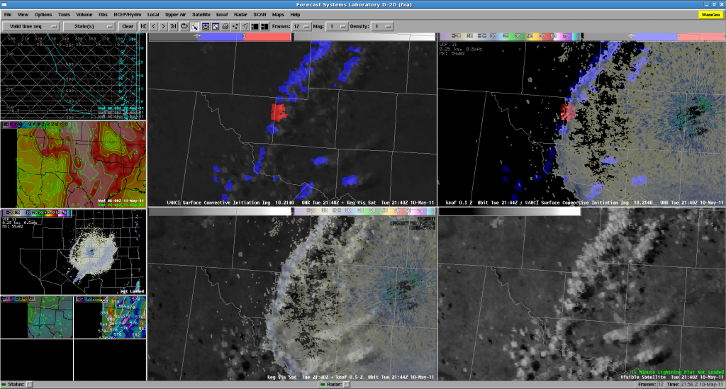
Forecasters remained in the MAF and SJT regions through the end of the forecast day focusing mostly on convection initiation products and short-range models. With an extend Cu field across the region and GOES in rapid scan operations, the forecasters observed a severe limitation of the UAH-CI product.  Every 5 to 8 min time step the UAH product would catch minimally growing Cu between the time steps exhibiting a high percentage of false alarms.

Overall, this was a minimal day in terms of testing all EWP experimental products limited by weather and technology with the floater domain unavailable due to a morning raid failure.

4-panel forecaster AWIPS display: UAH-CI and Visible satellite at 2144 UTC.

-K. Kuhlman (Weekly Coordinator)

Tags: None

2011-05-10: Area Forecast Update

Update to previous discussion…

Biggest change resides in surface wind field already responding to upstream pressure falls, with backing winds across a large portion of the domain. In contrast, deeper moisture discontinuity gradient resides through Sweetwater to Dryden as of early this afternoon. Recent satellite imagery depicts high-based cu developing within dry air in proximity of weak surface convergence. Low probability of this initial activity persisting due to concerns with very high T/Td spreads, via cold pool dominance. Outside of this area, skies continue to clear, with the main clearing line stretching from CDS to DRT. At the present time, moisture will need to stream NWward in order to establish severe weather threat. Short range forecast guidance continues to indicate a rapid transport of surface moisture between 00-03z and likewise shows a weak signal of convective initiation upon retreating dryline approximately 23-02z, generally east of Midland, TX. Forecast consensus considers this scenario low-confidence. However, if convection does develop in this region, environment supports robust development with conditions favorable for initial mode of supercellular activity. Models trend for upscale growth as low-level jet increases early this evening as convection translates east or northeastward over the remainder of MAF and SJT CWAs.

Blair/Curran/Billings/Taylor/Vincent

Tags: None

2011-05-10: Initial Area Forecast Discussion

  • Focus today through this evening over the MAF and SJT CWAs.
  • Ongoing convection initiated on lead wave this morning extending from the western Hill Country northeast into Oklahoma complicating matters.
  • Dryline initially from 30 W KCDS south to near KSWW then southwest to KFST will mix/advect west about 30-40 miles before stalling and retreating westward in advance of shortwave rounding the base of the longwave trough over the western CONUS.
  • OUN WRF indicates weak convection firing along and ahead of dryline/differential heating boundary from near KSNK south to near KJCT.
  • Initial activity should move northeast…high res models suggest activity will decay a bit after 23z.
  • Well defined wave on WV and short term model guidance expected to move out of northern Mexico after 00z.
  • Convergence along retreating dryline with MLCAPEs over 2500 J/kg.
  • RUC SBCAPE indicates significant increase in instability retreating west with the dryline after 00z.
  • Another round of CI expected to occur between 00z and 03z invof MAF.  Deep moisture over western Hill Country southeast should not mix much owing to cloud cover and attenuated insolation.
  • NAM and HRRR hints at robust convection between MAF and SJT around sunset.
  • Potential for supercellular structure with large hail (aoa baseballs) with second round.  Tornado and high wind threat somewhat less owing to stabilization of PBL.

Tags: None

Week 1 Underway

After the typical culmination of late night hours and technology wrestling matches, the 2011 edition of the Experimental Warning Program’s spring experiment, or EWP2011, gets underway today.  We want to welcome our first set of visiting forecasters:  Jerilyn Billings (WFO Wichita, KS), Scott Blair (WFO Topeka, KS), Brian Curran (WFO Midland, TX), Andy Taylor (WFO Norman, OK), and Brandon Vincent (WFO, Raleigh, NC).

We are trying a few new things this year:

1)  Monday is our dedicated training and orientation day.  In the past, we’ve crammed in both training, orientation, and real-time operations on the first days of each operational week, and have felt rushed and in some cases, the forecasters felt unprepared.  So we’ve expanded our time dedicated toward our training sessions, and turned the last few hours of the shift into a hands-on get acquainted with the AWIPS software and experimental products session.  In addition, we’ve moved our Monday shift back 3 hours (10a-6p) so that our visitors can get started right away on their first day.

2)  Tuesday, Wednesday, and Thursday are our only real-time operational shifts.  The entire days will be devoted to real-time operations, instead of wrapping up unfinished training from Monday.

3)  Our real-time days now feature two overlapping shifts.  In an effort to a) emulate the forecast – nowcast – warning decision processes in a WFO, and b) start bridging the gap between the EWP and the Experimental Forecast Program (EFP) of the HWT, we’ve added an early shift.  We are splitting our visiting forecasters into two groups, and each group will have opportunities to work both shifts.  The early shift runs from 9a-5p and the late shift is our usual 1p-9p.  The early shift will issue a morning Area Forecast Discussion (AFD).  Between 1p-5p, both shifts will overlap and collaborate on an update to the AFD, as well as being the process of monitoring convective initiation (CI), issuing nowcasts, and eventually warnings, all weather dependent on the forecast/warning area chosen for the day.

4)  The EWP and EFP will conduct a joint map discussion at 1pm on the real-time operations days.  The EWP will inform the EFP about the previous day’s events, and the EFP and our morning EWP shift will help inform the EWP on the likely areas of warning operations for the afternoon and evening.

Watch here for daily outlooks, live blogging during operations, daily summaries, and an end-of-week summary for the next 5 weeks.  Note that we take a holiday the entire week of Memorial Day.

Greg Stumpf, EWP2011 Operations Coordinator
Tags: None