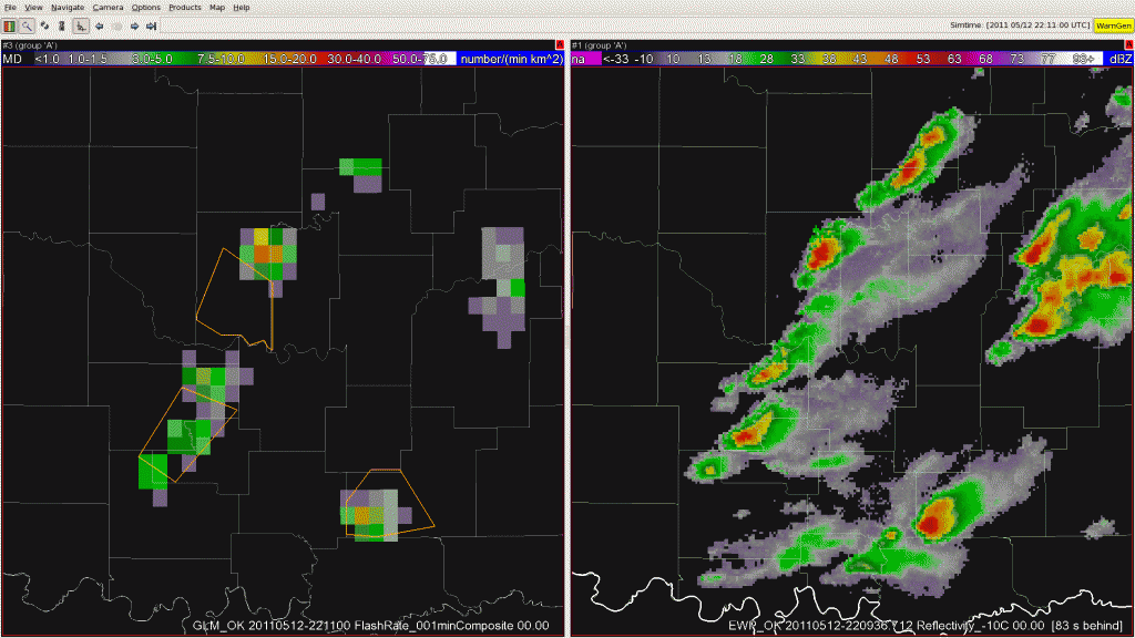
Today’s afternoon shift started with forecasters working across the Norman, Tulsa, and Little Rock county warning areas. With the some storms beginning to form south and east of Norman, Oklahoma, it was felt this would be a good opportunity to take another look at the PGLM flash extent density observations and focus on total lightning. The PGLM flash extent density was very useful in identifying when the first cloud-to-ground strikes would occur. The PGLM was preceeding the first cloud-to-ground strike by approximately 30 minutes today.
As the the afternoon progressed, the storms began to intensify, both on radar and with the PGLM flash extent density and we shifted from using the PGLM for lightning safety and moved into warning operations. By 2211 UTC on 12 May 2011 (the first image of the loop shown above), three severe thunderstorm warnings were in effect. The area of interest for this post is in between the two existing warnings in the west. At 2211, the PGLM flash extent density was no more than a few flashes per minute. By 2214 UTC the number of PGLM flashes was already approaching 40 per minute. This continued to rapidly increase through 2220 UTC when the PGLM flash extent density observe 82 flashes in a 1 minute interval for a single 8×8 km grid box. This was one of the largest lightning jumps of the day with an increase of 75 flashes per minute in a nine minute time span. With this major lightning jump, along with the forecaster’s interrogation of radar data, a new severe thunderstorm warning was issued at 2226 UTC. This warning was later verified with several severe hail reports.
Submitted by Geoffrey Stano, PGLM PI for week of 9-13 May.

