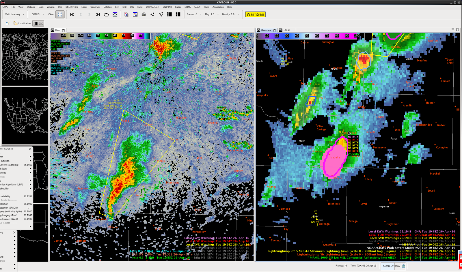
GOES-16 Sandwich Product showing a nice above anvil cirrus plume. ProbSVR showing 99% for large hail and Tor prob 5% with nice double rings. GLM Min Flash area remained in place with overshooting top of this supercell.
Official websites use .gov
A
.gov website belongs to an official government
organization in the United States.
Secure .gov websites use HTTPS
A
lock (
) or https:// means you’ve safely connected to
the .gov website. Share sensitive information only on official,
secure websites.

GOES-16 Sandwich Product showing a nice above anvil cirrus plume. ProbSVR showing 99% for large hail and Tor prob 5% with nice double rings. GLM Min Flash area remained in place with overshooting top of this supercell.
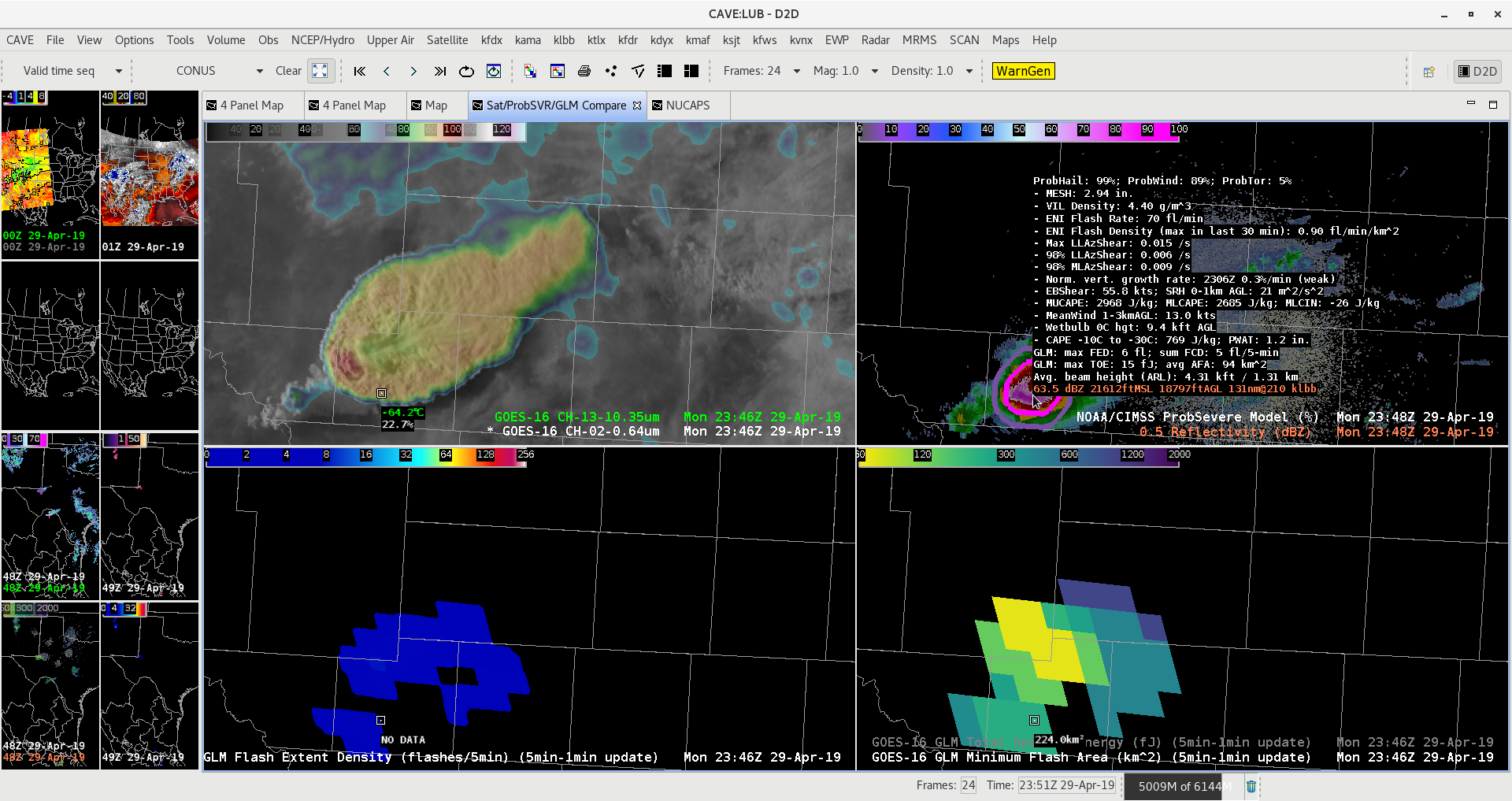
Below is an example of a case where prob severe my offer the best option for a warning decision. This storm is outside of the best RADAR coverage available; however, strong development has been seen on Satellite imagery for an extended period of time. In a case like this, the PROB Severe Algorithm may be the best option for a warning decision, based on the data available.
 South Beach
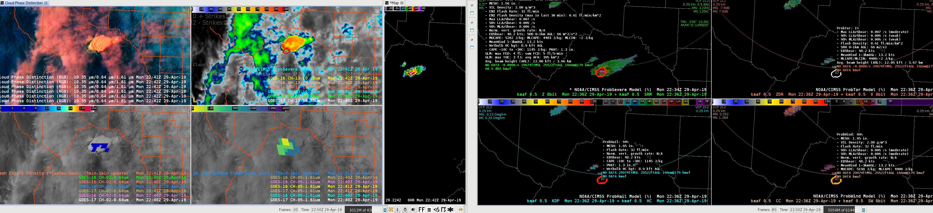
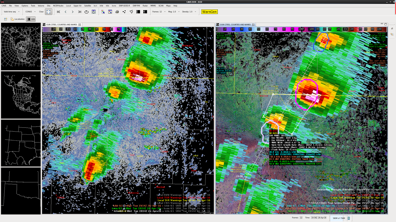
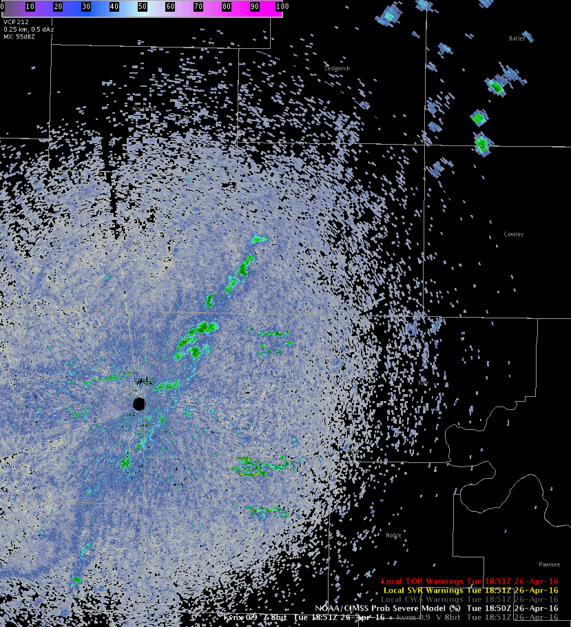
With this storm going through Milam and Burleson Counties in South Central Texas ProbSevere is saying 90%+ for ProbWind and only like 15% ProbTor. One possible reason for the lower ProbTor may be the large area that ProbSevere is tracking as one storm. Yes, it certainly is one large bowing line segment, but if you look at the AzShear Merged data in the lower right you can see localized maxima in Milam County. While there is not a defined couplet at this point there is some bookend vortex action going on in the area of the AzShear maxima. If the ProbSevere was broken into two different areas would the ProbTor and/or ProbWind be even higher for the Milam County storm due to the locally higher AzShear? I would say probably so! Because ProbSevere is encompassing the entire line segment the values of AzShear going into ProbSevere are probably dampened some from the less active southern part of the storm.
-Alexander T.
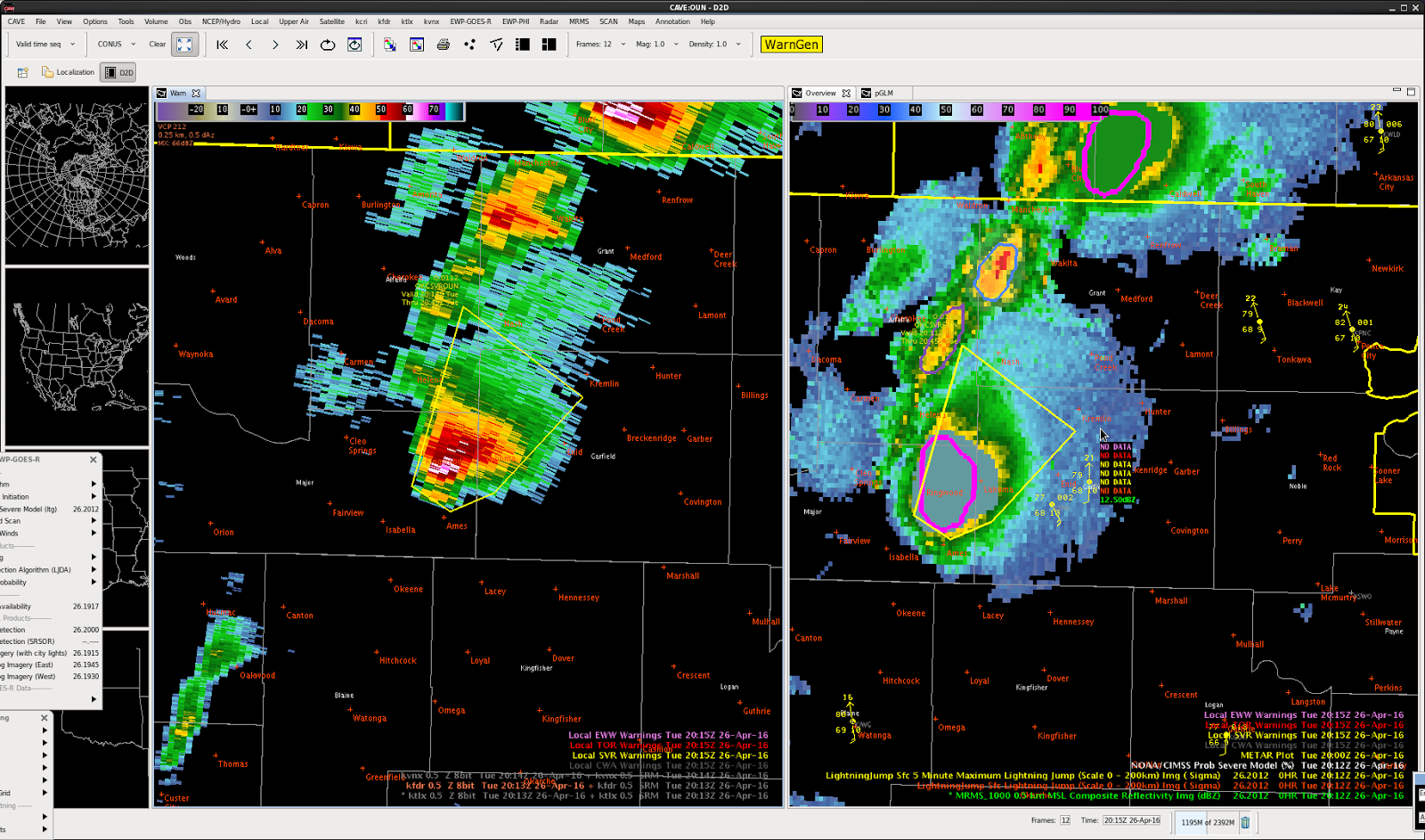
Radar signatures clearly indicated this storm deserved a severe thunderstorm warning about 5 minutes before ProbSevere exceeded 60% or any lightning jump was evident. ProbSevere and the lightning jump did eventually catch on, jumping to 99% and 4-sigma, respectively.
-Toki Wartooth
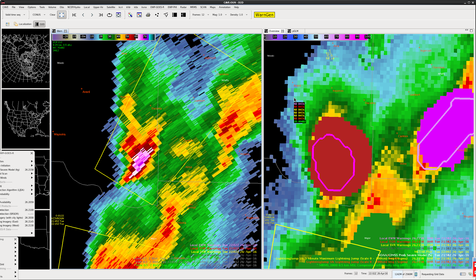
The storm that prompted the severe thunderstorm warning #2 continued to show the potential of severe weather. Both radar signatures as well as ProbSevere and the Lightning jump algorithm show this possibility.
-Toki Wartooth
WUUS54 KOUN 261956
SVROUN
OKC003-053-262030-
/O.NEW.KOUN.SV.W.0111.160426T1956Z-160426T2030Z/
BULLETIN – IMMEDIATE BROADCAST REQUESTED
SEVERE THUNDERSTORM WARNING NORMAN OK
NATIONAL WEATHER SERVICE
255 PM CDT TUE APR 26 2016
THE NATIONAL WEATHER SERVICE IN NORMAN HAS ISSUED A
* SEVERE THUNDERSTORM WARNING FOR…
EASTERN ALFALFA COUNTY IN NORTHWESTERN OKLAHOMA…
NORTHWESTERN GRANT COUNTY IN NORTHERN OKLAHOMA…
* UNTIL 330 PM CDT
* AT 255 PM CDT…DOPPLER RADAR INDICATED A SEVERE THUNDERSTORM CAPABLE OF PRODUCING QUARTER SIZE HAIL AND DAMAGING WINDS IN EXCESS OF 60 MPH. THIS STORM WAS LOCATED NEAR MANCHESTER…OR 16 MILES SOUTH OF ANTHONY…AND MOVING NORTHEAST AT 70 MPH.
* LOCATIONS IMPACTED INCLUDE…
WAKITA AND MANCHESTER.
PRECAUTIONARY/PREPAREDNESS ACTIONS…
A TORNADO WATCH REMAINS IN EFFECT FOR THE AREA. ALTHOUGH A TORNADO IS NOT IMMEDIATELY LIKELY…IF ONE IS SPOTTED…ACT QUICKLY AND MOVE TO A PLACE OF SAFETY IN A STURDY STRUCTURE…SUCH AS A BASEMENT OR SMALL INTERIOR ROOM.
&&
LAT…LON 3679 9796 3688 9815 3700 9809 3700 9780
TIME…MOT…LOC 1955Z 207DEG 61KT 3692 9801
$$
BMS
Forecaster: Schuerman
Pulled the trigger on the second severe thunderstorm warning of the day. Radar signatures (60 dBZ to -20C, TBSS) began to indicate hail was possible at roughly the same time that ProbSevere jumped to around 80% and there was a 7-sigma lightning jump. I was ready to pull the trigger when I saw the radar signatures, but the ProbSevere and lightning jump gave me more confidence on the warning.
-Toki Wartooth
KICT was down for us, but we relayed with OUN on warning (also pulled up the Topeka radar to help).
BULLETIN – IMMEDIATE BROADCAST REQUESTED
SEVERE THUNDERSTORM WARNING
NATIONAL WEATHER SERVICE WICHITA KS
233 PM CDT TUE APR 26 2016
THE NATIONAL WEATHER SERVICE IN WICHITA HAS ISSUED A
* SEVERE THUNDERSTORM WARNING FOR…
SOUTHEASTERN HARPER COUNTY IN SOUTH CENTRAL KANSAS…
SOUTHWESTERN SUMNER COUNTY IN SOUTH CENTRAL KANSAS…
* UNTIL 315 PM CDT
* AT 233 PM CDT…DOPPLER RADAR INDICATED A SEVERE THUNDERSTORM
CAPABLE OF PRODUCING LARGE DAMAGING HAIL UP TO GOLF BALL SIZE AND
DAMAGING WINDS IN EXCESS OF 60 MPH. THIS STORM WAS LOCATED NEAR
WAKITA…OR 14 MILES NORTHWEST OF MEDFORD…AND MOVING NORTHEAST AT
25 MPH.
* LOCATIONS IMPACTED INCLUDE…
ARGONIA…BLUFF CITY AND FREEPORT.
PRECAUTIONARY/PREPAREDNESS ACTIONS…
IF YOU ARE IN THE PATH OF THIS STORM…PREPARE IMMEDIATELY FOR LARGE
HAIL AND DEADLY CLOUD TO GROUND LIGHTNING. PEOPLE OUTSIDE SHOULD MOVE
TO A SHELTER…PREFERABLY INSIDE A STRONG BUILDING AND AWAY FROM
WINDOWS.
&&
LAT…LON 3732 9779 3716 9752 3699 9775 3700 9799
TIME…MOT…LOC 1933Z 216DEG 24KT 3693 9795
$$
BAJ
WWUS83 KMKX 252034
SPSMKX
SPECIAL WEATHER STATEMENT
NATIONAL WEATHER SERVICE MILWAUKEE-SULLIVAN WI
333 PM CDT MON APR 25 2016
WIZ060-065-066-252115-
OZAUKEE WI-WAUKESHA WI-MILWAUKEE WI-
333 PM CDT MON APR 25 2016
…SIGNIFICANT WEATHER ADVISORY FOR SOUTH CENTRAL OZAUKEE…
NORTHWESTERN MILWAUKEE AND NORTHEASTERN WAUKESHA COUNTIES UNTIL 415 PM CDT…
AT 333 PM CDT…DOPPLER RADAR WAS TRACKING A STRONG THUNDERSTORM OVER NORTHERN MILWAUKEE…MOVING NORTHEAST AT 30 MPH.
HALF INCH HAIL AND WINDS IN EXCESS OF 40 MPH WILL BE POSSIBLE WITH THIS STORM.
LOCATIONS IMPACTED INCLUDE…NORTHERN MILWAUKEE…MENOMONEE FALLS…MEQUON…WHITEFISH BAY…BROWN DEER…FOX POINT…BAYSIDE…RIVER HILLS AND GLENDALE.
PRECAUTIONARY/PREPAREDNESS ACTIONS…
TORRENTIAL RAINFALL IS ALSO OCCURRING WITH THIS STORM…AND MAY LEAD TO LOCALIZED FLOODING. DO NOT DRIVE YOUR VEHICLE THROUGH FLOODED ROADWAYS.
&&
LAT…LON 4314 8790 4312 8790 4309 8799 4318 8808
4326 8791 4324 8791 4321 8790 4320 8790
4316 8788
TIME…MOT…LOC 2033Z 238DEG 25KT 4318 8800
$$
BMS
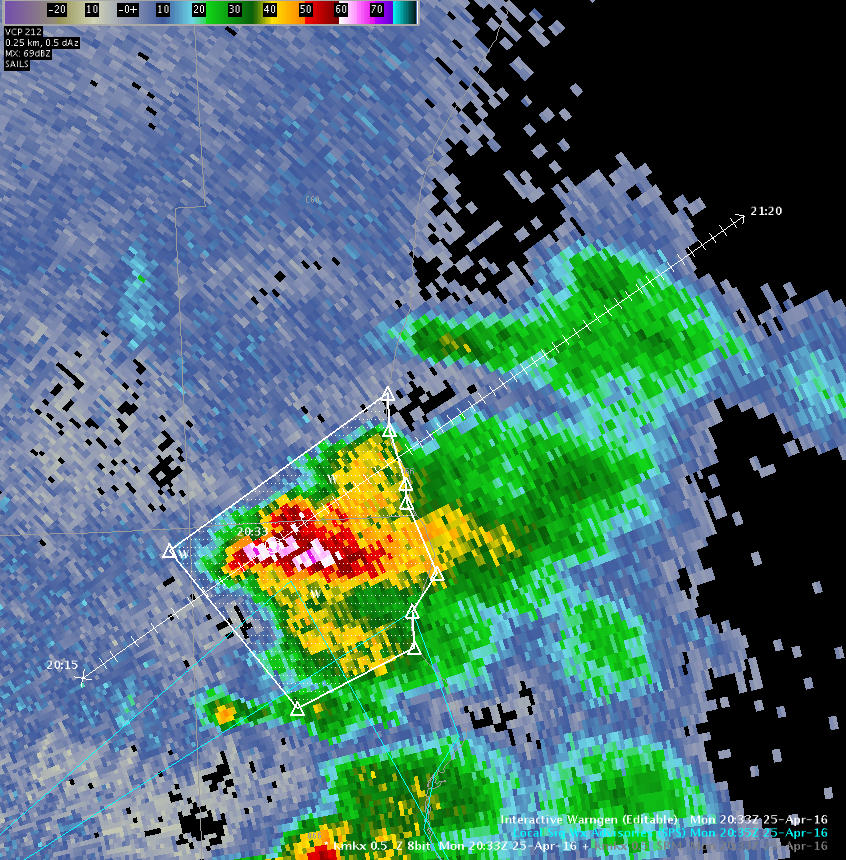
Second Significant Weather Advisory issues for thunderstorm to the north of first Significant Weather Advisory. MESH is now over 0.50″ with Prob Severe at 35%. Went for half inch sized hail and winds in excess of 40 MPH with these. Lightning being presented at 2.0 Sigma for these thunderstorms as they are heading off shore.
Forecaster: Schuerman
J-Money:
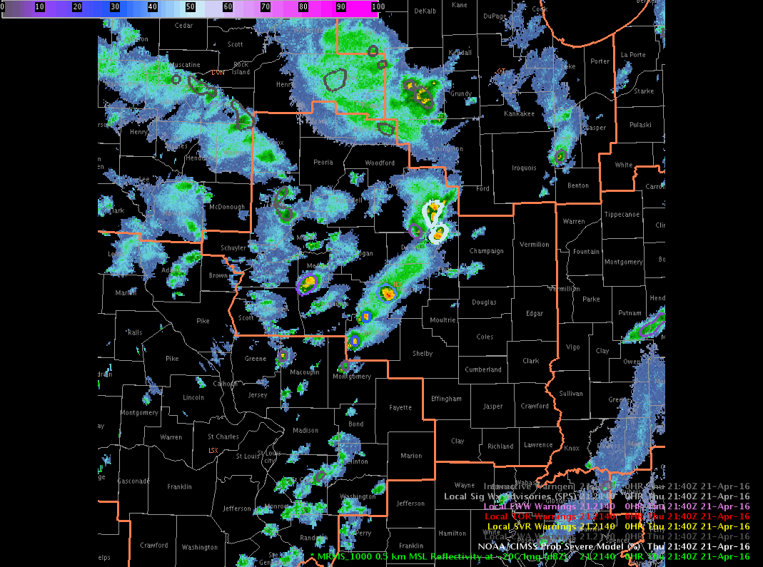
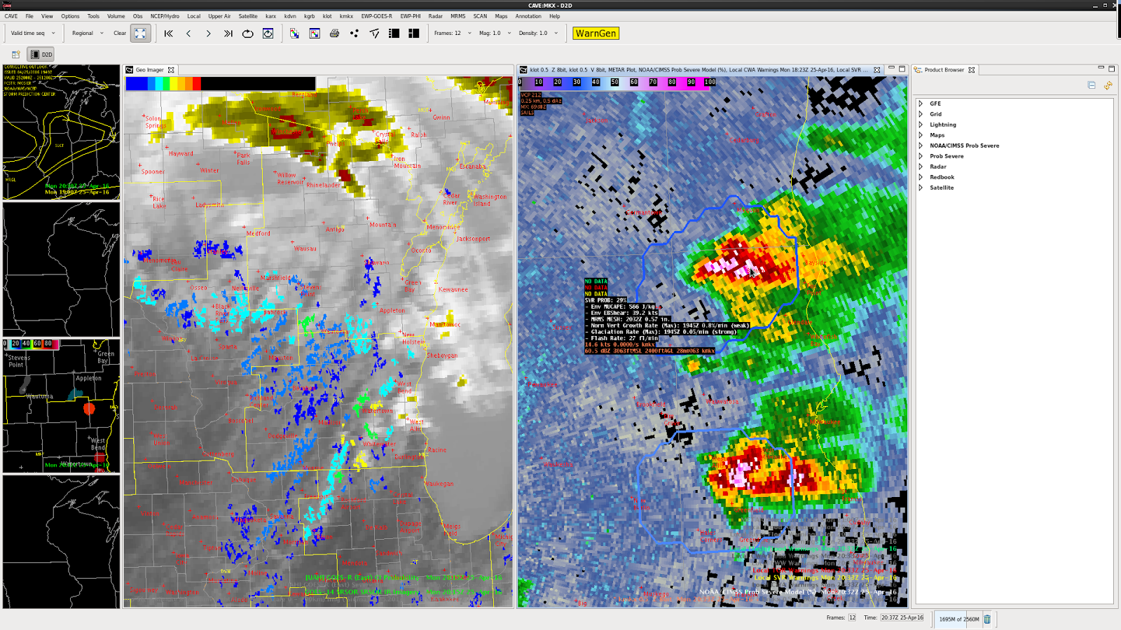
For much of the afternoon, so far, scattered to numerous storms in central/southern IL have been non-severe in nature, with occasional small hail. Prob Severe values have been correspondingly low, with meager flash rates, and poor growth rates.
However, just before 22z, a storm intensified in the far northeast part of the ILX CWA. Prob Severe values rose quickly into the 70s and 80s, as flash rates and MESH values increased. A warning was issued, based on the environment of cold air aloft, and seemingly more favorable storm-scale parameters for hail, as shown by Prob Severe.
A loop of refectivity at the -20C level, with Prob Severe overlayed, is shown here. It well correlates with the above descriptions.