Live Blog – 19 May 2009 (2:55 pm) – Thoughts on Radar Coverage in the West

During the outlook briefing, Mike Vescio noted that our Southeast Montana target is in an area where radar coverage is either poor or non-existent.  The Utah/Idaho/Wyoming target is also in a region of relatively sparse coverage affected by beam blocking.  This may not be a detriment to the experiment, however.  Kiel Ortega points out that one of the expected strengths of Multi-Radar/Multi-Sensor output should be to more easily facilitate severe weather warnings in areas like the Intermountain West, where forecasters need to make the most of every piece of data possible.

Patrick Burke (EWP Weekly Coordinator, 18-22 May 2009)

Tags: None

Live Blog – 18 May 2009 (8:44 pm) – Comments from PAR team

Rob and Mike note that the PAR data is giving them more lead time on severe weather signatures compared to the 88D (KTLX, which they are viewing side by side with PAR).  Mike says, “We’re ahead of the game.”  And when asked if the PAR data is bombarding them perhaps too quickly, they say, “No!”  They wouldn’t mind if it came in even faster.

Patrick Burke (EWP Weekly Coordinator, 18-22 May 2009)

Tags: None

Live Blog – 18 May 2009 (8:42 pm) – Comments from CASA Team

The CASA team first familiarized themselves on visualizing and navigating the data with one brief case study.  Matthew noted that in the CASA data he is seeing familiar storm-scale processes happening at sub-storm scales of time and space.  They are now moving on to a displaced real-time archive case in which they will issue mock warnings.  The team read over the available environmental data to great length.  They appreciate this type of data in lieu of a traditional shift briefing.  They suggest that in addition to seeing a central Oklahoma upper air sounding, they would also like to see soundings from the surrounding area, numerical measures of severe weather parameters on those soundings, and an analyzed surface map.

Patrick Burke (EWP Weekly Coordinator, 18-22 May 2009)

Tags: None

Live Blog – 18 May 2009 (6:24 pm) – LMA Feedback & Dinner Plans

There has been much discussion of the lightning data.  Forecasters are interested in lightning, but are uncertain how it will help them in warning operations.  They have yet to get in and work with the data.  Matthew suggests that more training on typical LMA data signatures – related to storm morphology, would help get him/others ready to view this data in the HWT operational environment.

The group will break for dinner and then reconvene at 7:30pm CDT.  Groups of 2 will attack archive cases using PAR and CASA data, respectively.

Patrick Burke (EWP Weekly Coordinator, 18-22 May 2009)

Tags: None

Live Blog – 18 May 2009 (5:56 pm) – MRMS-derived products for hail detection

During MRMS training, Les Lemon recommended, based on some published research and his personal experience, that a useful MRMS product would be 60+ dbZ reflectivity mapped to the -20 deg C level.  Les uses this to predict when a storm will begin producing not severe hail, but significant severe hail (2 inch plus diameter).  So we haven’t looked at any data yet, archived or otherwise, but we already have a suggestion for improvement!

Patrick Burke (EWP Weekly Coordinator, 18-22 May 2009)

Tags: None

Live Blog – 18 May 2009 (5:41 pm) – Training Wraps up with LMA

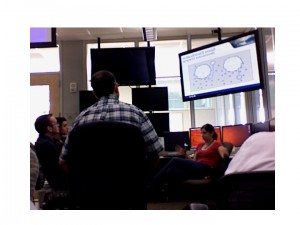
With each training session taking the form of an interactive seminar, the forecasters have absorbed a lot of information covering a wide variety of meteorology and technology.  Greg Stumpf elaborated on the multitude of radar-and-environment-derived products available with the NSSL’s Multi-Radar/Multi-Sensor approach.  Now Dr. Kristin Kuhlman, seen below, is discussing the Lightning Mapping Array, beginning with the physics behind LMA.  Soon the forecasters will take to their workstations and experience LMA data first hand.

Kristin teaches the Week 4 group about the Lightning Mapping Array

Patrick Burke (EWP Weekly Coordinator, 18-22 May 2009)

Tags: None

Live Blog – 18 May 2009 (4:14 pm) – Training Continues

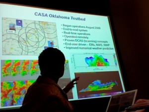
Forecasters are going in depth on the design of the PAR and CASA network.  There have been several questions, especially from Mike and Les, as to where we stand during 2009, with respect to the cycle of Research and Development.  The answer seems to be that both technologies have a strong footing with funding out for the next several years, and both have developed some intriguing datasets, but both are perhaps a decade or more from any eventual implementation in an operational network.  Below, Brenda Phillips of the University of Massachusetts discusses the CASA radars with our forecasters:

Patrick Burke (EWP Weekly Coordinator, 18-22 May 2009)

Tags: None

Live Blog – 18 May 2009 (2:33 pm) – Training Schedule

Forecasters are currently training on the use of the WDSS-II system for interrogation of radar data.  This year in the EWP, WDSS-II is used in tandem with AWIPS D2D.  From 2:30-3:15pm CDT, forecasters will train on interpreting PAR data, followed by training for CASA from 3:30 to at least 4:30pm.  After a short break, forecasters will train on MRMS and LMA, break for dinner, and then perform 2 displaced real-time warning simulations this evening – one using PAR data, and one using CASA.

Patrick Burke (EWP Weekly Coordinator, 18-22 May 2009)

Tags: None

Live Blog – 13 May 2009 (all live entries concatenated)

Southeastward moving cold front and extreme CAPE with marginal supercell deep layer shear will allow for central OK EWP activities to commence.

Convective initiated near 2230 z near Fairview to Deer Creek.  V2 crew is near Fairview.

We’ve got three projects to run:  LMA and PAR to begin then as convection approaches the CASA network, we’ll go to PAR and CASA.

2315z:  PAR showing very fine TBSS near Okeene, mainly elevated core.  MESH is 1.25″

2330z:  Big core dump observed to fall in cross-section from PAR near eastern Major County.

2341z:  LMA showing big ramp-up in LTG on segment in northern Blaine county.

2349z: Strong LL rotation on Kay county border.

2350z:  video of big funnel embedded in meso in Kay county storm.  Likely tornado.  PAR shows evolution nicely.

2351z:  Fay, THomas storm showed sizeable increase in LTG in LMA.

0001z:  Garfield county storm looks imminent tornadic on PAR and KVNX.

0009z:  PAR sector moved to southwest end of storms.

0017z:  Billings circulation increasing.  Pam suggests going to supercell VCP on PAR.  Anchor storm near Thomas is getting circulation.  V2 is on it but a bit too far northeast.

0021z:  Billings circulations, 2 of them, tighter one southwest of Billings.  LMA catching recycling over Billings.

0023z:  PAR team will now issue TORs, LMA team will issue SVRs.

0026z:  DOWs just saw shear get down to the ground on anchor storm west of Geary.

0031z:  Circulation driven by strong RFD near Billings with circulation visible in lowering.   Watonga storm (Geary storm) filled in with precip and new storms forming on its southwest side.

0046z:  Moving PAR sector 10 deg to the south to catch anchor storm crossing I-40 west of Hinton.  In NOble county LMA VLMA increased before MESH increased.  Increased confidence in severe warning.

0055z:  Possible LTG hole in VLMA in Blaine county storm.  It’s colocated with meso and BWER.

0105z:  VLMA is highest of the day for Canadian county with evidence of a lightning hole near the elevated meso.

0112z:  PAR noted rear inflow notch onset 0110z.  POssible new product idea for LMA:  LMA level -20C product to match radar layer reflectivity at -20, -10, 0 C.

0157z:  Look for storm top divergence on the PAR.  It was up to 240kts over the last 20 min from KTLX over Guthrie.

0201z:  Mode of southwestern storm is changing, beginning to bow more to the southeast with new cells growing to the east.

0213z:  CASA fully engaged in southwestern storm complex.  They’re seeing circulations not seen before on 88D.

0220z:  CASA showing circulation via velocity and rotating rain bands going around the notch near Gracemont.

0223z:  CASA showing reflectivity hole near circulation in Gracemont.

0232z:  CASA showing multi-vortices just south of Gracemont both in reflectivity holes and velocity centers.  PAR showing northern storm backbuilding south on I-35 into Edmund.  Transient TVSs observed.  They’re lasting around 10 min and we’re getting 8 or so volume scans to sample them.

0249z:  CASA showing weakening circulatoin.  BTW, 3DVAR showed circulation at least 1km wide south of Gracemont.  New intense push of outflow north of KGYR may result in new LLmeso.  Meanwhile northern storm is backbuilding over the city.

0253z:  VLMA showing a burst over OKC in last 5 min.

0256z:  OUN chat sais circulation SE of Anadarko but PAR showing strengthening.  CASA Chickasha radar showing precip wrapping around center.

0309z:  TOR warning for us.  Hook echo on PAR near OKC airport with convergence along the RFD but no vortex yet.

0409z:  TOR warned storm for Cleveland county showed small circulations forming on leading RFD edge from Stanley Draper to the north arm of Lake T-bird.  Now the storm is dying as new convection forms under the anvil of the western activity and to our south.

Jim LaDue (EWP Weekly Coordinator, 11 – 15 May 2009)
Tags: None