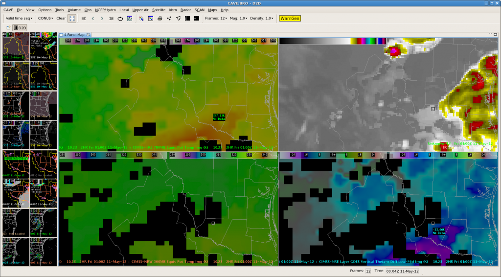
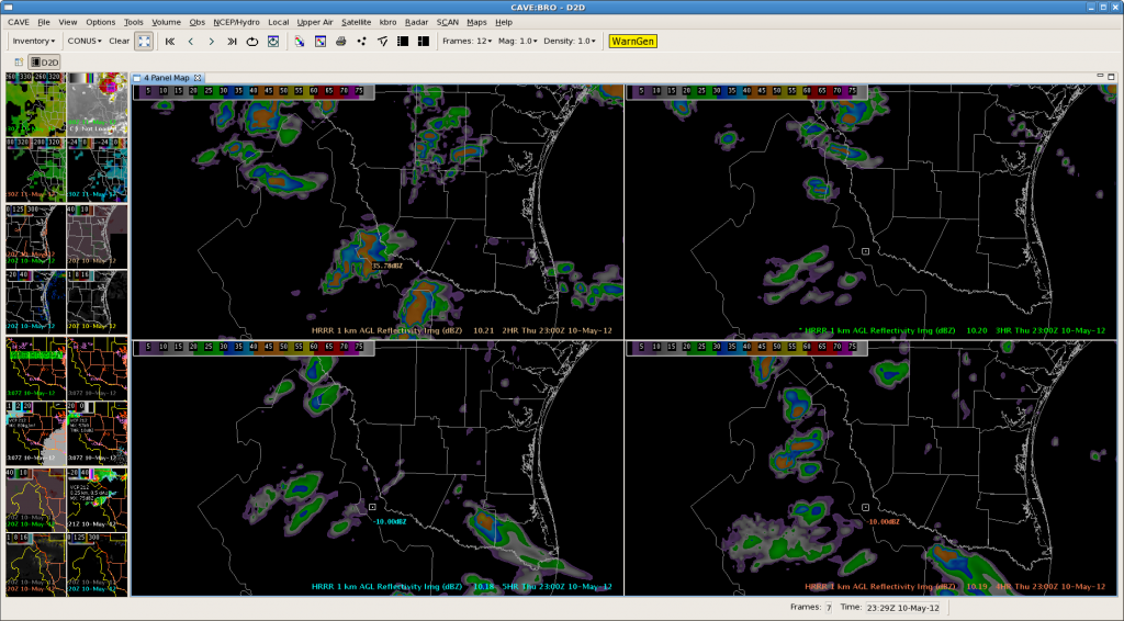
NearCAST guidance continues to support the enhancement of thunderstorm development from Jim Hogg and Starr counties. It’s appears the model indicated a weak disturbance increasing Theta E across forecast area between 01Z and 04Z, which will add to the existing unstable conditions. Severe thunderstorm potential remains high. Emergency managers and other decision makers are strongly encouraged to prepare for the threat of severe weather through 05Z. Isolated tornadoes are still possible. rn/ams
Category: Live Blogs
Real-time posts made during testbed nowcast and warning operations.
BRO MESO Desk @ 2330Z
BRO MESO Desk @ 2310Z
CRP – Tornadic Supercell near Loma Alta 6:08 PM
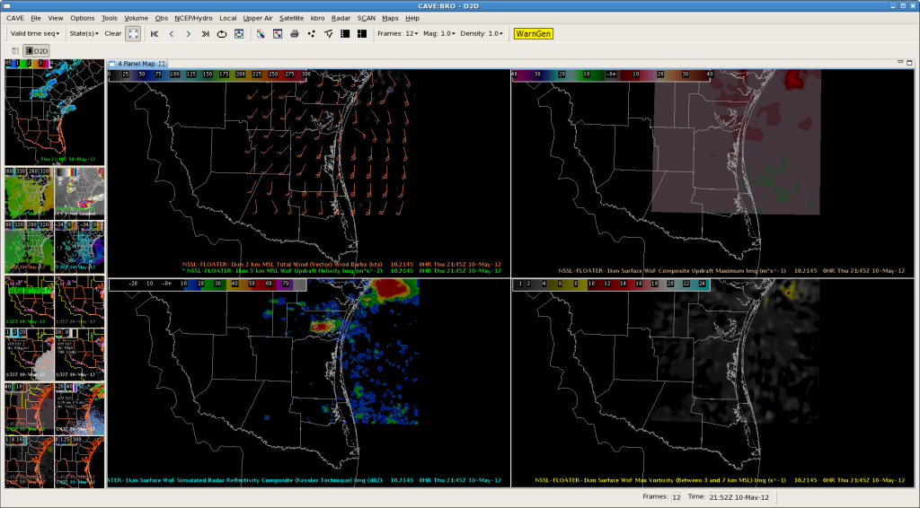
The image below shows the 1km composite updraft maximum (top left), 0.5 z, 1km surface maximum vorticity (bottom left), and the 1-5km updraft helicity (bottom right). Although the 0.5 velocity data is not shown, it is contaminated and not very useful. This makes the 3DVAR data extremely useful in identifying where the strongest low level rotation is located and the potential for a tornado.
BRO/CRP West Radar Analysis 2240Z
CI continues to show promising results in terms of providing significant lead for strong/severe t-storms.
The first image below at 2115Z shows a strength of signal around 99 (red) in UAH-CI in the upper left pane for a developing storm west of Laredo.
The next image at 2125Z depicts -14C/15 min UW-CI (lower left) for the developing storm.
Radar imagery continued to show storm growth and the storm reached 50 to 55 dbz at 2208Z as shown in the upper right pane of the image below. Also, MESH reached 1.18 inches at this time as well.
With these figures in mind, the lead time from initial CI detection on UAH-CI was around 55 min. and the lead time from UW-CI was around 45 min. It would be great to put a product out conveying the possibility of strong storms when we first see these CI signals with an actual warning coming later.
AMS/Nunez
BRO MESO Desk @ 2250Z
BRO/CRP West Meso Desk @ 2220Z
MESO Desk update @ 2150Z
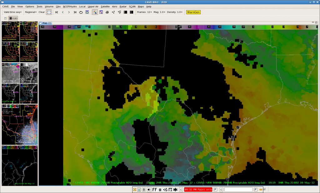
These two nearCast screen captures depict the main axis of theta e/PW that was translating east of the BRO. Ample moisture remains over the eastern and southern parts of the BRO CWA and support thunderstorm development. Sadly, convection continues to be inhibited and is reflected on the 3DVAR sim. comp. reflectivity. RN/AMS
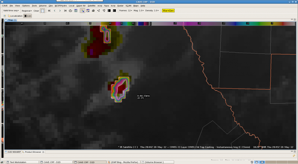
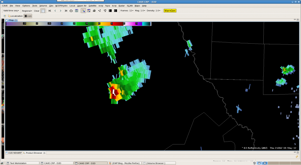
CRP: Mexico! CTC shows a rapidly developing thunderstorm
BRO Meso Analysis with Nearcast/Sythetic WRF at 2030Z
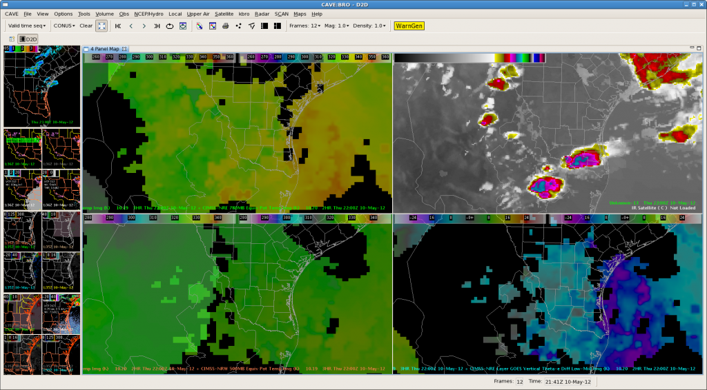
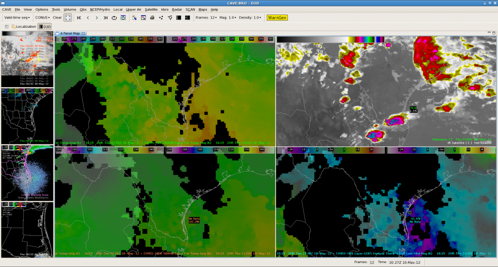
The below image at 22Z depicts nearcast theta-e at 780 mb in the upper left pane, synthetic WRF IR in the upper right, nearcast theta-e at 500 mb in the lower left, and nearcast vertical theta-e difference low-mid in the bottom right.
Looking at the 780 mb theta-e, it shows areas in yellow of best moisture/instability predicted for this afternoon which matches up with storms predict in synthetic IR imagery. Because the 2 products derived off of different model projections are in decent agreement, this lends more confidence to this convective scenario for this afternoon.
AMS/Nunez


