
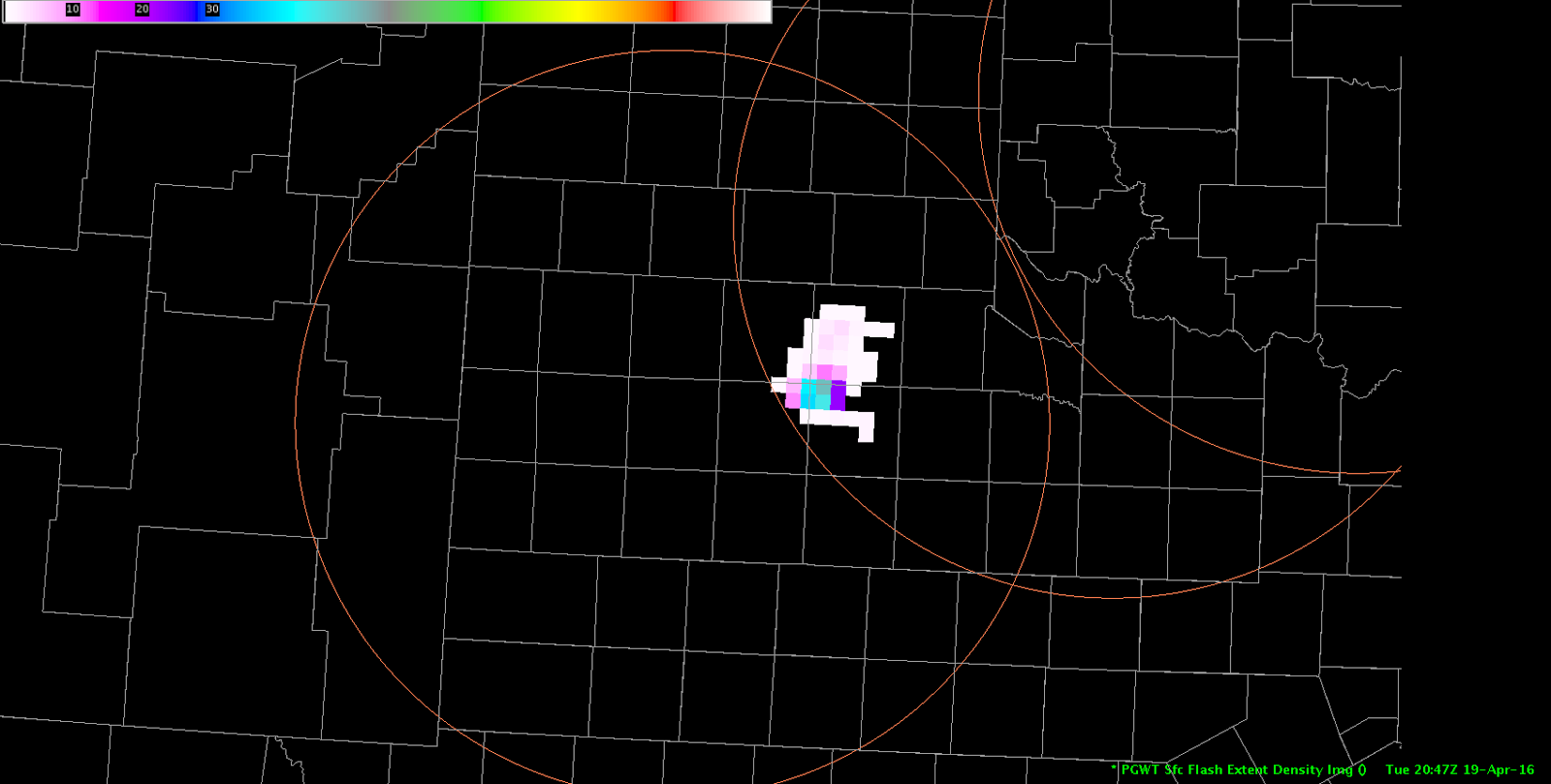
Of the three color curves currently available for LMA, the default LMA curve appears to highlight the flash densities the best:
Official websites use .gov
A
.gov website belongs to an official government
organization in the United States.
Secure .gov websites use HTTPS
A
lock (
) or https:// means you’ve safely connected to
the .gov website. Share sensitive information only on official,
secure websites.

Real-time posts made during testbed nowcast and warning operations.
Of the three color curves currently available for LMA, the default LMA curve appears to highlight the flash densities the best:
Latest WV/RAP PV analysis shows a shortwave rotating around the base of a persistent deep closed low to the west of the area early this afternoon. Subtle forcing from this feature should aid in convective development throughout the afternoon. 12z observed sounding at Midland shows a more moist boundary layer than the observation 12 hours prior with nearly saturated profile up to about 5KFT AGL where the base of a weak residual EML is present transported by modest westerly flow at this level extending up through the mid/upper atmosphere. Surface flow was not particularly strong per latest surface obs but plentiful surface moisture was already present with upper 50 to lower 60 degree dew points across much of southwest Texas east of the Davis Mountains. Some convection has initiated already mainly along and near terrain north. More widespread convection and a higher chance of severe will come later as diabatic heating contributes to greater instability and aforementioned shortwave nears. ~40 knots of effecive bulk shear should support organized cells including potential for supercells in an increasingly/moderately unstable environment. Convective initiation is expected mostly around difficult to define surface boundaries and terrain features.
-dryadiabat
Mesoscale Discussion as of 1830z (J-Money):
On the large-scale, water vapor imagery shows an upstream short-wave over northern NM, rotating around the Rockies Front Range upper low. As this feature continues to swing eastward into West TX this afternoon, convective coverage should grow. This may especially be the case in the TX Big Bend area (MAF CWA), where the atmosphere is more unstable at this time (ML Capes of 750-1500 and 700-500 mb LR’s of 7+ C/km). Although deep-layered shear is marginal as of 18z (0-3 km values of 15-20 kt), it should improve later this afternoon, as stronger mid-level winds rotate from Mexico and NM into West Texas. This presumed unstable, deep-layer shear environment should support large hail with any supercell structures, and perhaps isolated downburst type winds. 1-minute visible imagery has been depicting increasingly rapid convective blowoff to the east with initial convective towers, perhaps attesting to the developing mid-level shear. Once again today, the tornado threat looks low, with weaker 0-1 km shear and elevated LCL heights.
Regular CI products have been hinting at near-future storm formation in MAF’s CWA, just west of where a persistent low cloud mass is clearing out. So far, Severe CI and Prob Severe values have been low. We’ll monitor closely.
Diffuse surface front now stalled across the Permian Basin of west Texas. South of this boundary, the 1-km GOES-14 data showing ample clearing of low clouds as daytime heating continues to heat the boundary layer this afternoon. As a result of surface dewpoints residing in the upper 50 to low 60s, moderate levels of instability have developed with latest SPC mesoanalysis showing 1500-2000 joules of MLCAPE. Deep-layered shear on the order 40 kts should allow for supercell structures as forcing for ascent increases ahead of pronounced shortwave trough appraching from south-central New Mexico. With -20C levels around 19.4 kft, supercells will be capable of large hail and strong damaging winds thanks for steep low and midlevel lapse rates.
Initial cell as weakened below severe limits with a secondary storm strengthening directly to its south. Overall thoughts on PROBSvr remain unchanged as it seems to lag behind observed radar trends. Traditional radar interrogation methods (50 dBZ core above the -20C line) continue to provide greater lead-time for warning decisions.
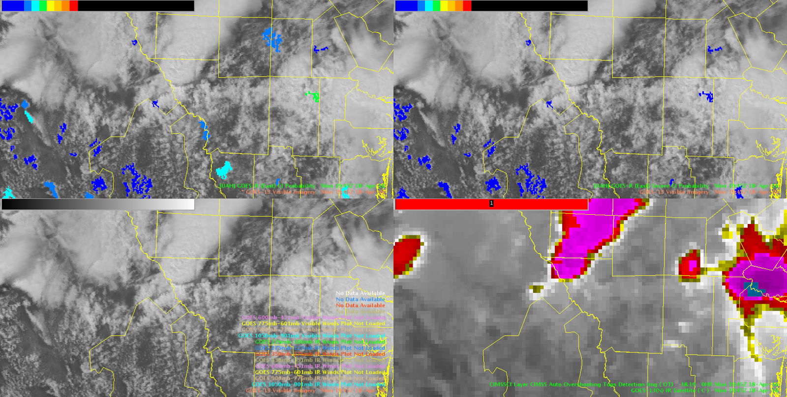
Convective initiation algorithem actually did hint at general region of southern TX for new storm development over 1-hr in advance of new storms forming. Once storms form, is there something that could be displayed to show that the CI algorithem is no longer tracking the area?
torman1
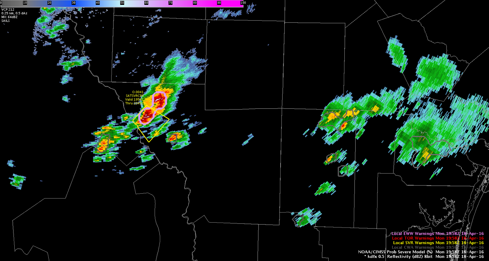
Additional severe thunderstorm warning issued for flanking line developing SW of initial storm in Northern Webb county, TX. Large hail is again quite probable, with deep, tall core through the mid-levels.
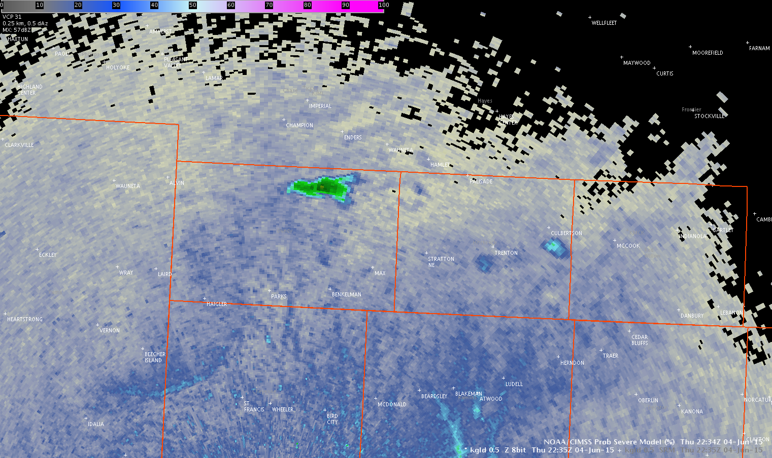
Interestingly, severe CI has seemingly remained fairly low with this storm, while ProbSevere has elevated values.
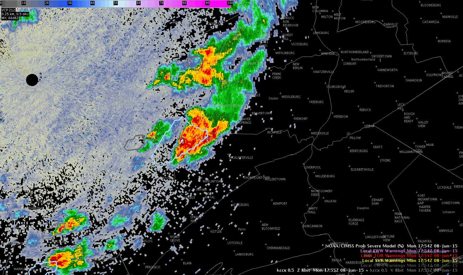
Most of the storms across CTP were already going when our shift started, so Shasta and I had to play catch up. We found using the ProbSevere model was the easiest to help discern which storms were the strongest and where we should focus our attention.
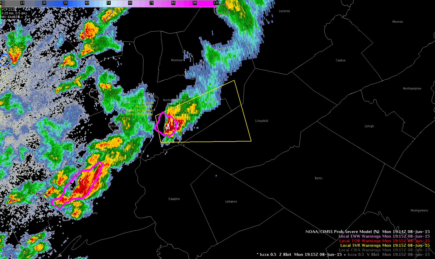
The first storm we warned was across Northumberland and Schuylkill Cos and we warned it for hail and wind. We did have a report of the storm previously producing a funnel cloud.
ProbSevere first went above 50% at 1756z (56%) with the funnel cloud reported at 1805z near Selinsgrove.
-Brick “BT” Tamland
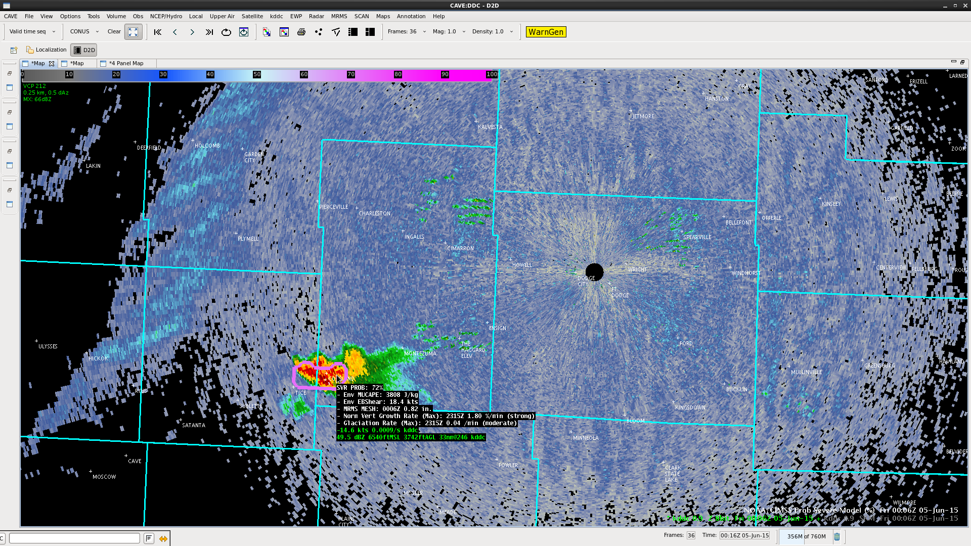
Dime sized hail reported at ~0011z near Copeland, KS. While it’s subsevere, the ProbSevere product did jump from 12% at 0000z to 72% at 0006z.
Jason Williams

Click for loop. You can see a couple of updrafts come shooting up. Reflectivity also increased, although ProbSevere has remained quite low (6%, if it even has a value show up at all). Would hesitate to go SVR given the very low ProbSevere numbers. I’m not seeing a TBSS, and ProbSevere MESH has been around 1/4″.
Jason Williams
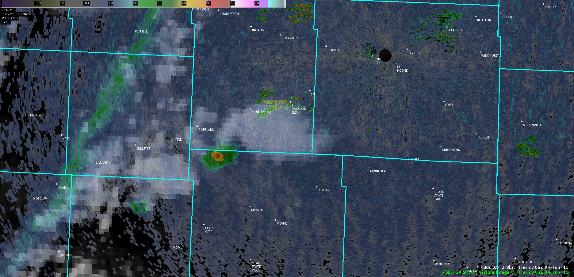
Something for forecasters to keep in mind is that parallax is a factor. Below is the 1min vis and NEXRAD scan at 2306z.
Jason Williams
 50% CI at 2208z; however, that particular cloud element ended up fading away. There was one just to its west that ended up initiating; however, it was underneath the cirrus shield from storms to the west and thus wasn’t caught by the CI product.
Jason Williams & CoonieCatEye
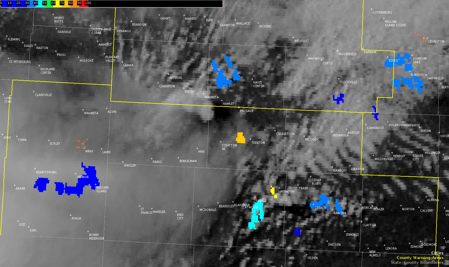
Even though we haven’t had anything manage to sustain itself in the GLD CWA, there has been a lot of utility in the 1 minute visible imagery. Using imagery with coarser time resolution would almost certainly have us missing much of the (albeit brief) life cycle of those little pulses that tried to get an updraft going before getting sheared off.
Having such fine time resolution really helps to pick out which clouds might have the most promise of going up, and being able to see them begin to get sheared almost as it’s happening is valuable in assessing not just the individual cell’s situation, but the environmental conditions as a whole. Clearly, even though CAPE values were being shown as quite high, updrafts were not able to be sustained. Having real-time information on actual conditions was very helpful in having an idea of how the short-term would likely evolve, rather than simply relying on short-term model data and/or satellite imagery that only would come in every 15+ minutes.
Jason Williams