Live Blog – 8 May 2008 (7:17pm)

Hail threat:

Cynthia’s turning off that irritating ellipse and going with a multi-vertex polygon because the shape of the hail threat according to MESH is not an ellipse anymore. There’s still some issues with building the correctly shaped threat polygon.

The storm wrapped up again and the updraft intensity’s come down a bit. However the trailing storm is now merging with the lead supercell through the initiation of intervening cells. Does Cindy and Craig combine the two storms into one threat area? They’ll keep them separate for now.

Jim LaDue (EWP Weekly Coordinator, 5-9 May)

Tags: None

Live Blog – 8 May 2008 (7:10pm)

Brian and Bill are to issue TOR probabilities. They’re going with Initial probabilities of 50% but they think it’ll recycle so they want the probabilities to go down and then go up. To play it conservative they’ll go down to 40% in 20 min. They’d go with a legacy TOR but they aren’t going higher because the initial TVS is totally rain wrapped and has come down in velocity difference. There’s no report either.

Jim LaDue (EWP Weekly Coordinator, 5-9 May)

Tags: None

Live Blog – 8 May 2008 (6:58pm)

The supercell is recycling as MESH values rose and the reflectivity is rising as well as the velocity couplet.

The initial storm motion was a little fast so Cindy and Brian lowered it down to 20 kts. They’ll be keeping the hail prob of 100% initial and 90% in 30 min. Their storm motion uncertainty is 15deg and 10kts. They went with ellipses because the initial hail signature was circular. They’ll have to issue a new threat ID if the storm changed shapes.

So far the team has not been issuing TOR prob guidance. Greg’s starting up a new machine for TOR prob warnings.

Jim LaDue (EWP Weekly Coordinator, 5-9 May)
Tags: None

Live Blog – 8 May 2008 (6:47pm)

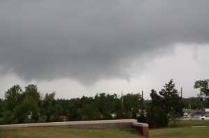
Cindy is in the driver’s seat for probwarn while Craig, Bill and Brian are contributors. The southeastern supercell underwent a major occlusion with an incredibly aggressive, hail-filled RFD and now the storm cycled down a little. However 100% hail probability is gauranteed and ended with 70% at 30 min. The storm following behind was warned for a 70% hail and kept it that high.

The low-level reflectivity and even the MESH show a hole in the middle of the storm as a result of the core in the RFD wrapping all the way around until it met the forward flank core. New convection exploded on the leading edge of the RFD.

Jim LaDue (EWP Weekly Coordinator, 5-9 May)
Tags: None

Live Blog – 7 May 2008 (5:57pm)

KTLX and TDWR shows a TVS 1.5 mi south of the NWC. It’s too far for the CASA though the Chickasha radar showed other shear features along the same gust front to the west.

We have a visual of a V-shaped loose funnel just south of the NWC – picture to follow. Rapid rising motion and some circulation may mean a weak tornado may have occurred just to the south.

V-shaped funnel south of the NWC

PAR snagged spectacular circulation deforming the reflectivity field over OKC.

Donut-shaped reflectivity field being deformed by the circulation around the surface low in OKC.  A tornado was recently reported in west OKC.

Jim LaDue (EWP Weekly Coordinator, 5-9 May)

Tags: None

Live Blog – 7 May 2008 (5:23pm)

TDWR shows numerous vortices rolling up along the north edge of the intense gust front bowing north in McClain county. Chickasha CASA radar shows them but not quite as well. KTLX shows it too just north of Washington.

PAR is focused on the OKC storm only where the echoes wrapped around the vortex/synoptic low center and almost closed off an eye!

Jim LaDue (EWP Weekly Coordinator, 5-9 May)

Tags: None

Live Blog – 7 May 2008 (5:16pm)

PAR: Kristen’s moving the sector to keep up with a TOR warned squall line component going through OKC. PAR shows echo features around the squall line segment swirling around a broad center while velocity shows vortices rolling up along the gust front interface. It’s amazing to see the evolution of these short-lived features.

This feature is colocated with the surface low center.

Jim LaDue (EWP Weekly Coordinator, 5-9 May)

Tags: None

Live Blog – 7 May 2008 (4:41pm)

CASA: Rush Springs radar shows 73.5kts inbound at .7kft just east of the radar, like, right on top of it. KTLX shows -62 kts in a small area east of Rush SPrings at 2139Z. So Rush Springs had a jump of 5 min on KTLX. No warning.

Jim LaDue (EWP Weekly Coordinator, 5-9 May)

Tags: None

Live Blog – 7 May 2008 (4:36pm)

CASA: Chickasha RHI facing 285 deg shows an upshear tilted line segment with the gustfront appearing to leave cells behind its leading edge.

PAR: There’s a azimuthal cyclonic couplet in northern Garvin county. There appeared to be a merger of a small supercellular shaped echo with a large round echo to its south. The couplet occurred at the merger point on the supercellular echo’s rear. KTLX doesn’t show it as well.

PAR noise is there but not bothersome.

Jim LaDue (EWP Weekly Coordinator, 5-9 May)

Tags: None