new LAPS run…boundary issues continue

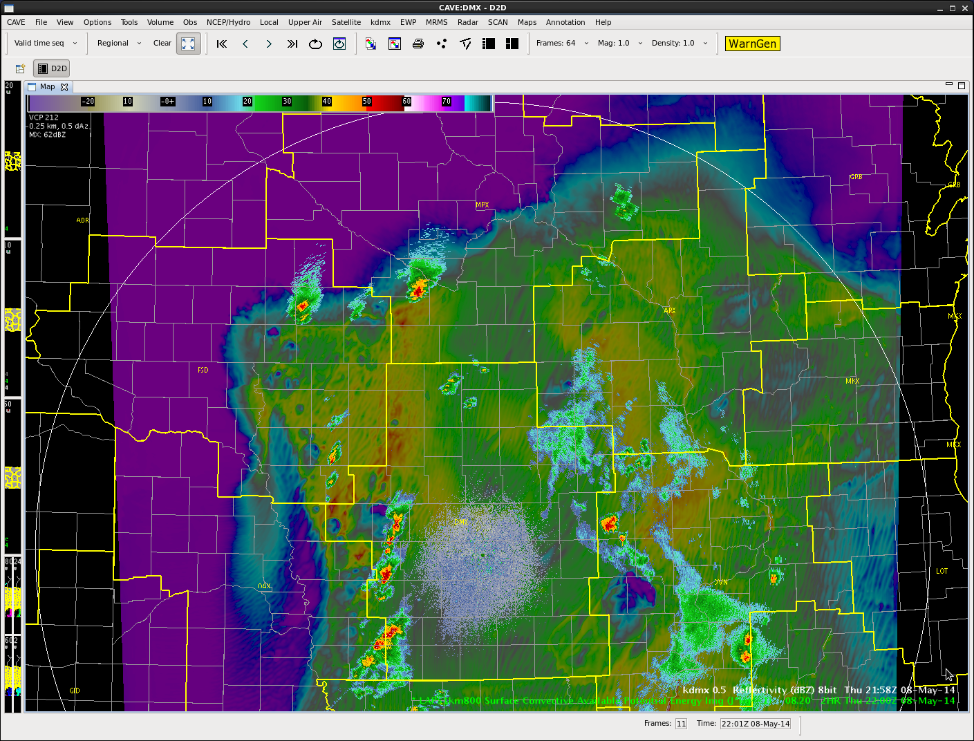
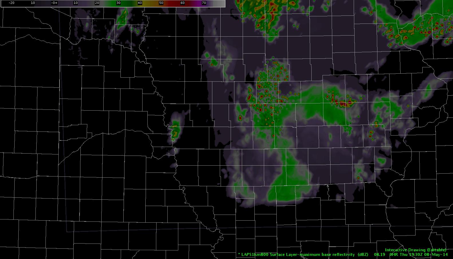
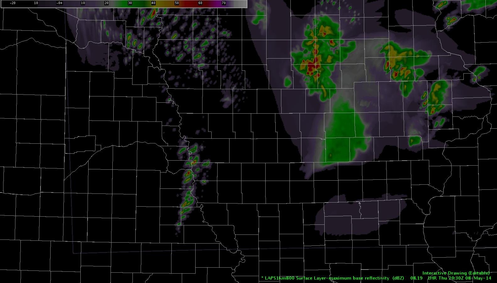
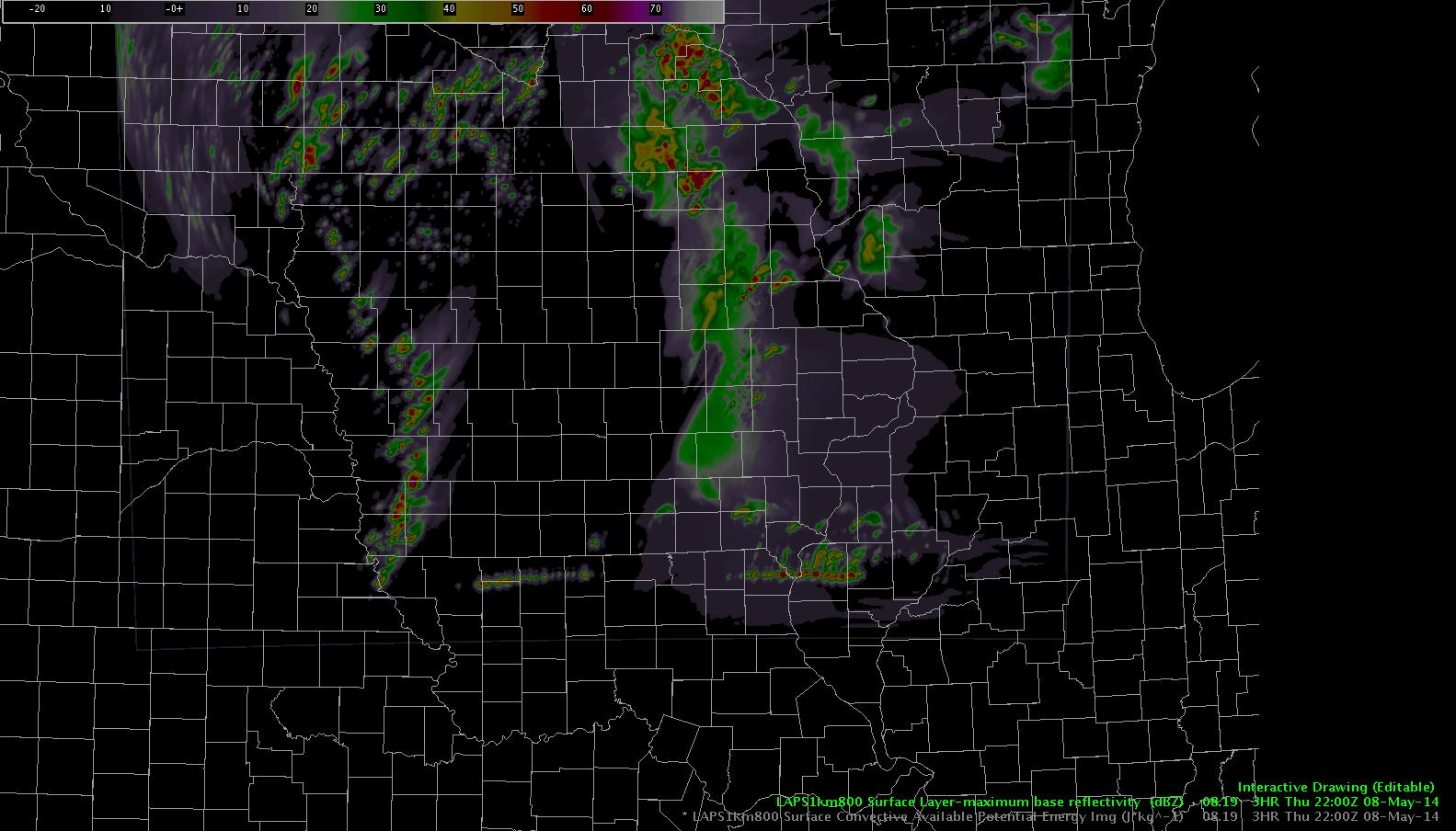
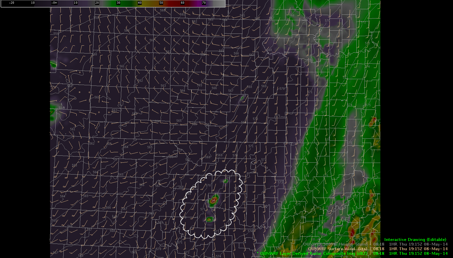
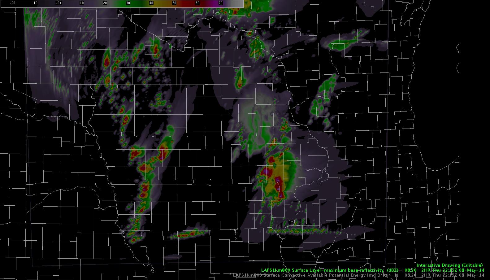
Here’s the max base reflectivity forecast for 22:15 Z..again , notice the east/west line of convection along the IA/MO border.

laps2

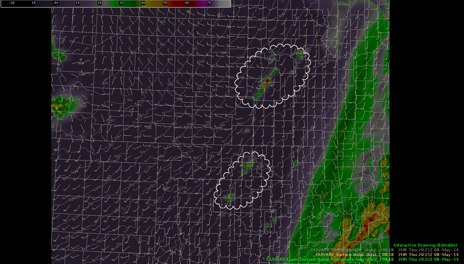
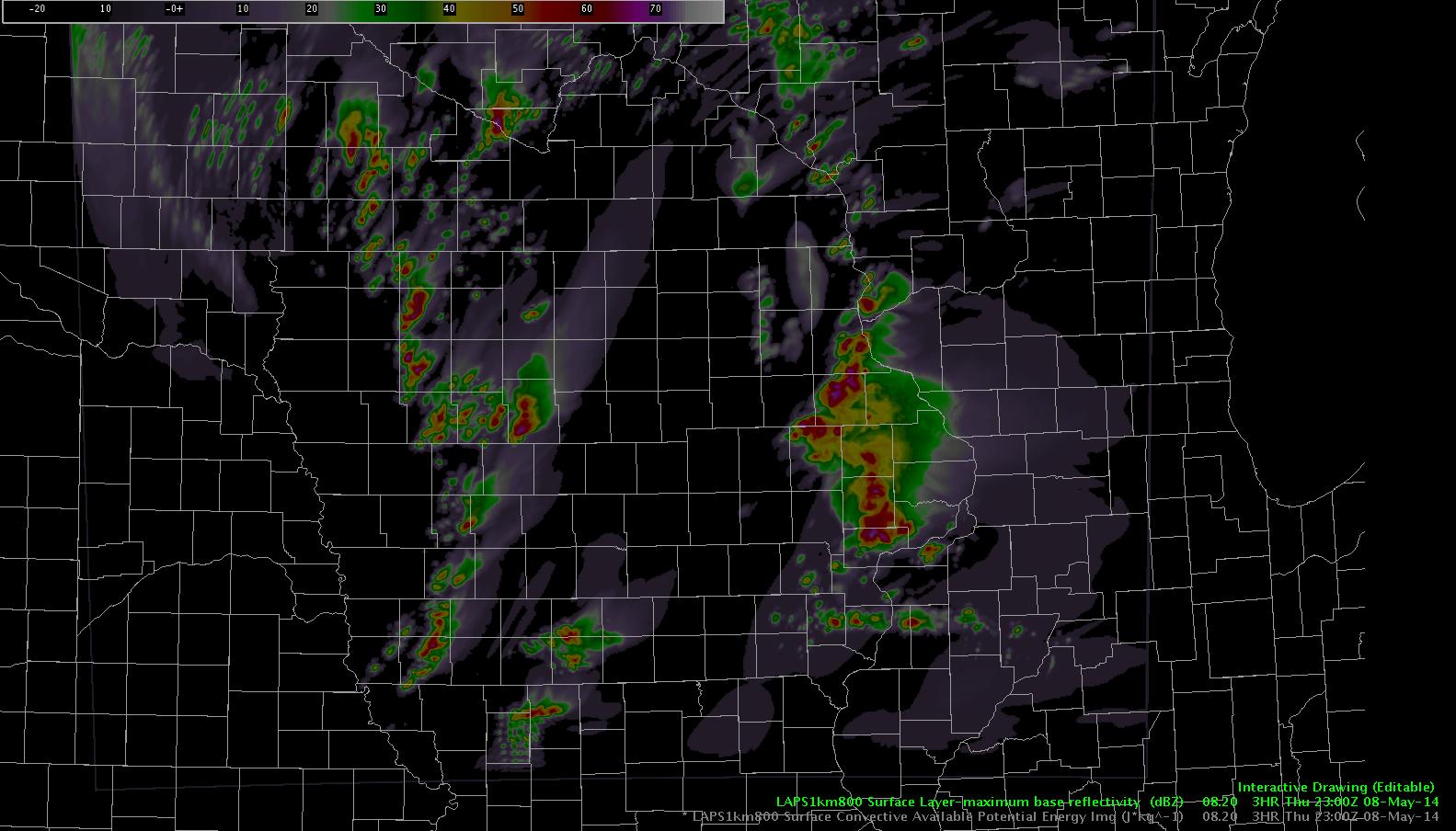
Here’s the 23Z forecast.  Notice how the western edge of that east/west line seems to interact with the “real” convection line to the west…taking on less of a linear character and looking more like the individual cells we have been seeing so far.  The eastern edge of that east/west line remains linear and lifts to the northeast.

laps3


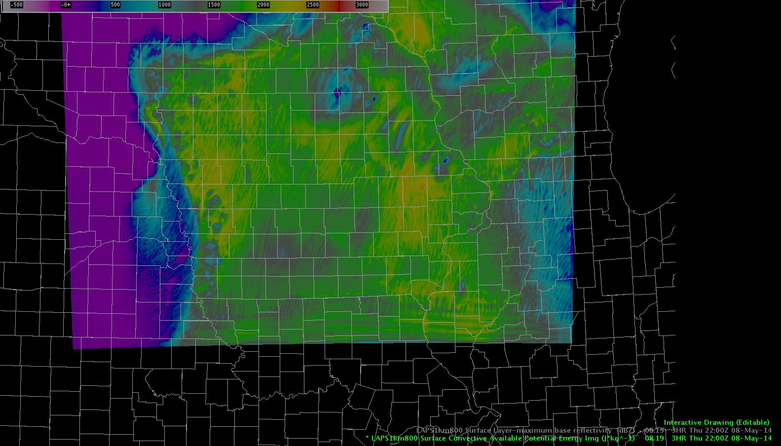
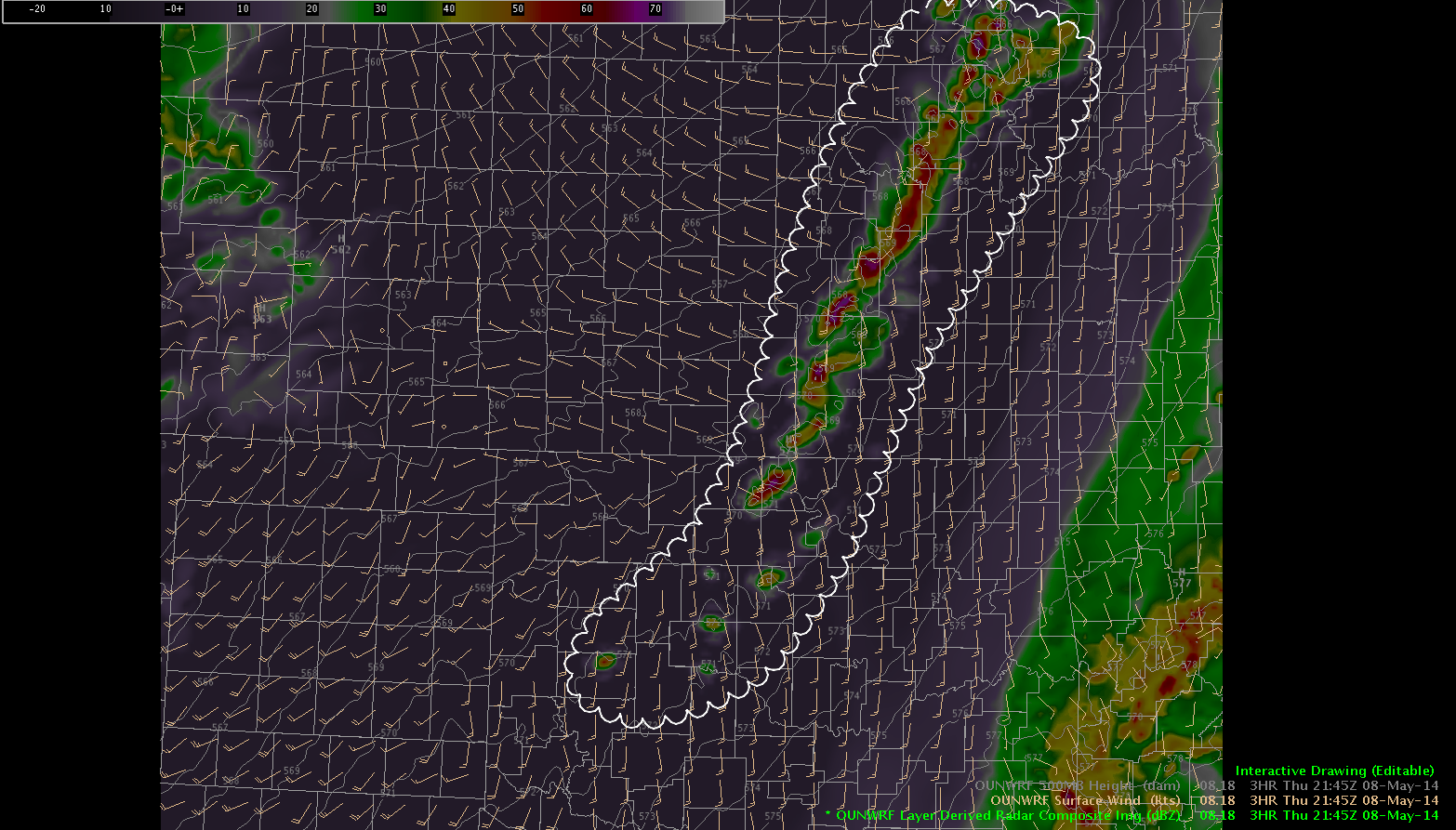
Here’s the 23Z CAPE forecast,  Notice we continue to see a persistent east/west oriented waveform along our southern domain boundary.  Non-damped boundary waves are being turned into peaks of instability, leading to convective response in the model.

laps4

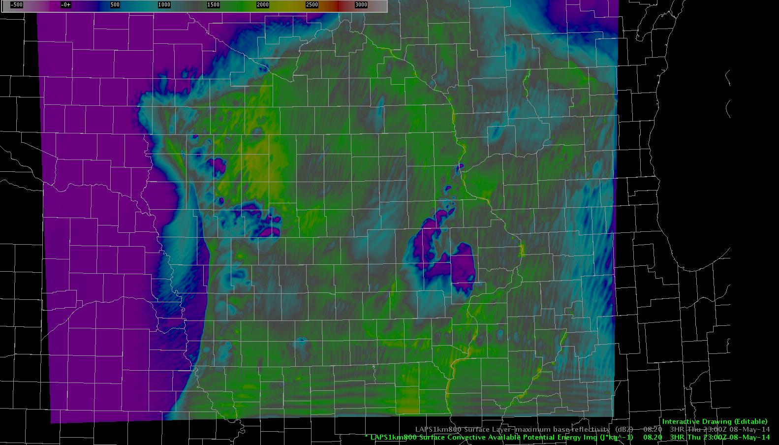
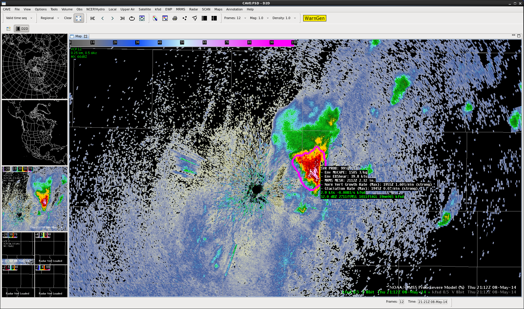
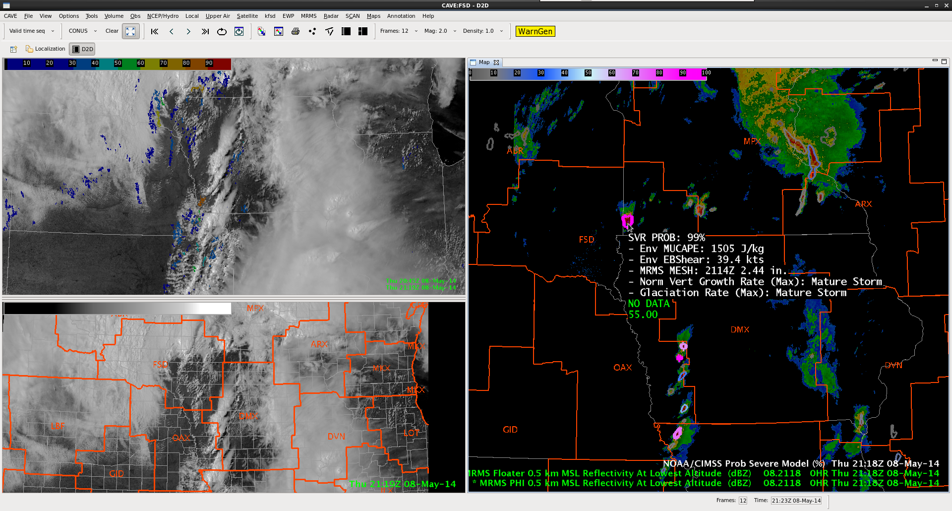
Obviously, where a forecaster sees a radar feature in line with spurious model waves, they can discount it.  Of concern is when these features interact with/react to “actual” convective features the model is tracking.  This could lead to other spurious development or result in contaminating the character of any convection that wanders into the waveform.

db

Tags: None

DSM set-up update

22Z…a broken line of storms continues through western IA.  To this point, strong…but not strong enough to warrant warning.

radar

The LAPS model forecast for 22Z is below

bogusradar

Catches the basic idea of the shape/character of convection to the west, but just a little off in location.

Here’s the Nearcast instability forecast looking ahead four hours…highest instability will lift northeast, and this batch of convection will move with it.  Notice lingering instability (relatively speaking)near the NE/IA border.

instability

The CI product shows the potential for more convection to develop along the main cold front behind our initial line.  Expecting this activity, should it take hold, will be less of a concern with lower instability to work with compared to the first line.

CI

db

Tags: None

Prob Severe of 99%…Three Body Scatter Spike

8May14 Prob Svr TBSS 8May14 Three Body Scatter Spike

While monitoring the Souix Falls radar this morning, this storm developed just east of the radar site. The Prob Severe Model jumped to 99%.The hail size was predicted by the tool to be over 2 inches in diameter. A short time later a nice three body scatter spike appeared. We are still awaiting any reports from the area.

Jared Maples

Tags: None

Operations Update: Day 4 @2115 UTC

While ICT still has the possibility of severe convection later this afternoon / evening (a severe thunderstorm watch was recently issued), due to the limited operational time left today that team is moving to the Souix Falls (FSD) CWA which is covered by the tornado watch.  Severe convection is already ongoing in the region (note the 99% probability of severe in the next hour in the ProbWarn Product in the image below).  Meanwhile a line of storms are about to move into the DMX CWA.

Top left: Visible Sat / UAH CI. Bottom Left: Visible Sat / CWA borders. Right: MRMS Reflectivity at lowest altitude and ProbSevere at 2115 UTC.

-K. Calhoun, Week 1 Coordinator


Tags: None

LAPS and DSM

LAPS has finally caught up a bit.  Seems to be struggling a little with the line of storms crossing the IA/NE border.  Here’s LAPS forecast 1930Z column max reflectivity

laps1930Drawing

Here’s DMX-88D from 19:30.  Notice model underestimation of developing line.

rad1rawing

Jump ahead to 2030Z.  LAPS had that initial cell move no the NE and dissipate completely, then rapid redevelopment of convection between 20:15 and 20:30Z near the IA/NE border again.

laps2rawing

That initial line of convection never quit, though…and by 20:27Z a much stouter line of convection was continuing and farther east than what LAPS has indicated.rad2Drawing

What remains to be seen…here’s the LAPS forecast valid 2200Z.  Line of convection continues…what seems odd is the east/west line of something that develops near the IA/MO border and is moving northeast. Also of note…an east/west, wave-like formation in the CAPE forecast that drifts in from the south.  Anomalous CAPE ridges spurring on a convective response in the model?  Is this a model issue near the domain edge or is there a process that the model is trying to pick up on?  someone remind me to check at 22Z!  db

CAPE rad3


Update: it’s a boundary condition issue.


Tags: None

1 Minute Satellite Feed

8May14 Wichita Reflectivity 2052z 8May14 GOES-14 2052z

Today the GOES-14 SRSOR is updating at one minute intervals. This provides an excellent opportunity to see how quickly cloud tops develop, even well before the radar updates. In the first image you can see the void in the circled area. This general area is the same area in which clouds have already developed and are beginning to can upper level winds.

Update: Showers and thunderstorms have initiated in the same area that satellite feed was showing the high tops. The one minute feed gave great lead time in this instance.

Jared Maples

Tags: None

OUNWRF Fires Convection in Kansas, Northern Oklahoma

8May14 OUNWRF Ref 1915z8May14 OUNWRF 2015z8May14 OUNWRF 2145z

So far all has been quiet in the Central Plains. The OUNWRF would believe otherwise. It has bee more robust in developing showers and thunderstorms early this afternoon  through this evening. The top frame shows what it was forecasting for 1915z, the second frame is 2015z and the final frame is 2215z. The model would suggest that most convection would be limited to Oklahoma City and points north and east, especially into Eastern Kansas. As the front continues to push east through Kansas, winds have switched to the northwest as far east as Downtown Wichita and dewpoints have dropped in the 40s…and eventually into the 30s just a little further west. Stay tuned…

Jared Maples

Tags: None

CI picks up on line of initiating convection

Line of convection working through Omaha’s CWA. Initial CI hits 50-60% at the northern end of a line of cumulus at 1825Z.

ciLine1

At 1830Z CI probs increase to 80-90%. Weak reflectivity is evident at this point.

ciLine2

At 1855Z cumulus further south along the line shows CI at 60-70%. The northern portion of the line has developed into a strong shower/minimal thunderstorm.

ciLine3

At 1915Z the CI probs have verified – the line of developing cumulus is now a line of showers and thunderstorms.

ciLine4


Scott Rudge.

Tags: None