High risk day for Nebraska Iowa and we are focusing on North Platte area, Getting situation awareness. seeing extreme instability and high theta e diff. over our area. Ongoing storms underway to our north and expect a strong tornado or two along with a developing derecho type wind event into Illinois and perhaps Indiana by 06-08Z on 4 June.
Looking at v laps and discussing areas of highest cape. High cape seems to be advecting into Nebraska from KS where there was and is extreme heating south of the warm front. V laps proving valuable for sit awareness as I noted yday.
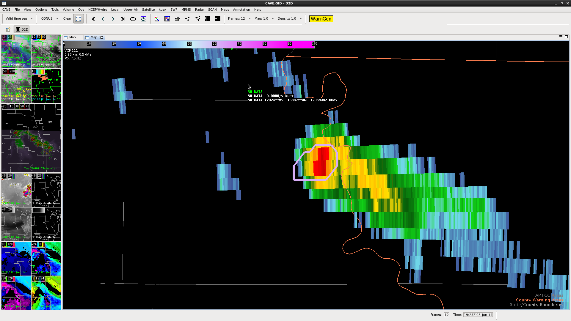
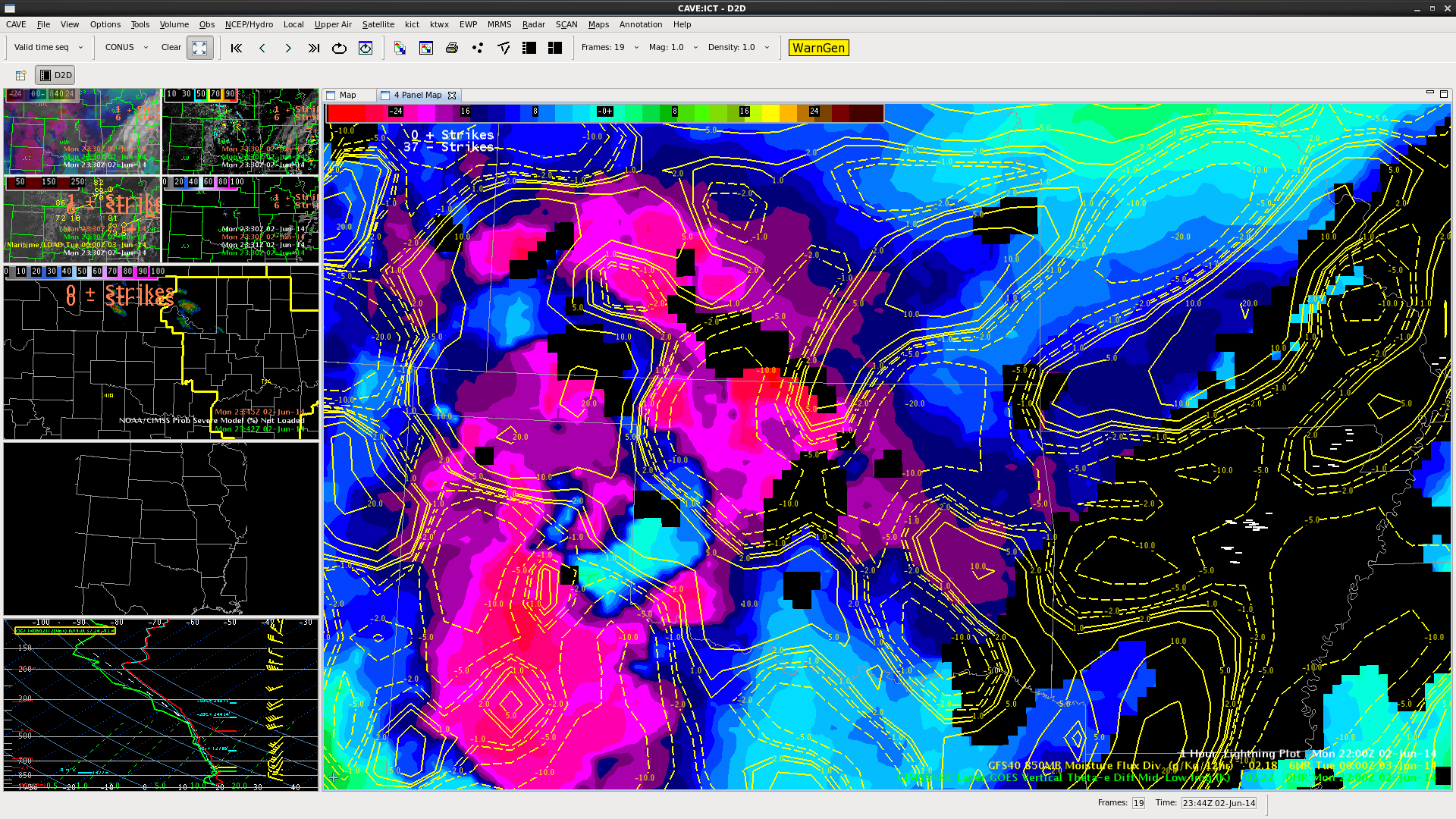
Looking at storm over northern NB and prob severe shows 92% for 2 consec scans. OUN WRF and V-laps forecasting a severe cell in SW NB near Colorado border. Nothing yet but theta diff is large in area and watching area closely.
Update 1930Z 3 june
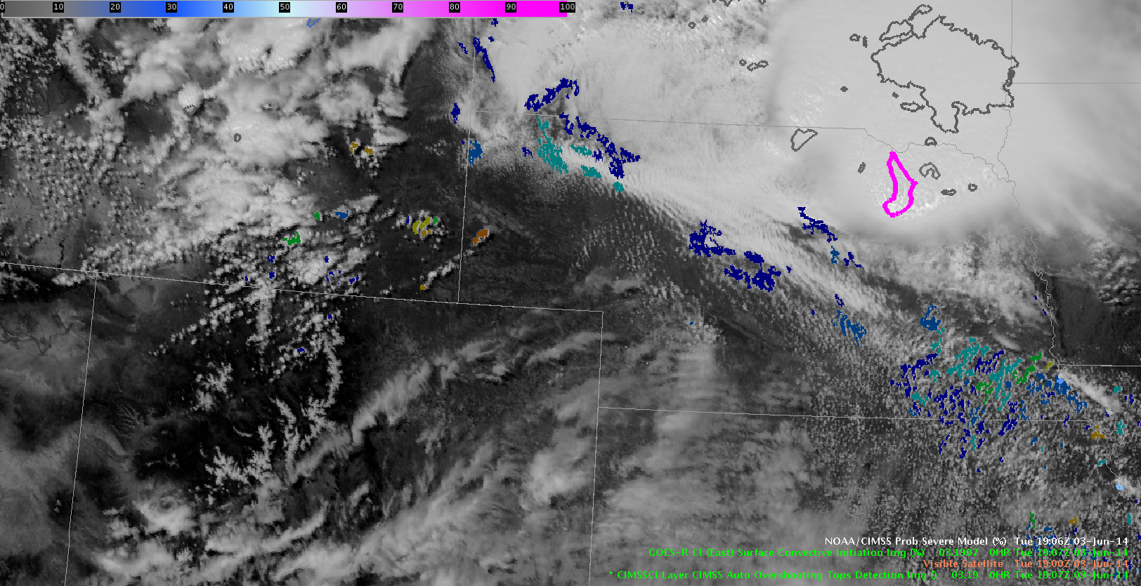
 Convective init. parameter is keying on on convection to the west of an area that vlaps indicated would fire and also an area that theta diff is indicating a key area. See extreme west NB and WY in image above. CONVEC INIT is adding valuable info to confirm our thinking about this area. Watching now for an indication of overshooting top… none yet!
d satterfield
WBOC TV


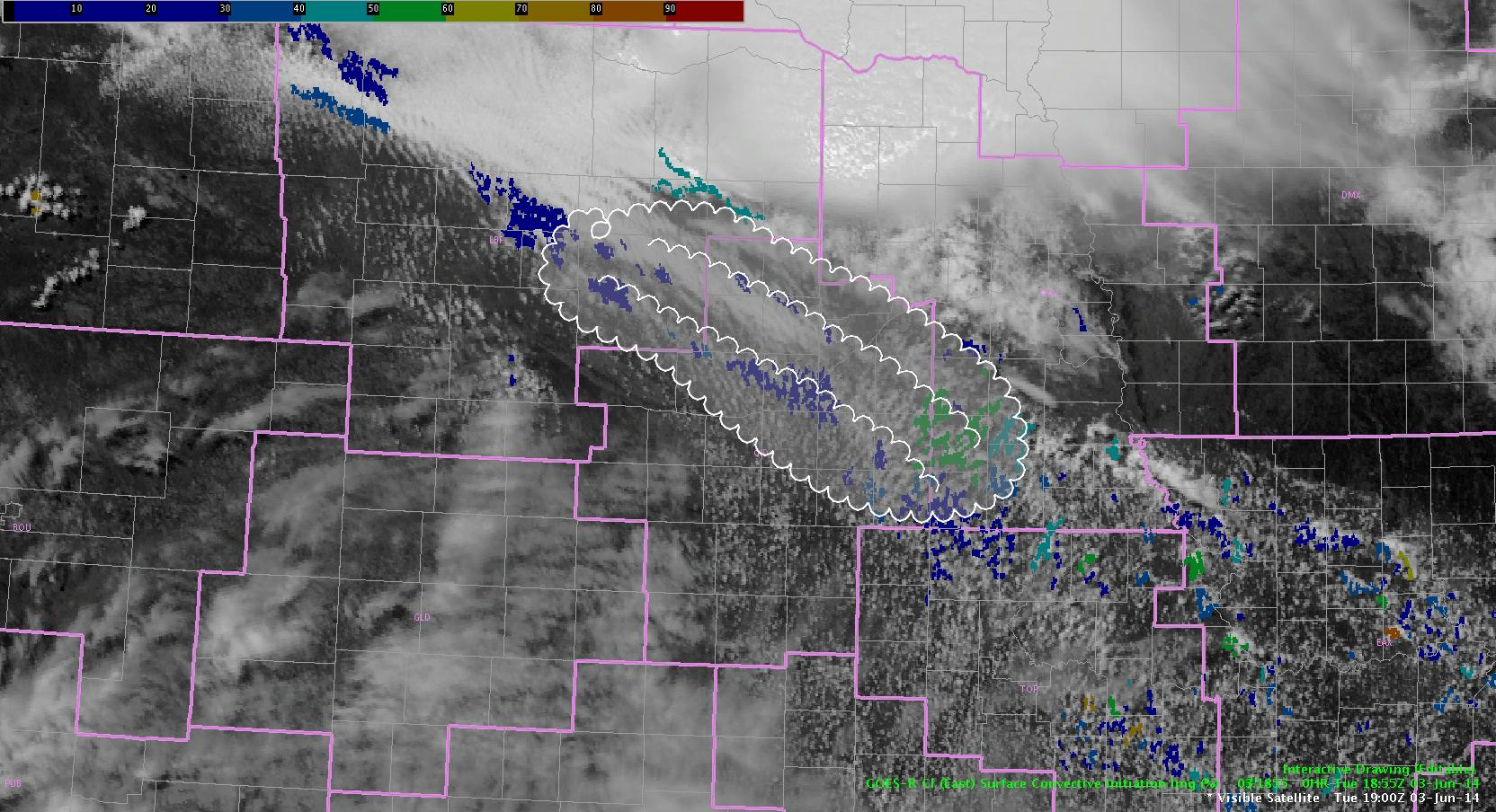
 based on the above image, its still up in the air as to which area highlighted will develop convection first, and just as importantly, which area will so severe first. The instability gradient to the west is more impressive, but the CI is higher and more consistent to the east. Stay tuned for updates…
 d satterfield