Overview: Main concern in the near term is focused on timing of convective initiation across eastern Montana that will advect into the western Bismarck CWA. Initial synoptic analysis reveals a broad upper low across the Pacific Northwest with mostly zonal flow across the Dakotas and a weak trough over Canada (Fig 1) dipping into the eastern Dakotas.

Fig 1: 00z Tuesday.
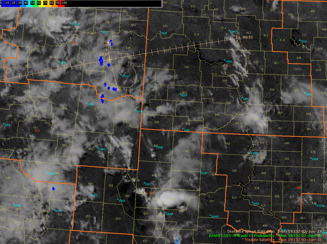
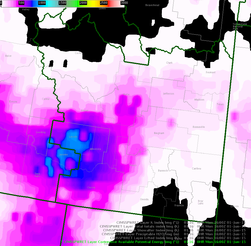
Initiation: As of this writing, no convective cells of significance have developed. There is a lack of large scale forcing over the next few hours. Will initially focus on surface convergence associated with the surface low coupled with convective heating through the afternoon. CIMSS 900mb PWAT indicates plenty of low level moisture advection with south flow ahead of the surface low. Surface dew points increasing to near 60 degrees. Inspection of the pseudo GOES-R CI data show about 15-20% as of 1915Z (Fig 2). Estimating time of arrival into Bismarck’s CWA is estimated at 21Z using TOA tool. This seems in line with HRRR which develops around 22Z. Also feel with cloud cover increasing across that the CI probabilities may be lower than expected. CIMSS CAPE analysis (Fig 3) favors what are now cloud free areas and show mid 80s over 50s. If development occurs over eastern Montana and advect into this region we could see rapid development. Better dynamics trail the system making noctural convection appear favorable.

Fig 2: CI and Vis. Probabilities around 15-20%

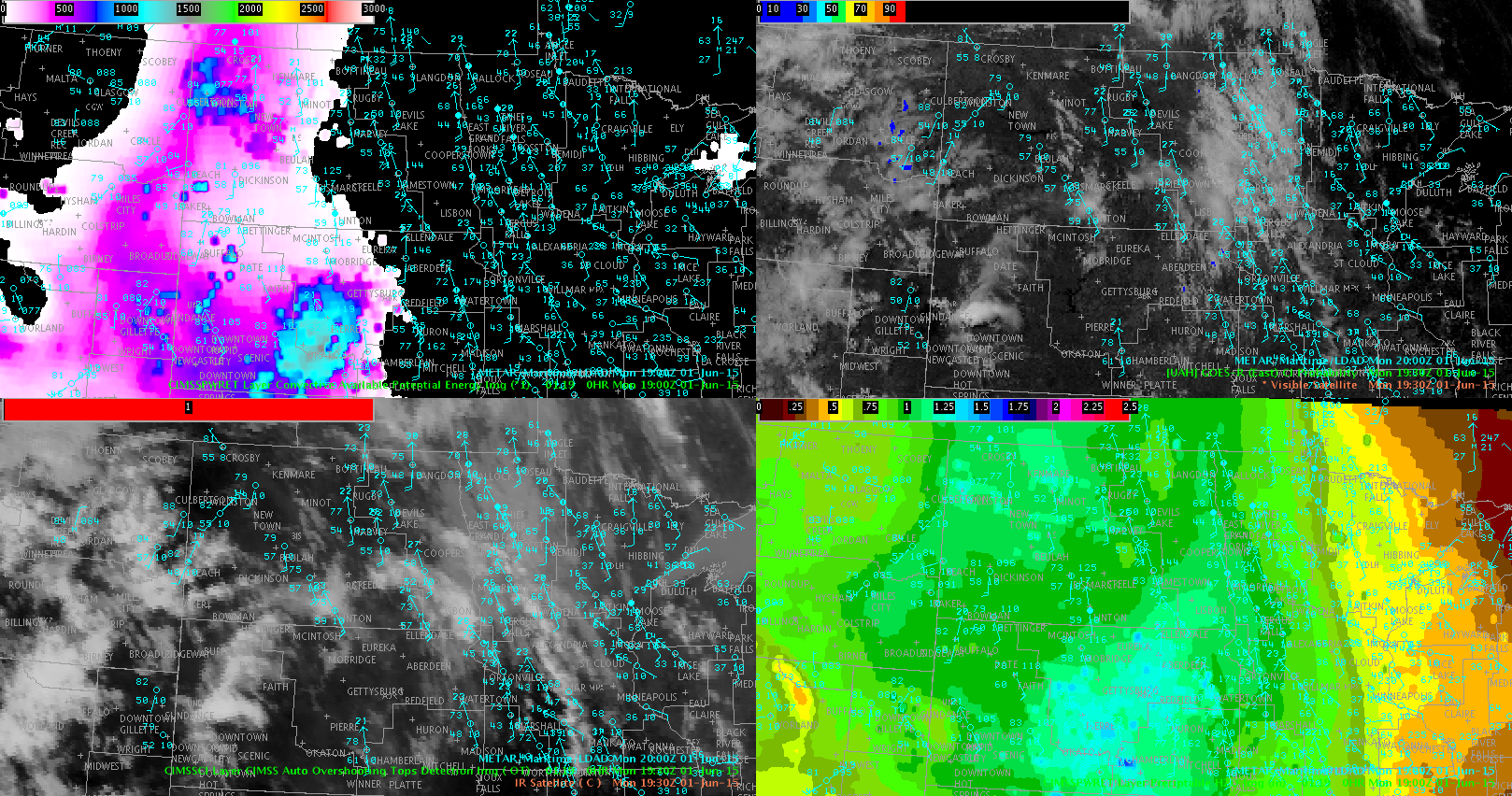
Fig 3: CIMSS CAPE Metars, Overshooting tops, PWAT, etc.
Monitoring: Plan on monitoring CI probabilities in conjunction with traditional satellite and radar trends for anticipated development. Once convection forms will turn to experimental lightning, severeProb, etc tools.
Forecasters: Cattywampus/CoonieCatEye


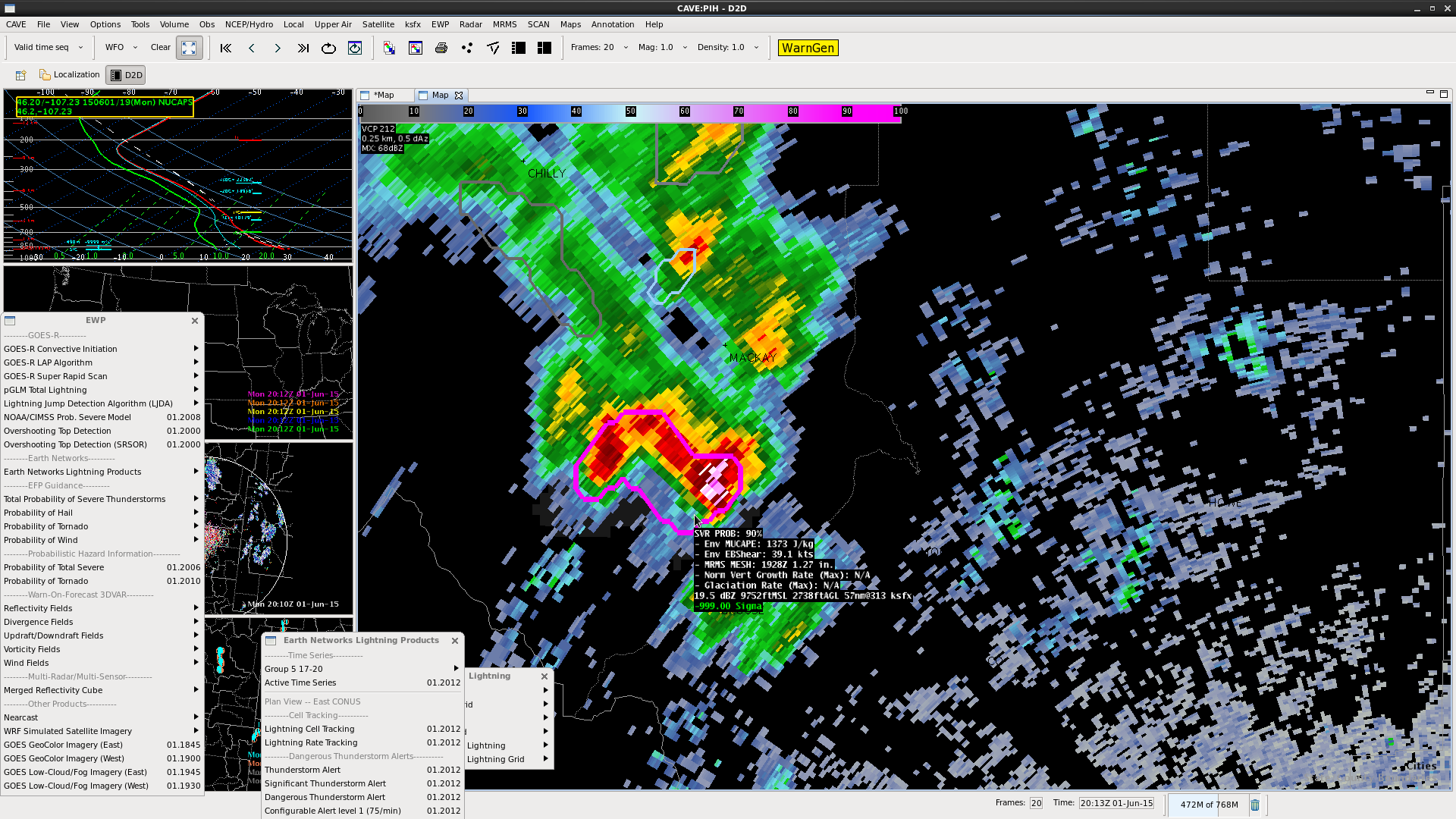
 Discrepancy in the number of CGs and the polarity between ENI and NLDN. ENI did not have any thunderstorm alerts until 2020z, 10 minutes after we issued a SVR based on ProbSvr and reflectivity. At 2020z, the ENI flagged a general thunderstorm alert.