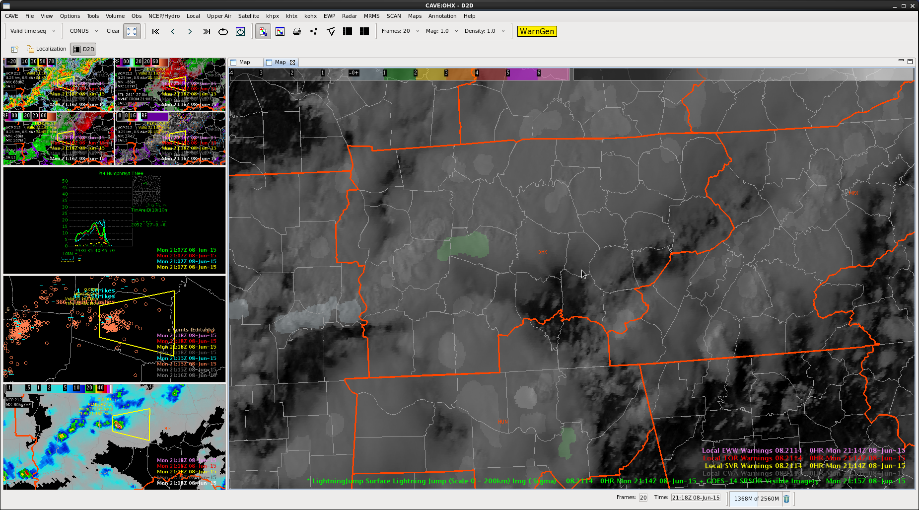
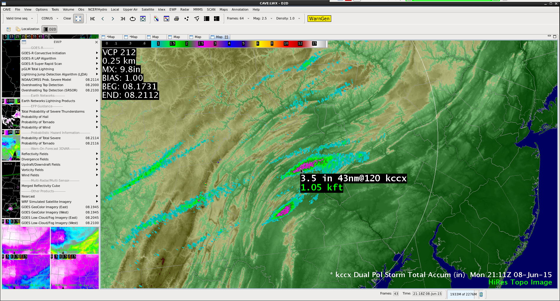
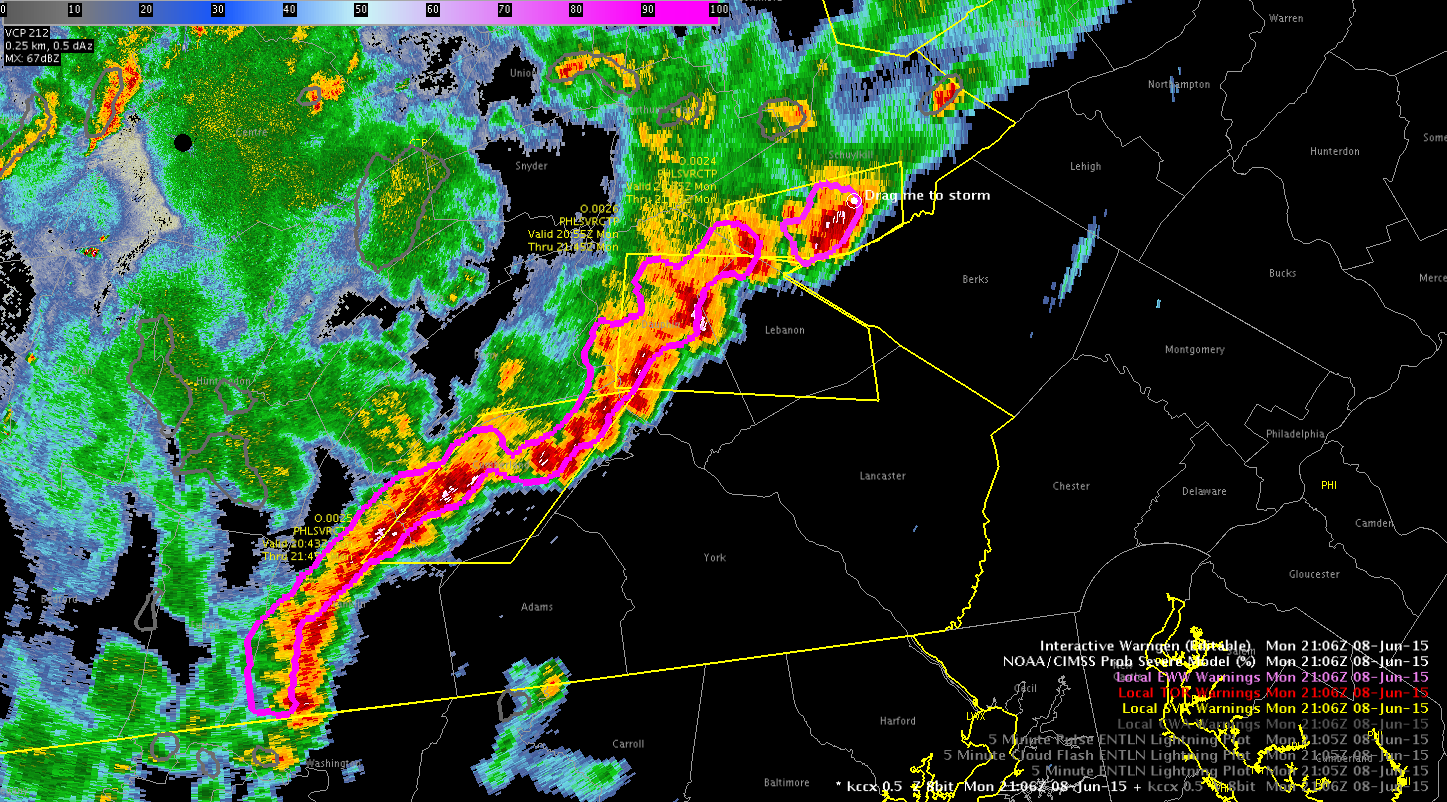
SRSO shows several things. First the overshooting top in PA was nearly stationary, anchored to the terrain by the southerly inflow impinging on the inflection point in the Appalachians. Dual Pol radar estimates up to 3.5″ rainfall there near Harrisburg, PA and a Flash Flood warning was issued for the area. A couple of the overshooting tops including this one were caught by the algorithm (denoted by the red grids in the visible imagery) but one to the northeast was not as seen by visible imagery. Also of note in the SRSO were the north south cloud streets in MD and the Chesapeake Bay breeze front just east of KBWI with cooler temps in the 70s and lack of clouds over the Bay into southeast PA. MrSnow/Wacha
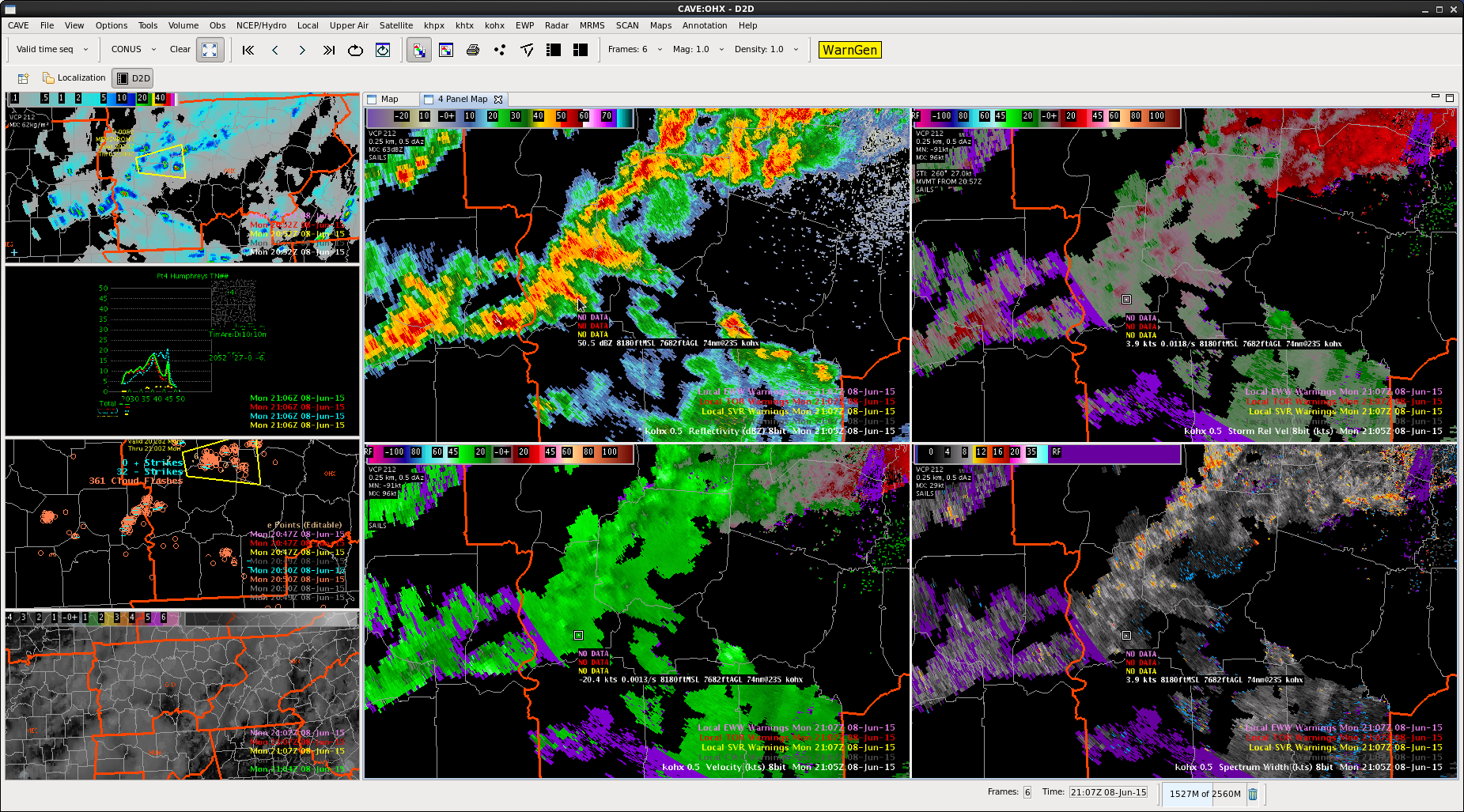
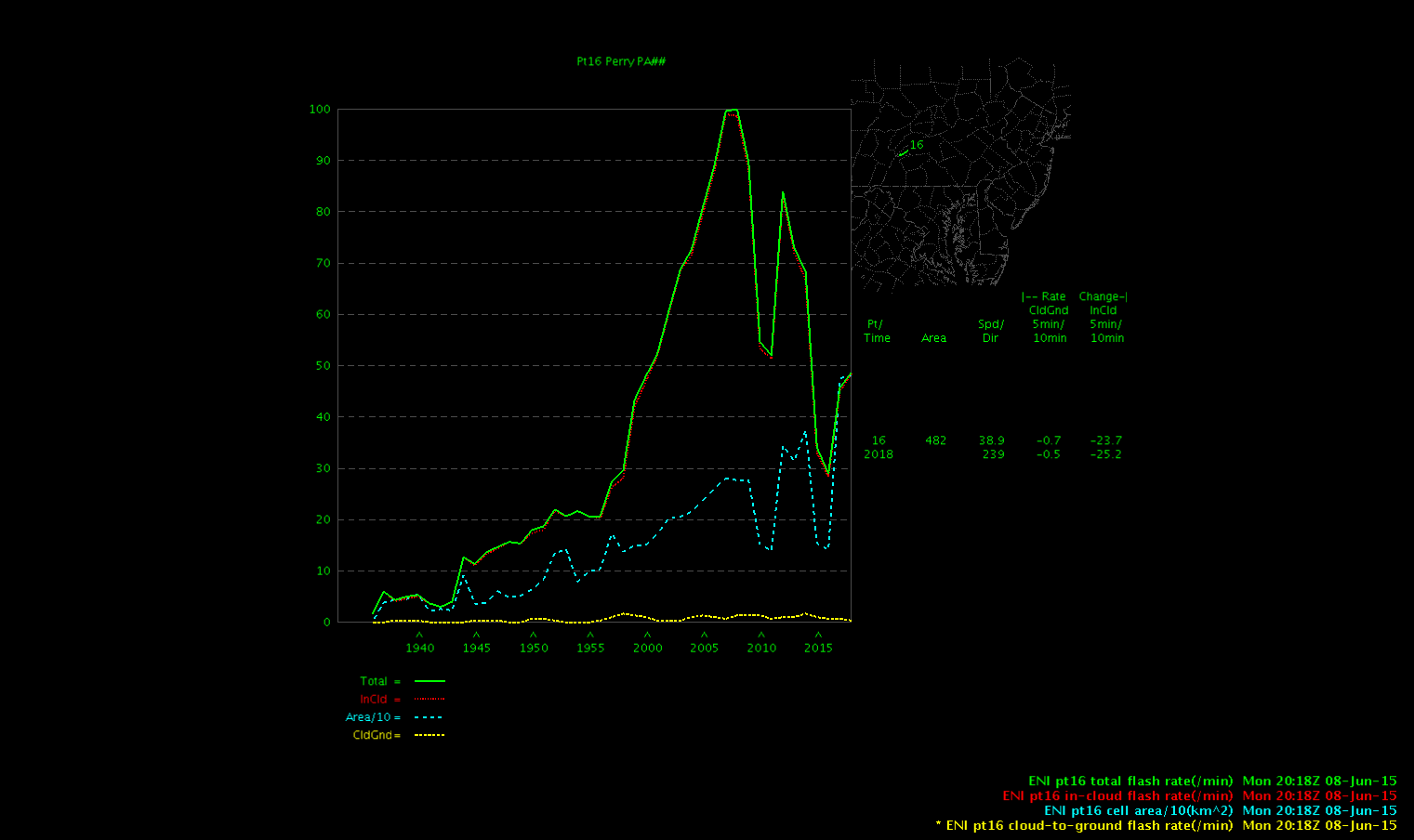
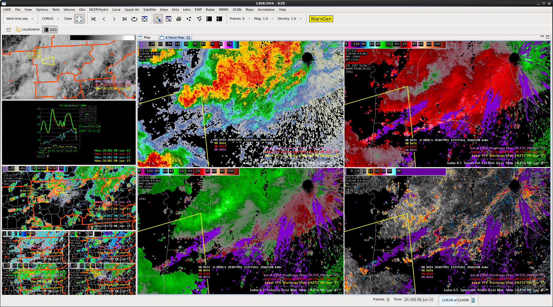
 Did not have a high lightning count
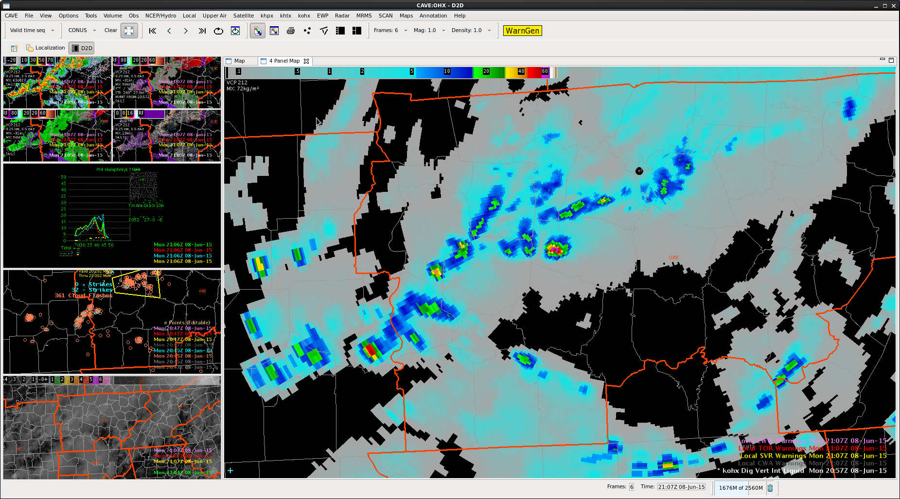
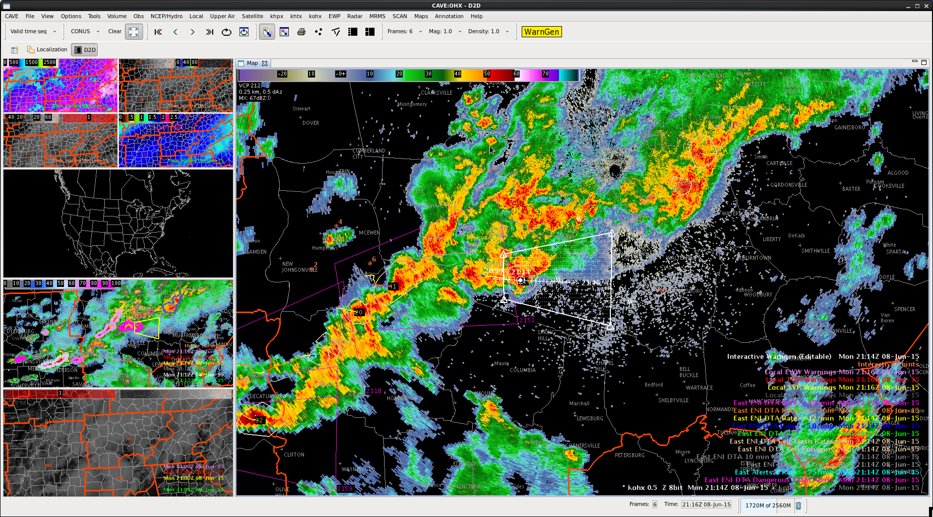
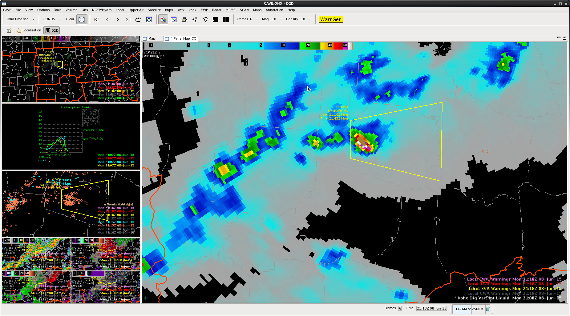 Had a quickly building DVIL
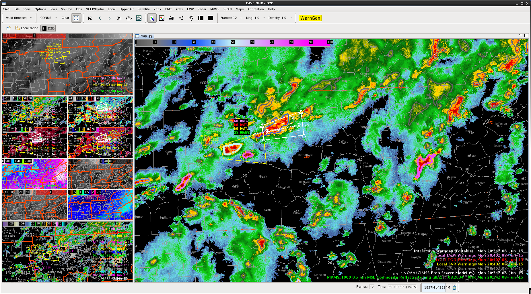
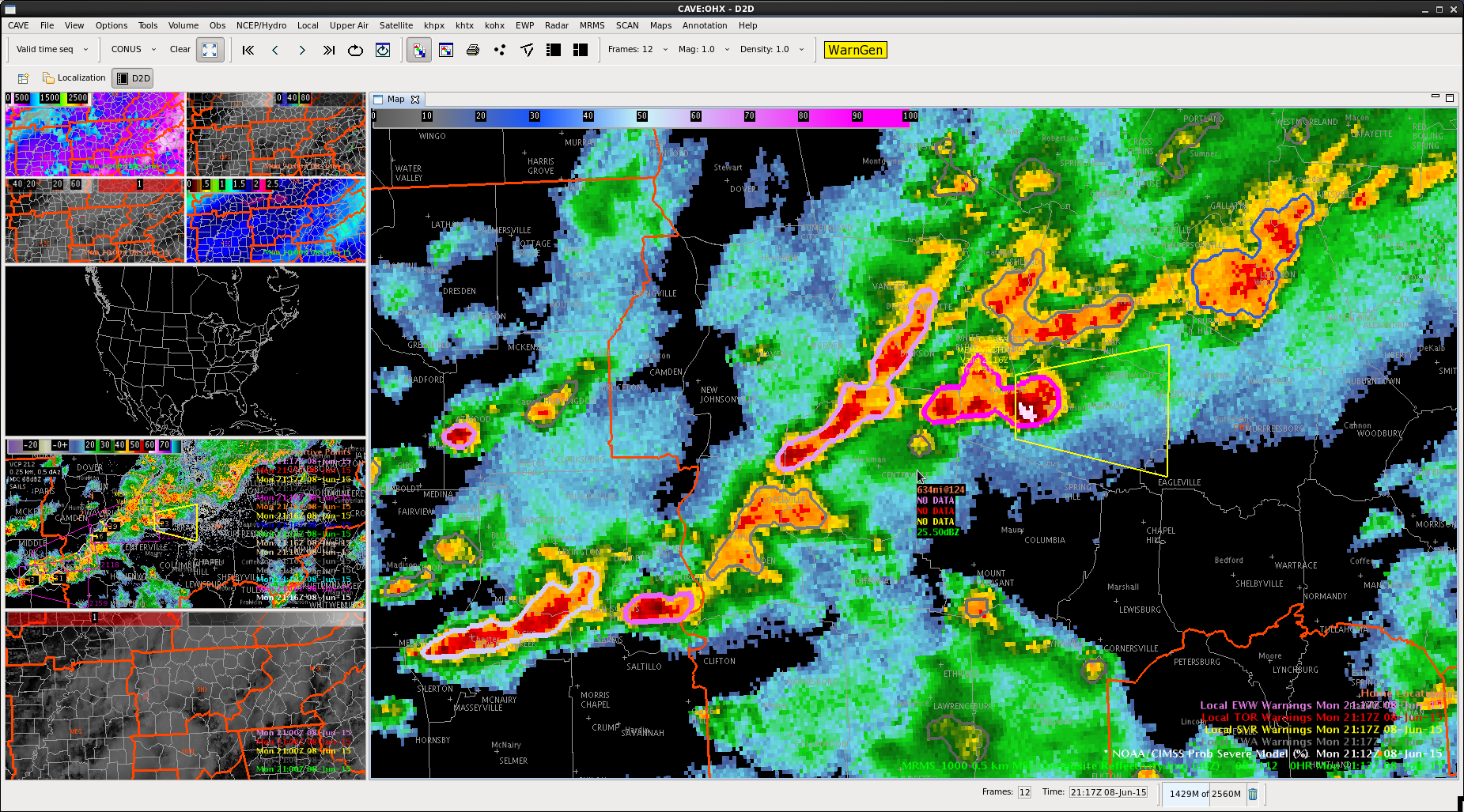 ProbSevere was high
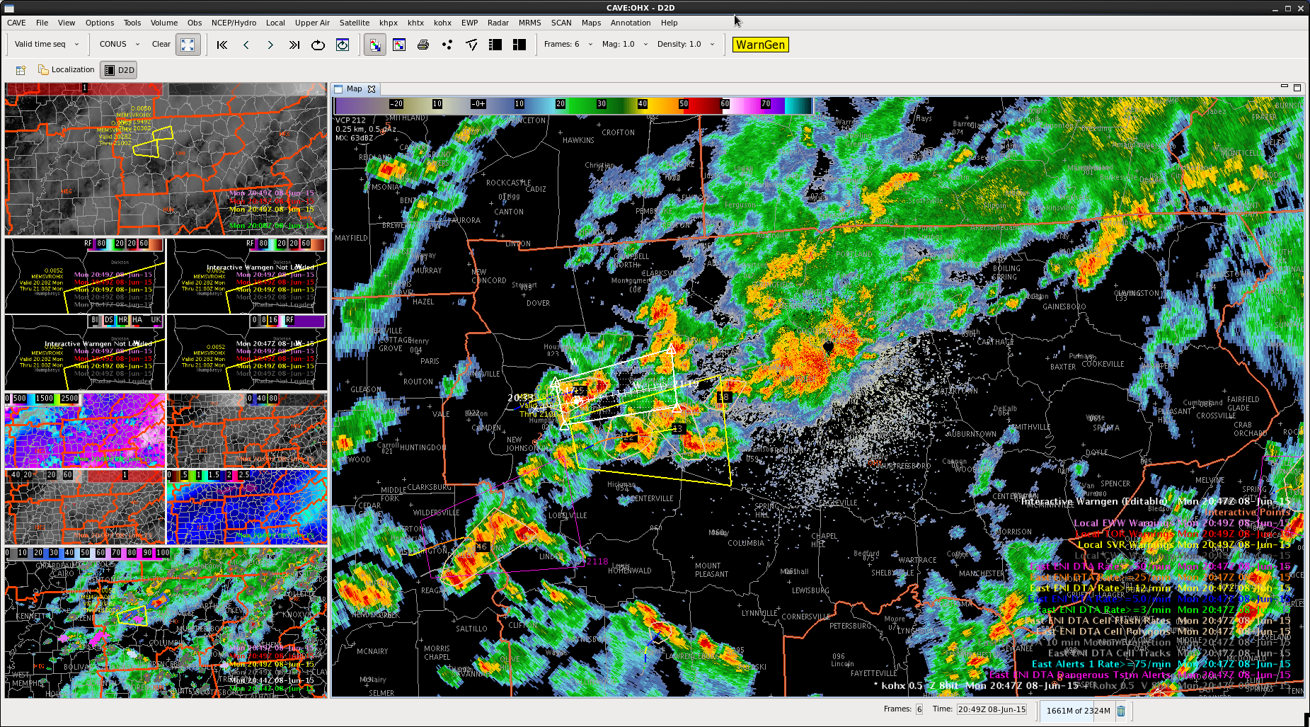
 Storm formed on boundary…moving right of mean flow
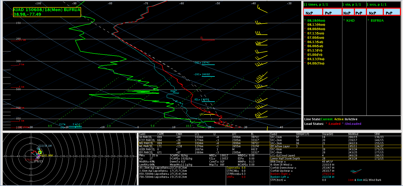