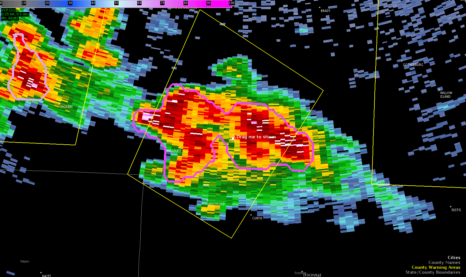
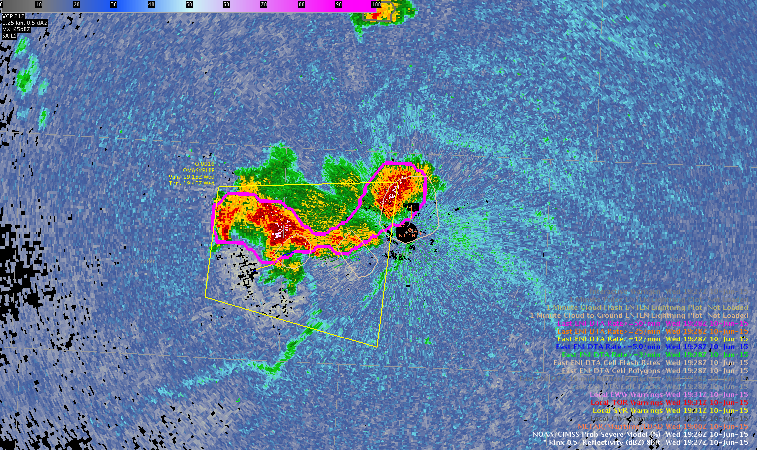
Hail reports of 1″ (1905z) and 1.25″ (1930z) from Wellfleet have come in. First warning came out at 1909z which covered the second report, but missed the first. ProbSevere is helping out big time! MESH hail has been pretty good so far. -BT
Official websites use .gov
A
.gov website belongs to an official government
organization in the United States.
Secure .gov websites use HTTPS
A
lock (
) or https:// means you’ve safely connected to
the .gov website. Share sensitive information only on official,
secure websites.

General Information and News
Hail reports of 1″ (1905z) and 1.25″ (1930z) from Wellfleet have come in. First warning came out at 1909z which covered the second report, but missed the first. ProbSevere is helping out big time! MESH hail has been pretty good so far. -BT
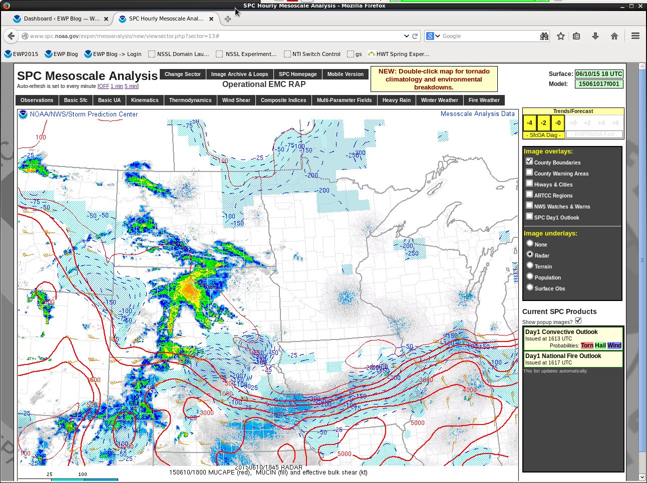
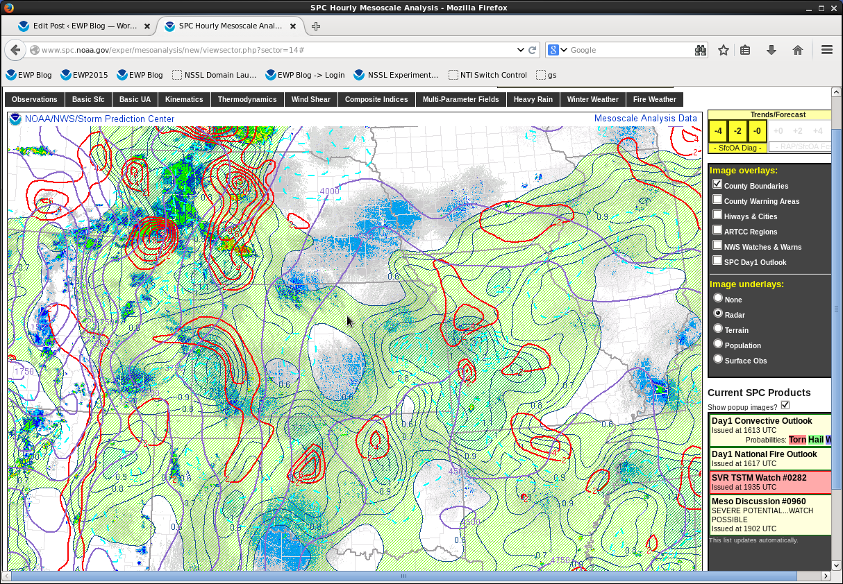
Manipulated surface to match current values of 70 Dew point and 88 Temp to the NUCAPS sounding at 1731Z. CAPES registered at 4800 J/Kg…which was consistent with the SPC mesoscale analysis.
Did not end up with a CI marker for the cells developing in this region. Did have some thin cirrus up here.
 Precip placement potential shows a narrow convergent signal close to higher precip, northeast of current storms in North Platte’s area. Otherwise, area is pretty quiet.
Cell in North Platte’s area forecast by DTA to stay out of our CWA. Still close enough to keep watch on, especially should in build to the east.
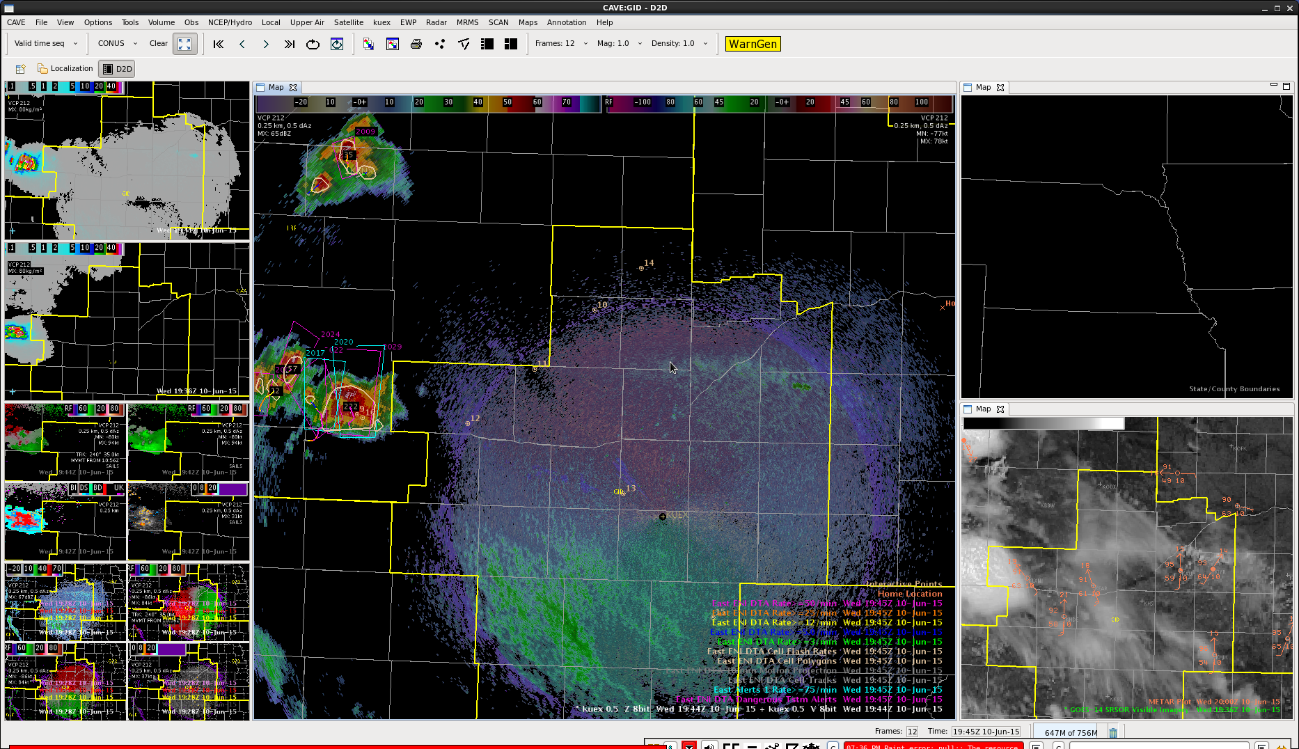
Even though we aren’t dealing with linear storms, these two cells are still close enough in proximity for the ProbSevere model to merge them. Out of curiosity, I wonder if the cell’s proximity to the radar will impact the model. Or if the model would be more useful in this situation since we can’t sample the storm as well. -BT
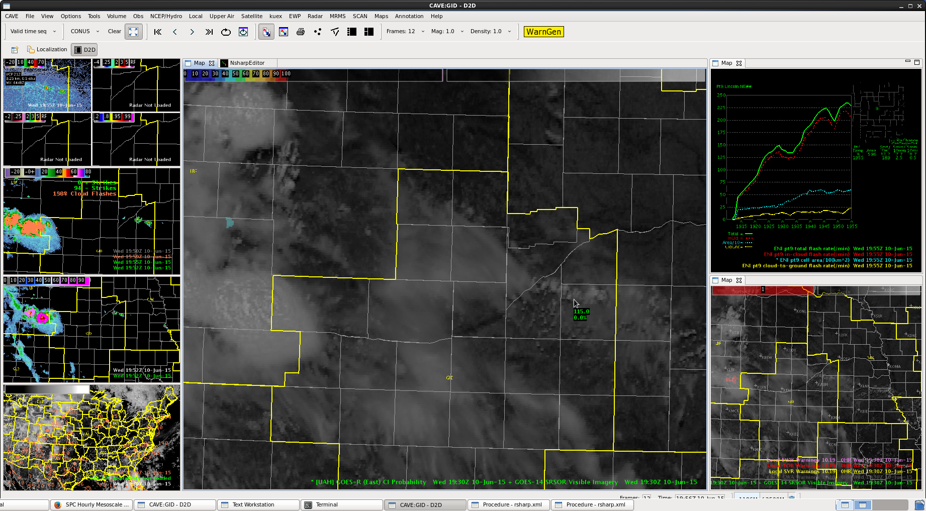
Things firing quickly here in North Platte. Lightning data and ProbSevere was helpful in warning issuance without having much situational awareness. Seems to be accurate at the moment.

-BT
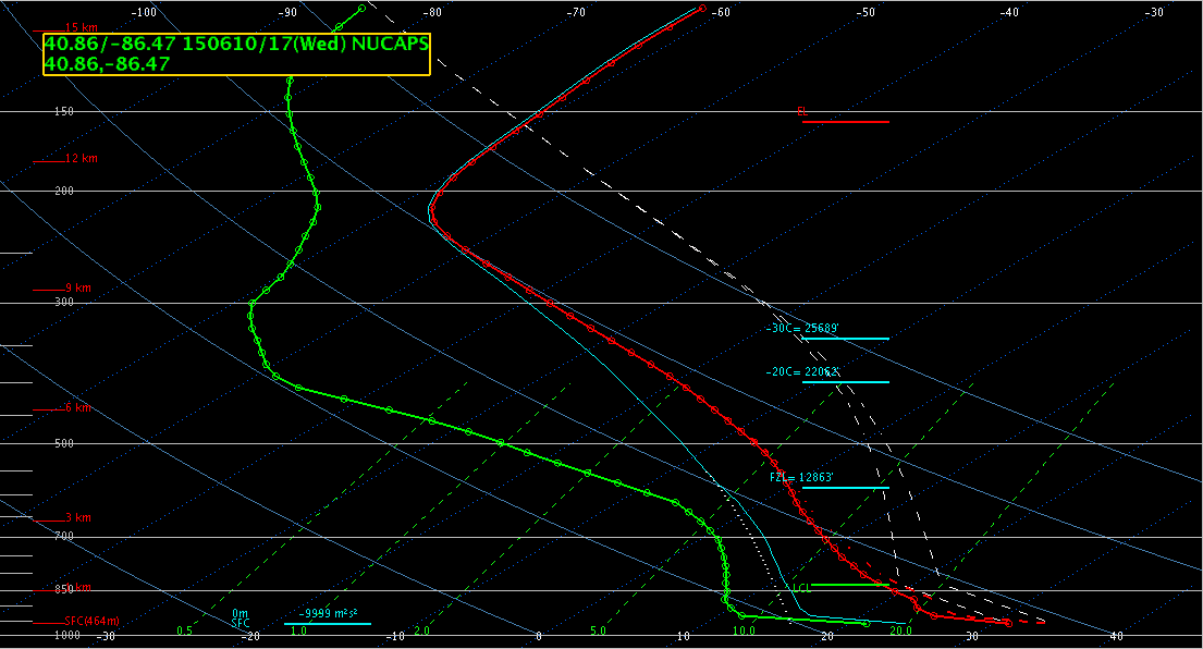
Have some cirrus crossing the region from earlier storms to our west. Have some new cells firing up along a frontal boundary just west of our region. This front is indicated in our region as a narrow line of weak cumulus clouds. Temperatures south of the front are in the low 90s with dewpoints in the low 60s. North of the boundary temperatures are in the upper 80s with dewpoints in the upper 50s. LAP Sounder data is masked by the cirrus, but earlier readings in the clear sky had a gradient bisecting our county warning area, basically south of the front.
North Platte soundings modified for current temp/dewpoint is similar to SPC mesoanalysis for the region, with CAPEs in the 3-4 k range and limited inversions, if any. Thus will be watching for cells developing along the front and
Boundary positioned today over LOT CWA. Small amount of CIN remaining but Convective temps are expected to be reached shortly across much of the area. Goes_R parameters are showing CAPES in excess of 3000 across the western portions of the CWA. These 18Z values are showing somewhat less than what we are currently seeing on the SPC Meso-analysis, but this may be due to the sharp increase in capes over the last several hours over 2000 increase in some areas. Other indicies (LI, TT and showalter) are all sufficient to support severe weather…effective bulk shear is also about 25-30KT. Given the instability and shear the main threats will be for damaging winds and hail.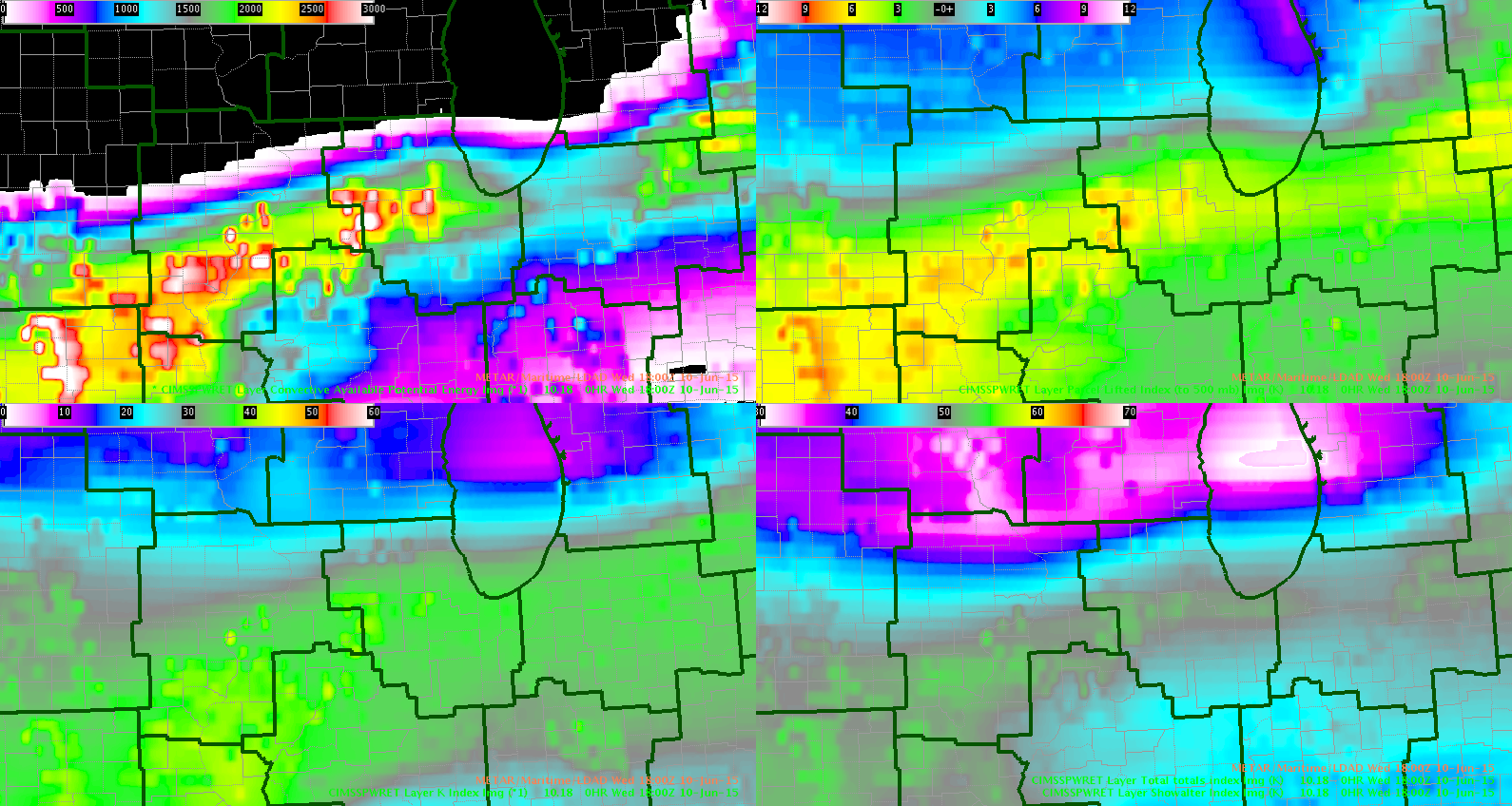
Inthecards/wacha
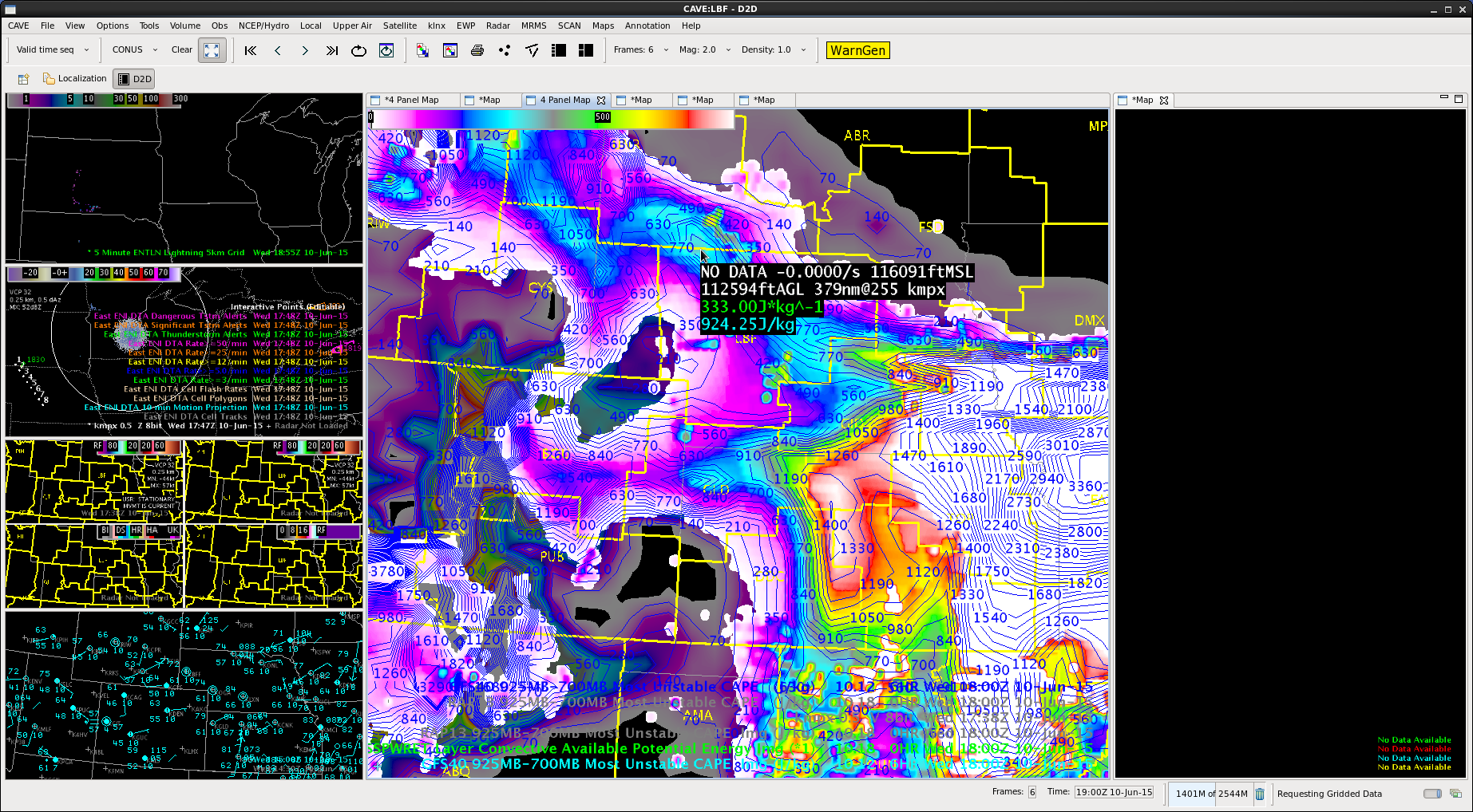
HUGE LAP RAP GFS CAPE differences noted in LBF area. The LAP CAPE is 250 J/kg, First guess GFS ~ 900 J/kg MUCAPE while SPC/RAP is showing 2500 MLCAPE and 3000 MUCAPE. Explosive development is now taking place near LBF. So my guess is the LAP CAPE is seriously underdone. MrSnow/Brick Tamland
– Large differences are because you are comparing LAP CAPE (which is closest to SBCAPE) to GFS and RAP MUCAPE. Of course MUCAPE will be higher, sometimes significantly, than SBCAPE. I would suspect the GFS first guess had weak instability, which is why the LAP would be low as well – BL