Daily Summary: 10 May 2011

Forecasters remained in the MAF and SJT regions through the end of the forecast day focusing mostly on convection initiation products and short-range models. With an extend Cu field across the region and GOES in rapid scan operations, the forecasters observed a severe limitation of the UAH-CI product.  Every 5 to 8 min time step the UAH product would catch minimally growing Cu between the time steps exhibiting a high percentage of false alarms.

Overall, this was a minimal day in terms of testing all EWP experimental products limited by weather and technology with the floater domain unavailable due to a morning raid failure.
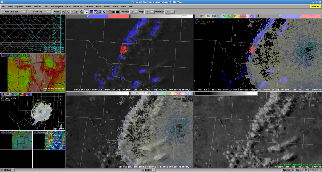
4-panel forecaster AWIPS display: UAH-CI and Visible satellite at 2144 UTC.

-K. Kuhlman (Weekly Coordinator)
Tags: None

Daily Summary – 17 June 2010

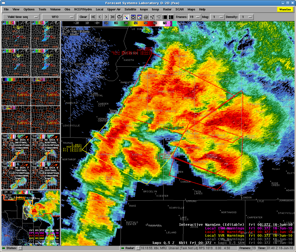
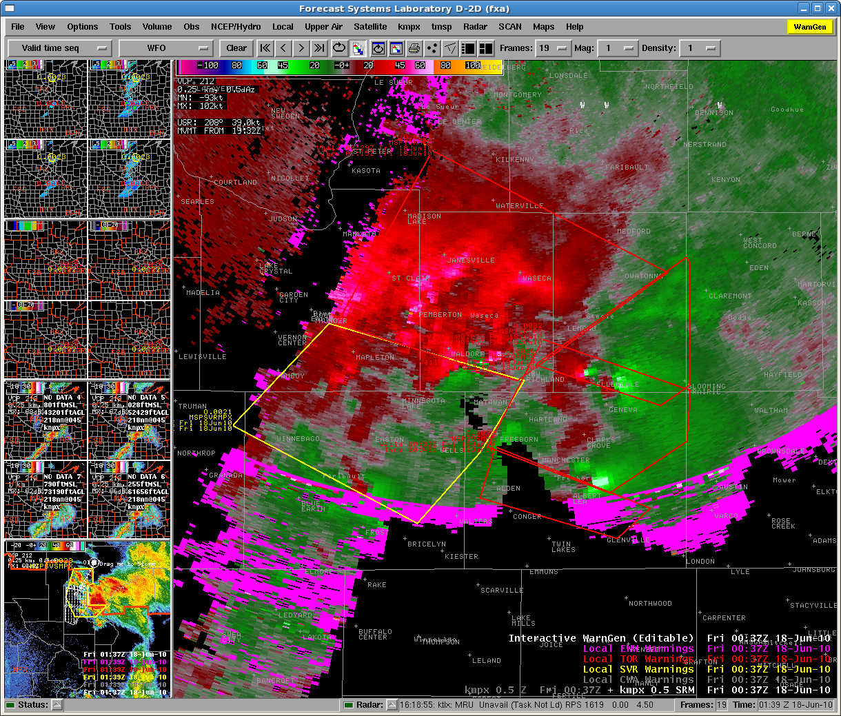
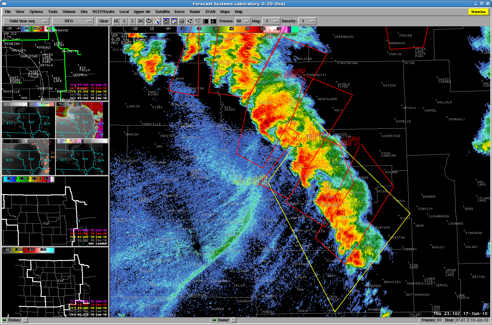
Whew!  What a way to finish up EWP2010.  I will post more pictures of our products and warnings on the weekly summary.  Just around 8pm, storms exited the FGF CWA, and our two forecasters there began their surveys.  In addition, a large rotating cluster of tornadic supercells raked across southern Minnesota near Albert Lea.  The radar presentation on that event brought back memories of what the Beloit Kansas supercell complex from 6/15/92 must have looked like:  “TORNADOES ALQDS”.   Note the 5 or 6 simultaneous TVSs!

Our forecasters working the FGF (Grand Forks ND) WFO had to contend with “lines” of tornadic storms.  For example:

There have been 35 tornadoes so far reported on the SPC logs (some in BIS and DSM CWAs), and we expect that the number will increase greatly as all of the reports start filtering in.  This was by far the most active (non-Oklahoma) event for the Experimental Warning program in 4 years of HWT activities.  And to top off the success, there were barely any AWIPS technical issues at all – the heavily taxed system finally worked well!

Greg Stumpf (EWP Weekly Coordinator, 14-18 June 2010)

Tags: None

Daily Summary – 16 June 2010

Two parts today.

Part 1 (pre-600pm):  DC-LMA domain.  Our Sterling WFO (LWX) team issued a number of SVR warnings, mostly for wind.  Our State College WFO (CTP) had numerous AWIPS problems (no notifications), and there were no severe storms.

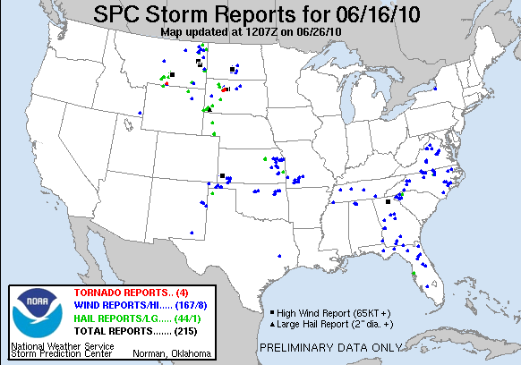
Part 2 (post-600pm):  Floater domain over the western half of South Dakota.  Two forecasters in the Rapid City domain, and one briefly in the Aberdeen domain.  Three severe storms, including one major supercell that produced prolific large tornadoes and was nearly stationary near Faith.  All systems worked well today.

Also during Part 2, one forecaster went through the 5/24/08 archive case.

Surveys were given to the two forecasters that issued most of the warnings today.

Greg Stumpf (EWP Weekly Coordinator, 14-18 June 2010)

Tags: None

Daily Summary – 15 June 2010

We conducted another long IOP over the Ohio Valley, alternating between the forecast offices in Paducah KY, Indianapolis IN, Louisville KY, and finally Wilmington OH.  The event was characterized by an advancing MCS with a bowed linear structure, and isolated supercells in advance of the line.  Our teams issued a number of Severe Thunderstorm Warnings and a few Tornado Warnings, although there were no official tornadoes reported in the SPC log.  Most of the threat was for severe wind (or barely-severe wind), of which we have only a few possible MRMS products that could help.  In fact, one of the biggest comments we’ve gotten regarding development of new products is to add some MRMS products that can help with severe convective wind warnings.  This might include a mid-altitude radial convergence (MARC) product.

For the GOES-R CI products, there was little help even though most of the area was cirrus free.   The GOES-R folks will be looking at this case as a possible failure mode case.

Greg Stumpf (EWP Weekly Coordinator, 14-18 June 2010)

Tags: None

Daily Summary – 14 June 2010

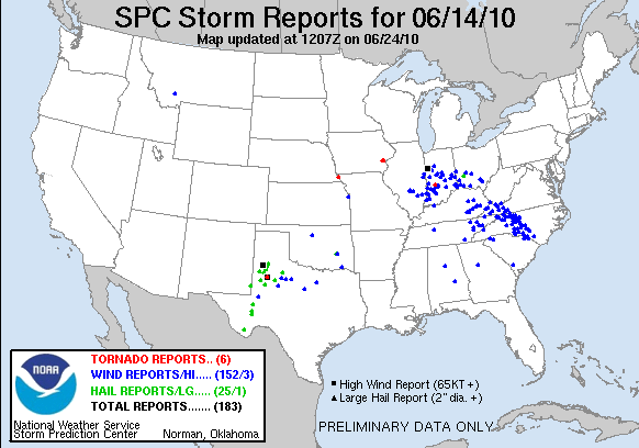
We spent most of the day, as usual for a Monday, training our new set of visitors about the various data sets we will be working with this week.  After wards, we conductive a “semi” intensive operations period with one workstation pair devoted to the central Oklahoma data, and the associate special total lightning products.  The other workstation pair was devoted to the LUB WFO, looking as a few severe storms there.  This was a very low key IOP, designed primarily to give the new forecasters some familiarity with the new products and issue a few practice warnings.  Nothing of real significance occurred in either CWA.  Finally, the forecasters took both the “pre-operations” MRMS survey which inventories several aspects of their warning decision practices, and the lightning survey.

Greg Stumpf (EWP Weekly Coordinator, 14-18 June 2010)

Tags: None

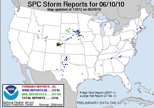
Daily Summary – 10 June 2010

We are starting to wrap up operations.  Storms are either leaving the CYS domain or are diminishing in severity, so Dan N and Frank are starting their surveys.  The BOU crew is still operating a bit longer, but we’ll end their activities soon.

There was a tornado visible via streaming chaser cams on the SAD.  Also, we had on the large monitor in the corner a WDSSII display with two panels: one with warnings and MESH and the other with warnings and 30 min RotationTracks.  Pat really liked this as a SA tool.

We tried some GOES-R operations for a good part of the day.  The cap kept a lid on things in the GLD domain pretty much all day.  There were a few reports of overshooting tops to add to the CI detections.

Technical Issues of the Day:

  • Tupelo was slow to load when we switched Dan D to that machine.  He was trying to load his procedure.  We tried a reboot and it was still pretty slow so we just patiently waited for it to load.
  • Otherwise things worked quite smoothly.

Kevin Manross (EWP Weekly Coordinator, 7-11 June 2010)

Tags: None

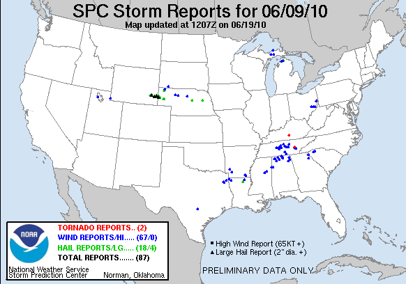
Daily Summary – 9 June 2010

Today we touched on all three sensor groups: GOES-R, pGLM, and MRMS.  For the second day in a row, we were dogged by cirrus that significantly limited our use of the GOES-R data, though we did have a few occasions where we could see an Overshooting Top.

We started off with Nashville’s CWA in an attempt to observe total lightning, as well as Huntsville’s CWA.  As the storms left Nashville, we switched to Birmingham during the dinner break.

There were a number of good questions from the forecasters to Geoff, which I’ll defer to his blog entries [enter blog link once we get it].

Technical Issues of the Day :

  • Archive Cases were running slow on the right ‘par’ machine.  Ben suggests it has to do with having so many products loaded (running multiple D2Ds) and the update needs to draw all those products at once slows the responsiveness
  • tupelo continues to have issues with warnings.  We ignored the error and issued anyway.  We need to see if they actually show.

Kevin Manross (EWP Weekly Coordinator, 7-11 June 2010)

Tags: None

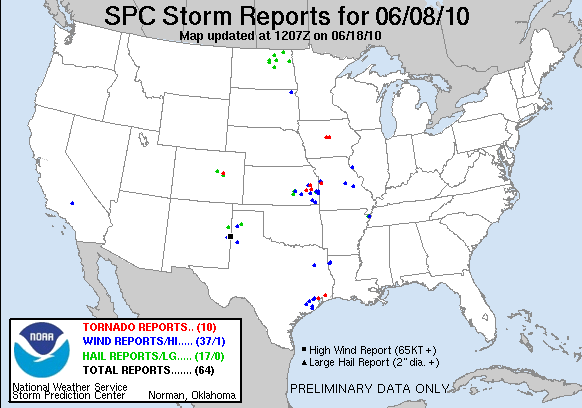
Daily Summary – 8 June 2010

Well, though there was plenty of convection in the area we targeted today, there was not a great deal of severe out of the storms.  In fact, SPC canceled their TOR watch.  We are ending our ops at 0115z (9 June) and will fill out surveys and spend some time discussing today’s event.

Surveys took a little longer than I expected (especially since we asked the forecasters to fill out both the MRMS & GOESR surveys) so we ended once the surveys were completed.

Technical Issues of the Day:

  • tupelo failed to allow warnings after the first couple were issued.  We continued to use it for analysis, but didn’t issue any more warnings on it the rest of the day.  Update: Ben says that a reboot of the machine should fix the issue we were seeing (something along the lines of “WRKOUNWRK1 Cannot Connect”)
  • Merged Products stopped updating on all workstations around 2340z.  Restarted the notification server on PX1 and that fixed the issue
  • pGLM/GOESR archie case failed to update GOESR products.  Ben fixed this during the exercise

Kevin Manross (EWP Weekly Coordinator, 7-11 June 2010)

Tags: None

Daily Summary – 7 June 2010

Group issued warnings until 0140 (8 June).  Seemed to take to analysis very quickly.  Several forecasters are already getting used to products.  We’ve gone ahead and asked them to fill out a survey (online – yay).  In the end, we had Andy and Frank issues warnings in North Platte’s (LBF) CWA after an attempt at GLD.  Dan N, Dan D, and Pat S focused on CYS all night and issued several SVR and TOR warnings.  We will spend a good amount of time tomorrow morning debriefing tonight’s event.

Technical issues of the Day:

  • Nothing major

Kevin Manross (EWP Weekly Coordinator, 7-11 June 2010)

Tags: None

Daily Summary – 27 May 2010

Today was EWP “Big Wig” day, with visits by OS&T Director Don Berchoff, GOES-R Program Manager Greg Mandt, and NCEP Director Louis Ucellini.  The atmosphere behaved once again, like last year, to provide a severe event over the Washington DC metro area, as well into eastern PA and NJ.  We started by issuing for Mt. Holly NJ (PHI), Sterling (LWX), and State College PA (CTP), although it became apparent that CTP was going to be non-productive so we shut it down.  We used Sterling (LWX) so we could capitalize on the pseudo-GLM data.  It ended up being a low-end severe event, with mostly wind reports for the PHI CWA.

We finally made the change that displays the PGLM data in AWIPS as 8 km grid squares.  But most of the storms in LWX area were marginally severe.

The MRMS data was used mainly by the PHI WFO, and noted that most of the hail numbers were showing a bit high compared to the actual reports.

Greg Stumpf (EWP2010 Operations Coordinator)

Tags: None