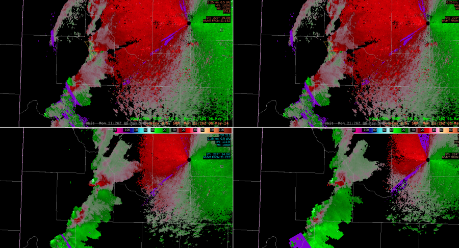
Along this line southwest of the radar, AzShear values increased but SRM still looked benign. TORP did pick up on probs above 20% and defined it as an object


TORP increased in area of the line break along with three ingredients method for meso vortex generation, decided to follow CR CWIP guidance and issue SVR w/TOR Possible TAG.
The portion of the line where the updraft/downdraft convergence zone (UDCZ) caused AzShear to jump and looks to be prompting higher TORP probabilities. It will be very critical for warning mets to know this limitation and be able to identify it, similar to vertical sidelobe contamination. These kinds properties may nearly require a RAC like training, even for experienced forecasters.
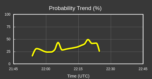
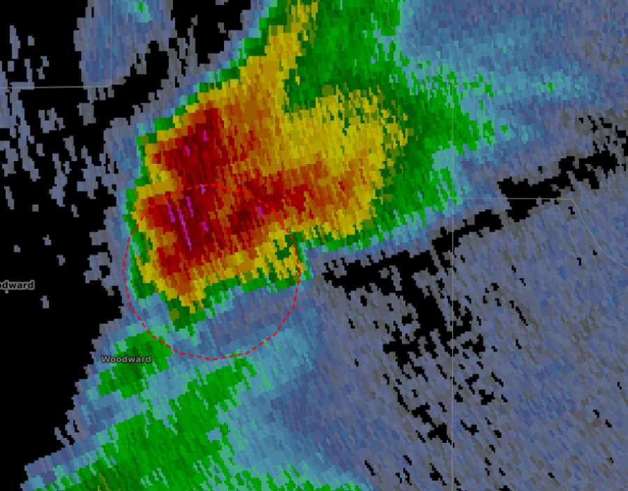
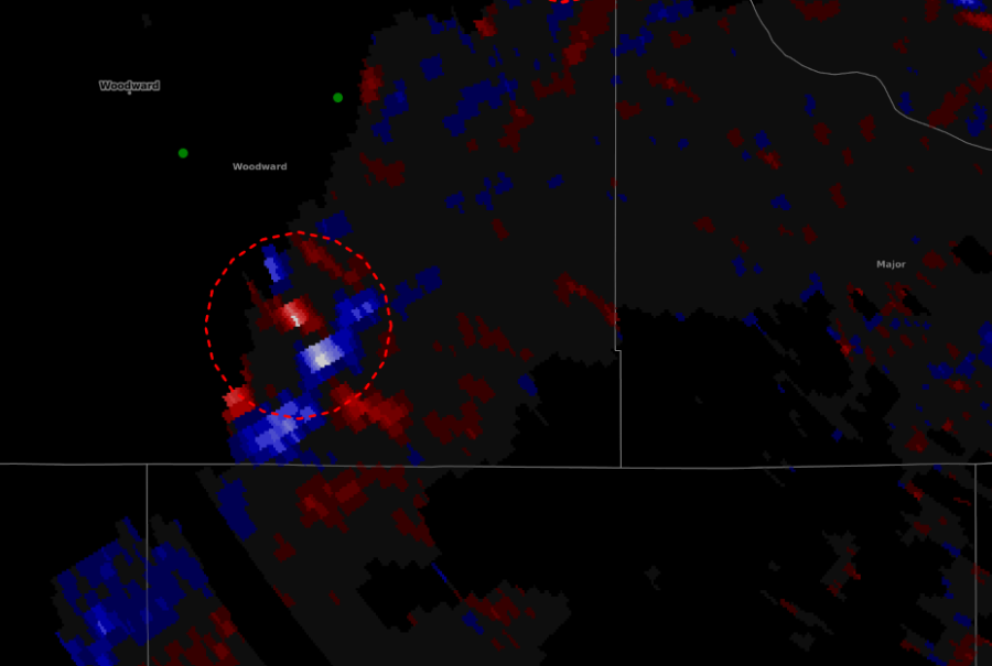
See photo below, noticing we are getting a lot of TORPs above 20 % when we get a line break with reflectivity, which is one of the CWIP nudgers

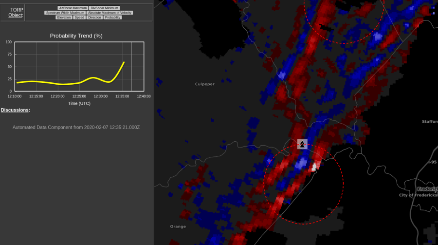
After turning on the range filtering in the Phi Tool, noticed an area closed to LWX had a 95% probability within the SVR w/TOR Possible tag. This was also near a line a break. Went ahead and issued a warning. Had I seen this object earlier, I would have considered a tornado warning earlier, but I only noticed it after the Vrot on SRM drastically increased. But these probs seem to matching some of the 3 IMs as stated in Schaumann and Pryzblylinzky (2012). (See two photos blelow)


Az_Shear appears to be catching on to increasing V_rot about 1-2 scans prior to when I as a forecaster catch onto it. This would certainly be useful to notice a trend is happening before it becomes apparently visible to the eye via SRM. (see below)
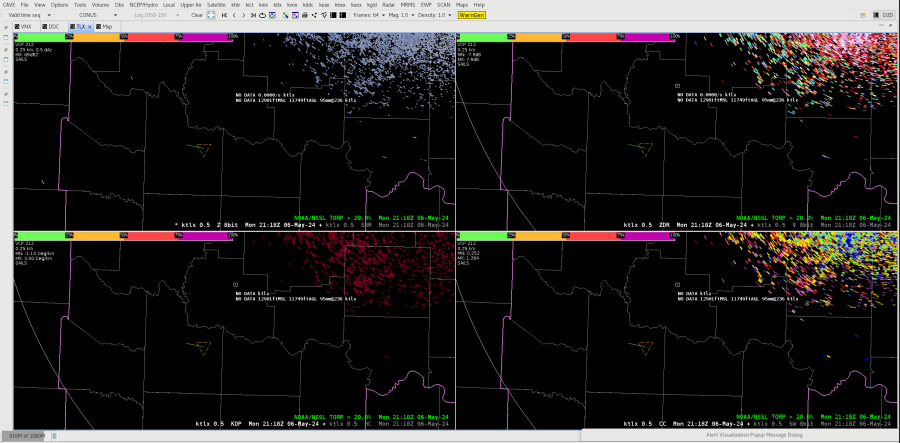
Object 88 near Myersville around 1244z, not sure why it would be there (below)

“Don’t time match on reflectivity”.
As of 1252z, coming up with better ideas for D2D procedure bundles and perspective to integrate AzShear/DivShear into a smoother work flow. I will have to compare MRMS rotational track, as well as MRMS 0-2km Azmithal Shear. These products may be able to replace a lot of MRMS product used for velocity fields. However, MRMS will still be needed for hail.
The workload of looking at AzShear and DivShear has decreased the amount of time am looking at Dual Polarization products. However, this could be in part because of only having one AWIPS screen, where at the office I would have 3. And perhaps having GR2 opened in on a Windows PC could also change this for easier viewing of Dual Pol products. Will need to make a consciously effort to incorporate Dual Pol with these products into my workflow.
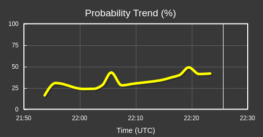
Another example of TOPR going up with line break. Also, it appears that we get a “couplet”, or a “dipole” like feature in DivShear where enhanced convergence is next to divergence (see 2 pictures below)


TORP probabilities of 30-50% (especially is showing an increasing trend) get my attention on radar and has me exploring base products more (and I need to be better about dual pol). TOPR above 70% has pushed me issue a tornado warning. Even in times of false alarm, I still get a problematic Vrot that I would likely issue a warning on ~1-2 scans later. TORP trends appears to be helping to add some lead time, especially if probs start crossing above 50%. Here on Day 2 of the experiment, still trying to mentally calibrate AzShear/DivShear values with this TORP output.