For future reference. IR satellite is in Celsius. The LAPs data is in Kelvin. It may be a good idea to convert the LAPs temperatures scale to Celsius for consistencies sake.
Grant H.
Official websites use .gov
A
.gov website belongs to an official government
organization in the United States.
Secure .gov websites use HTTPS
A
lock (
) or https:// means you’ve safely connected to
the .gov website. Share sensitive information only on official,
secure websites.

For future reference. IR satellite is in Celsius. The LAPs data is in Kelvin. It may be a good idea to convert the LAPs temperatures scale to Celsius for consistencies sake.
Grant H.
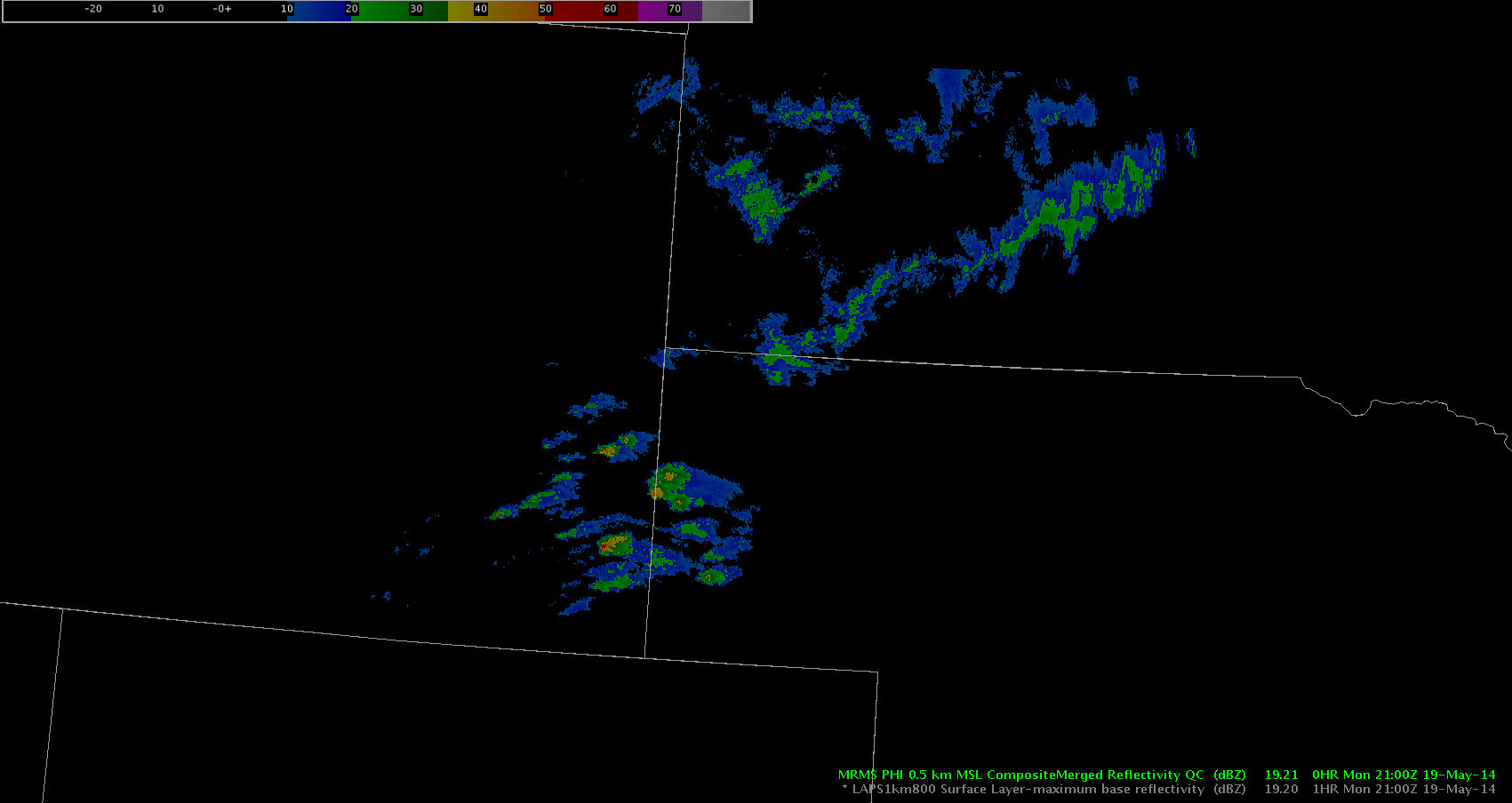
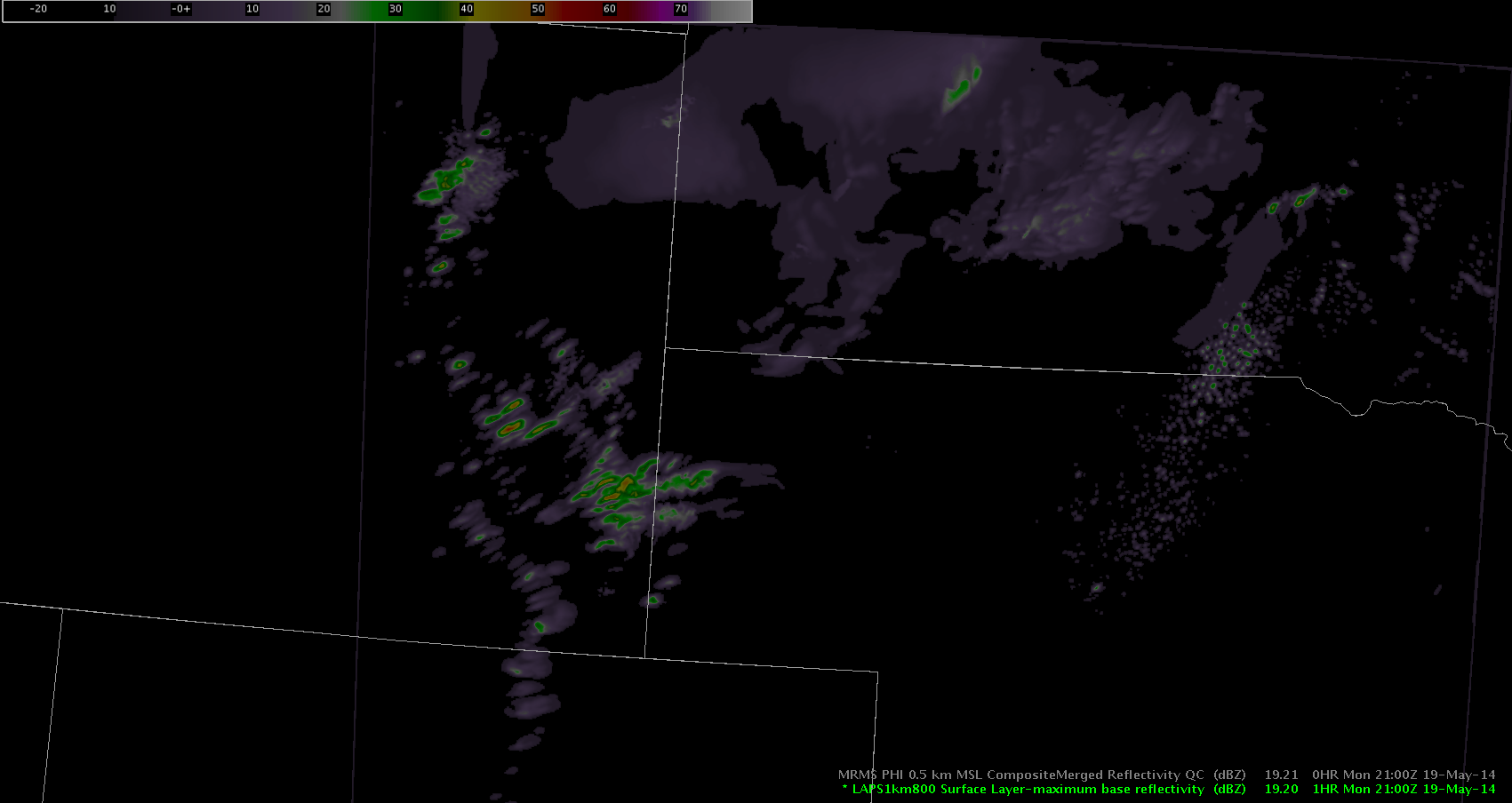
Unfortunately, vLAPS seems to be struggling in getting a handle with the lack of significant convection across eastern Wyoming, the panhandle of Nebraska, and southern South Dakota. Take a look at the screen capture below at 2230Z:

The KLNX 0.5 base reflectivity is overlaid on the vLAPS surface max base reflectivity and as you can see, vLAPS is overdone. As a result, I have low confidence in using this as a reliable tool for this afternoon’s/evening’s activity.
~Linda

In the lower left panel CAPE from the LAPS 20Z run is displayed. Of interest is the enhancement in the CAPE fields due to Lake Francis in FSD. At the same time suppression is also occurring along Mitchell River. This appears to be a more common effect than in previous models.
Grant H.
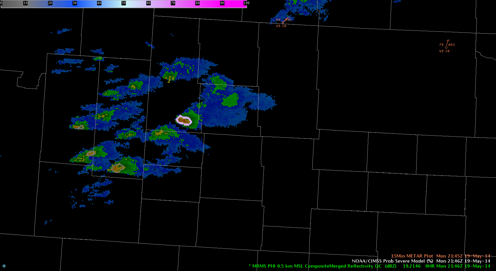
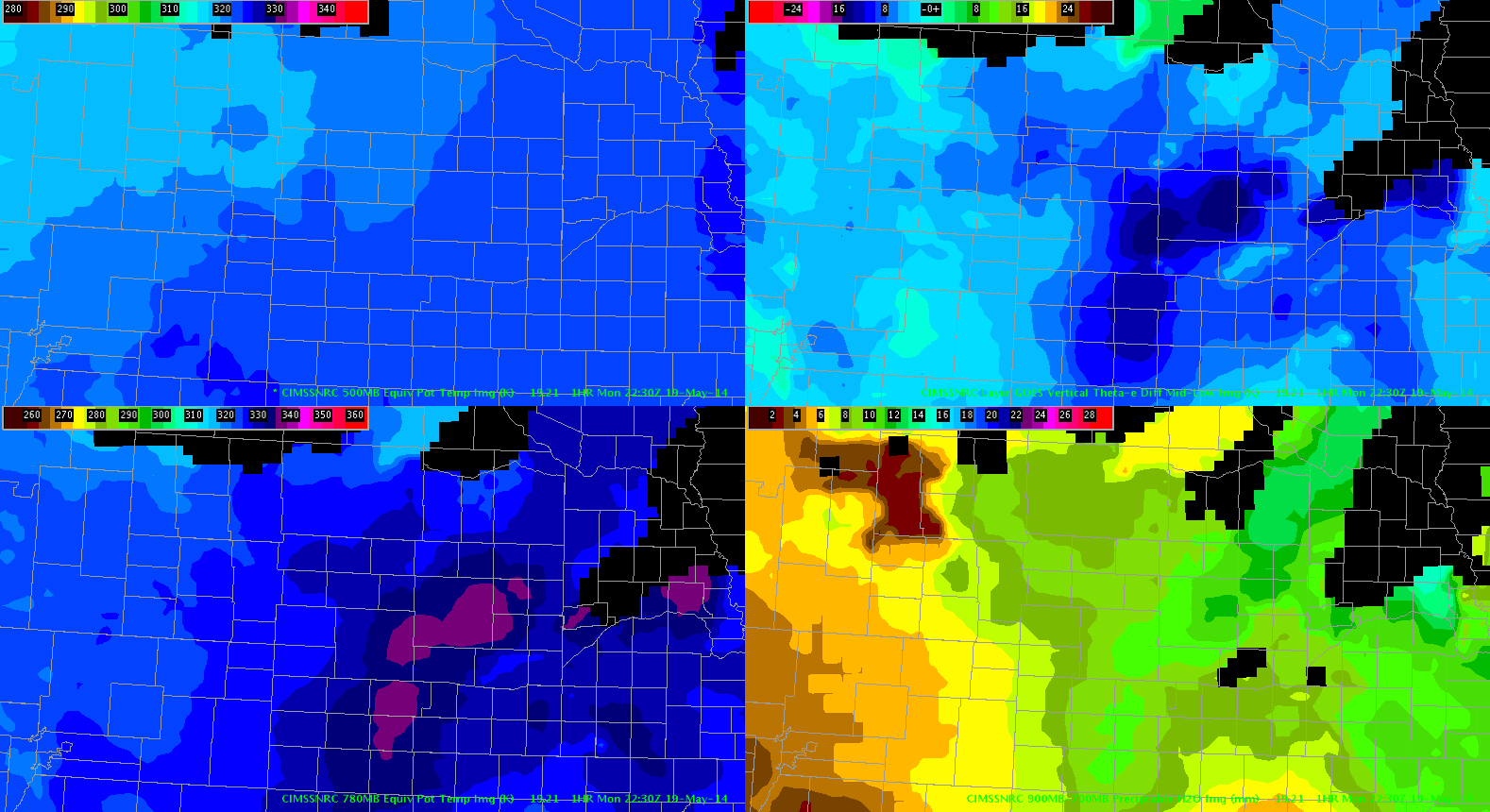
A stronger convective cell attempted to develop to the north of Scottsbluff, NE. As the radar indicated higher reflectivity the GOES Porb. Severe Model jumped to 62 percent with strong satellite growth rate. This cell quickly dissipated though and did not produce severe weather. Analysis of the NearCast System indicated that the strongest instability was located farther to the east into western and central Nebraska. While values near the cell indicated marginal instability. Using these two products in tandem may have been helpful. It will be interesting to see if this weak convection moves into the North Platte CWA as it gets into better convective instability.
-JB
The panels are showing Goes-14 SRSOR Vis and MRMS PHI Radar compared to LAPS1km800 Surface Layer. LAPS verifies right now. The interesting thing is LAPS is trying blow up storms in W. Nebraska where storms are. Also LAPS is trying to form storms in SE South Dakota & NE Nebraska where there are currently isn’t anything but clouds but it looks like good environment for storms to form. We will have to see what happens and if LAPS verifies or could be overdone. -Vollmar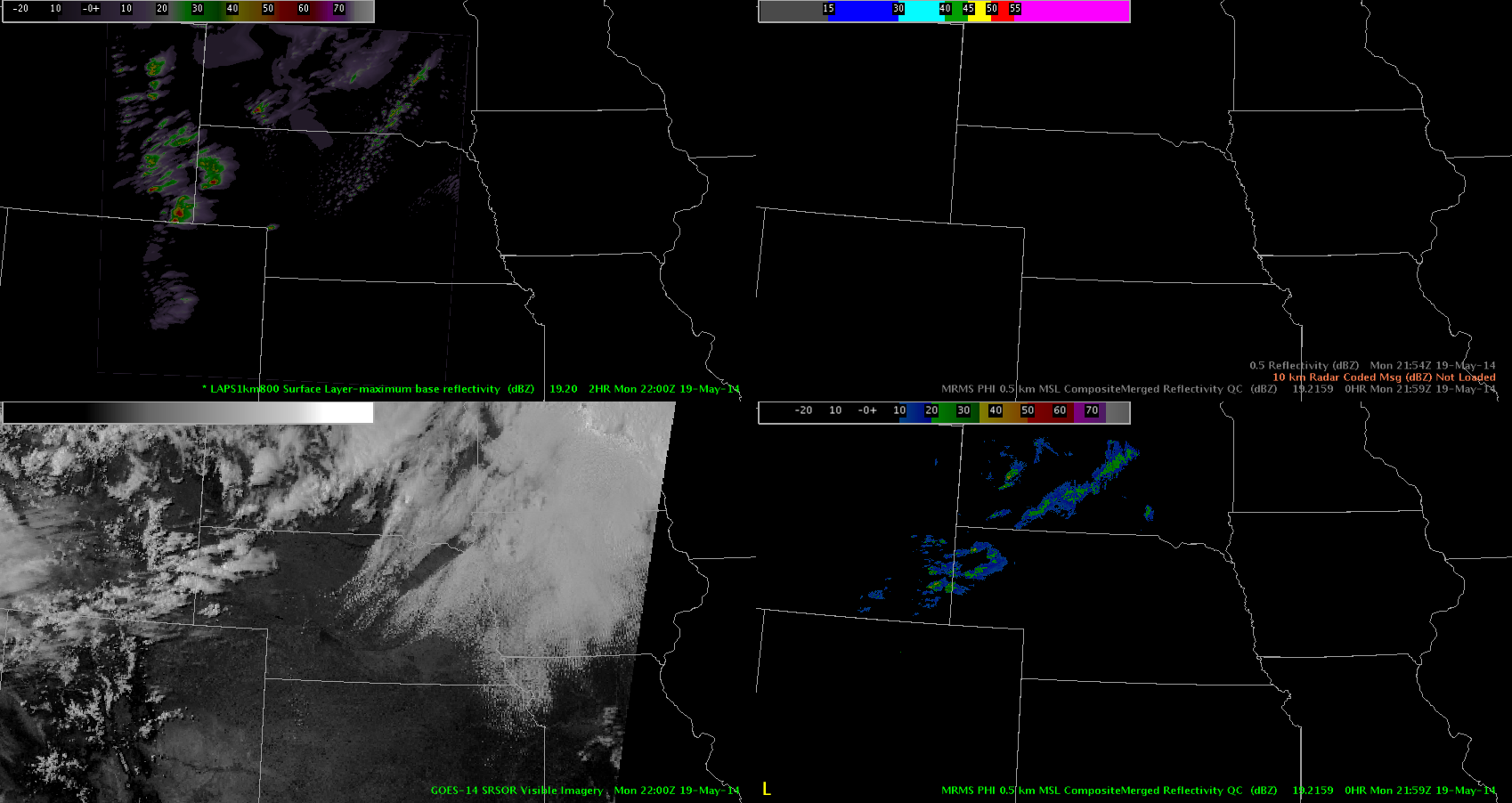
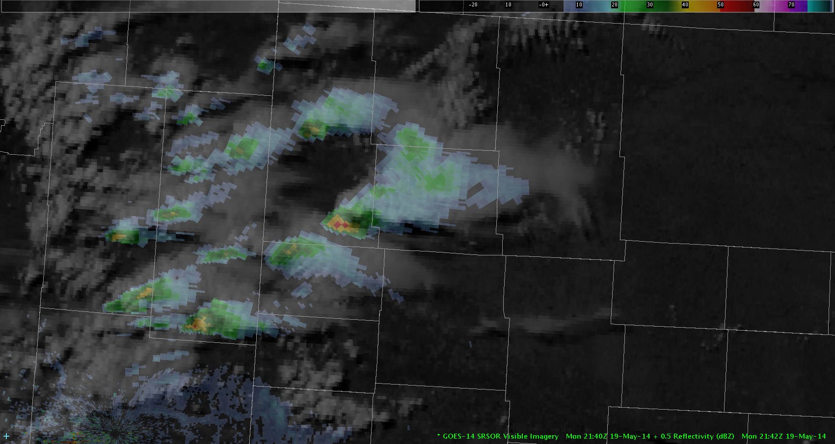
Being displayed here is the GOES-14 Super Rapid Scan overlayed with Composite Radar. In addition to the usual parallax radar error that normally exists, there is also a time lag with many products that update at a slower rate. This actually can enhance the parallax displacement of radar from satellite and is something to be aware of; Especially for those of us that like to overlay radar products with satellite.
Grant H.
Convection has slowly pushed eastward through eastern Wyoming into Western Nebraska. We have tracked one storm in particular that moved east of Torrington WY into southern Sioux County NE. To this point, convection has been fairly weak, with small hail signatures and momentary rotation tracks. We are waiting for the convection to hit a north/south line just east of H385 where LAPS products indicate much stronger instability. If convection reaches this instability during the daytime hours, perhaps convection will become more robust. 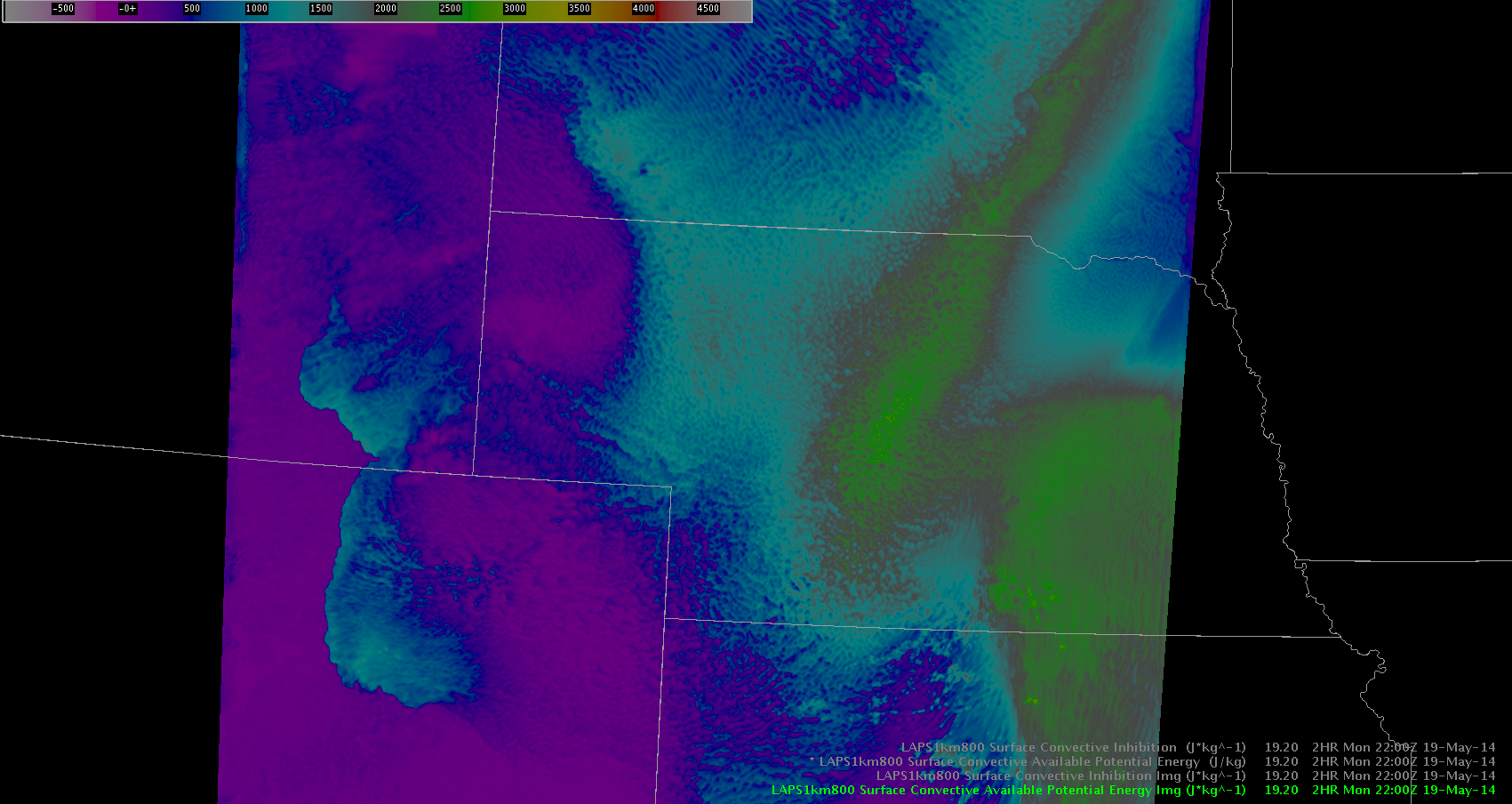
— JRM
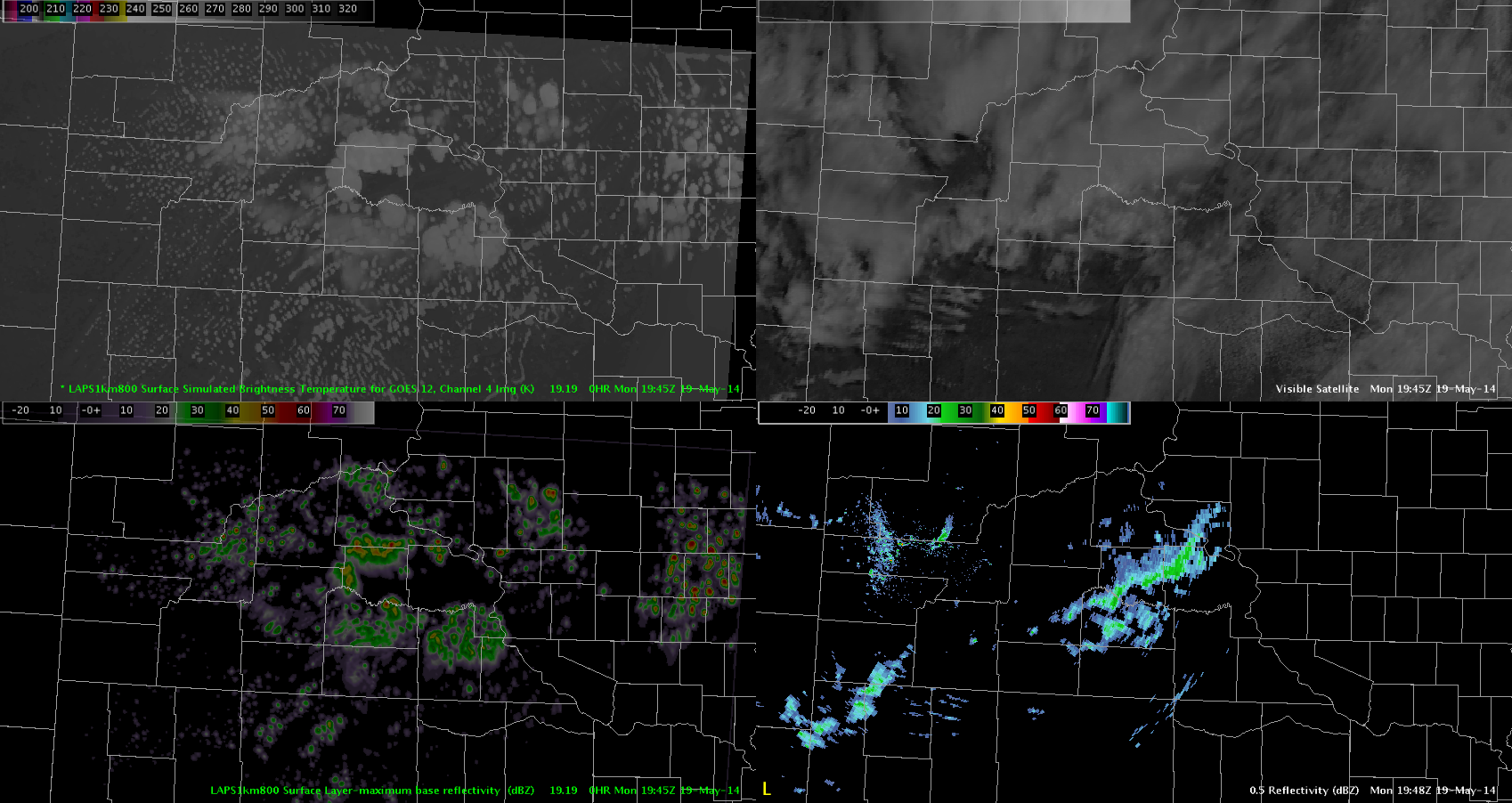
Here we are taking a look at the LAPS 2D Surface Brightness Temperatures and Maximum Base Reflectivity. These products can probably be useful for surface analysis. However for today, when compared against products in reality, we can quickly notice that cirrus is mysteriously absence from central South Dakota which is allowing the surface layer to bake in the model in its absence. This is leading to a set of storms being set off over this area for model radar that is not evident on current radar in reality. Confidence in this model over this area is low to minimal. The other big unfortunate item is that the model is also not initiating storms over Cheyenne territory which are already occurring with no cirrus and moving into Nebraska.
Grant H.
Edit: 22:43Z Come to find out. The LAPS domain at this time was actually located over the east coast. This was corrected with the hour and explains why radar and brightness IR from the models were so far off.
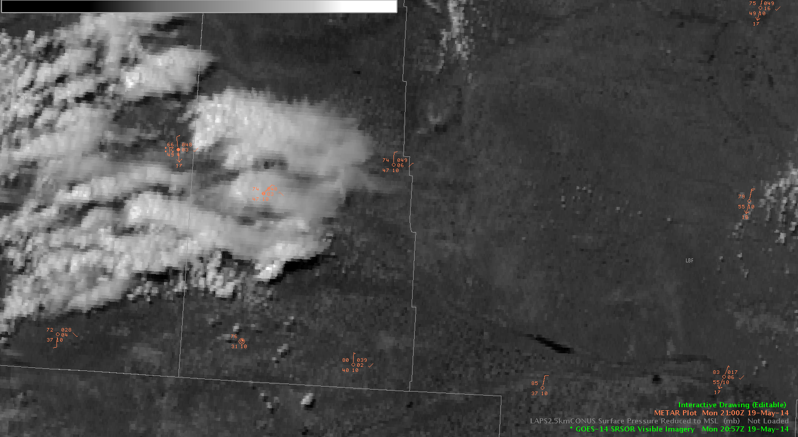
Using the 1 min GOES rapid scan to view individual towers grow is great. Being able to see individual convective attempts and failures is very useful. On radar I was not able to tell that the convective tower had failed, but with the visible imagery I was able to see that the tower had failed to mature and soon the radar echo dissipated. Pretty cool.
-JB