NLDN vs ENTLN


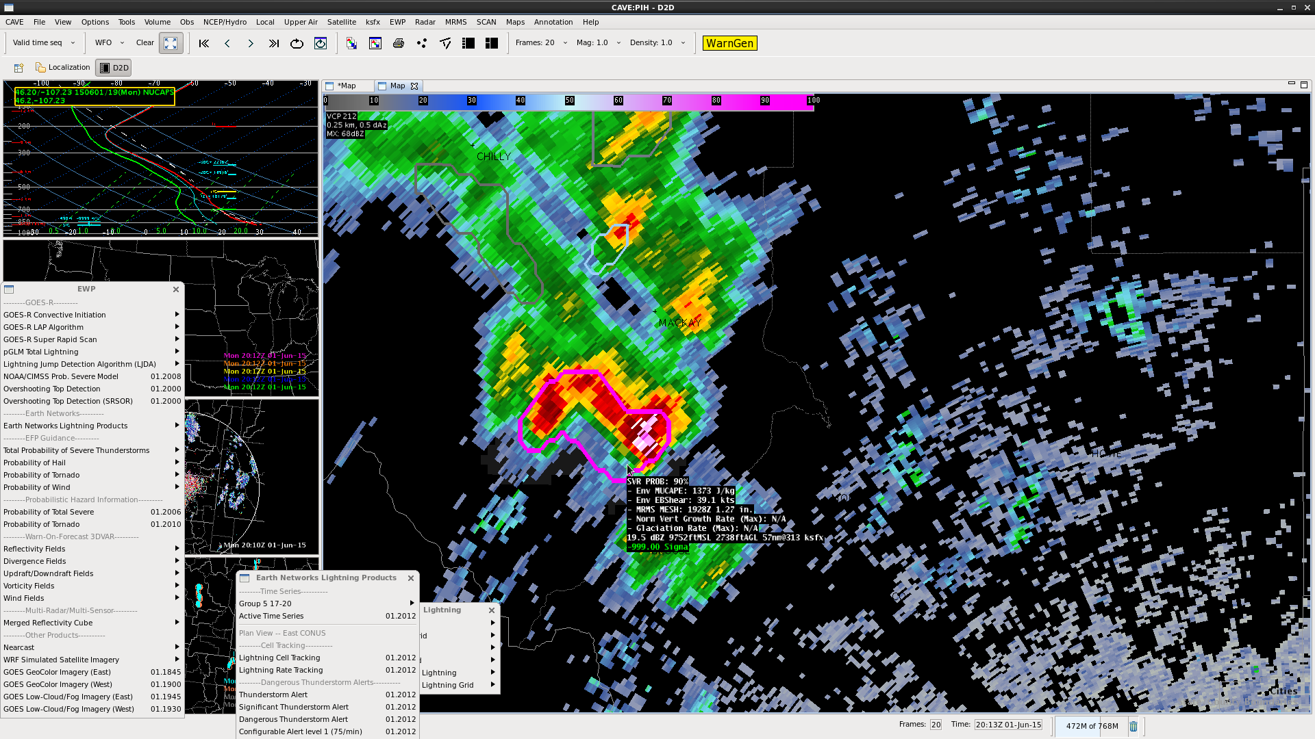
NLDN vs. ENTLN shows a problem with the number of CG strikes that have occurred.  This makes me wonder how accurate the lightning jump algorithm is.  With the low density of sensors in the west, the ENTLN seems like the likely one with bad data.

Screenshot-CAVE:PDT - D2D -2


Williams and MacGyver

Tags: None

NUCAPS vs. RAP

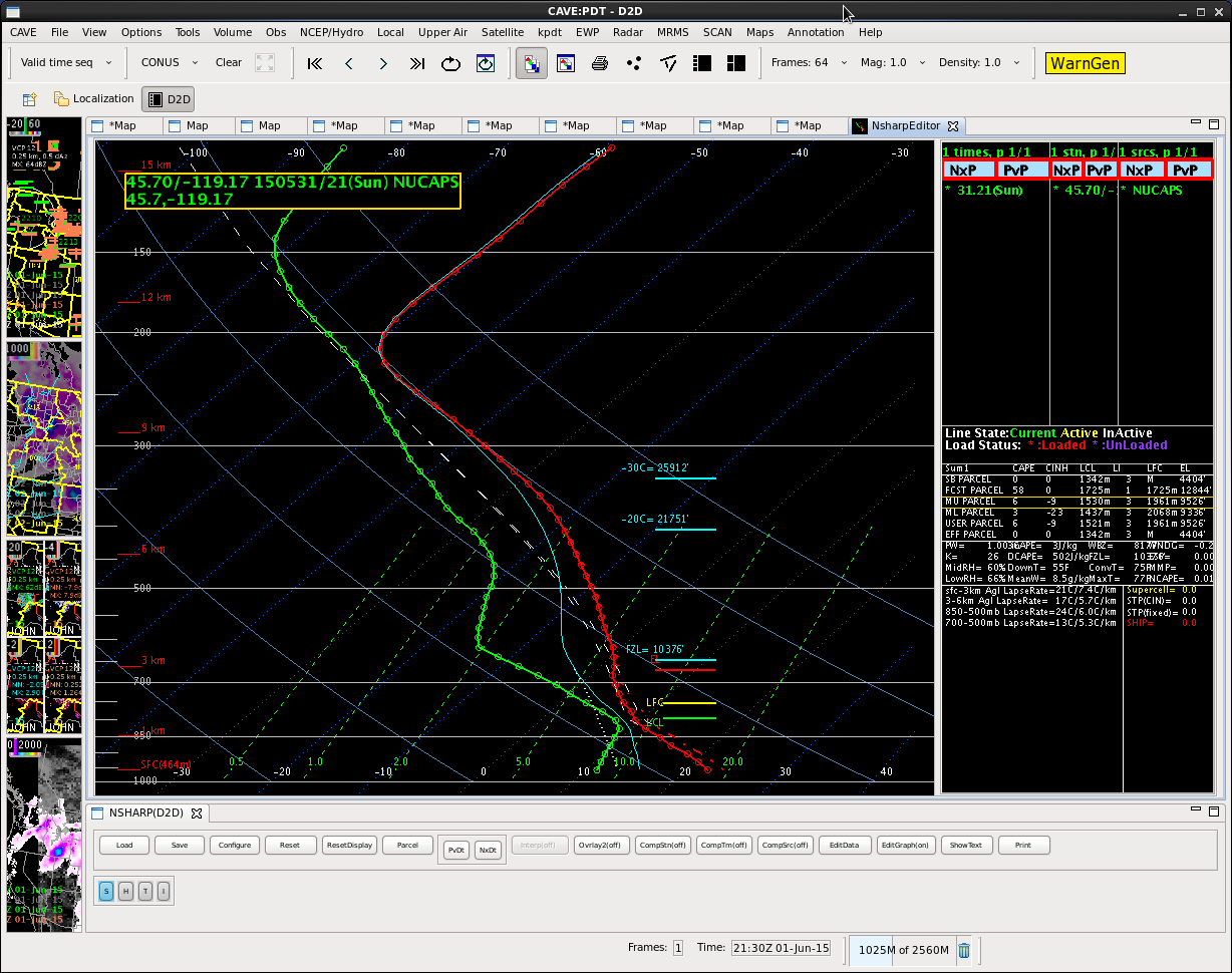
Finally got the NUCAPS data.  Was waiting for this data to compare with local sounding from BOI.  Had to mix the low levels to actual values.  After this, it was clear why convection was not going on to our northern CWA….there is some warm air across the northern CWA.  This sounding isnt as dry in the low levels, suggesting that there is not as high of a chance for wind.

Screenshot-CAVE:PDT - D2D -1

Williams & MacGyver

Tags: None

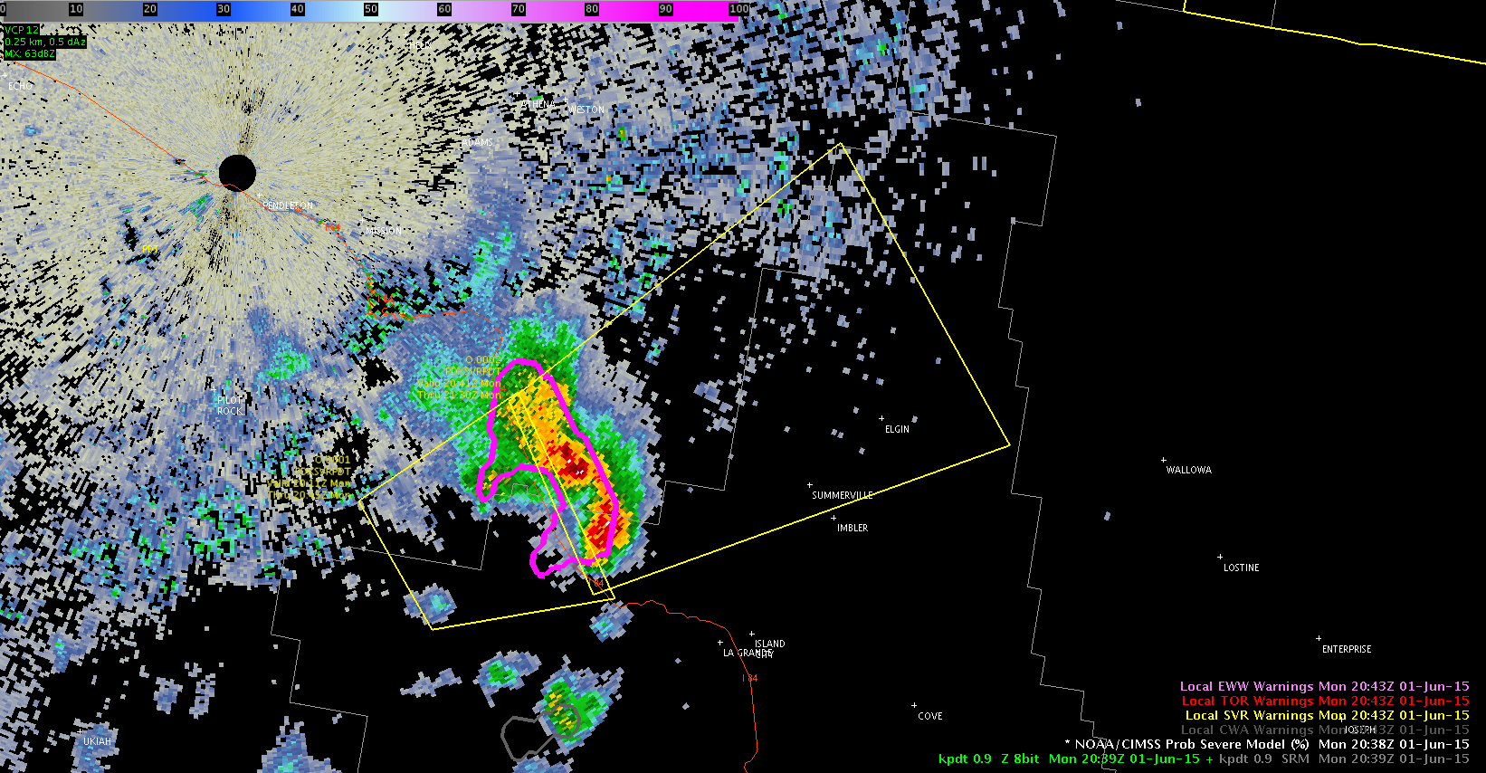
KPDT – fast jump in ProbSvr values

2042z_probsvr 2052z_probsvrTimeline of values:
2042z – 31%
2046z – 54%
2050z – 70%
Levelled off at 72% thereafter

The problem is that this is likely a very sparsely populated area, so even if there were to be severe weather, it probably won’t be reported. Will be hard to verify…

Growth rates show up as N/A for this cell, which has been the case for all cells that ProbSvr pegs in this area so far.

Williams & MacGyver

Tags: None

KPDT ProbSvr followup

2043svr

ProvSvr maxed out at 88%, MESH at about 1.5″ 2029z-2039z.

Wondering if best practice is to lengthen duration of warning in cases when using ProbSvr, since there is some extra lead time compared to when one might issue a warning without it. In our case, we issued at a 30 minute warning (fairly typical) when a 45 minute warning may have been more appropriate given how much sooner ProbSvr can flag a severe potential.

Williams & MacGyver

Tags: None

6/1/15: Bismarck, ND. CI East missed small cell formation.

Noticed that CI-East product didn’t capture the initiation of a small cell NE of Bismarck. At 2015Z a small cell formed (fig 1).  The first time CI showed a probability of initiation occurred at the same time (fig 2).  By 2038Z the cell  developed a small 50dbz+ core. Doesn’t seem like CI-East was able to capture this until it happened. Also, was not overly cloud covered.

2015_CI_East

Fig 1: CI-East – 2015Z 1st indication in CI

2015_Z

Fig 2: 2015Z: 1st reflectivity appearing.

2038_Z

Fig 2: 2038Z: Small 50dbz core starting.

Forecasters: Cattywampus/CoonieCatEye


Tags: None

KPDT ENI vs. NLDN

cgDiscrepancy in the number of CGs and the polarity between ENI and NLDN. ENI did not have any thunderstorm alerts until 2020z, 10 minutes after we issued a SVR based on ProbSvr and reflectivity. At 2020z, the ENI flagged a general thunderstorm alert.

Williams & MacGyver

Tags: None

6/1/15: 2018Z NUCAPS Profile (Bismarck)

Received a NUCAPS sounding in area relatively cloud free area and modified the sounding using the KISN metar of 88/52 degrees. This gave us a modified CAPE of 2343 J/kg (Fig1). Building confidence in convective developing based on current surface obs, and building cumulus field visibile on Super Rapid Scan Vis. (Fig 2).

19Z_KISN_Screenshot_Sat_Sounding

Fig 1: 19Z NUCAPS Sounding near KISN (Williston, North Dakota)

srso

Fig 2. Super Rapid Scan at about 20:25Z. Building Cu near Montana and N.Dakota.

Forecasters: Cattywampus/CoonieCatEye

Tags: None

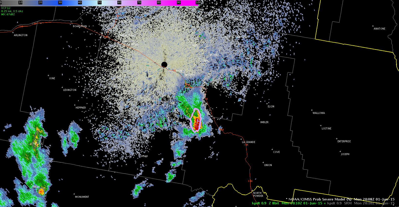
KPDT ProbSvr at 2011z

2013SVR

Issued a SVR at 2011z for SE of KPDT based in part on the ProbSvr product. Reached 67% at  1950z but came back down to 40% at 2000z. Shot back up to 77% at 2010z. Wanted to see how well it performed for our expected risks of 60mph wind and quarter-sized hail. Growth rates show up as N/A; MESH hail is over 1″, MUCAPE ~1600 J/kg.

Very little lightning, so ENI has not picked up any thunderstorm alerts.

Williams & Macgyver

Tags: None

AFD for KPDX

A well defined vort max on water vapor is moving into the KPDT CWA – very wound up. PWAT values of 1″ are showing up from the GOES sounder in the northeast CWA, which is the climatological max for June 1 at KBOI, the nearest sounding site (to the east).

Looking at RAP, CAPE gradient bisects the CWA at 20z. 0-6km shear is weak at 25 kts, suggesting organized convection will be multicell in nature. 0-1km shear is very low, basically negligible. Very large dry layer evident in the lowest 4000-5000 ft on the KBOI sounding. This suggests the main threats would be wind and possibly marginal hail (especially in the higher elevations) if any storms do turn severe. Really curious to see what the NUCAPS sounding looks like, especially in regards to the dry layer. We’ll have a forthcoming post regarding NUCAPS’ performance. We’ll have to see how the areas of clouds affect the data.

Given the strong shortwave, high PWATs, and weak flow, it appears heavy rain may be a threat from any convection that develops.

Eastern edge of the CWA is in an SPC MRGL outlook.

Jason Williams & MacGyver

Tags: None