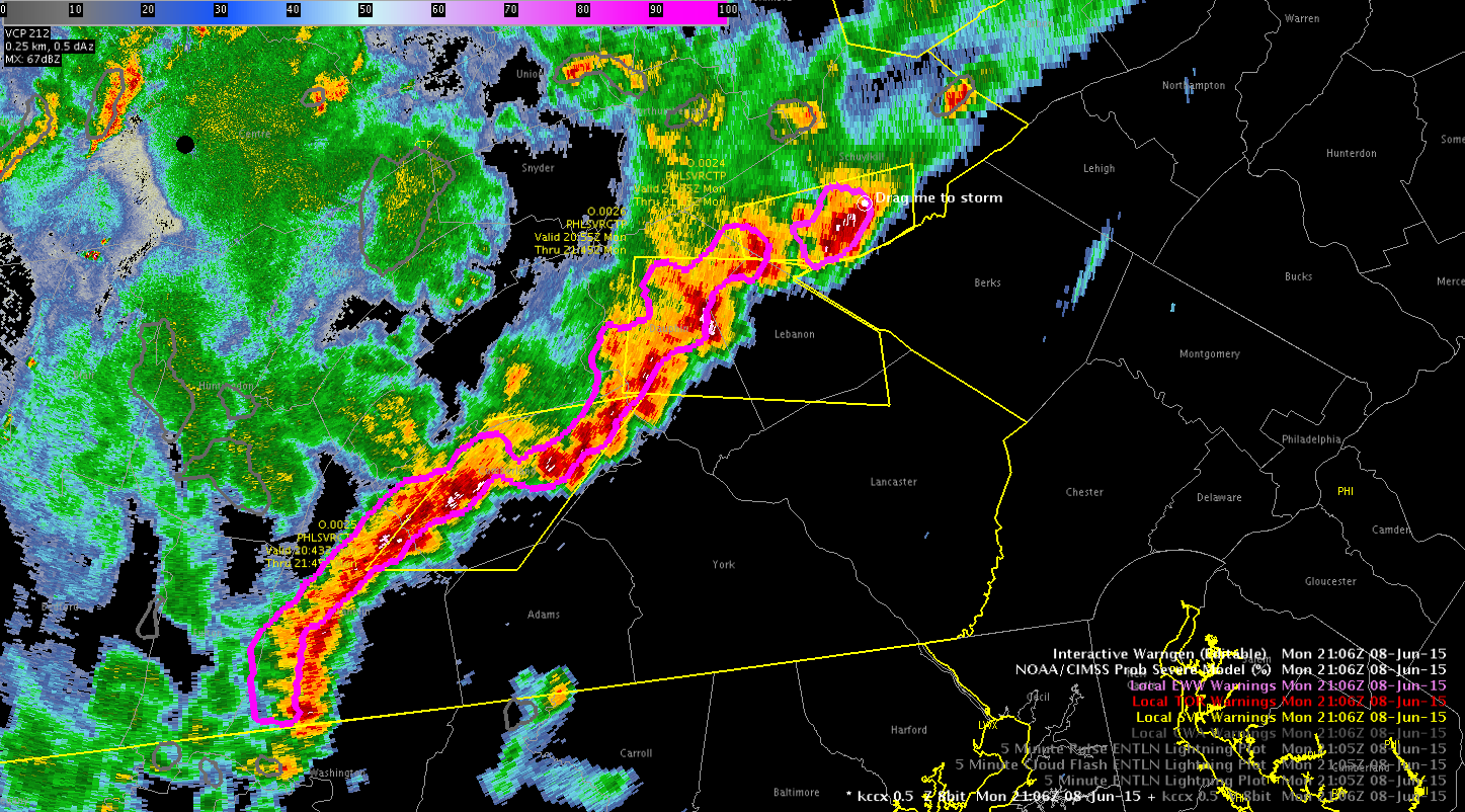
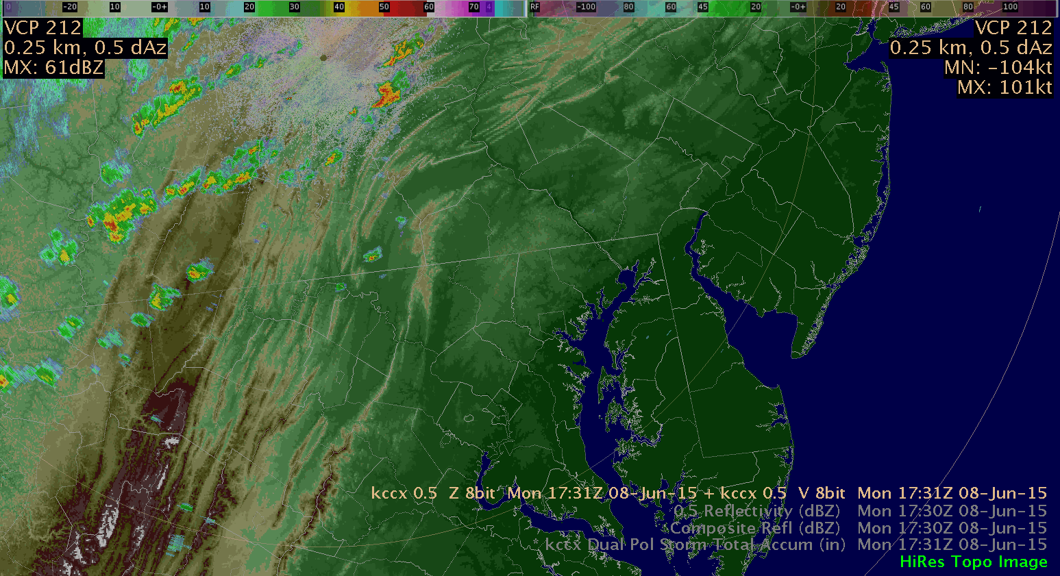
We’ve got 3 SVRs in the PHI WFO right now; however, we’ve had to rely on public reports and typical Z/V data. There is not much lightning with these storms and the ProbSevere model is only at 4%, despite history of wind reports up to 80mph.
-BT
Official websites use .gov
A
.gov website belongs to an official government
organization in the United States.
Secure .gov websites use HTTPS
A
lock (
) or https:// means you’ve safely connected to
the .gov website. Share sensitive information only on official,
secure websites.

We’ve got 3 SVRs in the PHI WFO right now; however, we’ve had to rely on public reports and typical Z/V data. There is not much lightning with these storms and the ProbSevere model is only at 4%, despite history of wind reports up to 80mph.
-BT
Remember the Pop up SkewT? You load it and mouse over the map and get a SkewT from an observed or model sounding at any point (see image). How about the same functionality for the Lightning Jump algorithm time series? Imagine this. Right click a cell and pick Pop up LJ TimeSeries, then just mouse-over the cell of interest. The current method of generating the time series through the use of points and menu choices is a bit cumbersome. MrSnow/Wacha

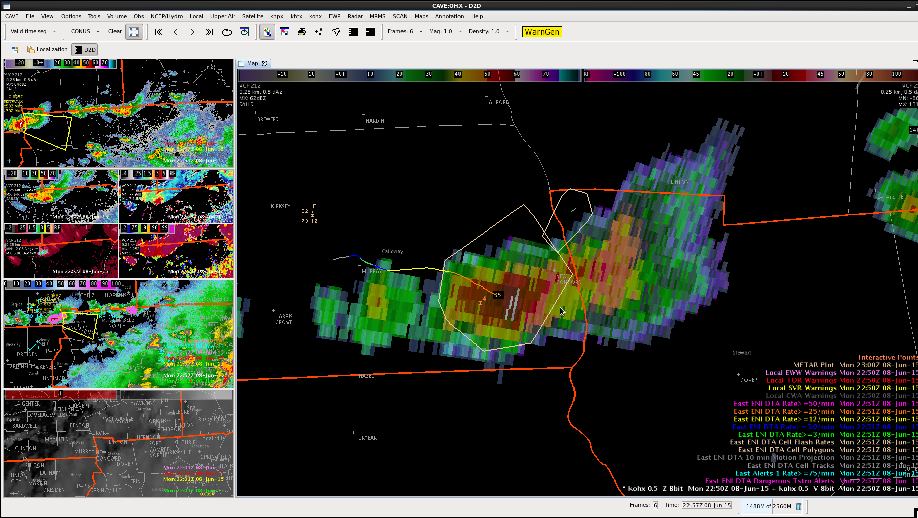
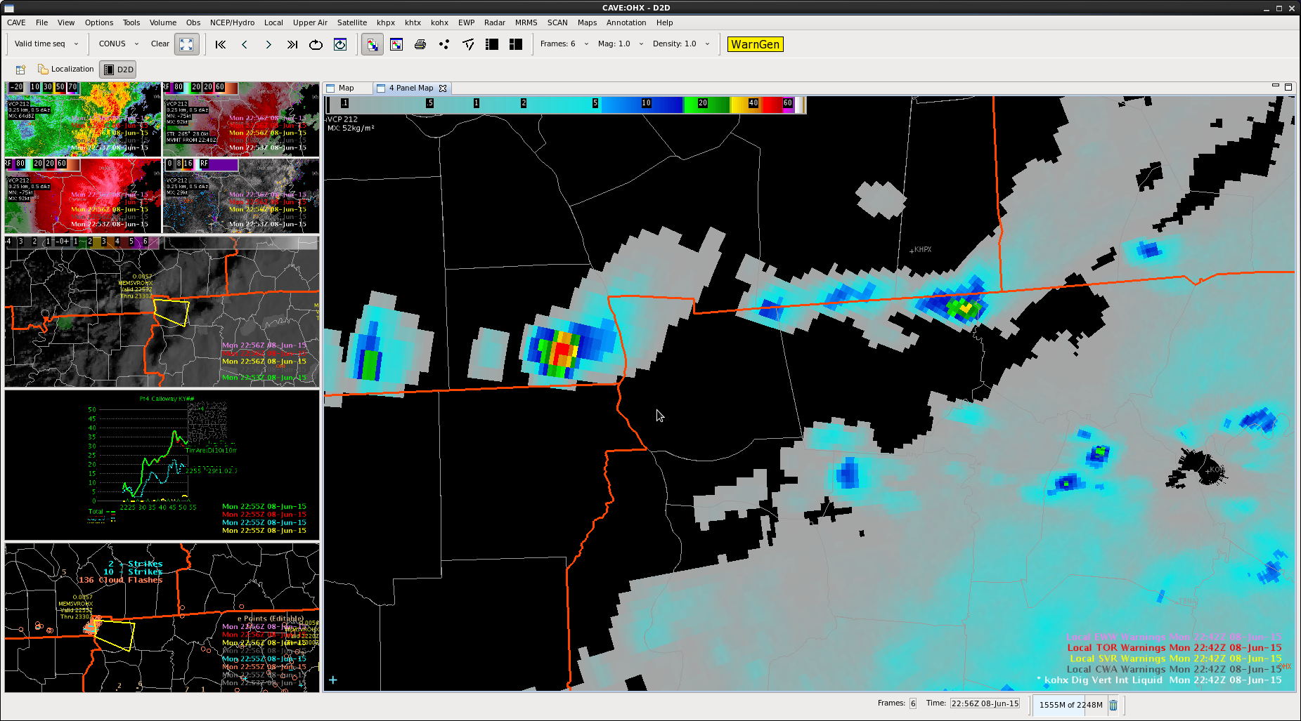
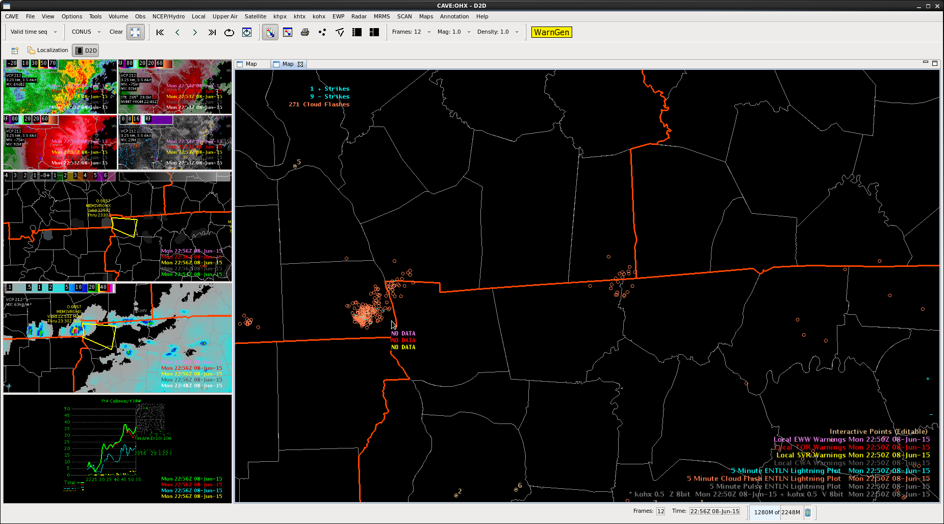
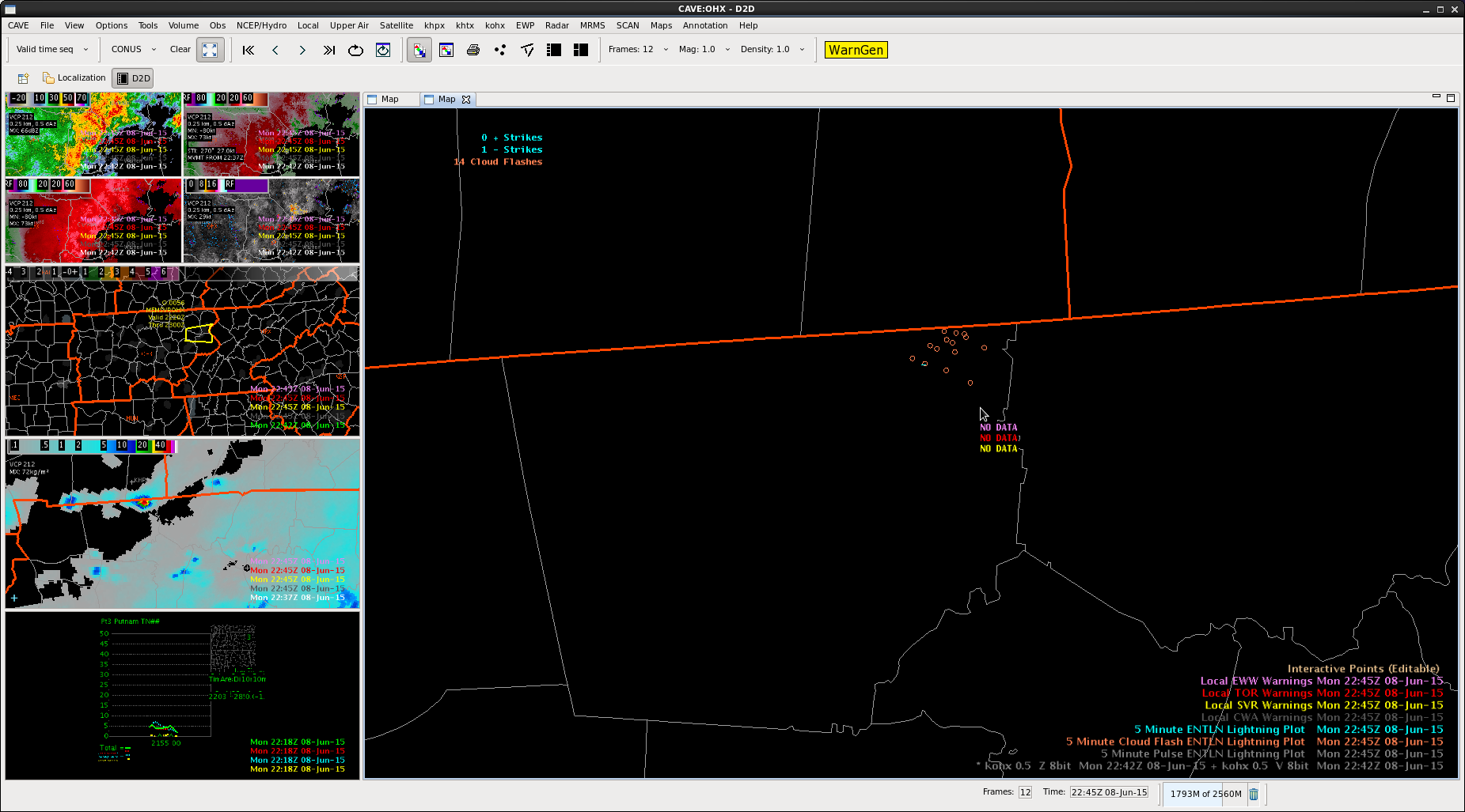
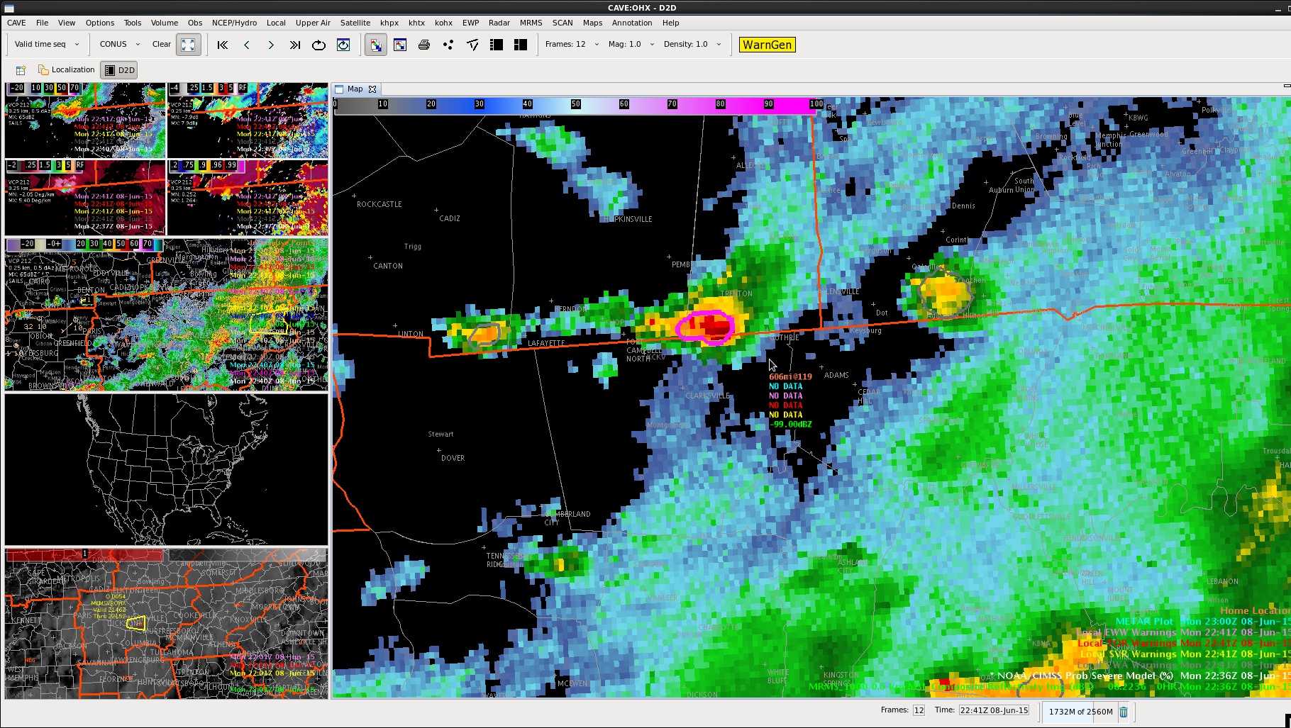
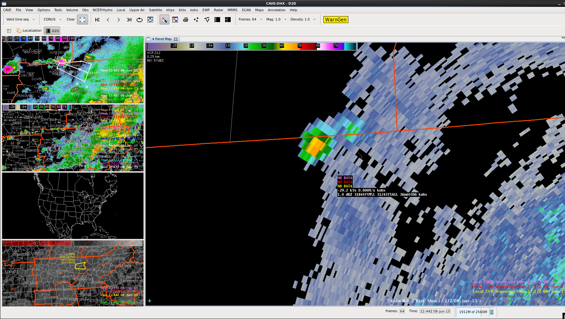
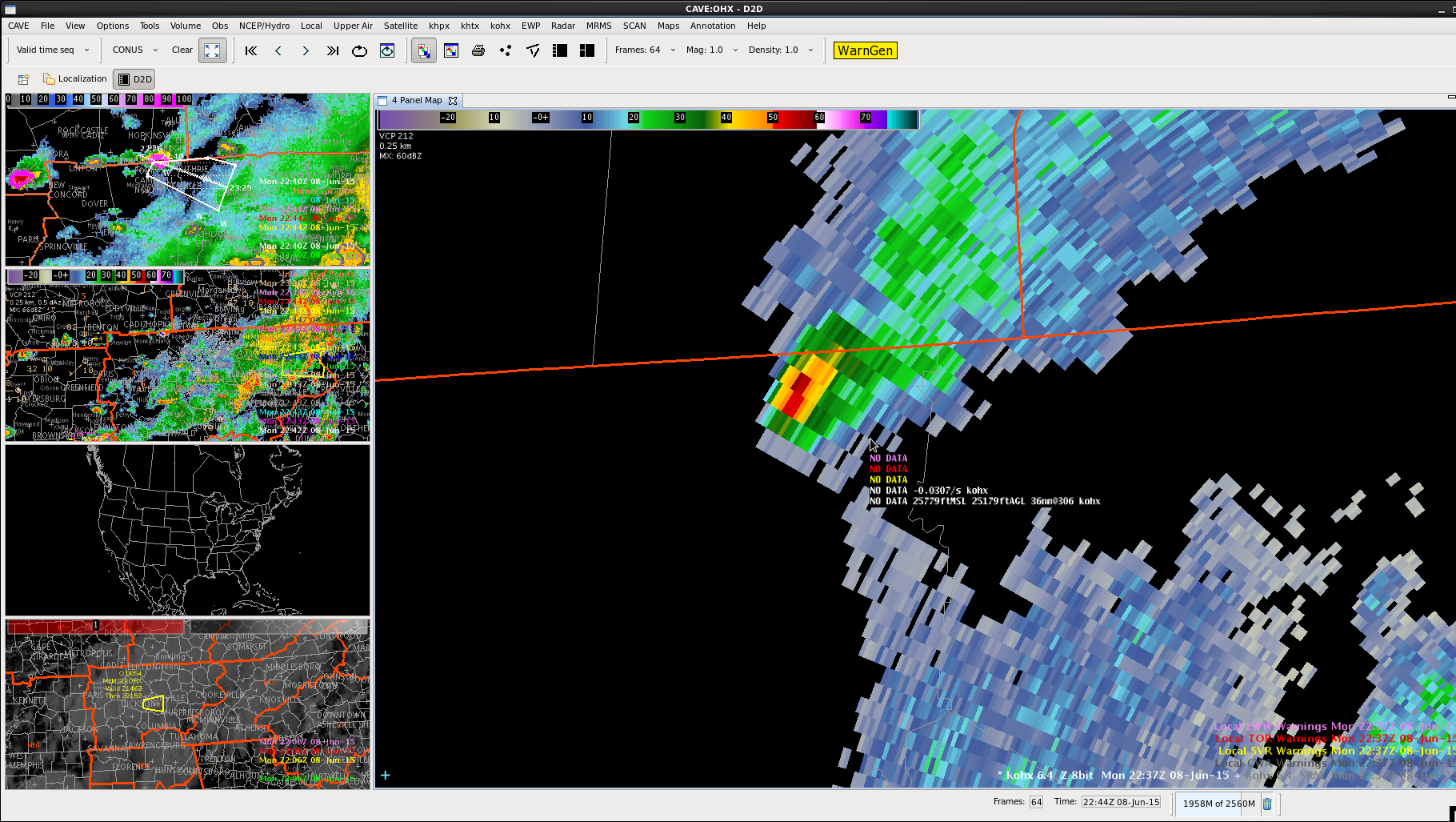
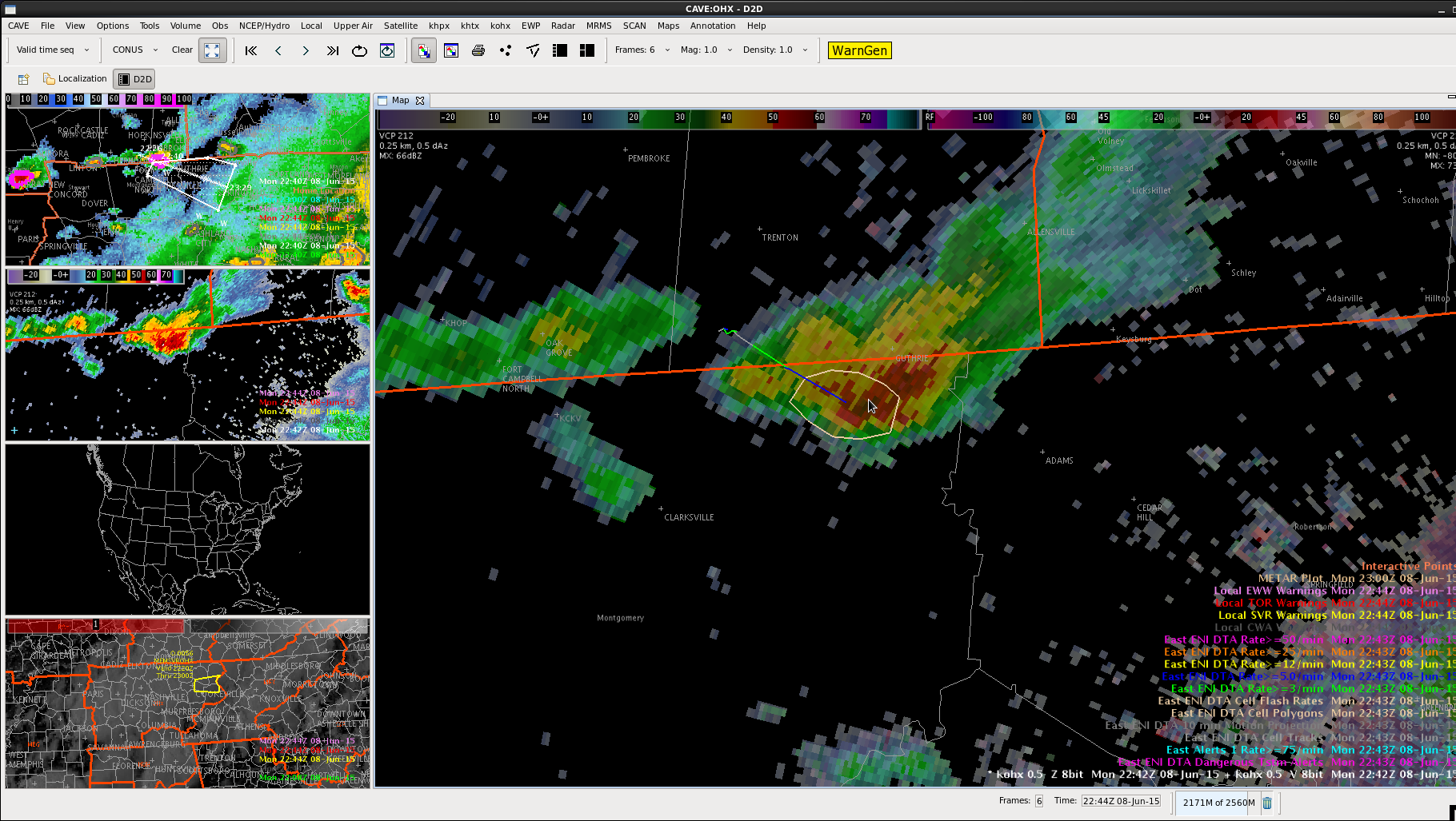
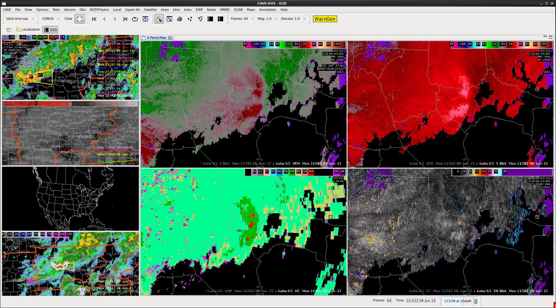
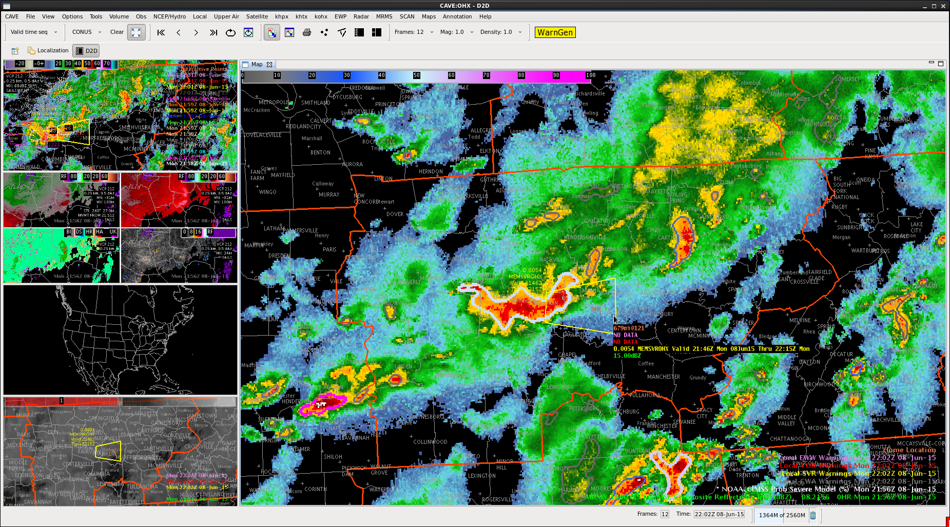
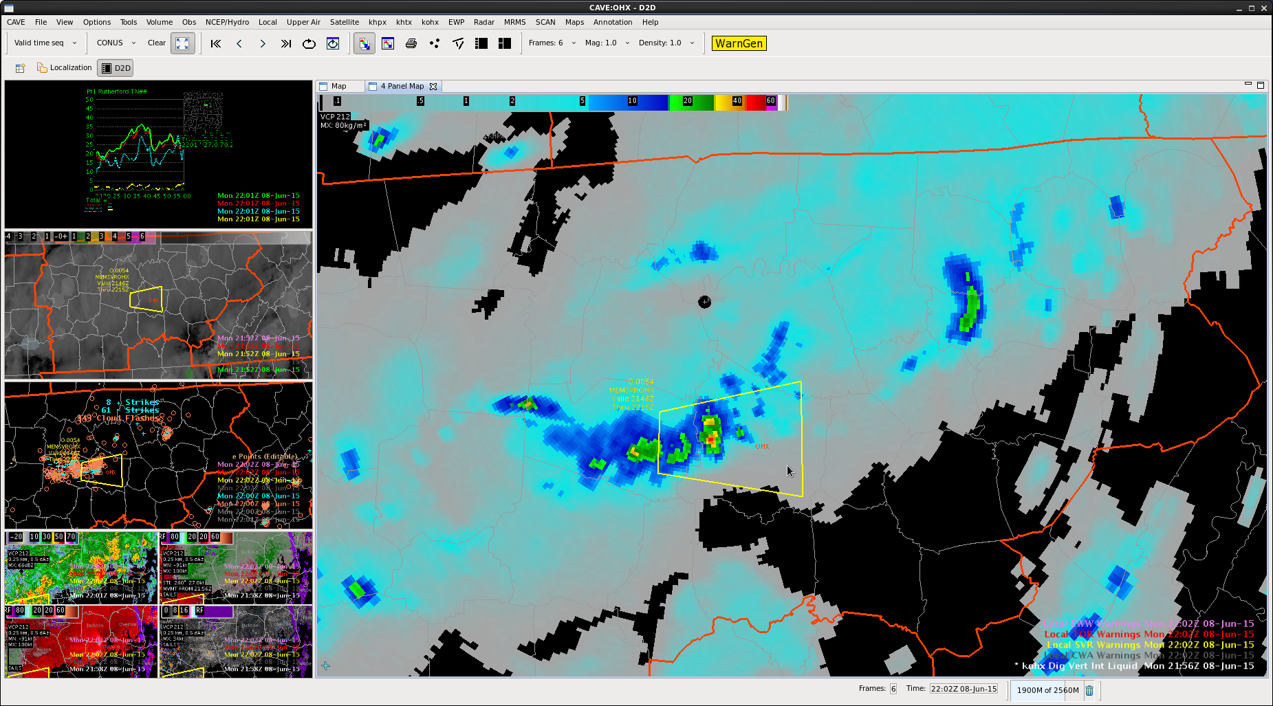
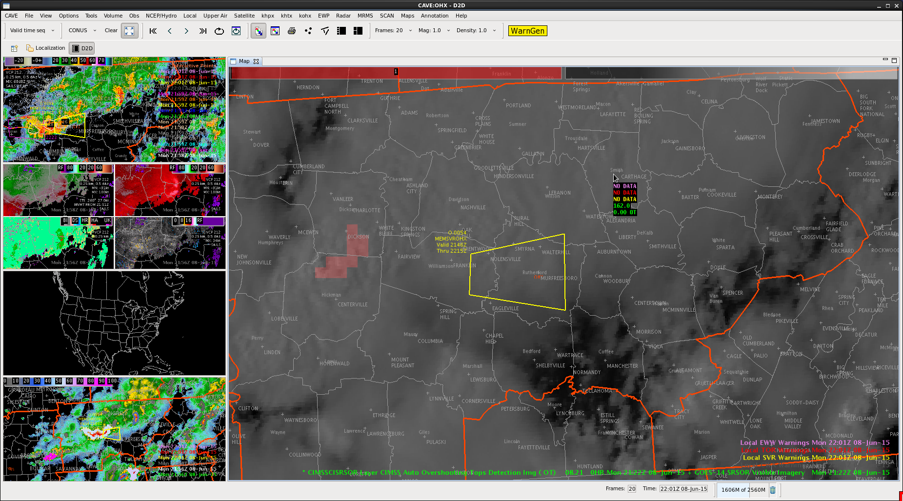
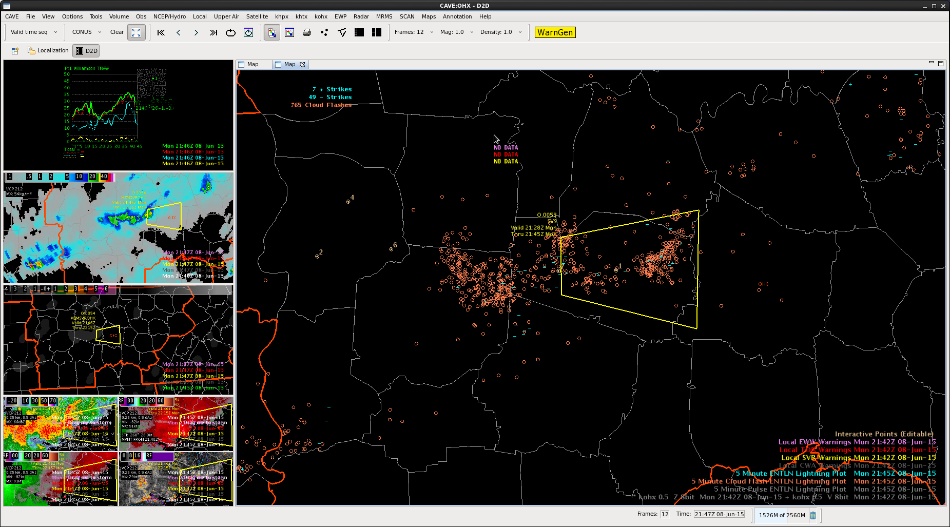
Noticed more storms forming near the KY/TN border near the NW corner of Nashville CWA. The lightning jump alerted us early with a sigma of 6 that this was a storm that needed to be monitored with more interrogation below we decided to warn on this storm.
A lone cell is coming in from the northwest. ProbSevere is high for this area, DVIL relatively high. Reflectivity aloft is ticking up though. Close to a severe. Low-level tilts had shown the hail all melting at the base, but starting to have a mix. Issued an SPS for dime-sized hail.
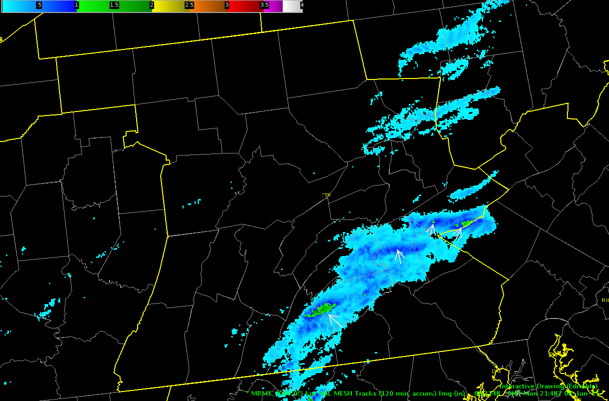
Below is an image of the MESH accumulated tracks over the last 2hrs for the CTP CWA. Severe Thunderstorm Warnings were issued, mentioning both hail and wind potential, but only the wind threat came to fruition. There were at least 4 locations where the MESH was over 1″ and in one case, it approached 2″. Reports of hail can be finicky, as maybe the larger hail fell in an area where no one lives/travels. The only report of hail that we received out of all of the warnings was pea sized in northern Perry County, PA.
-Shasta
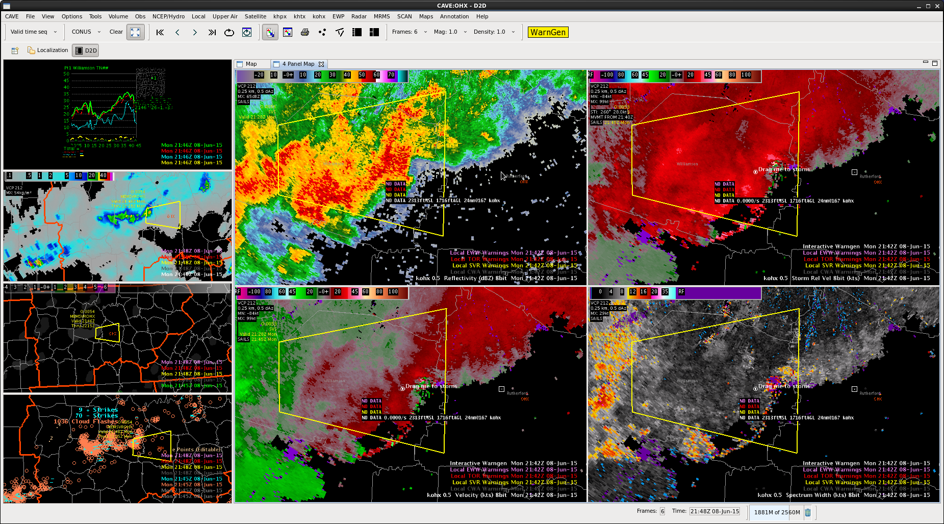
Used more reflectivity and velocity base products here. Had a good signal for wind and bowing line. Area moving into a little higher CAPE from the GOES Sounder. Lightning data not impressive here. Same with DVIL and lightning jump. No overshooting top in that area either.


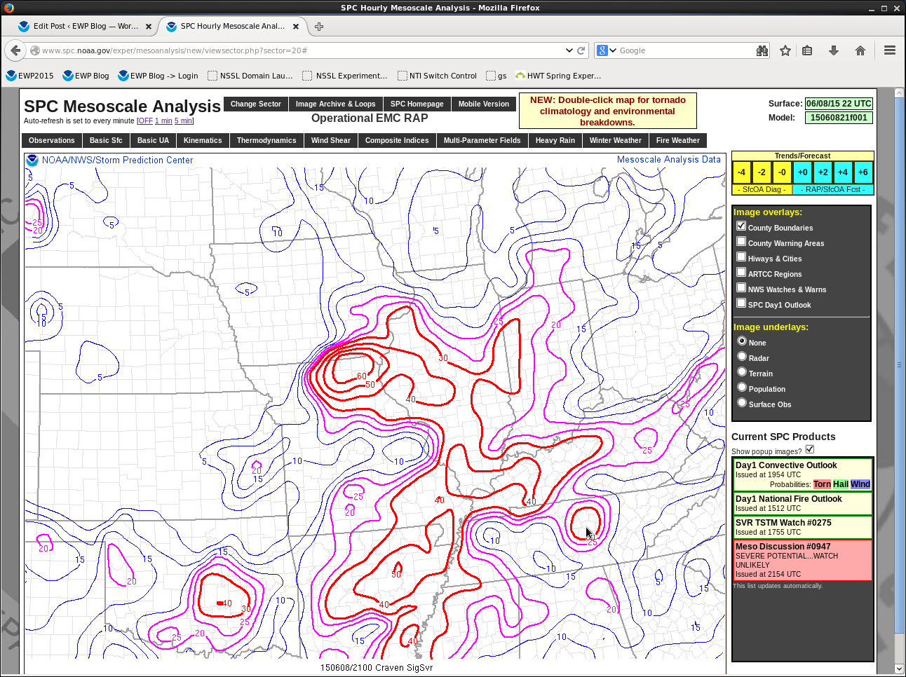
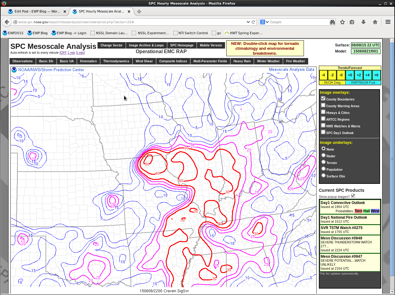
SPC Mesoanalysis page did have a maximum for the Craven/Brooks Sig Severe right over where this cell was.
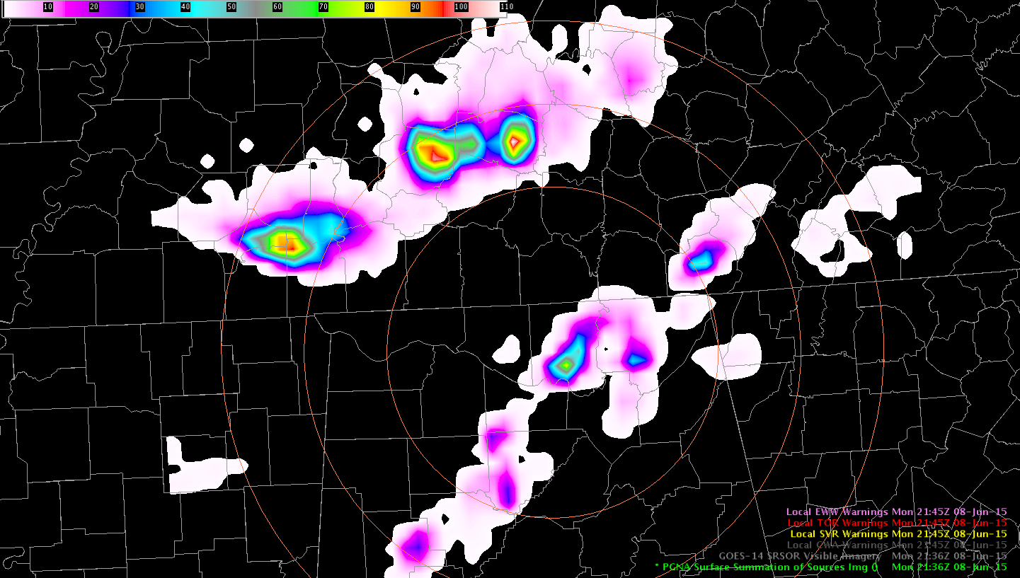
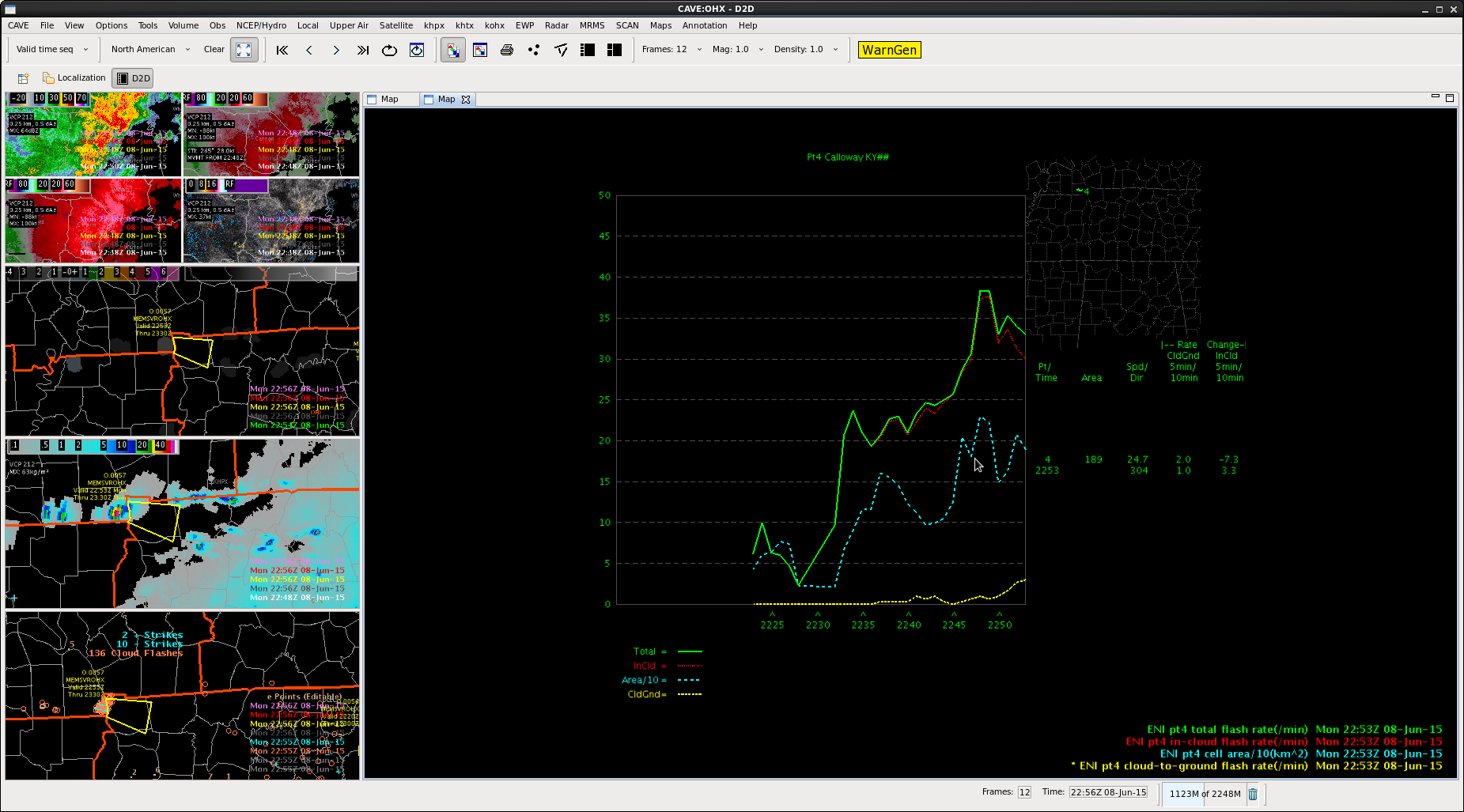
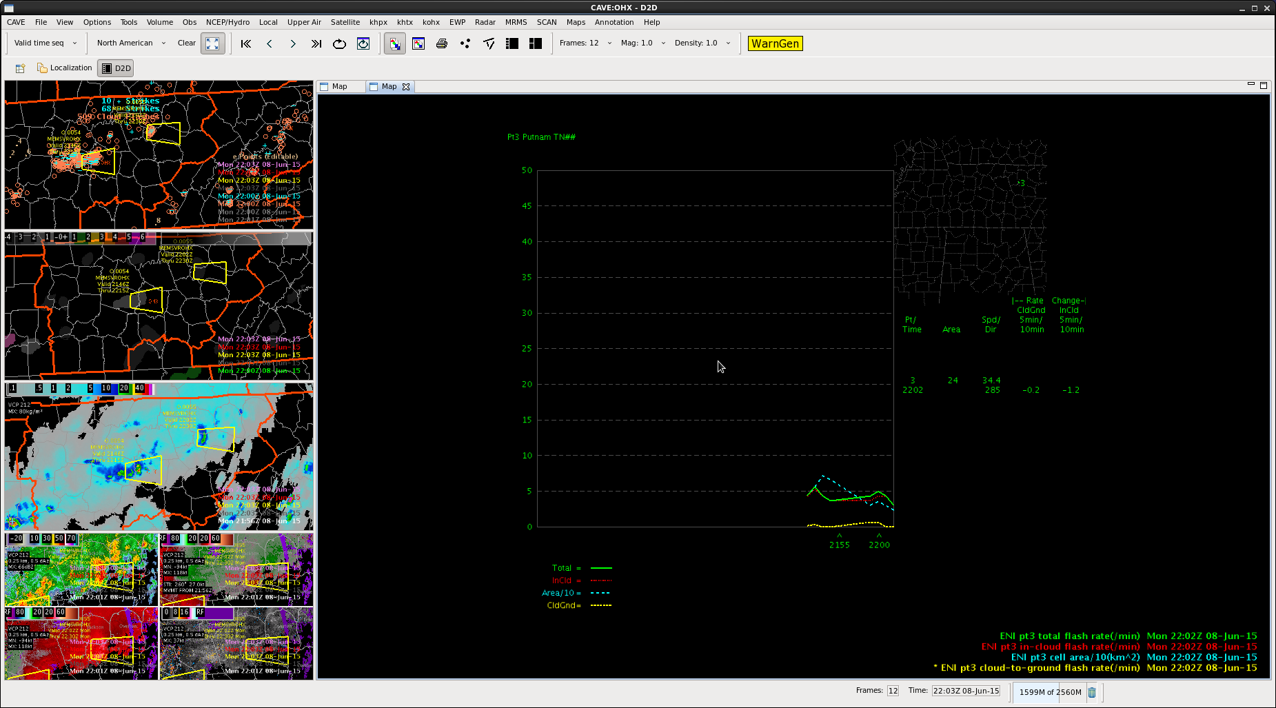
We were debating on whether or not to reissue a warning on storm and noticed that the PGNA product was showing an increase in total lightning and decided on issuing.
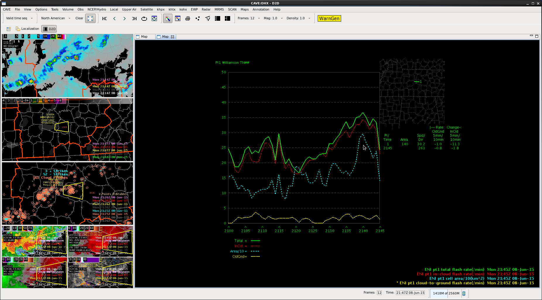
The time series product also showed an increase right before we re-warned…but quickly began to tail off again after we re-issued.
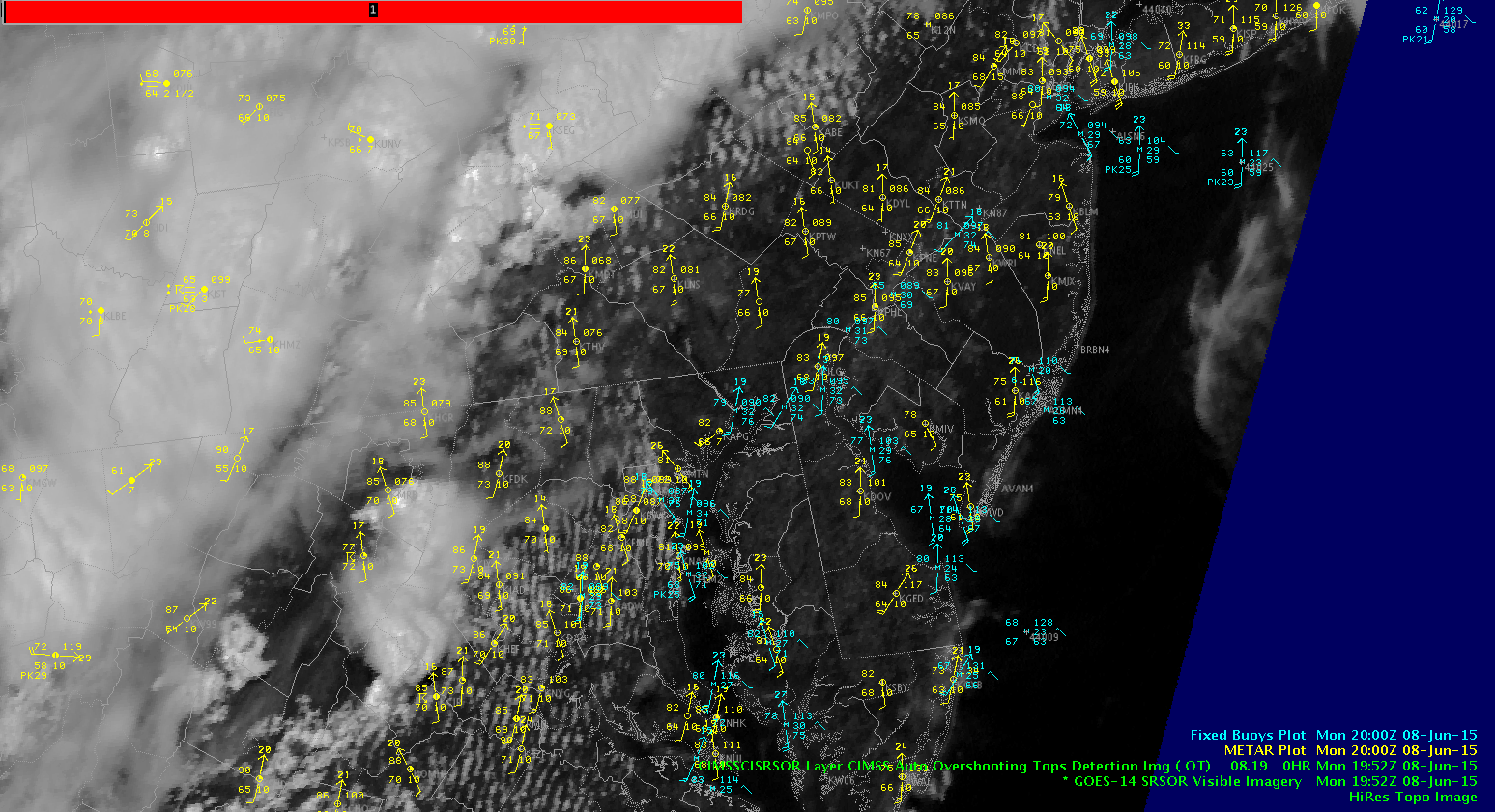
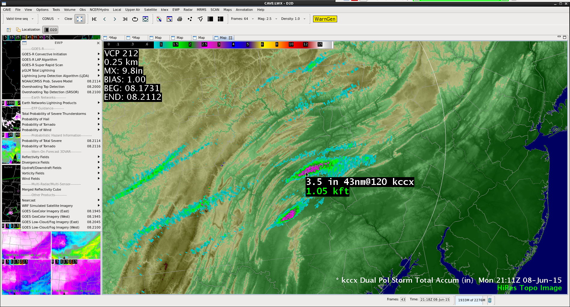
SRSO shows several things. First the overshooting top in PA was nearly stationary, anchored to the terrain by the southerly inflow impinging on the inflection point in the Appalachians. Dual Pol radar estimates up to 3.5″ rainfall there near Harrisburg, PA and a Flash Flood warning was issued for the area. A couple of the overshooting tops including this one were caught by the algorithm (denoted by the red grids in the visible imagery) but one to the northeast was not as seen by visible imagery. Also of note in the SRSO were the north south cloud streets in MD and the Chesapeake Bay breeze front just east of KBWI with cooler temps in the 70s and lack of clouds over the Bay into southeast PA. MrSnow/Wacha
Just taking a quick glance across the SE portion of our CWA…
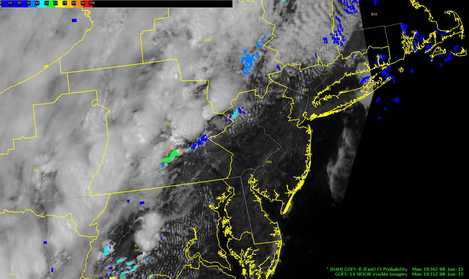
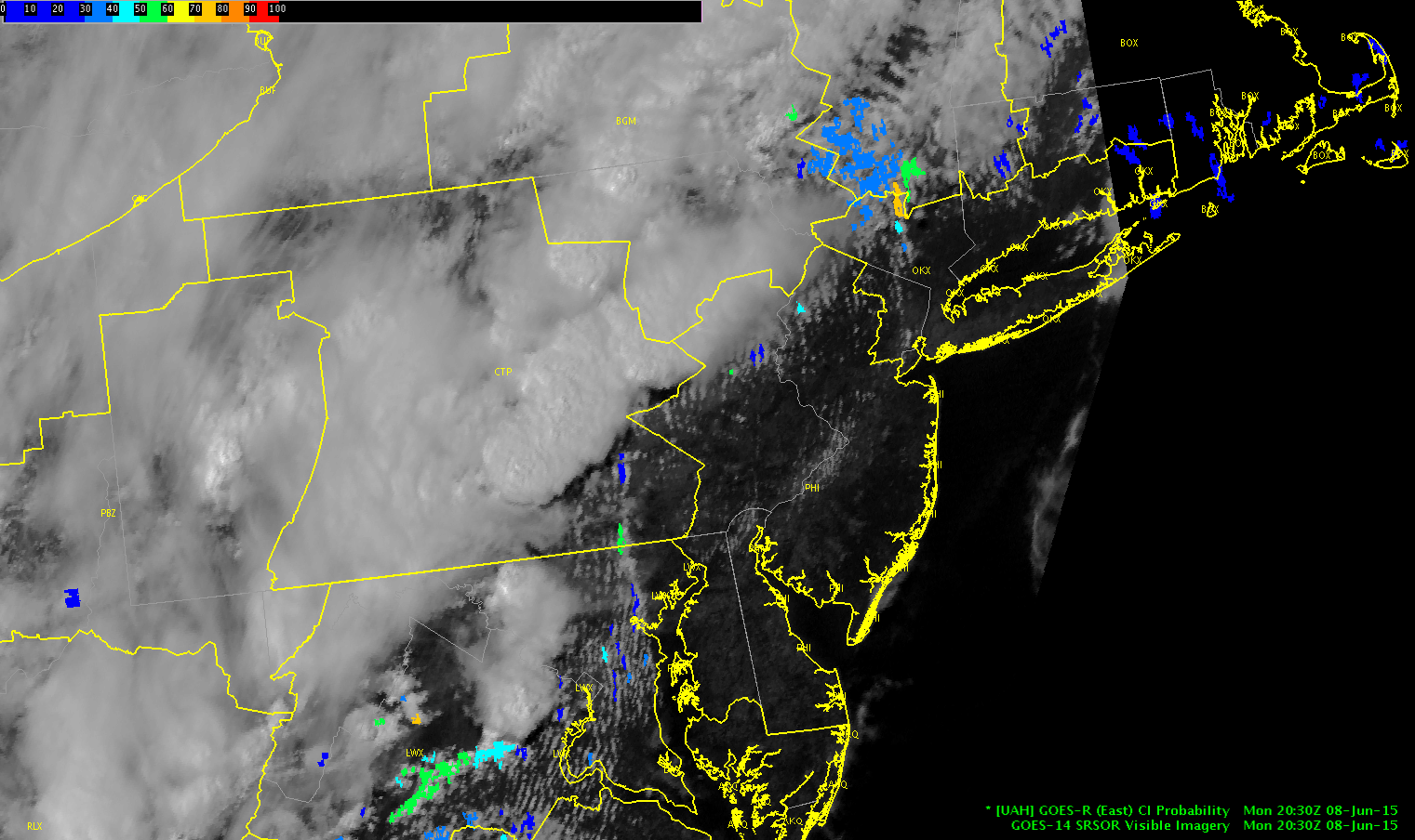
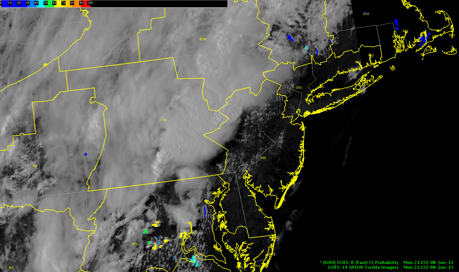
We noticed a few probabilities for CI early (50-60% max), but once the anvils from the storms to the west moved eastward, the model was not able to make any predictions.
-Shasta & Brick