
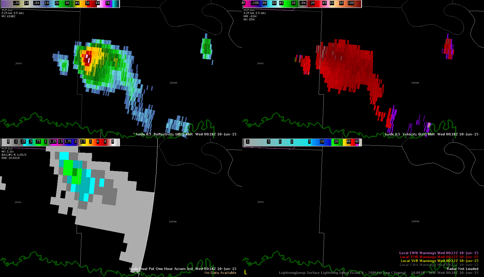
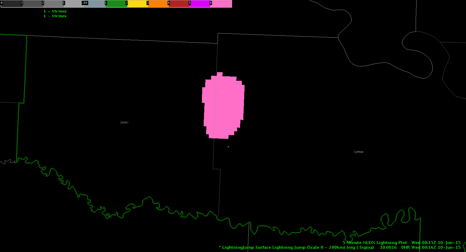
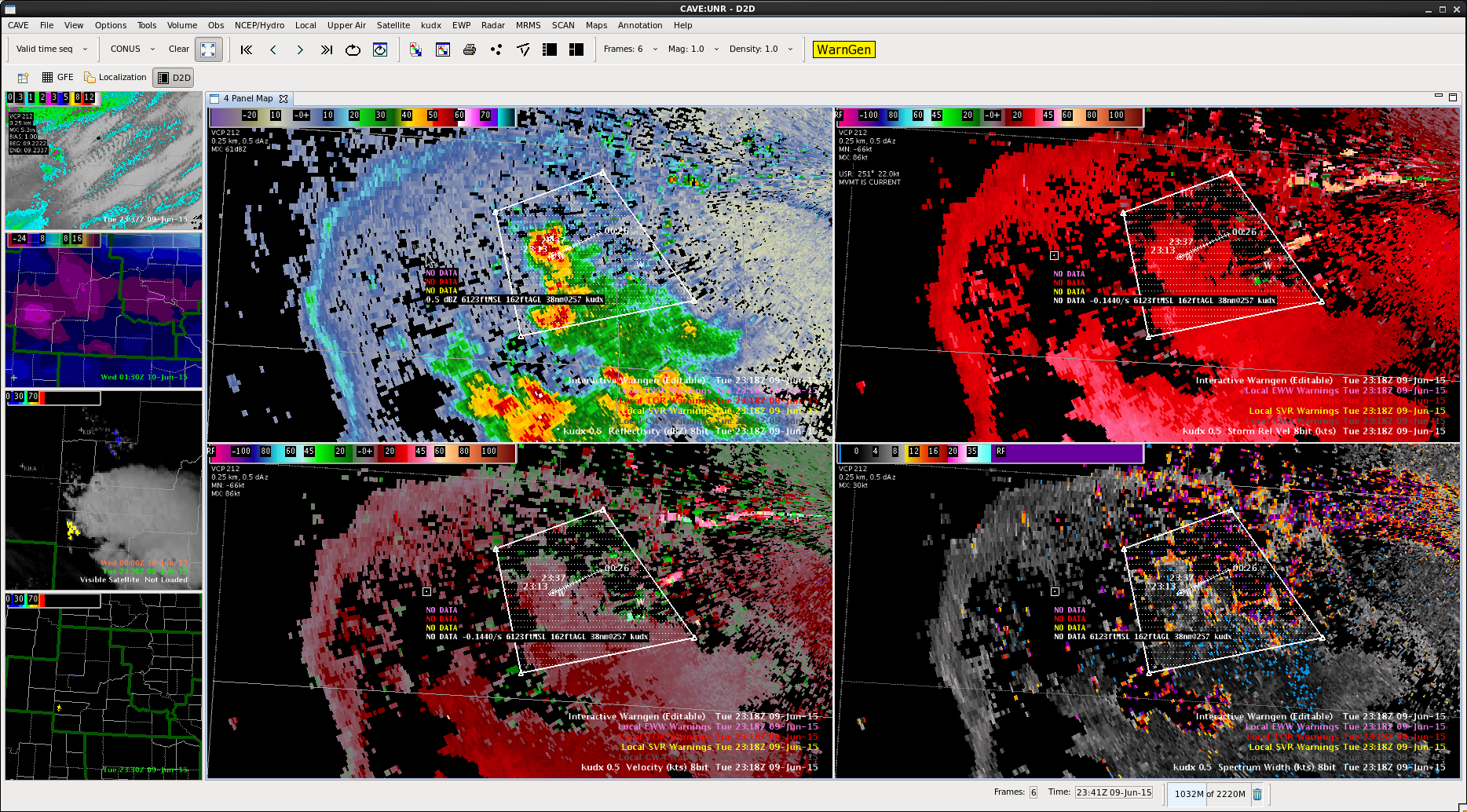
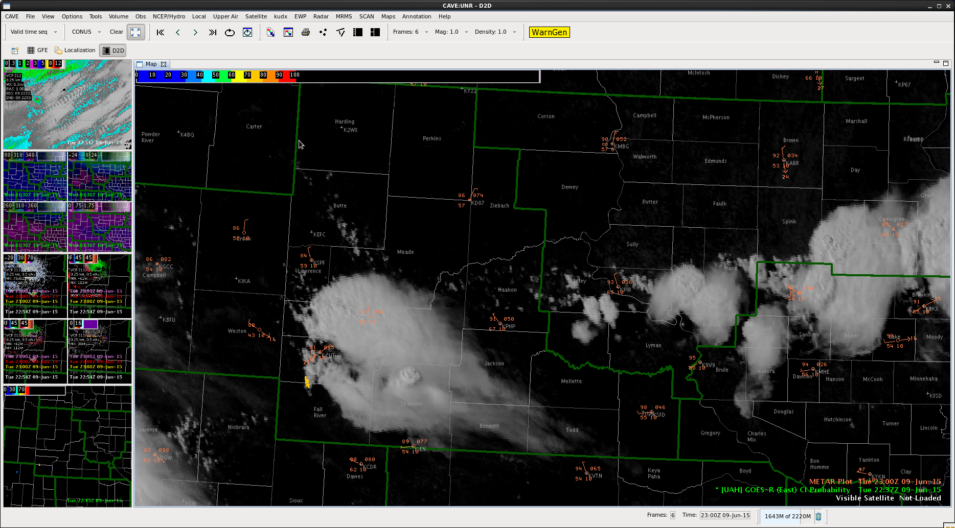
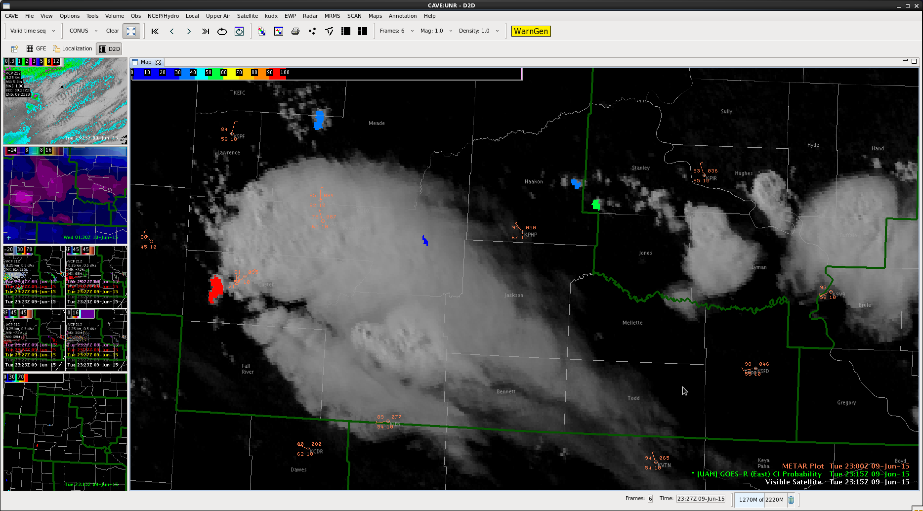
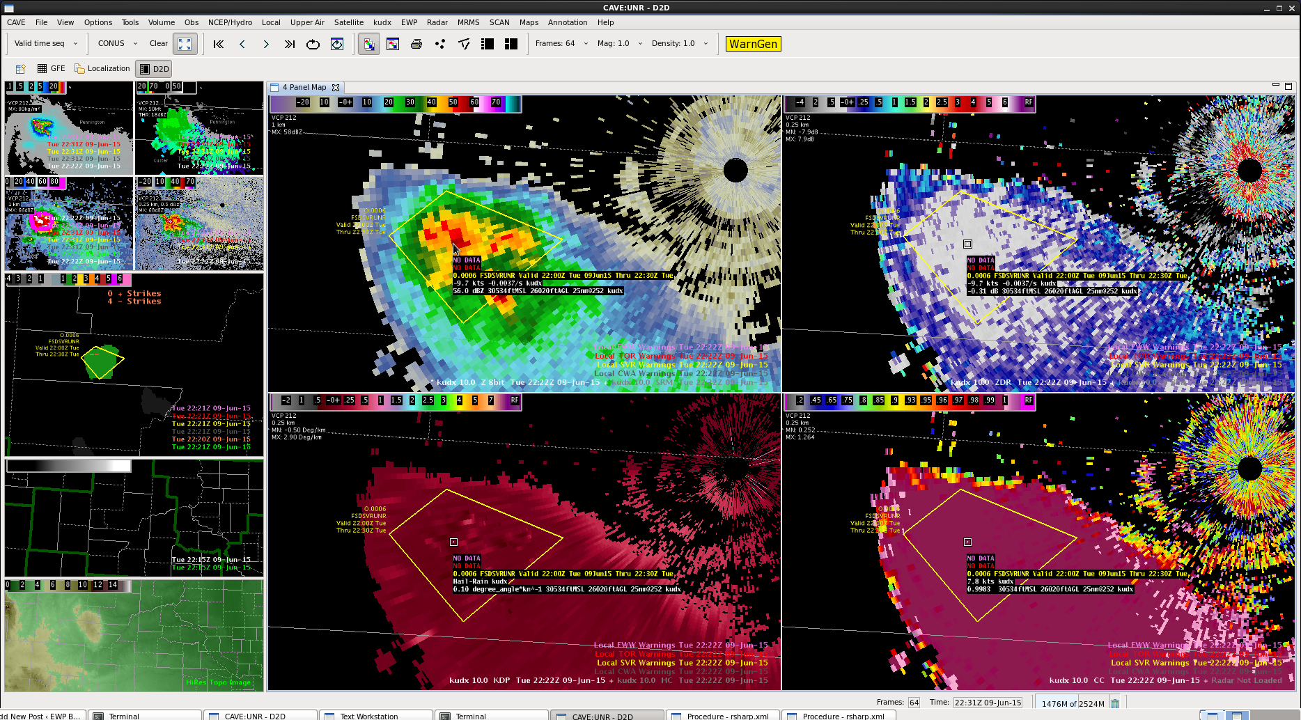
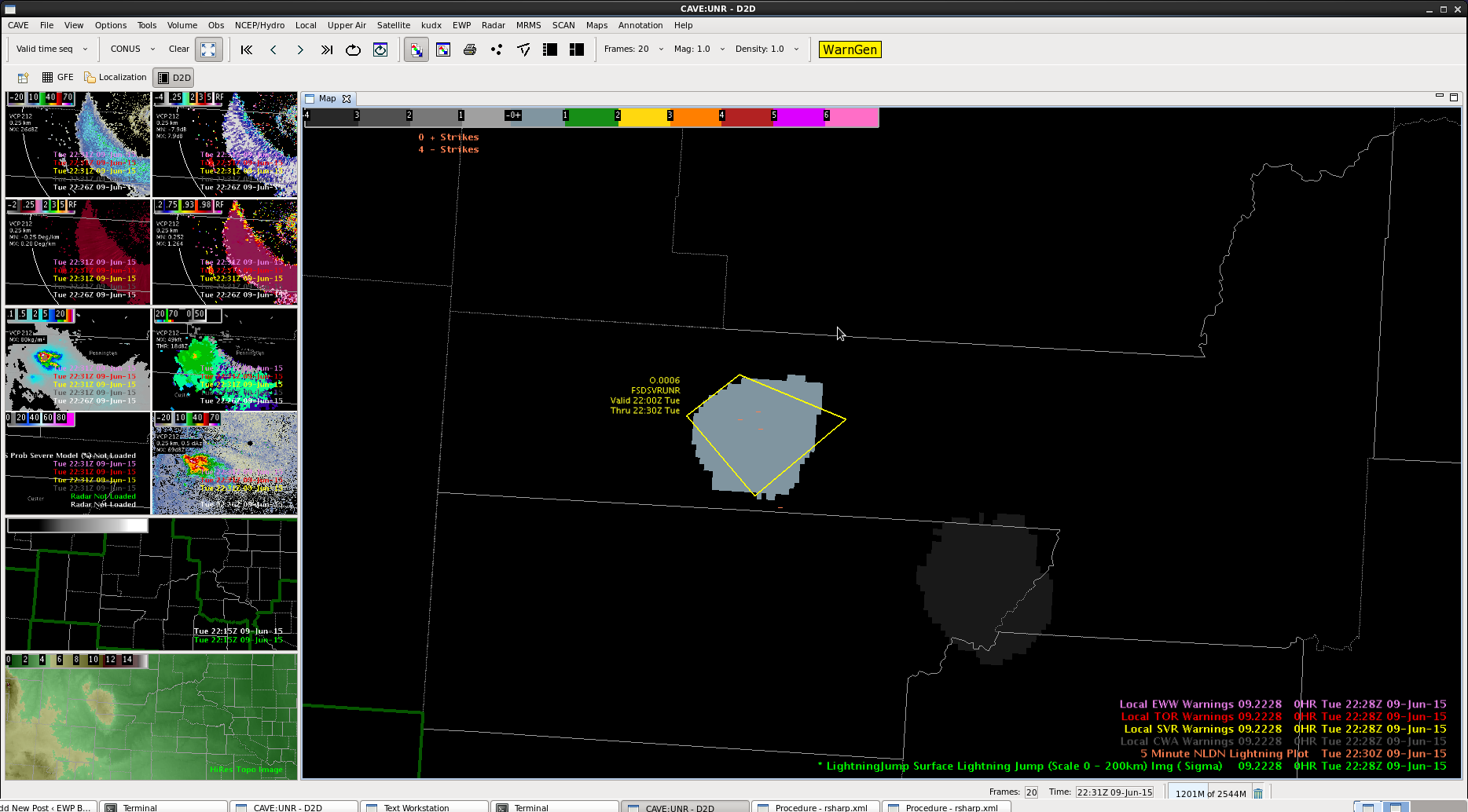
We spotted a 10 sigma lightning jump with the cell heading into Lyman Co, SD! This is probably the highest value we’ve spotted so far. There were only 2 CG strikes though. Still looks nice on reflectivity.
Official websites use .gov
A
.gov website belongs to an official government
organization in the United States.
Secure .gov websites use HTTPS
A
lock (
) or https:// means you’ve safely connected to
the .gov website. Share sensitive information only on official,
secure websites.

We spotted a 10 sigma lightning jump with the cell heading into Lyman Co, SD! This is probably the highest value we’ve spotted so far. There were only 2 CG strikes though. Still looks nice on reflectivity.
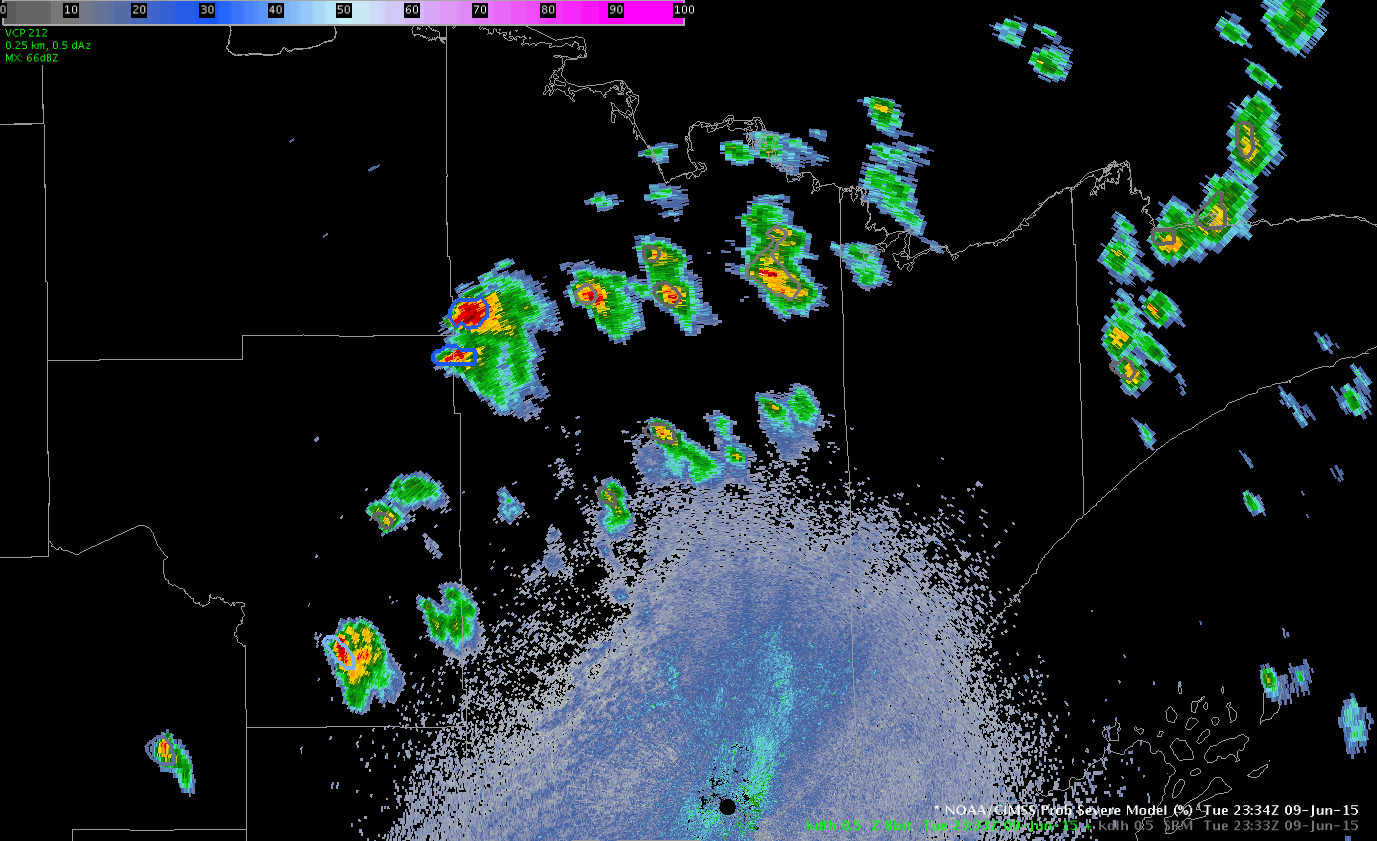
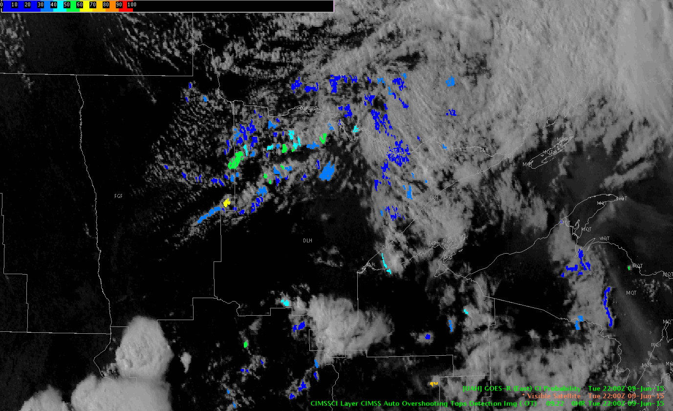
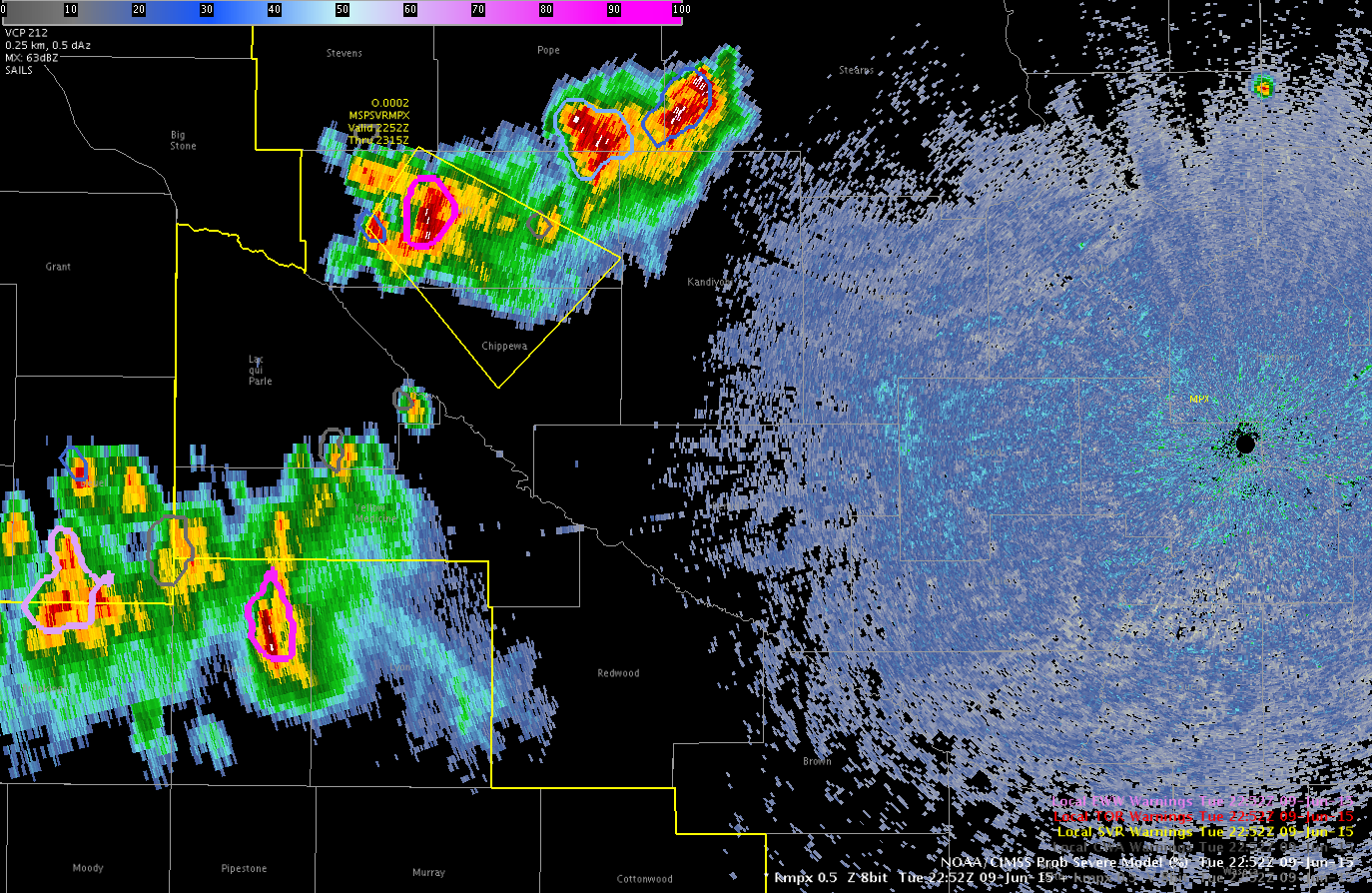
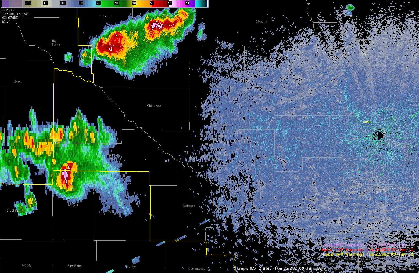
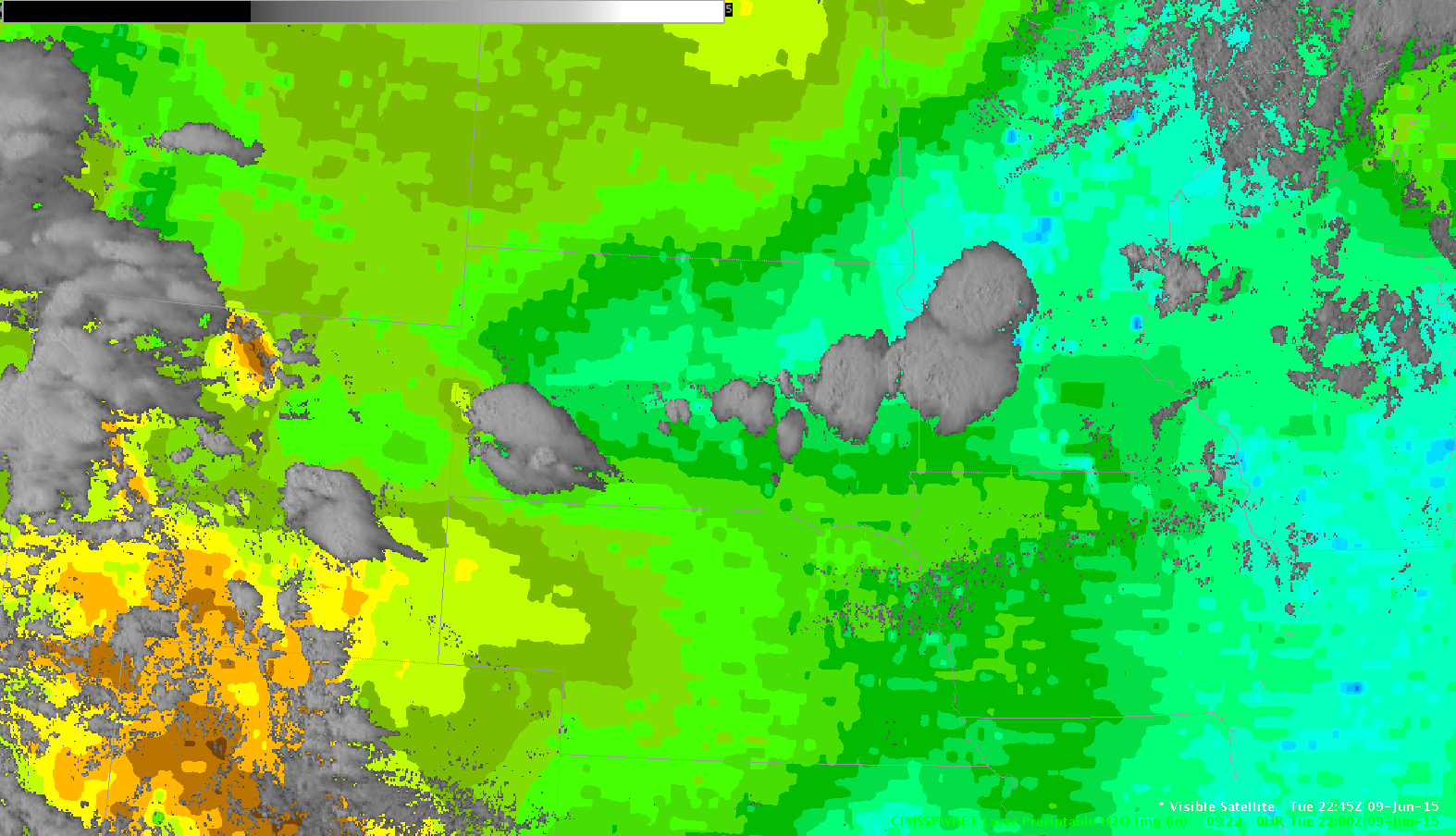
Scattered showers and storms finally formed in Northeastern MN late this afternoon. However, with just marginal instability storms have remained below severe limits despite excellent deep layer shear in the 40-50 kt range. As mentioned in a previous post CI indicated a line/cluster of showers and storms was likely to develop. As storms develop the CIMSS Prob severe model showed most storms having only a small chance of being severe, which has worked out great today (see images below for radar/prob svr at around 2330Z and CI near 22Z).
-Wacha
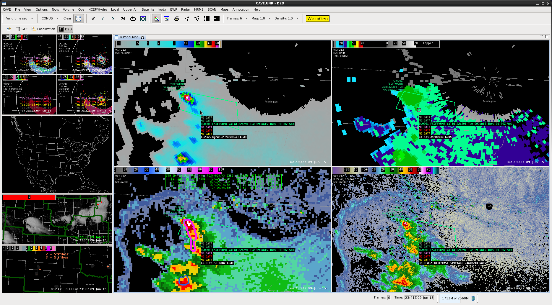
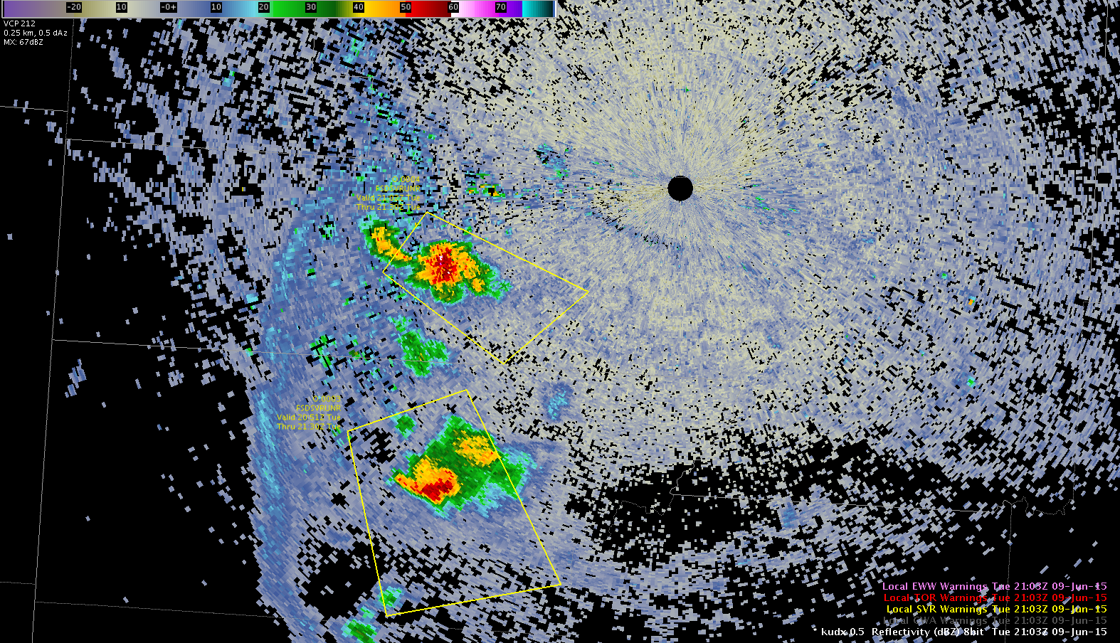
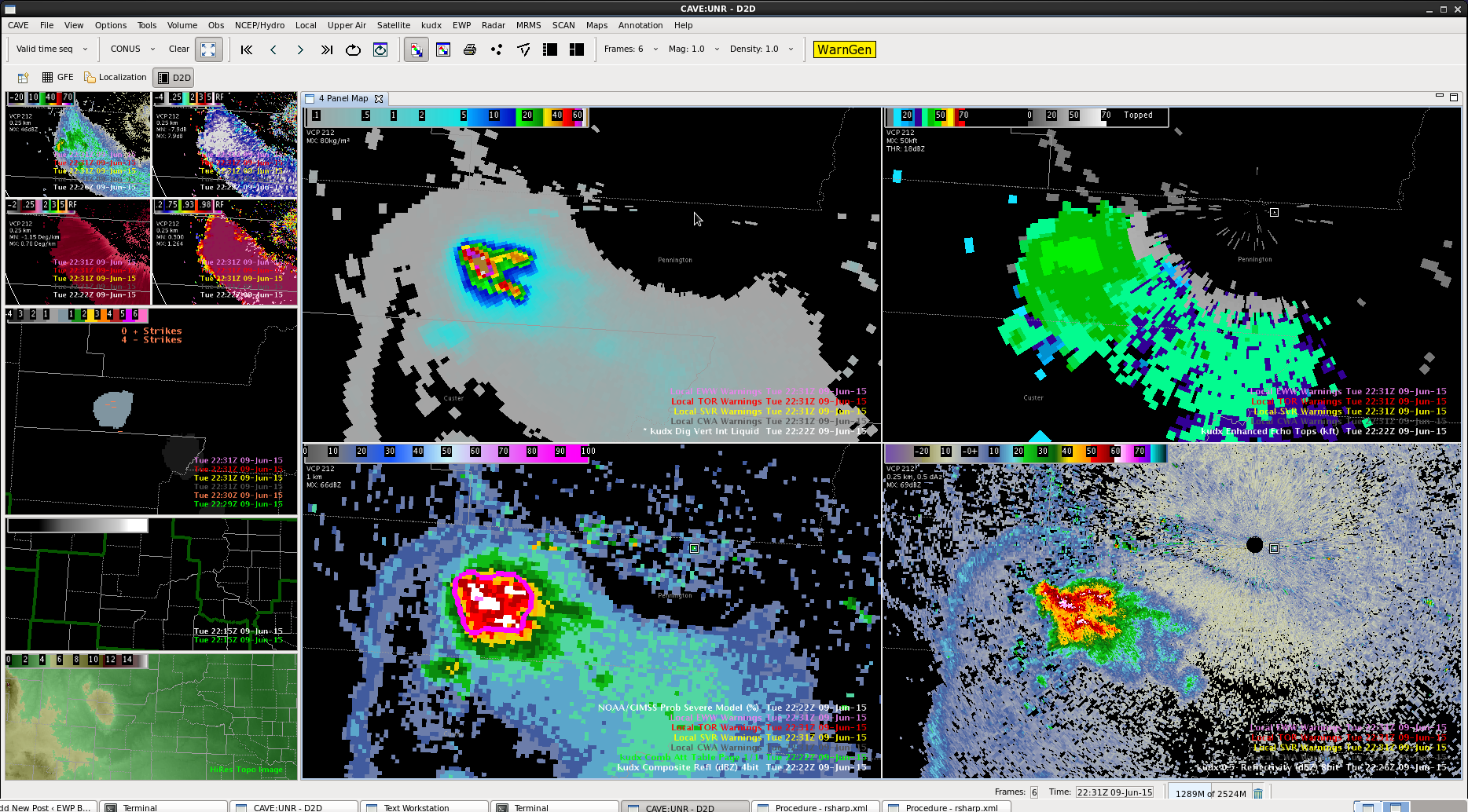
Cell still rooted along the topography pushed back up again on DVIL. ProbSevere came up with likely severe numbers, but cell was not overly tall on All Tilts. Had a 1-sigma lightning jump with this cell as well.
Switched to MPX CWA and had high confidence to issue based on 95% probability of severe.
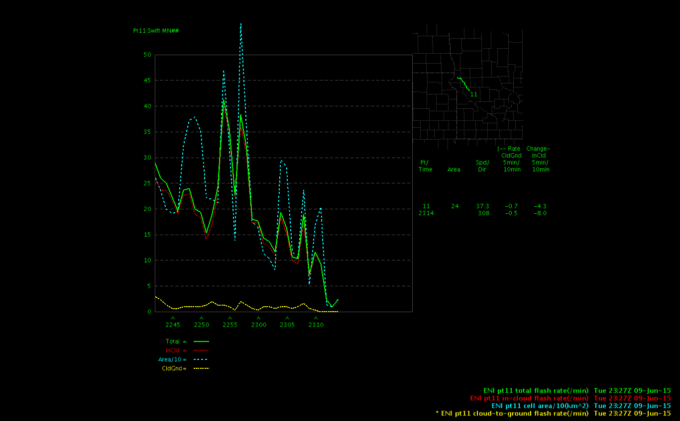
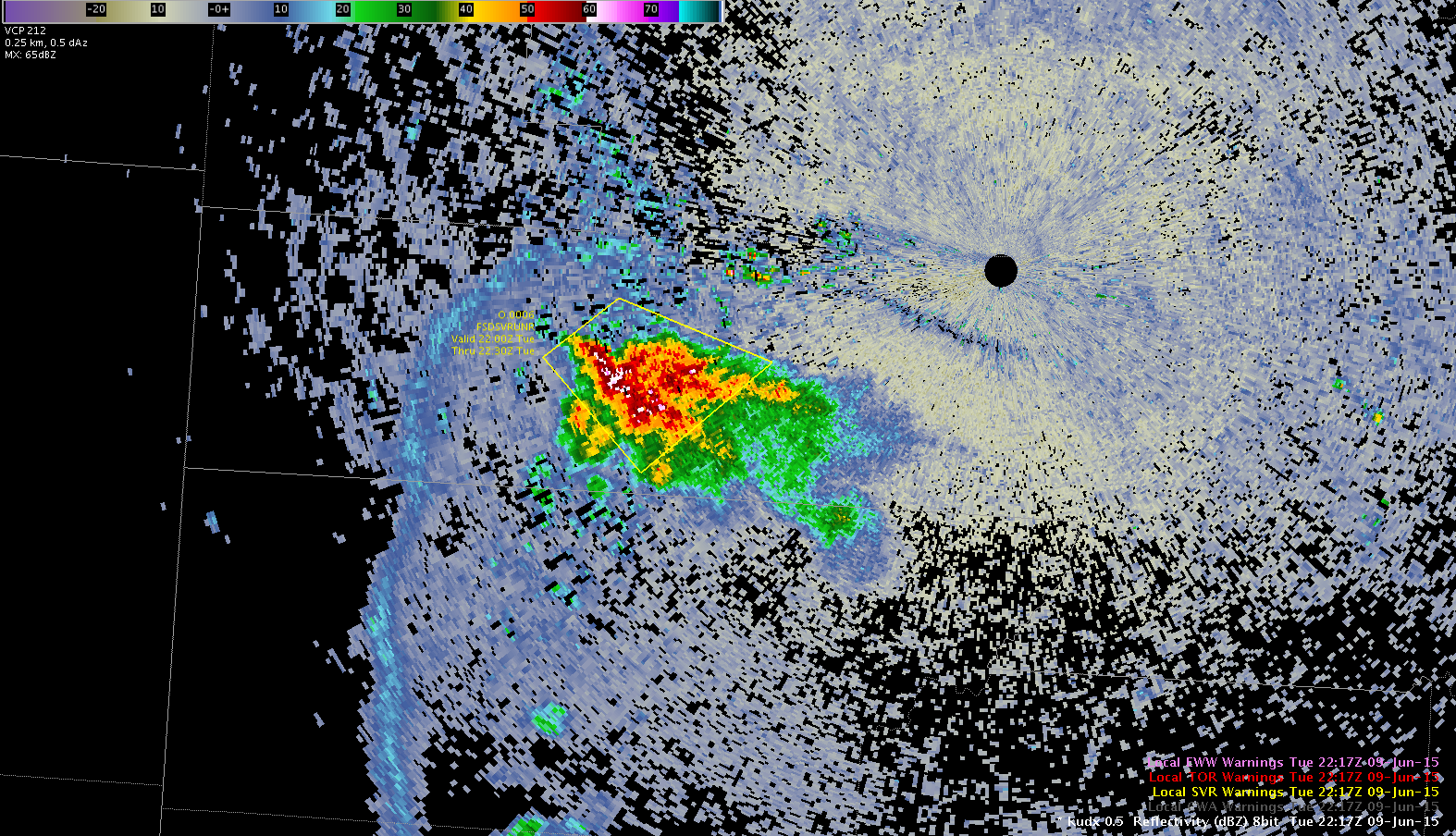
Interesting look at the time series for lightning…after I issued the second warning the cell showed a significant decrease in intensity…perhaps this the downtrend in lightning should have told me that the storm cell was already beginning to weaken. The storm was a good ways from the mpx radar.
Curious left mover from a second storm split produced 64 mph winds at 610 pm. Warning was based on 50+ dBZ to 36Kft. Lightning has waned to near zero, but reflectivity remains 65 to 70 dBZ. The right moving cells seem to be dying out. The initial warning was based on a 90% prob severe according to the NOAA/CIMSS model. This was extremely useful since we had little situational awareness since we just started but had enough trust in it and a quick glance at the radar confirmed it was probably on to something. Helped give us a nearly 20 minute lead time. MrSnow/itsinthecards
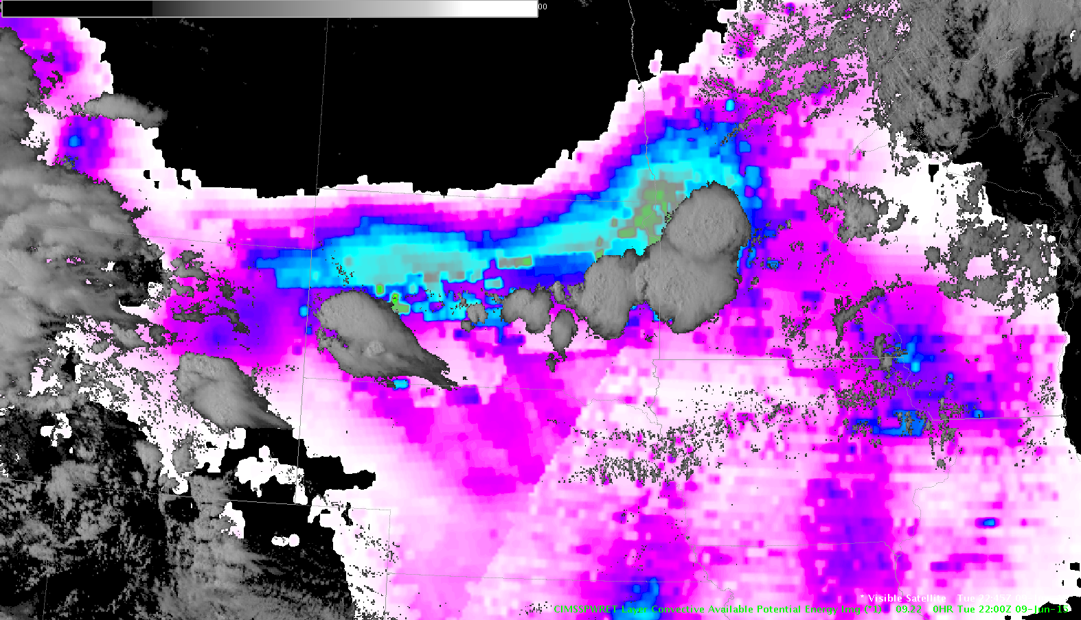
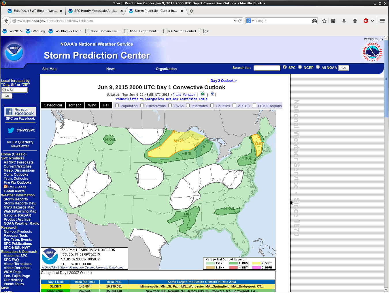
While looking at the CAPE and PWAT trends, we notices the storm development in SD matches almost exactly with the leading edge of the gradient ahead of the approaching cold front.
The exact CAPE values were about twice as much as the LAP analysis, but the overall pattern matched well. The NUCAPS altered sounding (adding low level moisture) brought the CAPE closer to expected values.
-BT
Have a new CI ping, 70-80% in Fall River county.
Looking at the Nearcast model, have a little peak that bends down to that point in the county. Will have to watch to see if we get new development there. It is a little drier down there, so wonder if a storm that forms here may have better mix down of winds.
UPDATE: That cell did not develop, however we have another high CI signal later, here:
After warning the cell multiple times, we finally started to get reports to verify our thinking.
We had 1″ hail reports at 3:25p and 4:15p and a 1.25″ report at 3:28p, all in Pennington Co.
Our first warning was issued at 3:02p based on ProbSevere, a few lightning jumps and DVIL with little help from Convective Outlook (only general risk).
-BT and Charley
Reports starting to come in now, but cell is starting to trend down. New cells had been creeping westward, with me having to go farther west slightly for each new warning. This is the first time the cell was maintaining in the middle of my last warning. Thus think the cell is beginning to cut itself off. Highest dbZ is only in the 25-30 kft range. Have not seen any further lightning jumps.
A few of us did interviews with NASA TV concerning what we were doing at the HWT, the use of GOES-R products, how it will change things, and how forecasters will train and ultimately use them in forecast and warning operations. They may show up on social media and NASA TV at some point in the future. I compared GOES-R to going to HD or UltraHD (4K) in TVs. MrSnow