

Nice AACP with the severe cell over Osage Co OK. Thermal couplet had a min of -73C and a max of -57C. Also a weaker AACP on the cell moving out of NE OK. 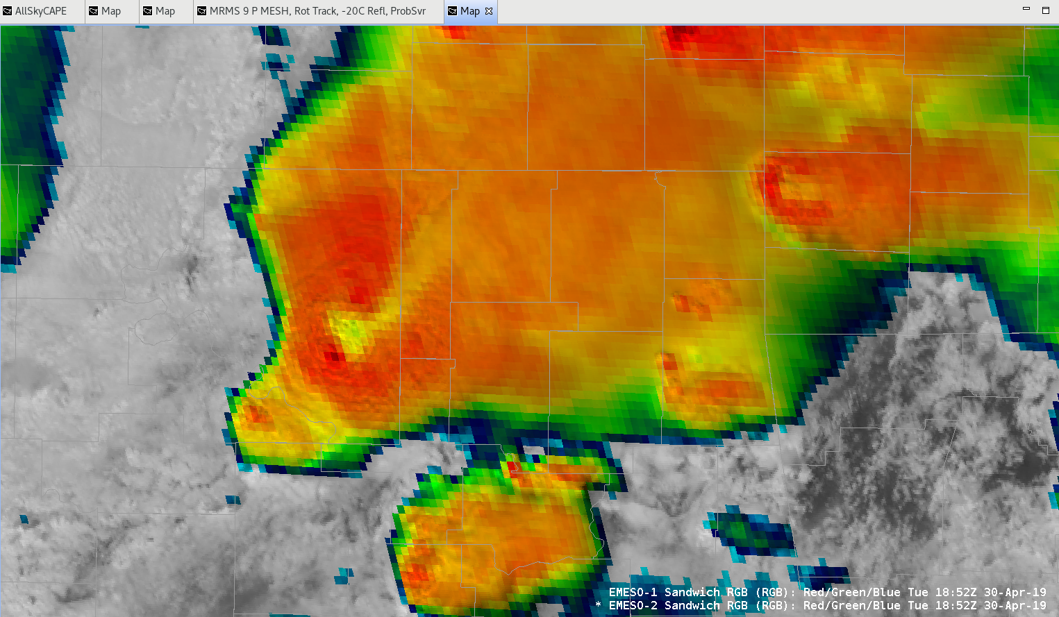
Contours-a-plenty in ProbSvr
ProbSevere double contours were plentiful at this time showing the utility that certain “big” days may need to be modified to increase the threshold for the second contour. This was the default 3%. Only a couple of the circulations were worth investigating in reality.
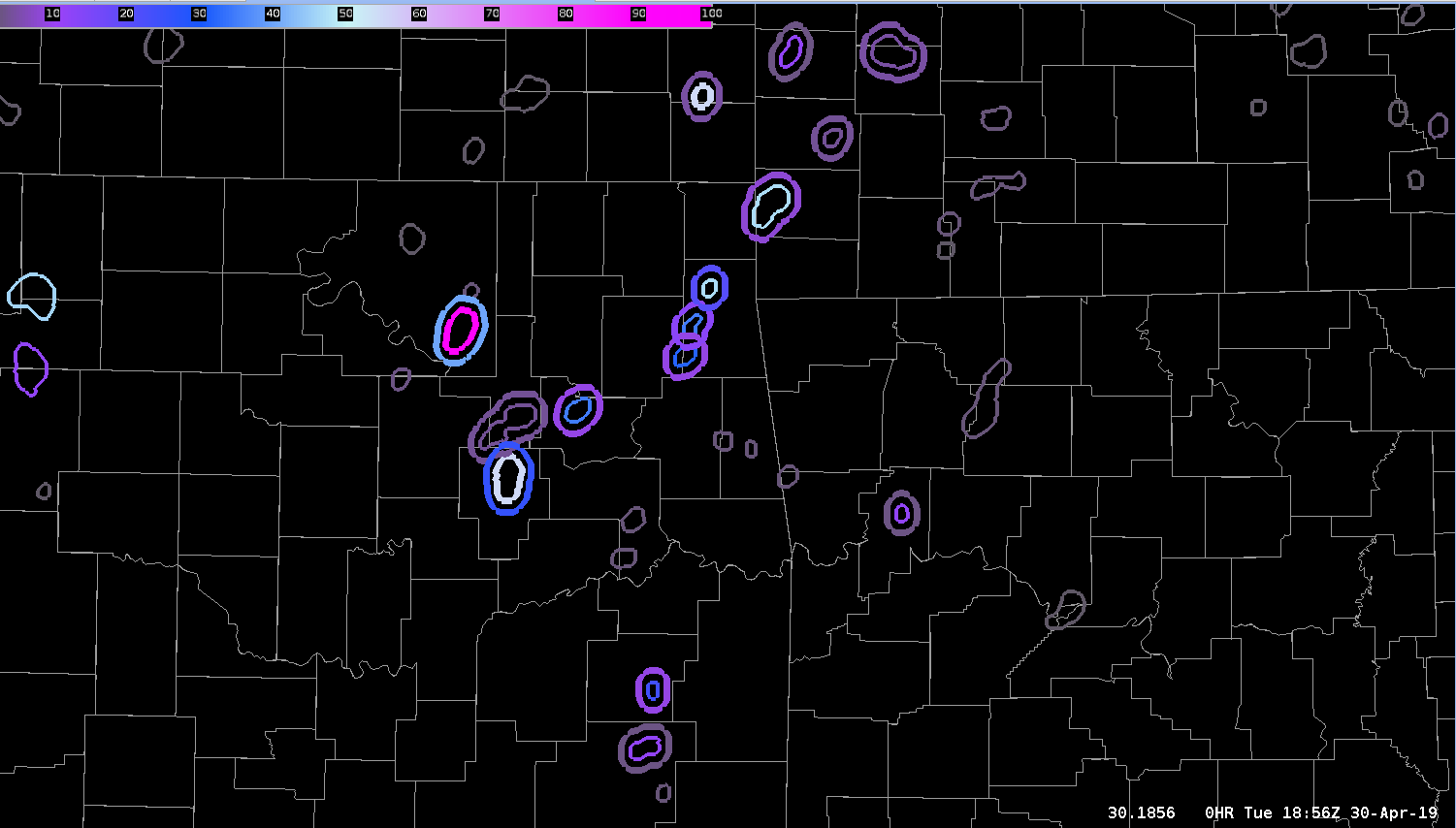
— S Coulomb
AZShear and CPTI Product for TUL SC
Watching storm northeast of Hominy @ 1854 utc. 0-2 km AzShear has been showing persistent max with the cell but seemed to displaced to far west of broad circulation. 0-2 kn Azshear not very helpful with this storm given displacement. CPTI has been showing consistent 50-55% 80 mph intensity probs for past several scans. – quik twip
Merged AzShear w/ non severe storm
The AzShear product showed a consistent, distinct circulation associated with the updraft core within a multi-cell cluster moving through the western part of SGF’s area. The velocity couplet was anticyclonic in nature. The feature was stronger in the 3-6 km AGL layer than at the surface.
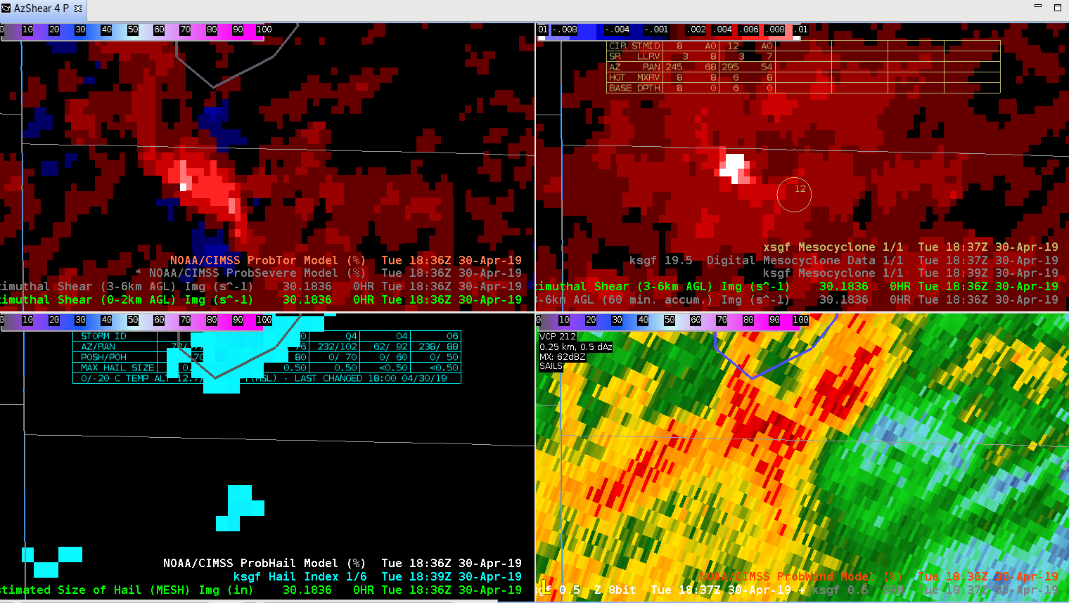
— S Coulomb
All-Sky LAP CAPE and Boundaries
The All-Sky LAP CAPE product is rather useful as a quick and dirty SA tool to quickly identify boundaries and their approximate location/orientation. While the actual CAPE values given are not as important (perhaps better to rely on obs, mesoanalysis, and short-term models for that), the LAP product does very well with identifying the key location of the gradient and subsequent boundary. The boundary location in today’s case is rather obvious, but this product will likely prove useful in more diffuse situations.
–Stanley Cupp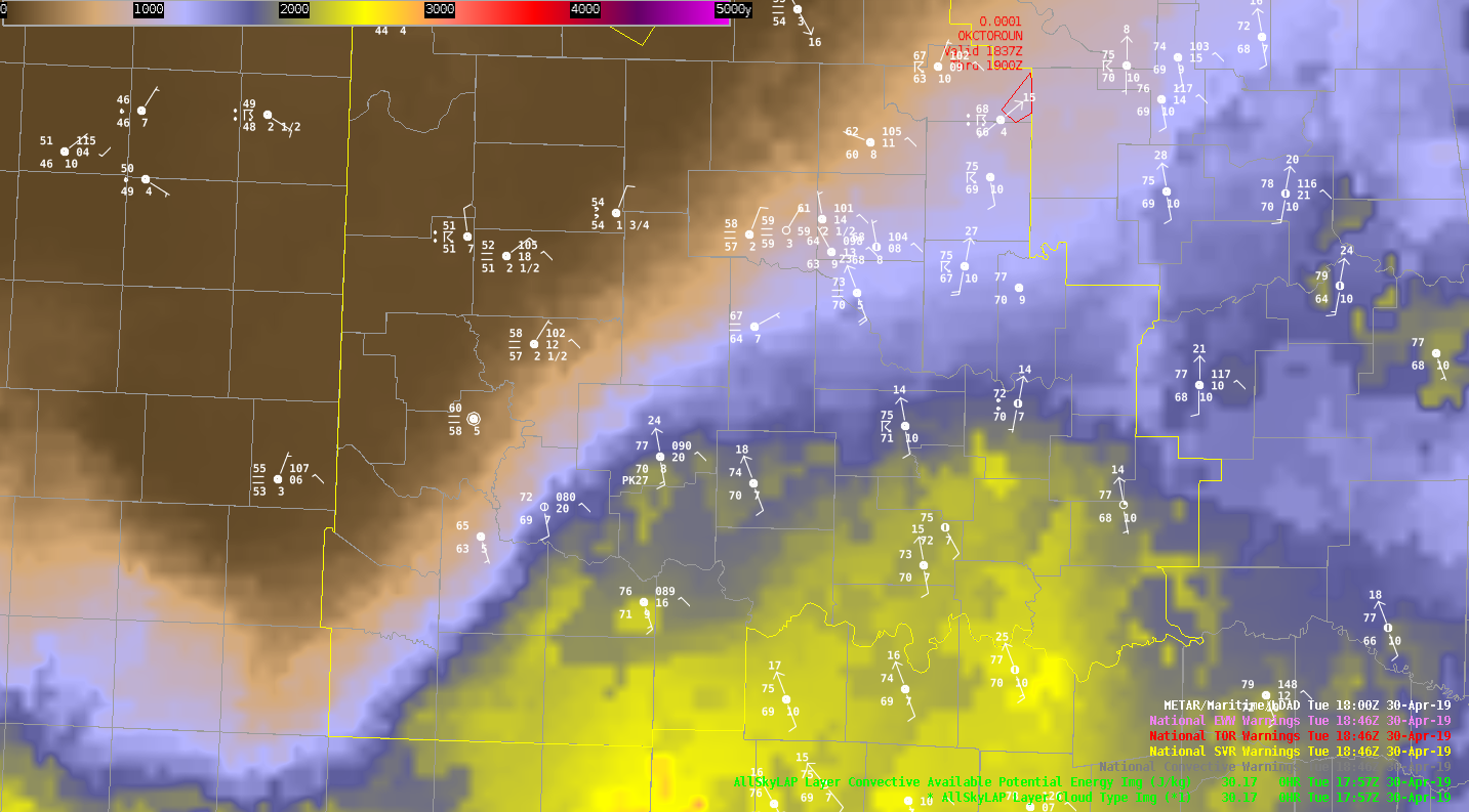
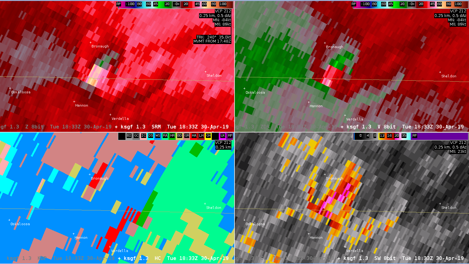
Merged AZ-Shear 0-2km

AZ-Shear Merged 0-2km:
Notice AZ_Shear Merged 0-2km was not well defined with the rotation couplet as compared to the base/SRM velocity products from a single radar. This product seems to work better in the single radar form versus merged form.
-Jake Johnson
GOES Sandwich/ProbSever/GLM
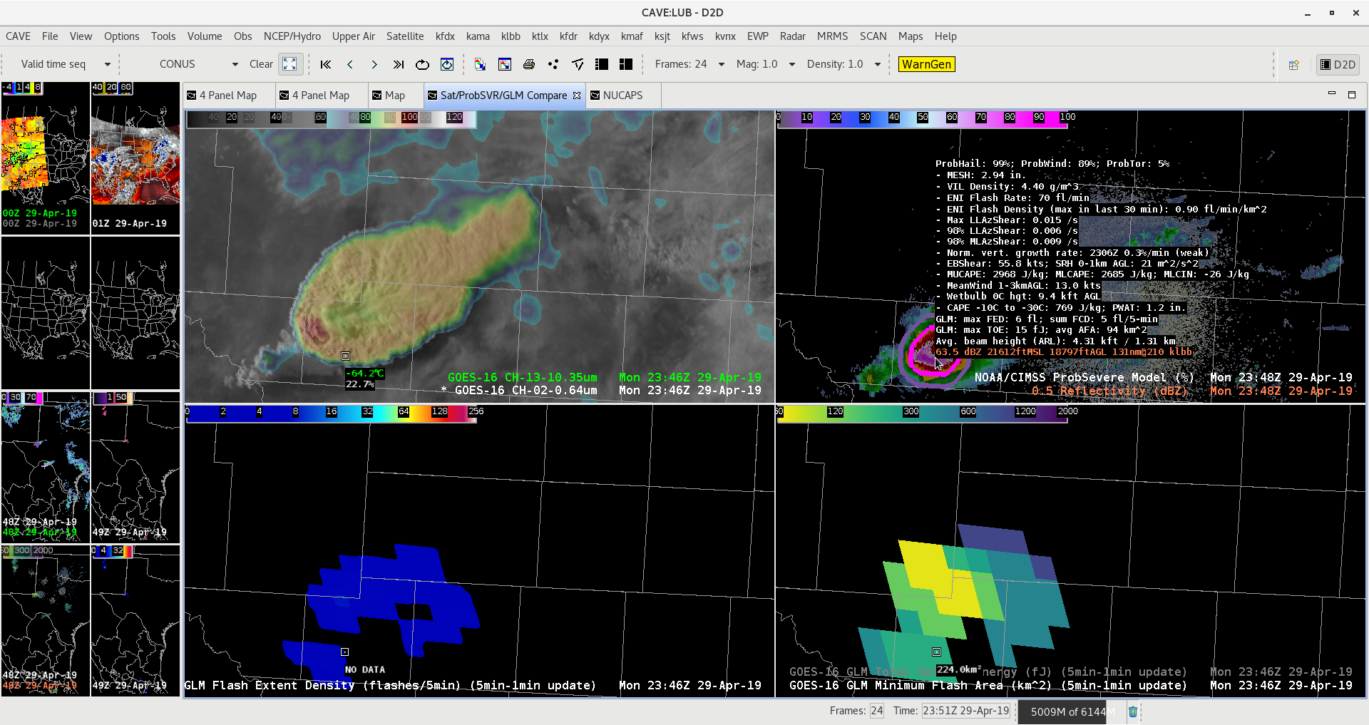
GOES-16 Sandwich Product showing a nice above anvil cirrus plume. ProbSVR showing 99% for large hail and Tor prob 5% with nice double rings. GLM Min Flash area remained in place with overshooting top of this supercell.
ProbSevere MouseOver
ProbSvr readout is becoming so long it is hard to fit within a 4_panel. It is not usable as a readout in a 9_panel due to the number of parameters being shown. Perhaps combine the LLAzShear into a single line such as (Max,LLA,MLA) (0.004/s,0.0002/s,0.005/s) to save space???
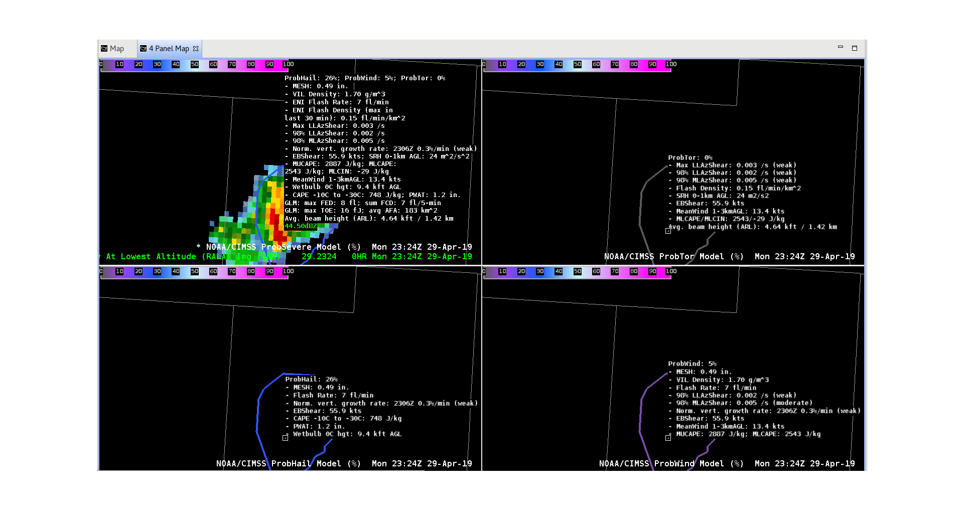
— S Coulomb
NUCAPS Soundings
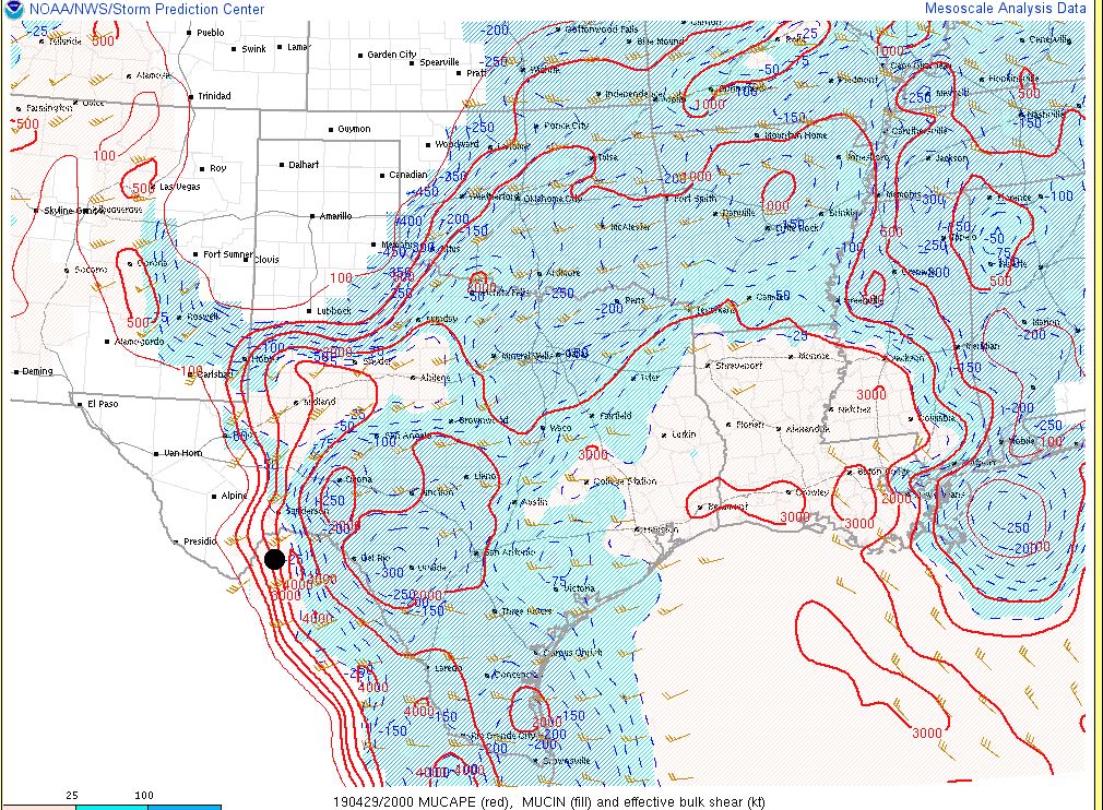
While it is very easy to plot forecast soundings from whatever model you may choose, NUCAPS provides yet another resource as an alternative to NWP. A strong thunderstorm formed in Mexico around 22z today, almost due west of Del Rio, TX. SPC mesoanalysis showed approximately 2000-3000 J/kg of MUCAPE in the vicinity prior to convection initiation (CI). A quick look at a 20z modified-NUCAPS sounding corroborated the SPC analysis, with ~2400 J/kg of MUCAPE at 20z. The NUCAPS data allow for a detailed analysis of the resulting profile and can be a useful alternative to model soundings, especially the modified products as they attempt to more accurately represent the boundary layer based upon RTMA data. The 20z NUCAPS had ample CAPE in the hail growth region along with 700-500 mb lapse rates in excess of 7C/km. Effective bulk shear in excess of 40 knots coupled with favorable thermodynamic environment likely resulted in this storm producing large hail as KMAF radar sampled greater than 60 dBZ at greater than 32K feet. ProbSevere hail output peaked at 97% (MRMS Mesh = 1.87″) roughly 40 minutes after CI.
–Stanley Cupp
20z NUCAPS sounding near storm in Mexico
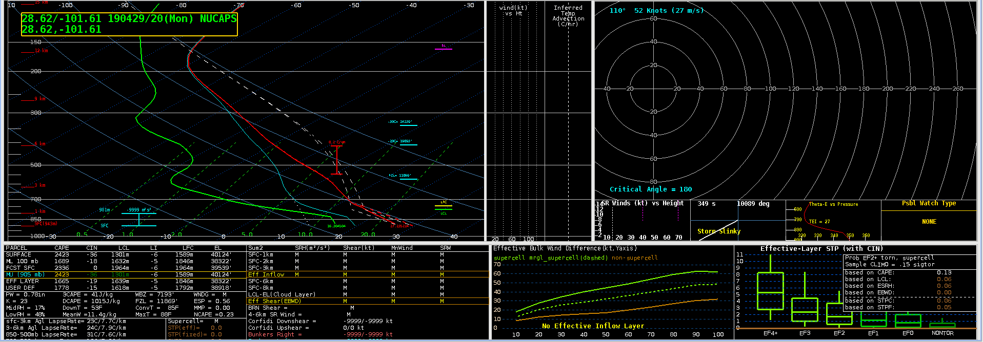
20z SPC Mesoanalysis MUCAPE and 0-6km shear (dot indicates point of CI)
Mexico splitter – Prob Severe and GLM data
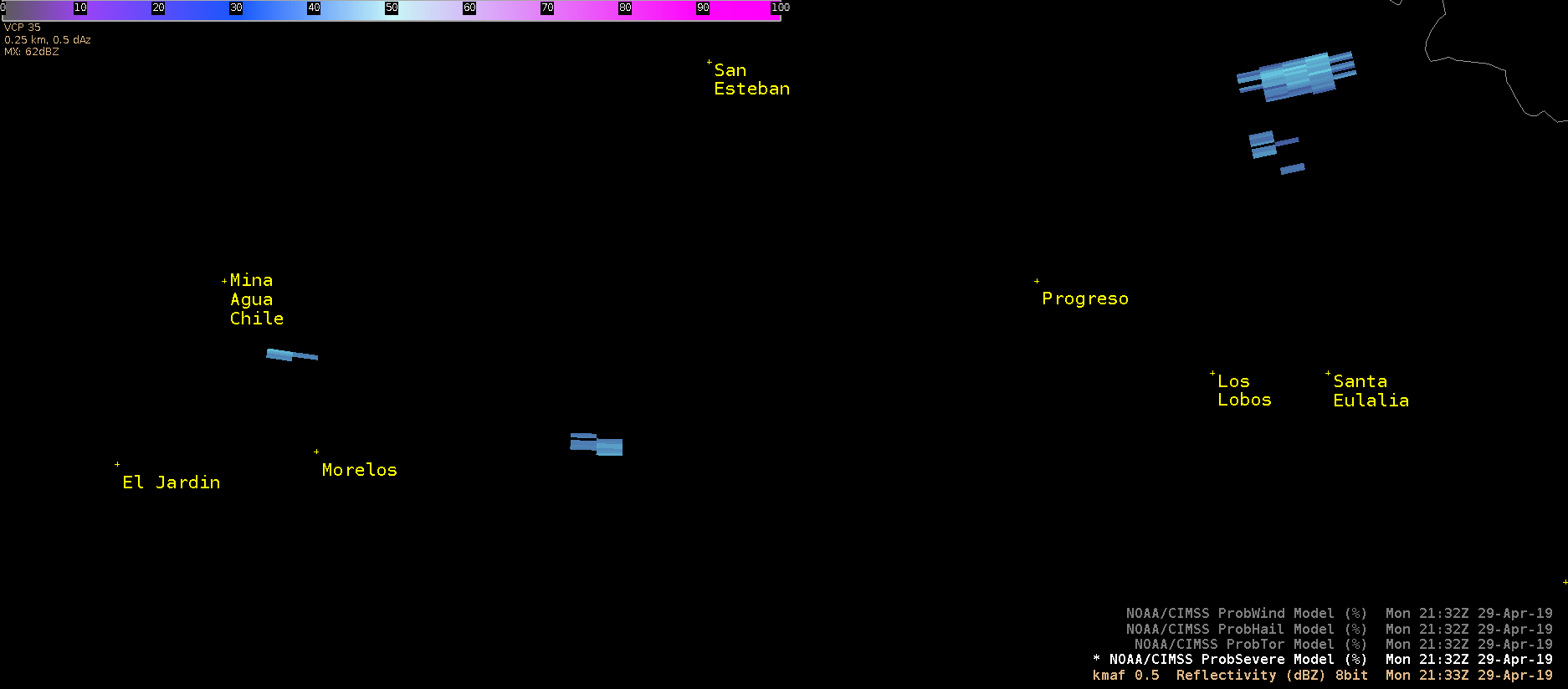 Loop showing the evolution of a strong cell west of Del Rio in Mexico. Prob Severe values were dominated by Prob Hail in this case. This hail threat makes sense given mesoanalysis and storm mode, supported by 12z Del Rio sounding. Peak values around 97% occurred before the storm split, but after peak dbz values observed on radar. This makes sense considering the beam height at this range (165 mi from MAF) was showing the mid-level core at 30kft MSL – hail would likely have needed time to fall out from this height. This case could be useful for offices with high radar beam heights distant from isolated thunderstorms. Prob Tor did nudge up around the time of the storm split enough to show the ‘double contour’, however V data at low levels was not present.
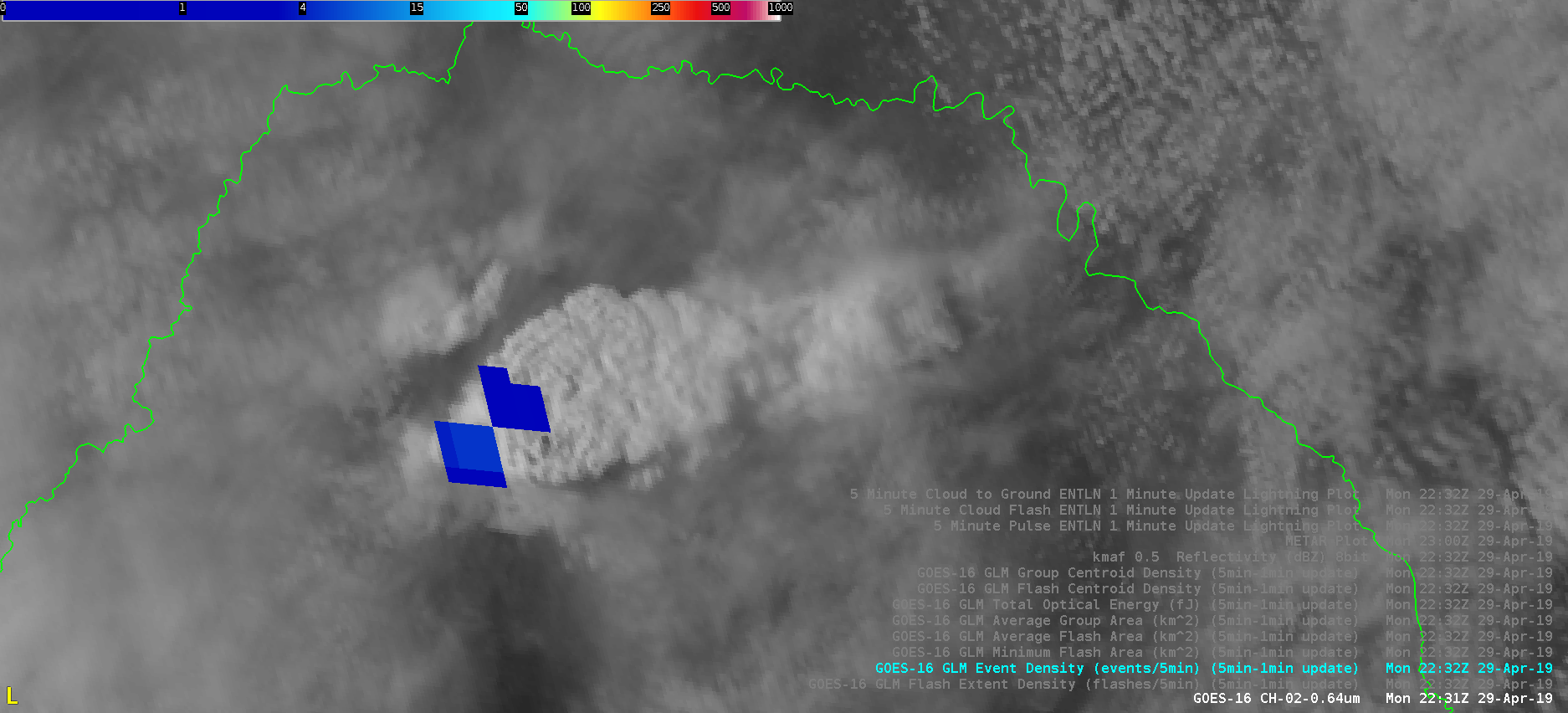
Same storm now with GLM Event Density. This data showed a lightning decrease around the time that the storm split. Following the split, almost 0 lightning was observed in the southern cell, while the left split saw a spike in event density. The left split reinvigorated shortly after the split while the right mover weakened.
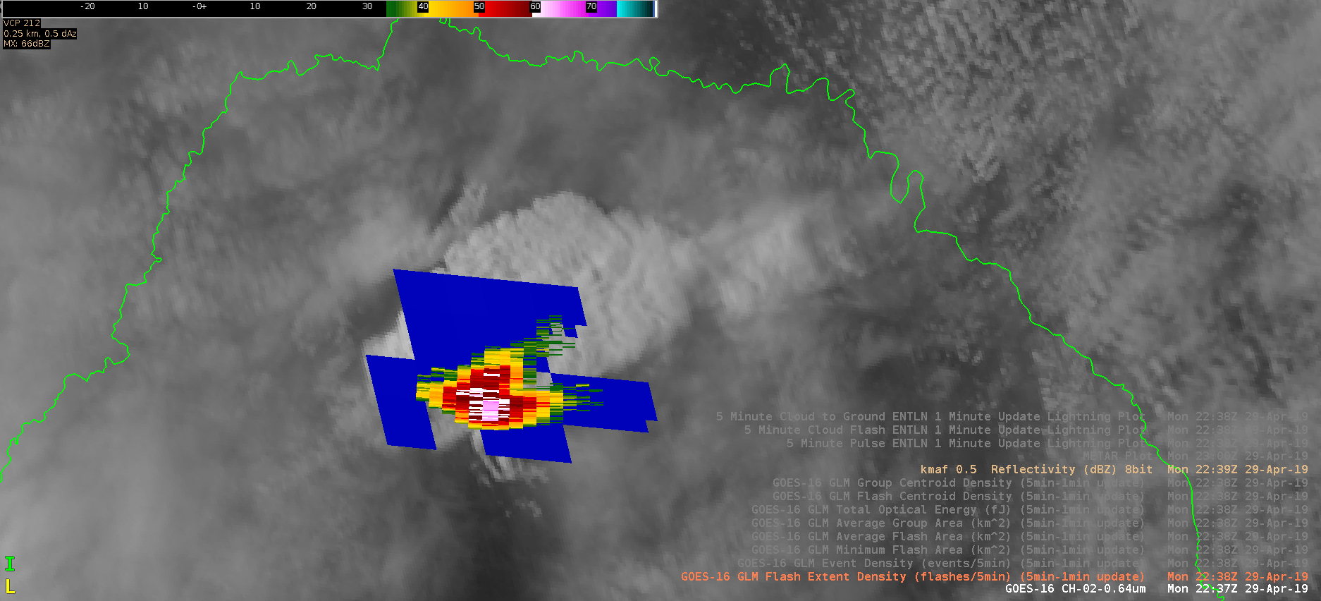
This is the same loop with radar overlaid that shows the storm split and this time flash extent density. Almost 0 lightning data seen in the south cell.