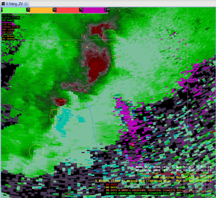
Around ~4Z, several NTDAs were being identified in areas of lowered reflectivity or where tornadic activity would not be generally expected. Causes looked to mostly be due to increased AzShear from noise, but at least probabilities remained small, below 20%
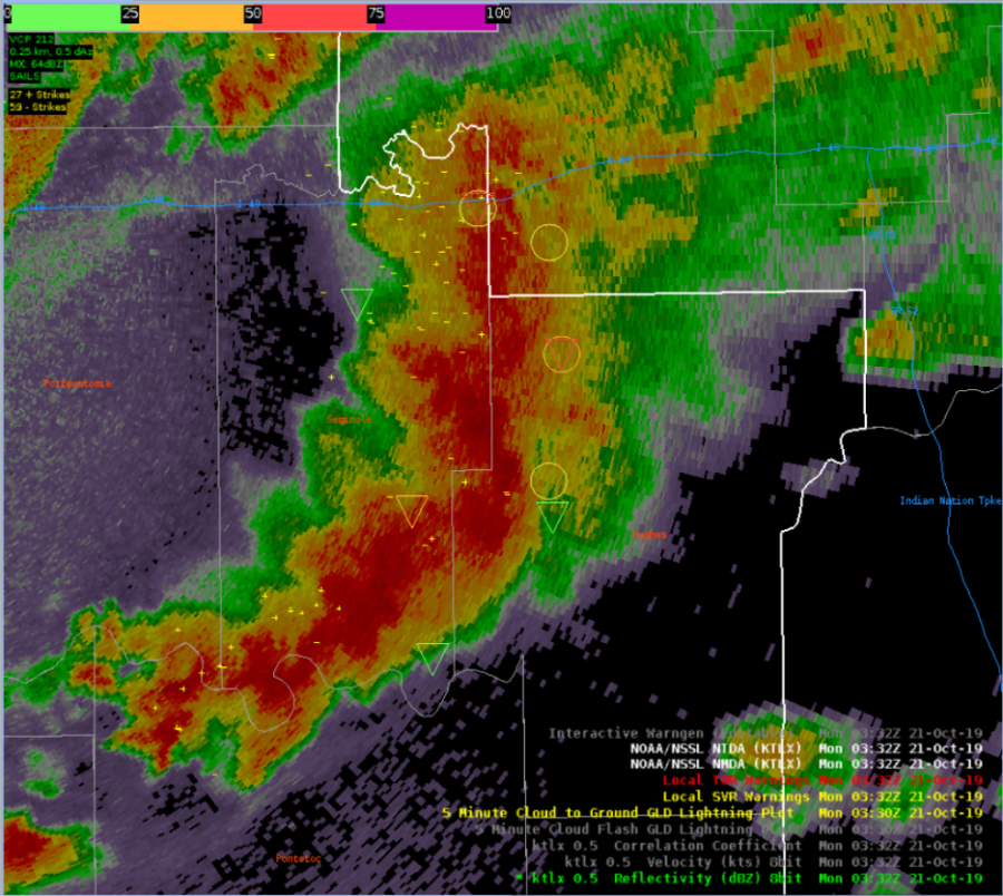
Both algorithms tagged onto the minor circulations within a developing QLCS pretty well with one or the other, or in several instances both, showing locations with increased vertical vorticity in areas that didn’t exhibit obvious bows or kinks in reflectivity. There was some noise and residual circulations in other parts of the storm, so there is room for detection improvement, but overall performance along the leading edge was okay.
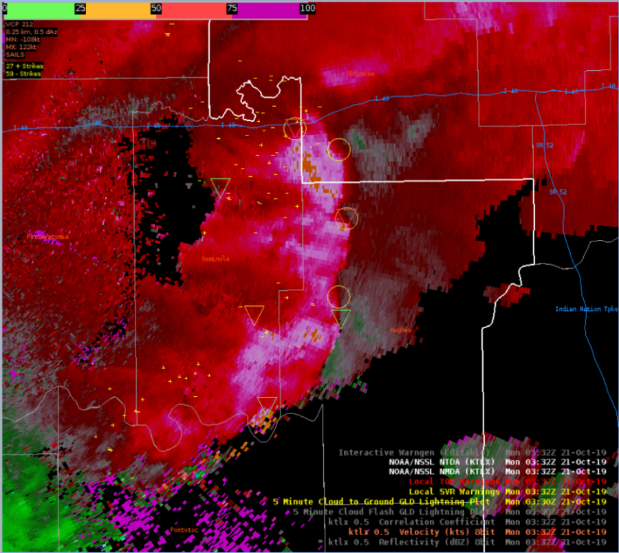
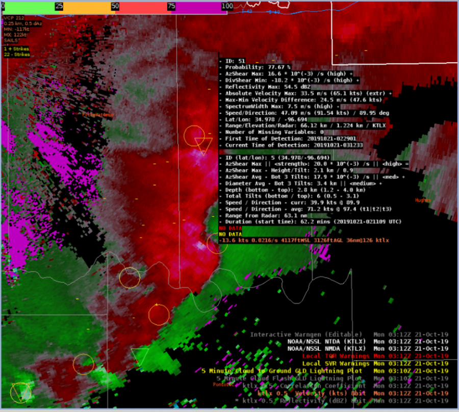
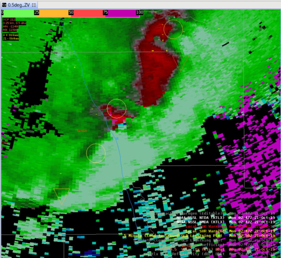
For a strong circulation that eventually became a tornadic in an occluding mesocyclone, the TDA and NDA did very well tracking the circulation in time. By 03:33Z (a time shown after the image below), the MDA had tracked the same circulation for ID 5 for over 82 minutes, and the TDA was able to track the storm for over 65 minutes. At times though the location of the MDA and TDA were a bit suspect
At ~0245Z, some data quality issues were occurring in areas of weaker reflectivity, which was likely caused by sidelobes. At 2 times when the velocity was a bit suspect, the NTDA indicated probabilities of 73% and 83%.
We noticed several instances during the archive case this morning that the NTDA would sometimes go off in what we would consider clutter. This could potentially cause issues for any offices that have scripts to audio alert forecasters.
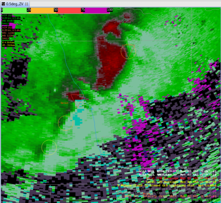
Ex of a TDA in clutter just to the southwest of the RDA
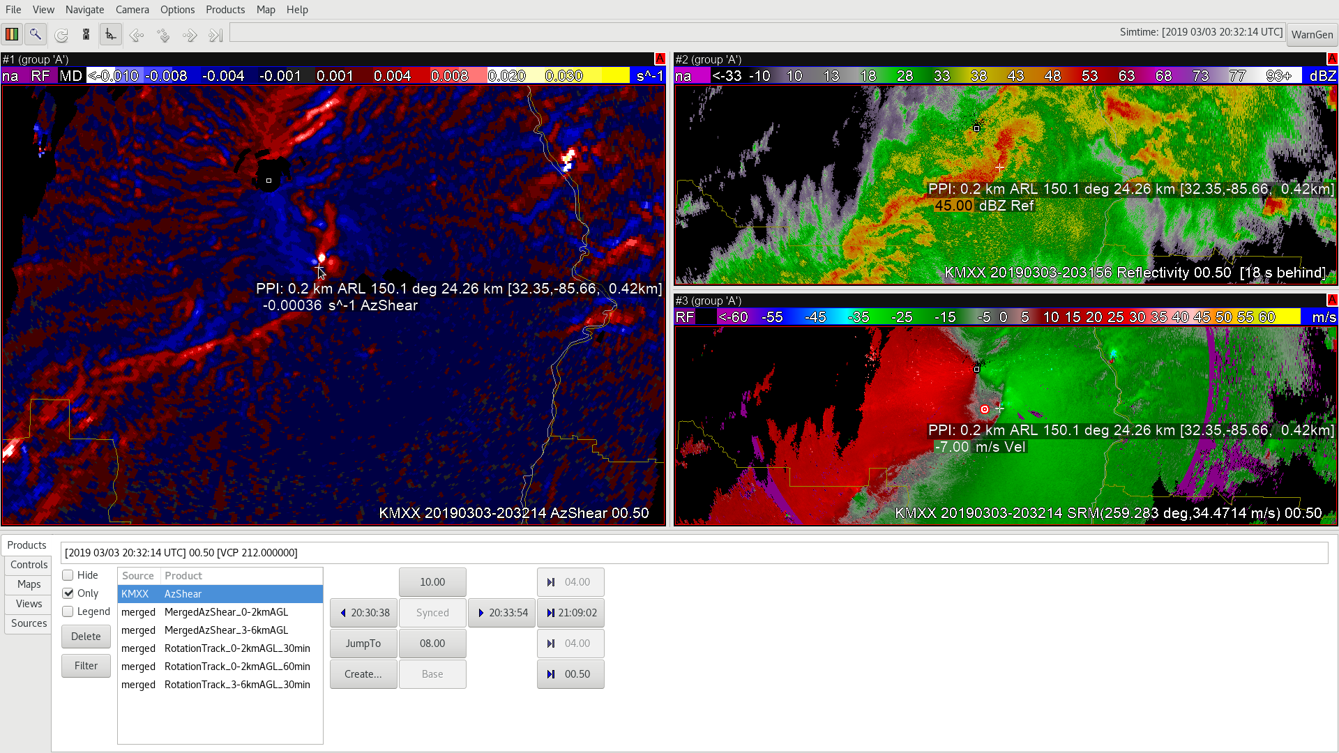
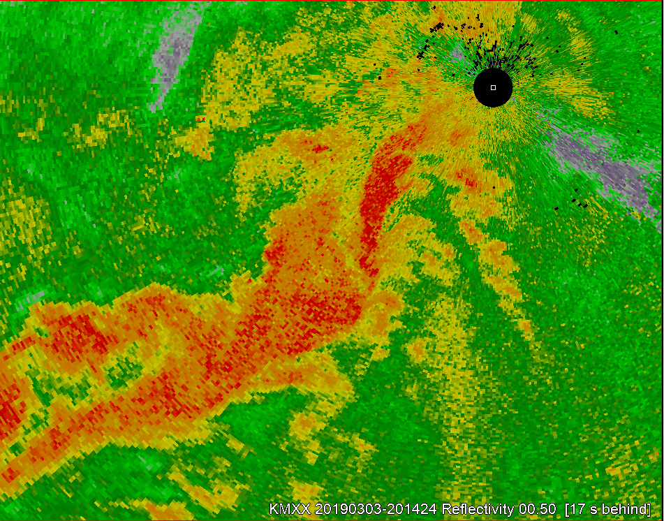
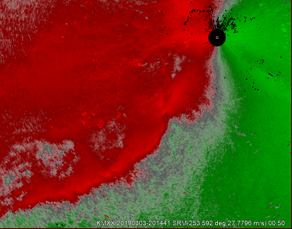
At 2014z the MXX radar showed a line of convection extending to the southwest of the radar location. SRM depicts convergence along the line but it is limited since it is down the radial. There are some notches in the reflectivity, and some wiggles in the convergence line, but there are not direct areas of rotation at this time.
2014z 0.5 reflectivity.2014z 0.5 SRM.
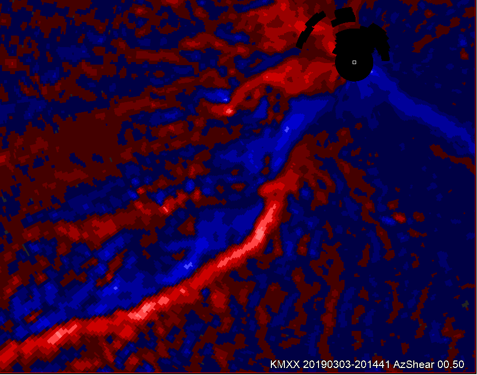
The single radar azimuthal shear supported the idea of a convergent line with a corridor of slightly positive values along the line.
2014z 0.5 AzShear
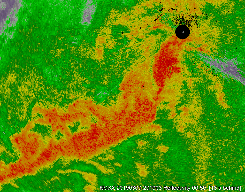
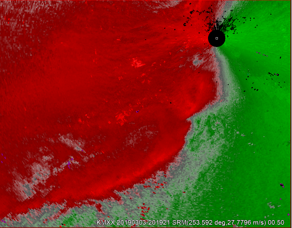
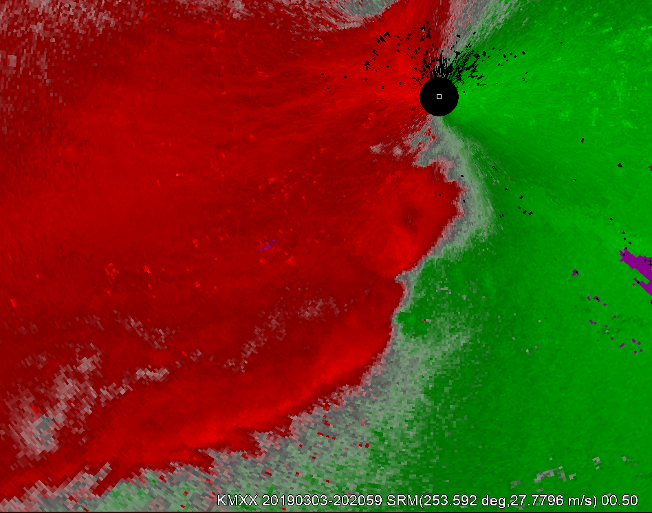
Stepping ahead 5 min some changes appear to be ongoing immediately to the SSW of the radar. The low-level reflectivity depicts that there is some discrete nature to the cell on the northern portion of the line. Of note, this does appear the be occurring near a surface low per the analysis, and upstream of a tornadic supercell. At this same time a kink does develop within the convergence line on the low tilt SRM.
2019z 0.5 reflectivity.2019z 0.5 SRM.
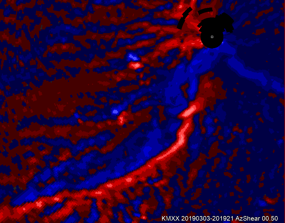
At the same time, the AzShear product shows some enhanced values at the northern end of the line that have become somewhat discrete from the remainder of the line. However, there are some enhanced values immediately south of the aforementioned area.
2019z 0.5 AzShear
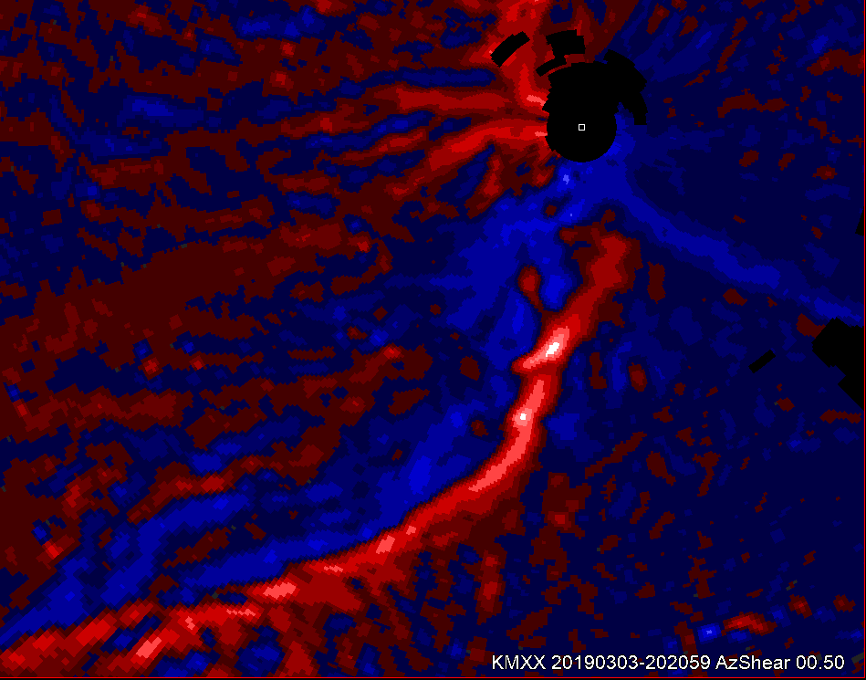
Advancing ahead about 2 min, the two areas become more enhanced in the AzShear product. At the same time the SRM does continue to show a kink in the line with the northern area of interest, and some weak and broad circulation on the southern area of interest.
2021z 0.5 AzShear2021z 0.5 SRM
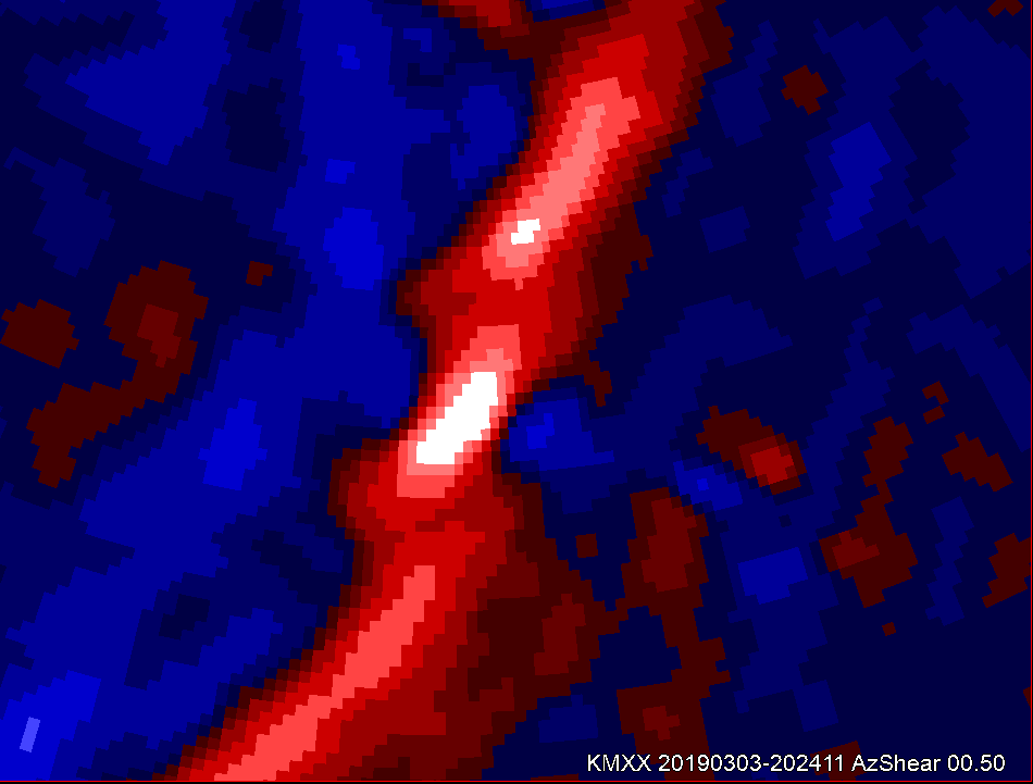
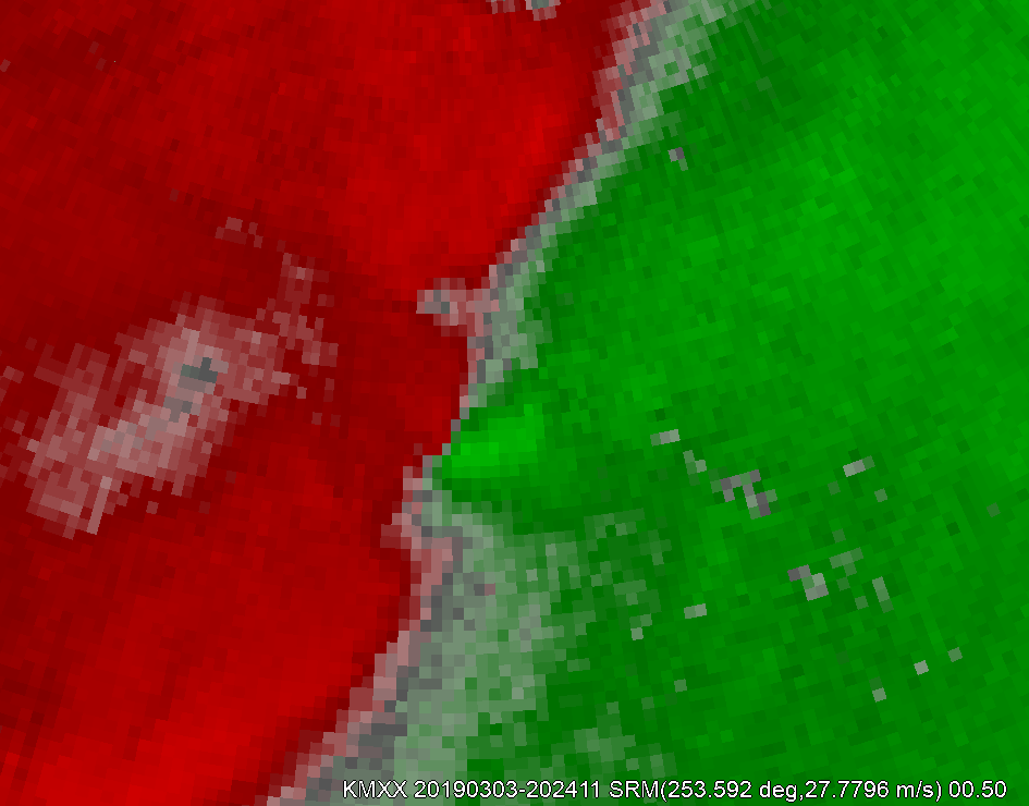
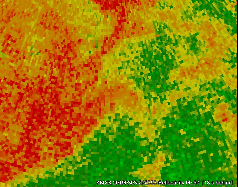
At this time, it is plausible to at least draft a polygon for a tornado warning based on the combination of increasing azimuthal shear and a favorable low-level environment. By 2024z the southern area of interest on the azimuthal shear has become dominant, and there is now a circulation on the 0.5 SRM. The reflectivity also shows high values associated with this circulation. In my opinion, using all three sources of information a tornado warning should be issued at least by this time.
2024z_AzShear2024z 0.5 SRM2024z 0.5 reflectivity
A tornado would develop out of this line shortly thereafter about 2727z and would be rather long-lived. After examining this particular storm in this case I see the single radar azimuthal shear as a ‘confidence builder’ that can be used along-side reflectivity and base velocity or SRM. The azimuthal shear product shows potential in highlighting particular areas of interest, which may provide a few additional minutes of lead-time.
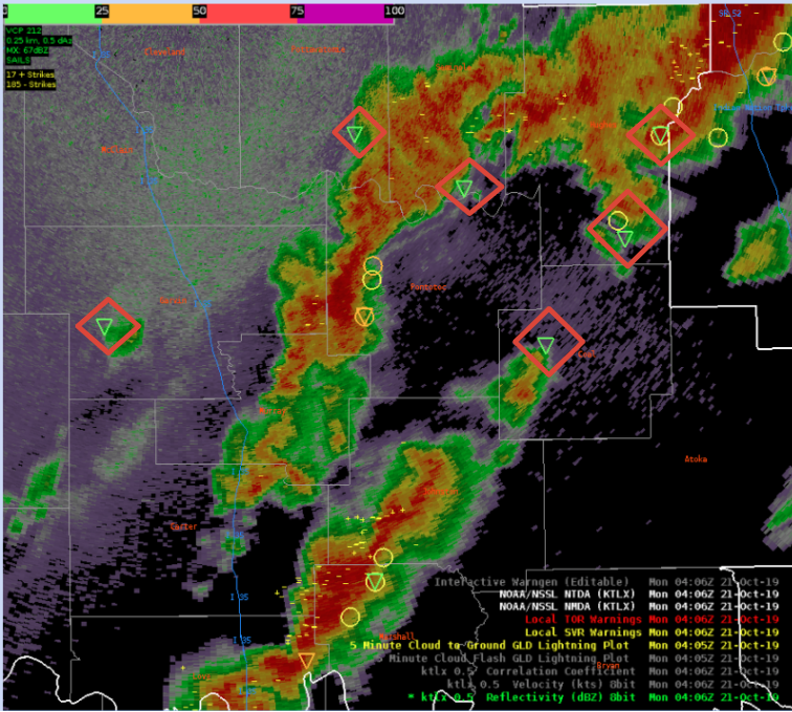
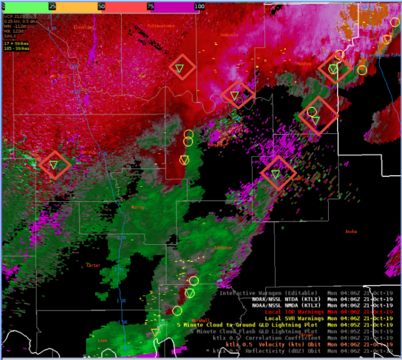
EOX radar depicted two distinct weaker circulations from circulations near the AL/GA border. Both storms had similar presentation on reflectivity and at a broad glance, the relative strength of the circulations were similar. The single radar azimuthal shear depicted that the southern circulation was stronger. One remaining question though is whether the southern circulation was stronger based on proximity to the radar.
Today’s case focuses on the March 3rd Eastern AL/Western GA AzShear Case, with the goal of evaluating the use of single radar AzShear and two merged AzShear products (i.e. 0-2km and 3 0 6km AGL).
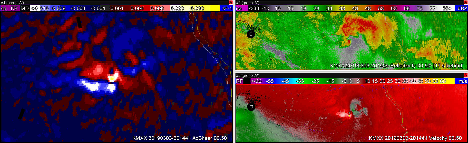
The first tornadic event was a semi-discrete supercell located out ahead of a developing QLCS type storm. Pictured (Left) is the single-radar AzShear product at the 0.5 degree slice, (Top Right) base reflectivity and the 0.5 degree slice, (Bottom Right) in the base velocity at 0.5 degree slice.
The first, more discrete cell, in the event was very noticeable in the single-radar AzShear product, with pretty persistence high values (0.02 to 0.035 S^-1) evident throughout the eventual life-span of the tornado once overlaying the post-event analysis track. It did seem to become slightly more muted as the storm progressed further east (85km from the radar site), although, to its credit, the AzShear product looked more pronounced than the BV product at said magnitude from the radar site. From a warning forecasters point of view, if just using BV, this would become a benefit of the product, however, a quick conversion and/or use of SRM fixed this issue quickly on my end. More on distance…The product, similar to it’s ingested data, did seem to get displaced a bit once the feature progressed over 100km downstream of the radar beam, no longer matching up with the post-event analyzed damage survey track (example below).
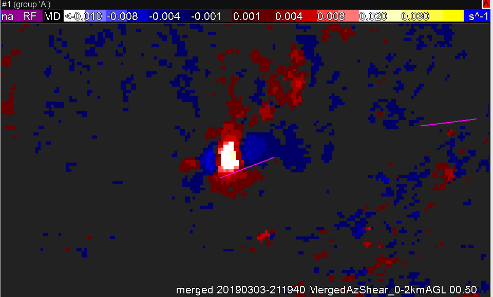
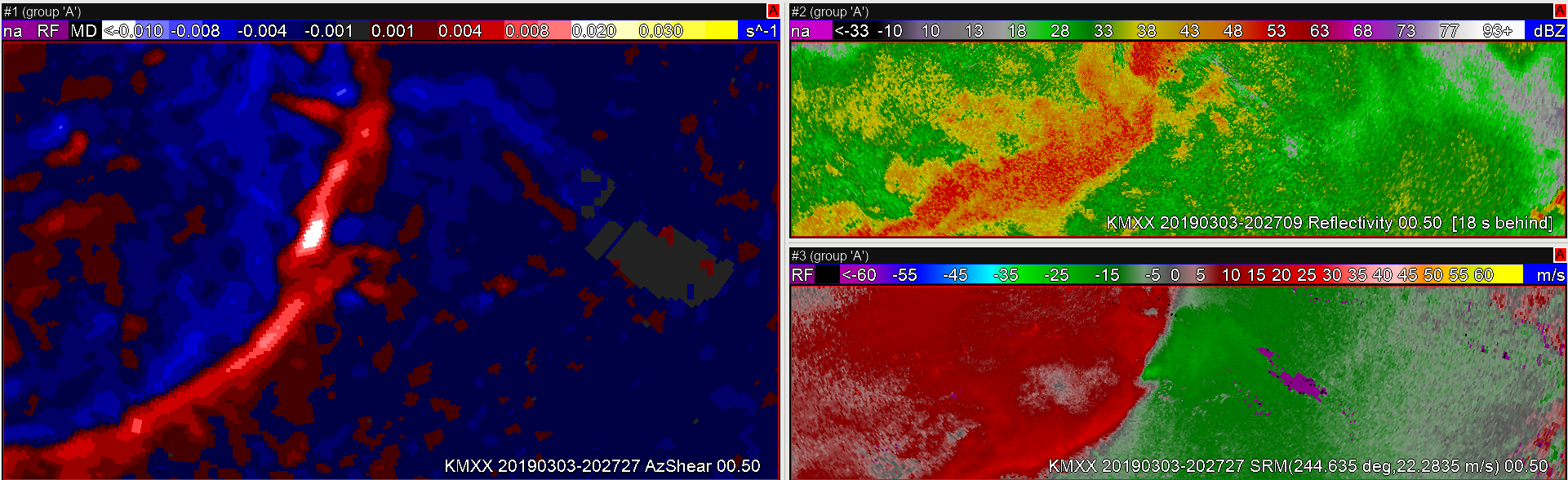
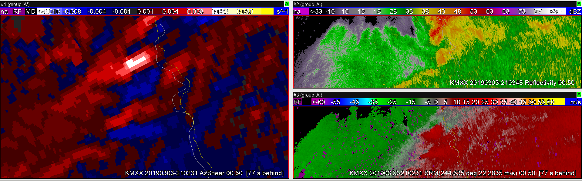
AzShear (0-2km) merged product roughly 143km away from KMXX and 145km from KEOX.The second Tornado event analyzed was a QLCS stlye embedded tornado that formed along the leading edge. Pictured (Left) is the 0.5 degree AzShear product, (Top Right) is the 0.5 degree base reflectivity product, (Bottom Right) is the Storm Relative Motion all from the KMXX radar.
There does seem to be some utility in utilizing the single-radar AzShear product when monitoring for embedded rotation in QLCS style events. In this case, a clear in-flow notch is not clearly evident via reflectivity, which can act as an identifier and/or precursor to a QLCS style tornadic event. Thus, using the AzShear product to monitor the entire bowing line segment became a valuable situational awareness tour, highlighting potential areas of interest ahead of time. It still, however, did not replace velocity’s utility, and I’d still prefer to use BV/SRM to draw any type of warning polygons in order to minimize unnecessary FAR within the eventual warned area.
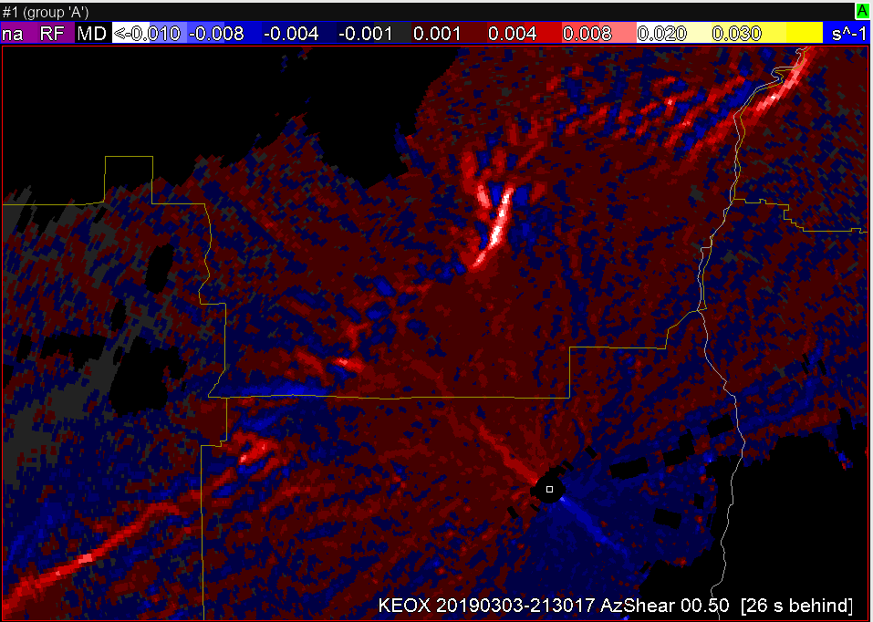
Third area of weak rotation from a semi-discrete cell north of the line. Picture (Left) is the 0.5 degree AzShear product, (Top Right) is the 0.5 degree base reflectivity product, (Bottom Right) is the Storm Relative Motion all from the KMXX radar.
Interestingly, through the analysis process, the AzShear product picked picked up on some weaker rotation from a semi-discrete cell further North of the line, which caused me to investigate the feature further. If just monitoring BV/SRM, this feature likely would have gone unnoticed due to reflectivity/velocity cluttering around the feature. Thus reinforcing the suggestion of utilizing AzShear (All-Tilts) as a situational awareness tool to help trigger areas of interest for the weather radar operator on-shift.
Looking at features further from the radar, AzShear seemed to struggle at depicting some of the weaker features (likely due to the reliance on good velocity data input which also struggled about the same in these scenarios). It did, however, continue to pick up some of the stronger rotational couplets, doing a good job at highlighting those.
Taking a look at both the 0-2km and 0-6km merged products, I am still a bit frustrated by the SAILS induced “skipping” which is apparent. My suggestion here would be to somehow ignore the Sails slices, only producing a new product when all of the 0-2km and/or 0-6km scans are available to do so. This would make for a much cleaner picture… Yes, it would also induce latency issues, but I think the accuracy of what is being displayed would be more useful. The 0-2km and 0-6km merged products also seemed to run a little “hotter,” especially when analyzing the QLCS structure, likely picking up some significant mid-level shear associated with the linear storm-mode of convection/cold pool interaction.
Rapping up a few thoughts…
I think that single-radar AzShear is an excellent product and overall is fairly easy to read as a forecaster (although, not 100% sure of how to fully process the blue/negative colors within operations at this point) . I feel like its best utility lies with situational awareness in operations and in post-storm analysis (i.e. picking out potential damage swaths). Even with some resolution degradation in the 0-2km and 3-6km merged AzShear products, I feel they could also be useful, especially at a regional/national scale where the finer details may not be required/needed. The 0-2km may also be useful in HSLC or Tropical Tornado type environments, where the low to mid-level rotation may be a valuable pre-cursor to short-lived spinups.
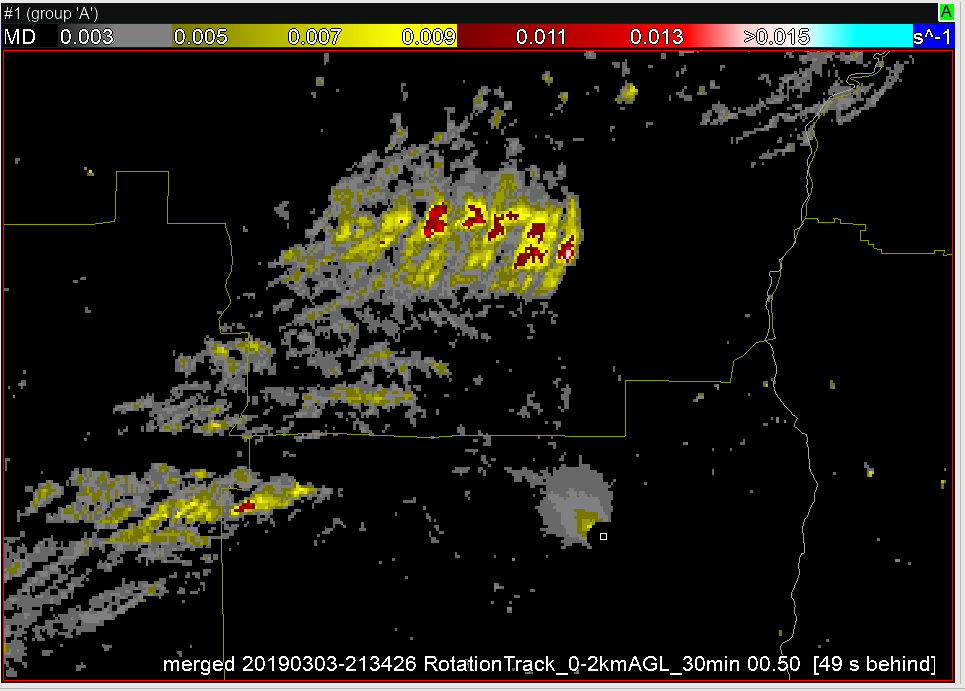
Now that convection has continued to move to the east, I’ve switched to the KEOX radar and, while reflectivity and velocity data show some interesting areas to look at, the AzShear product is guiding my attention to 3 areas, to the west, northwest and north-northwest of radar.
SRM shows a couple areas of possible rotation, but nothing substantial, at least yet. The more notable area is just east of the red/white marker. The 30-min 0-2km Rotation Track shows the recent AzShear history of the 3 cells. My most immediate concern for a developing tornado is the northern-most cell, about to pass north of the radar.
While tracking tornadoes in the beginning of this outbreak, a squall line of heavy convection has been present farther to the west. While notable in reflectivity, the AzShear & Merged AzShear products have been very useful for a quick-glance situational awareness of areas of higher concern for tornadoes. In areas that are equally far from multiple radars, forecasters would have to compare multiple velocity products to adequately interrogate areas along the squall line for rotation, including adjusting for SRM. The AzShear products readily and quickly highlight those areas that should be investigated further.
A secondary tornado near the KMXX radar has developed near the track of the larger tornado earlier. While this one doesn’t look as large, it was more apparent in the AzShear product, and after looking at the SRM of that area, my confidence in the presence of a secondary tornado was increased.

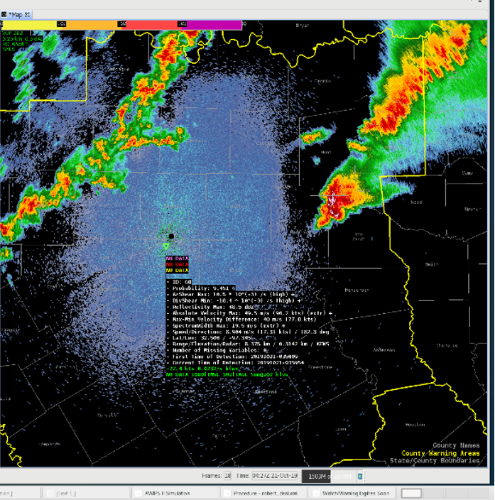

 SRM shows a couple areas of possible rotation, but nothing substantial, at least yet. The more notable area is just east of the red/white marker.
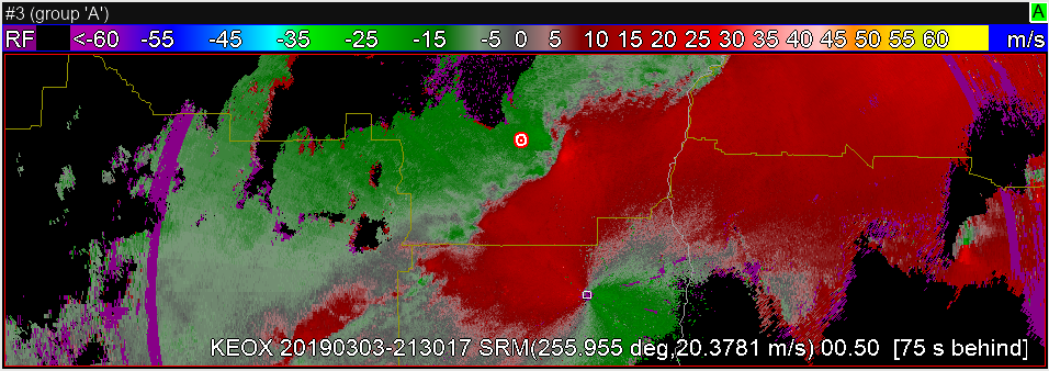 The 30-min 0-2km Rotation Track shows the recent AzShear history of the 3 cells. My most immediate concern for a developing tornado is the northern-most cell, about to pass north of the radar.