Compared several NUCAPS soundings across the pass to determine usefulness of the modified versus unmodified data. In each example, the modified is on the left and unmodified is on the right. 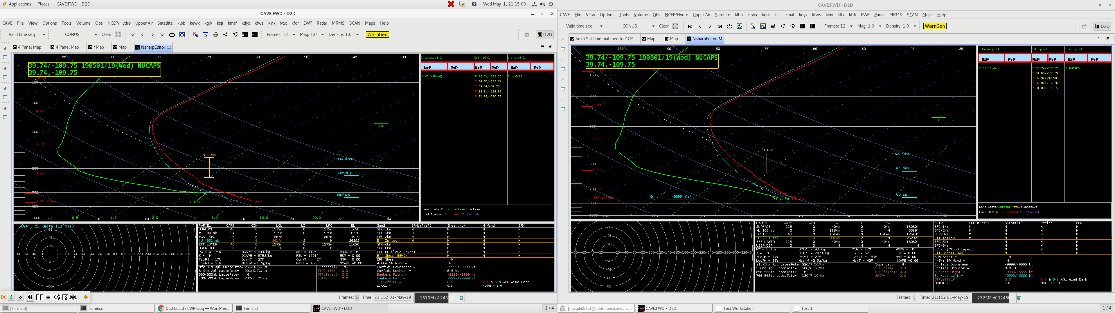 The example above was quite dramatic. This was an example over my home CWA. The modified sounding on the left captures the true mixing likely taking place over the point to the north of GJT airport, the right has a vastly different temp/td profile. This would have dramatic impacts for fire weather and smoke dispersal forecasting in remote areas, which is a critical task provided by our office.
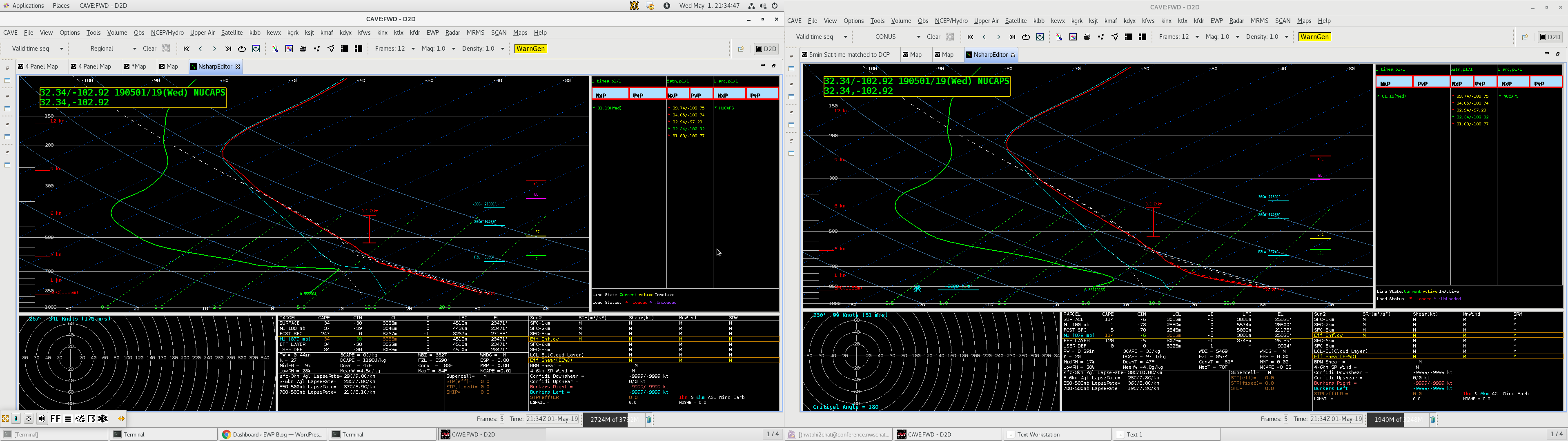
Moving south, the above example is well west of the dry line in New Mexico. Unmodified does capture a well mixed BL, but the modified shows this feature more pronounced. Clear skies were present throughout the entire day leading up to this point. 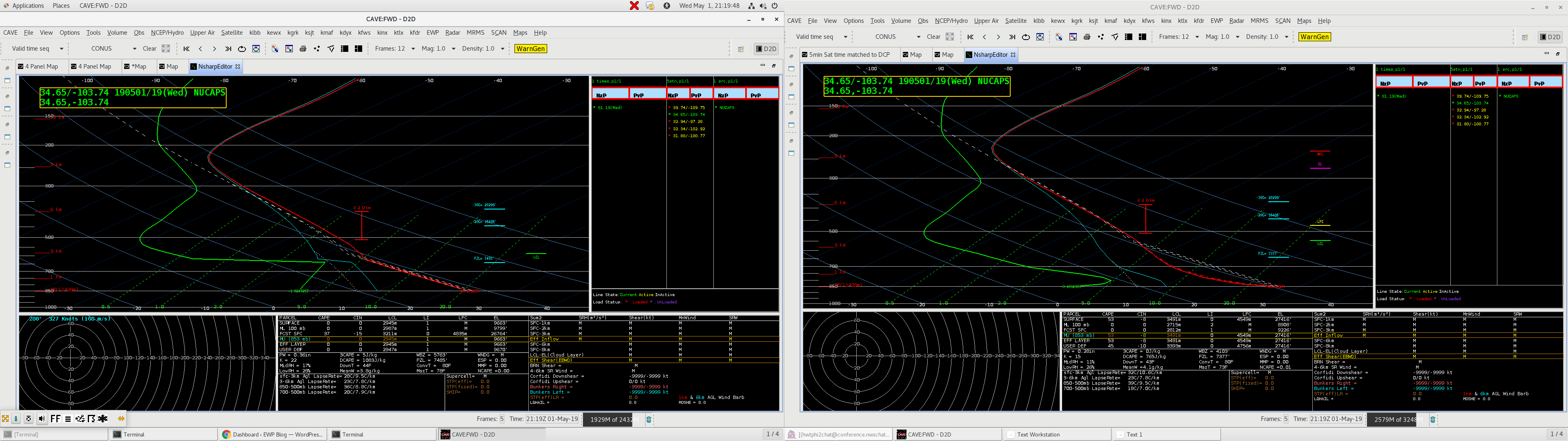
This sounding above was from just slightly west of the dryline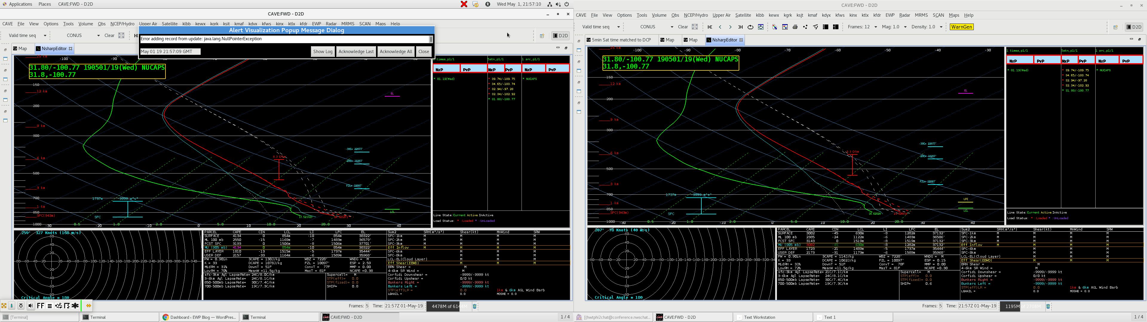
This sounding was a bit farther east, in the vicinity of increasing moisture east of the dry line. 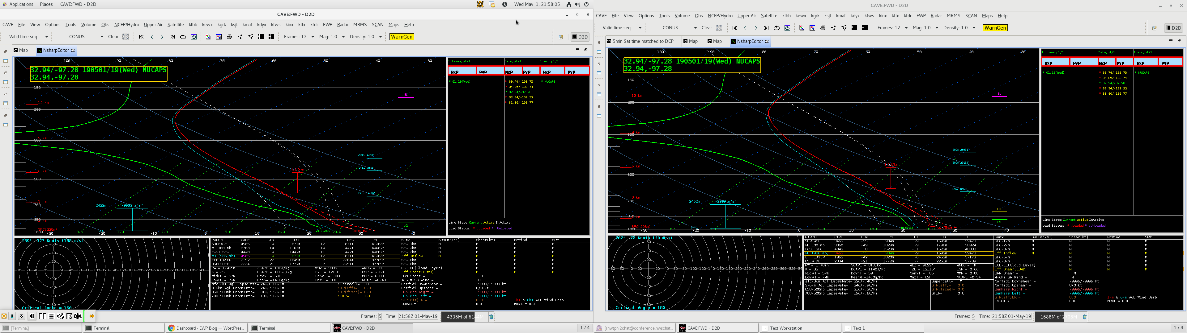 Finally this sounding was from well east of the dry line in the vicinity of intense thunderstorm development. Note the odd structure in the lower levels in the unmodified sounding on the left, these strange temp readings are eliminated in the modified sounding which greatly changes the CAPE values and other parameters.
-Dusty Davis


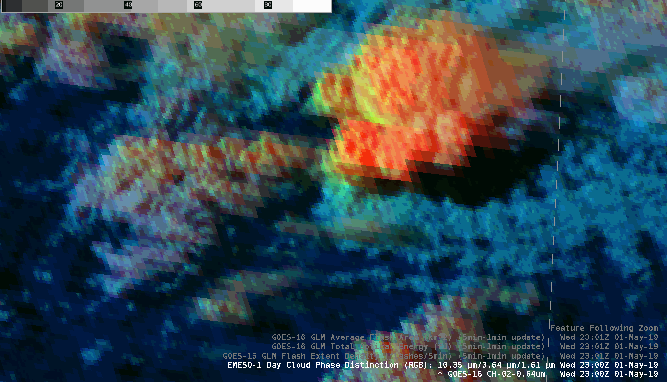 Day cloud phase 1 min of the same storm. Does not get much better than this!
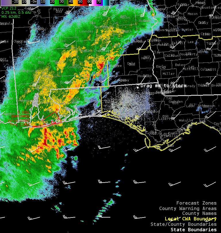
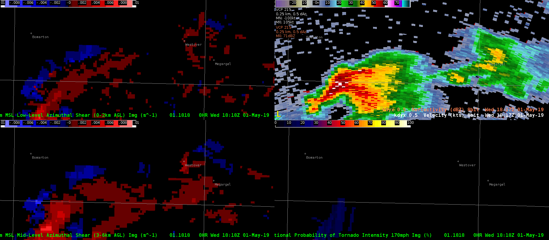 This example shows a supercell early in its lifecycle. The cell split and produced a tornado near the county boundary in the loop. In past examples, the AzShear product featured numerous time matching issues from multiple radar site’s data. In this case, cell motion was slower, possibly contributing to the less cluttered and more useful AzShear data.
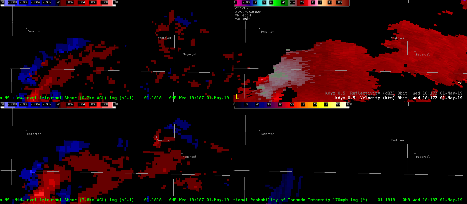 Same loop as above this time with V data. AzShear did anticipate possible tornadogenesis with upticks in values several scans before the tornado. On the bottom left, CPTI is shown for the 175mph threshold. Values for this threshold remained low.
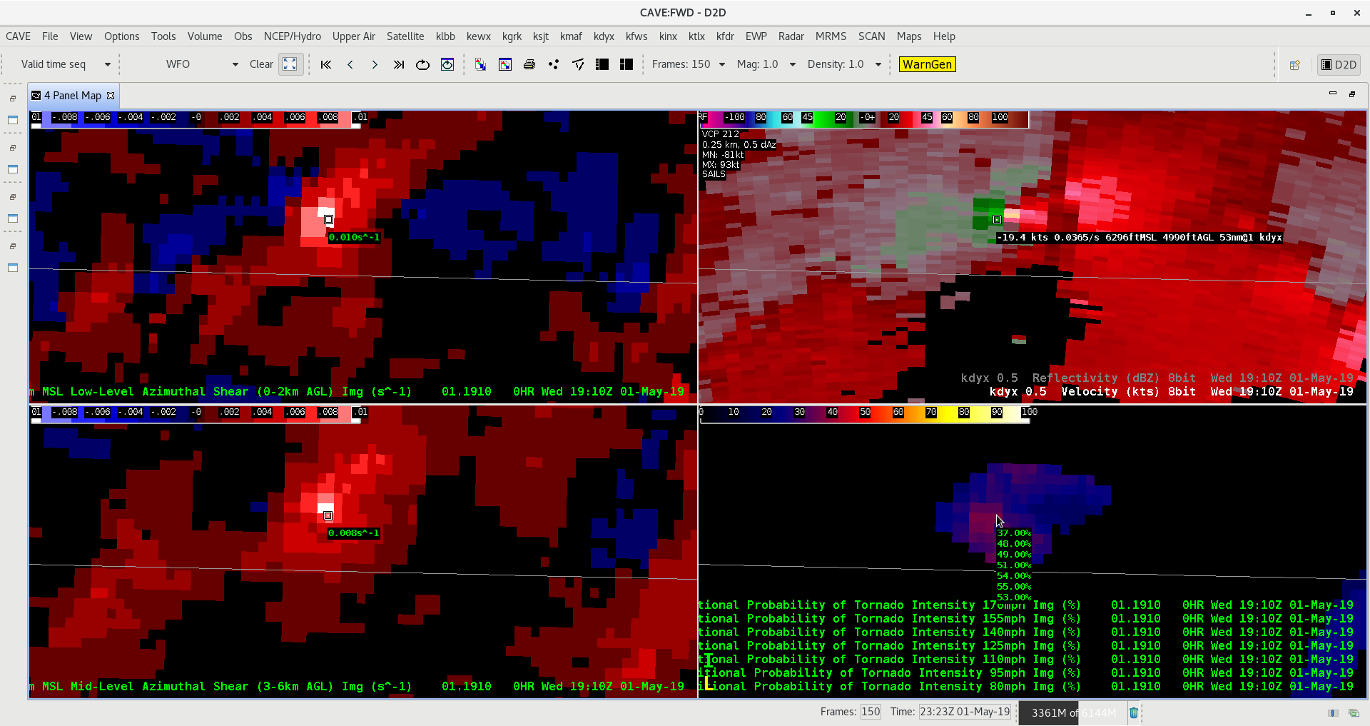 Values readout for the CPTI product on the bottom left at the time of strongest V couplet. Values ranged from 37 for 175 up to 48 for 155, but then did not show much of a change once again between 155mph down to 95 mph. In this range, the probability only rose from 48 to 55 percent between 155 to 95. Then, strangely enough, the prob dropped back down to 53 percent for 80mph.
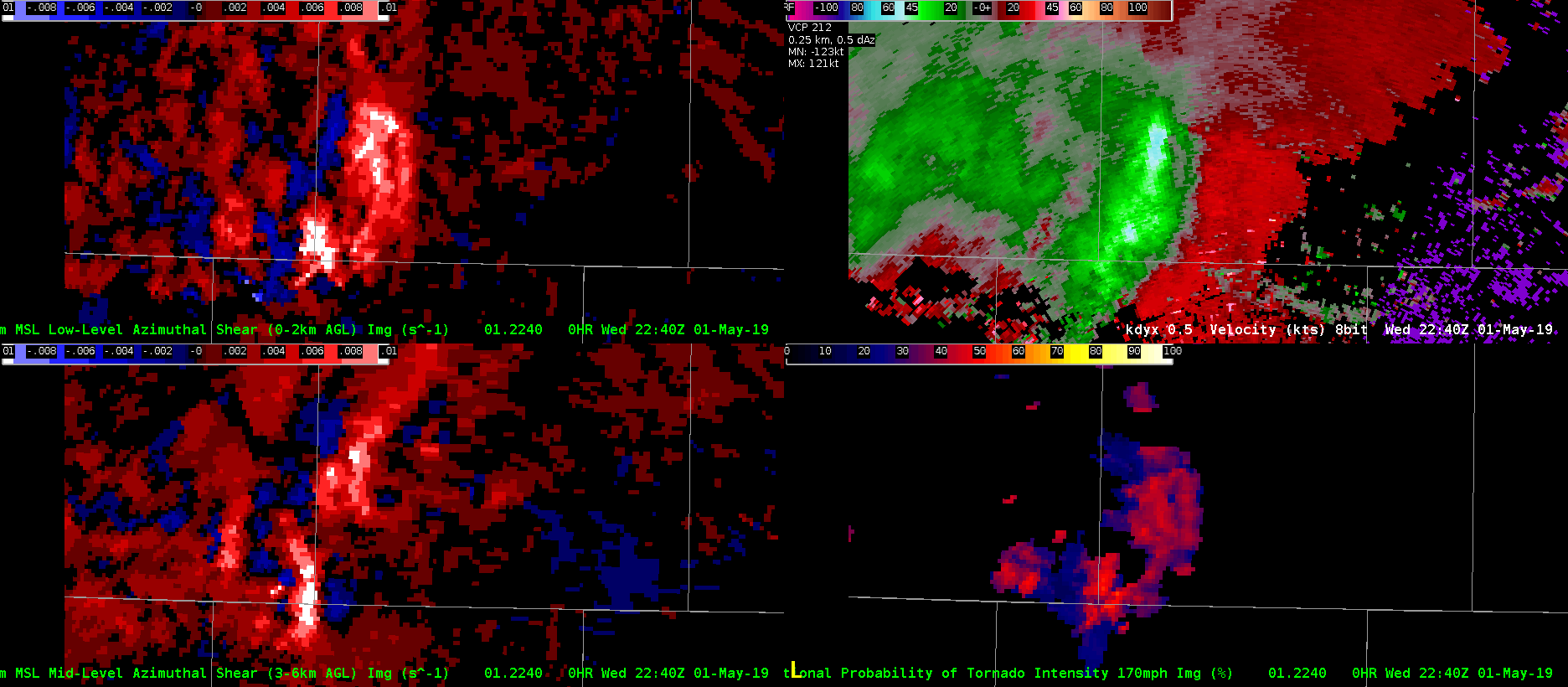 This later example shows another case of multiple sampling issues with AzShear
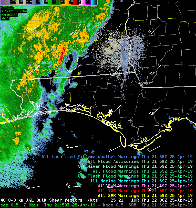
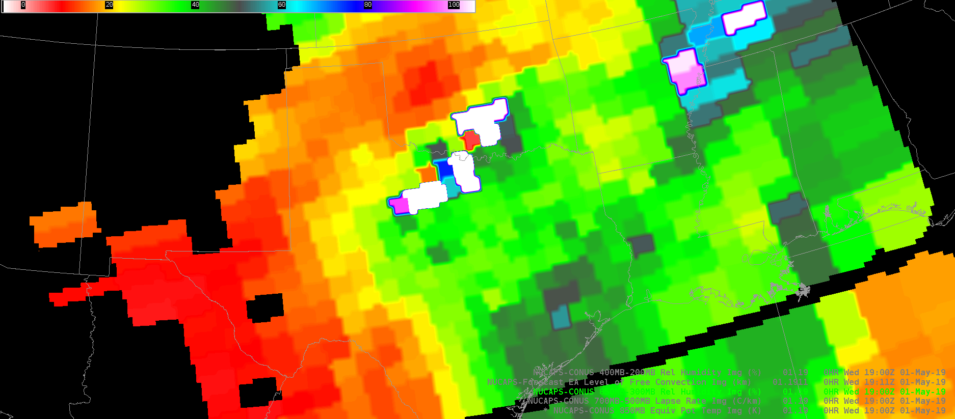
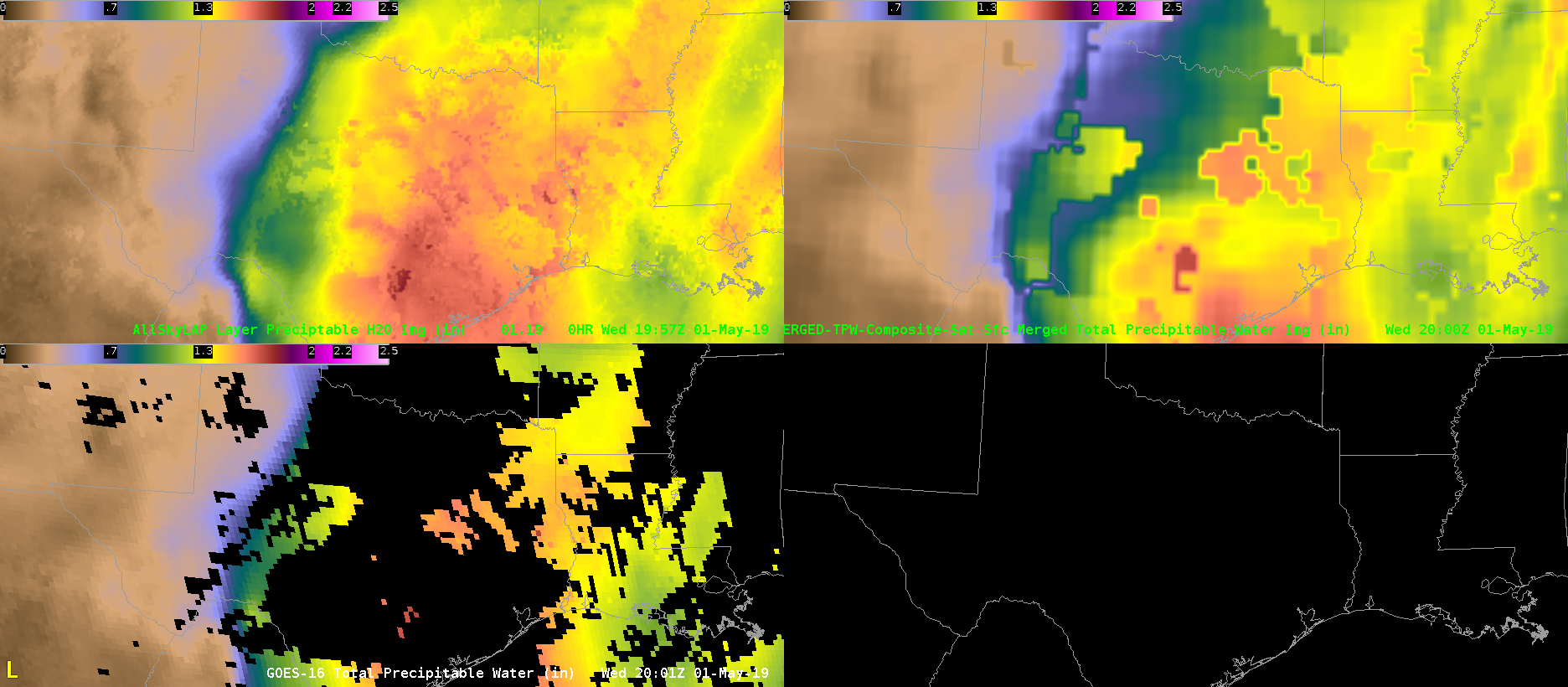
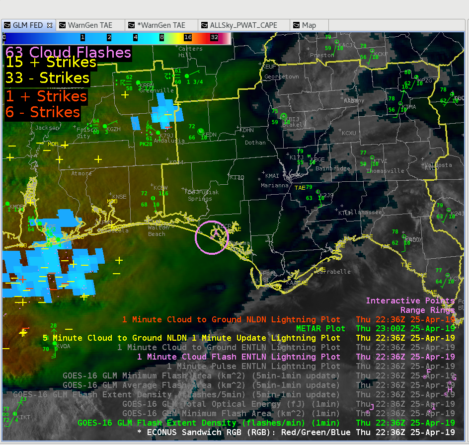
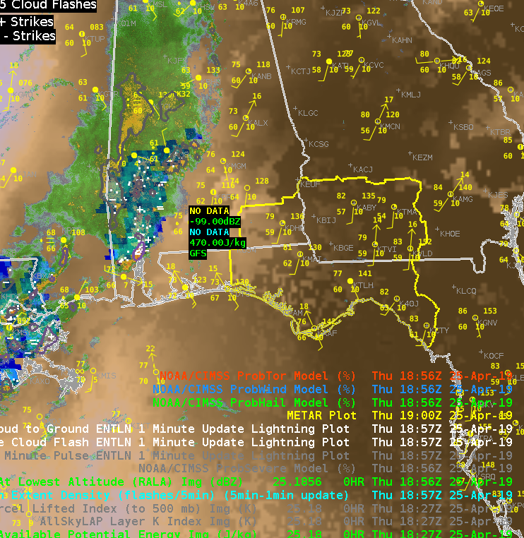
 The layered TPW product shows a tongue of moisture approaching the region. It looks like a line of towering cumulus developed over the Gulf of Mexico as this moisture interacted with the convergence line.
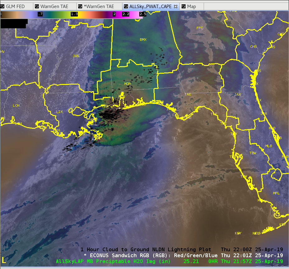 Sandor Clegane
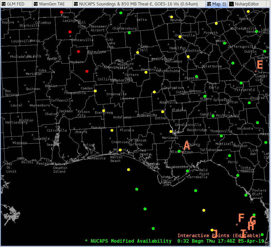
 An 8 hour loop shows how the instability has built and gives more confidence that instability will continue to build ahead of the storms to our west.
 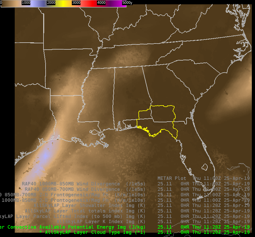 We did feel that LAPS CAPE seemed a bit underdone given the intensity of the downstream of the convection, so we took a look at the latest NUCAPS retrievals. We examined the point in the extreme SE of our CWA.
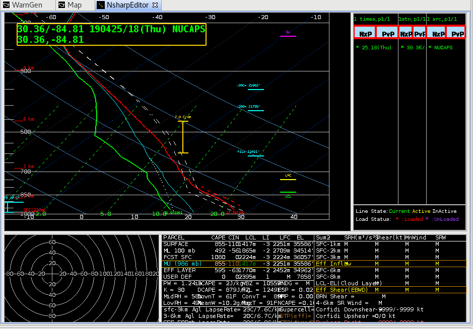
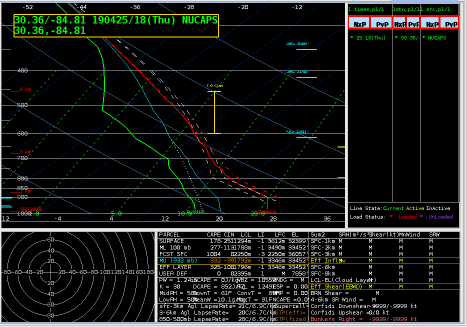
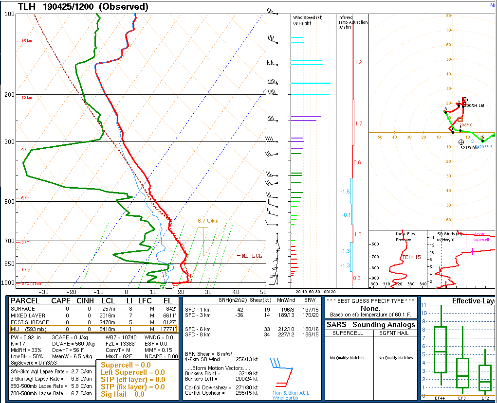
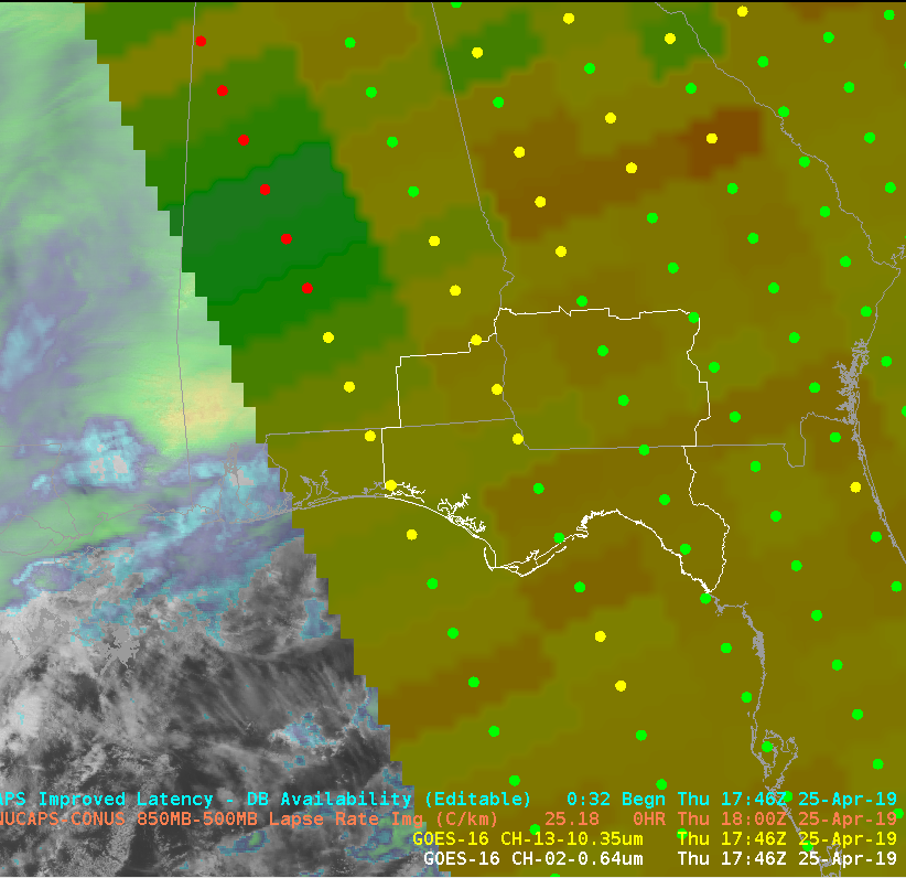 The boundary layer on the unadjusted sounding required some adjustment to match the nearest obs, but overall, seemed to capture the general profile well. I was initially skeptical about the warm nose just above 700mb, but a similar feature was evident on the 12z sounding from TAE. This feature may have an impact on storm intensity and potential hazards, and it would be particularly helpful to see how this feature changes over time.
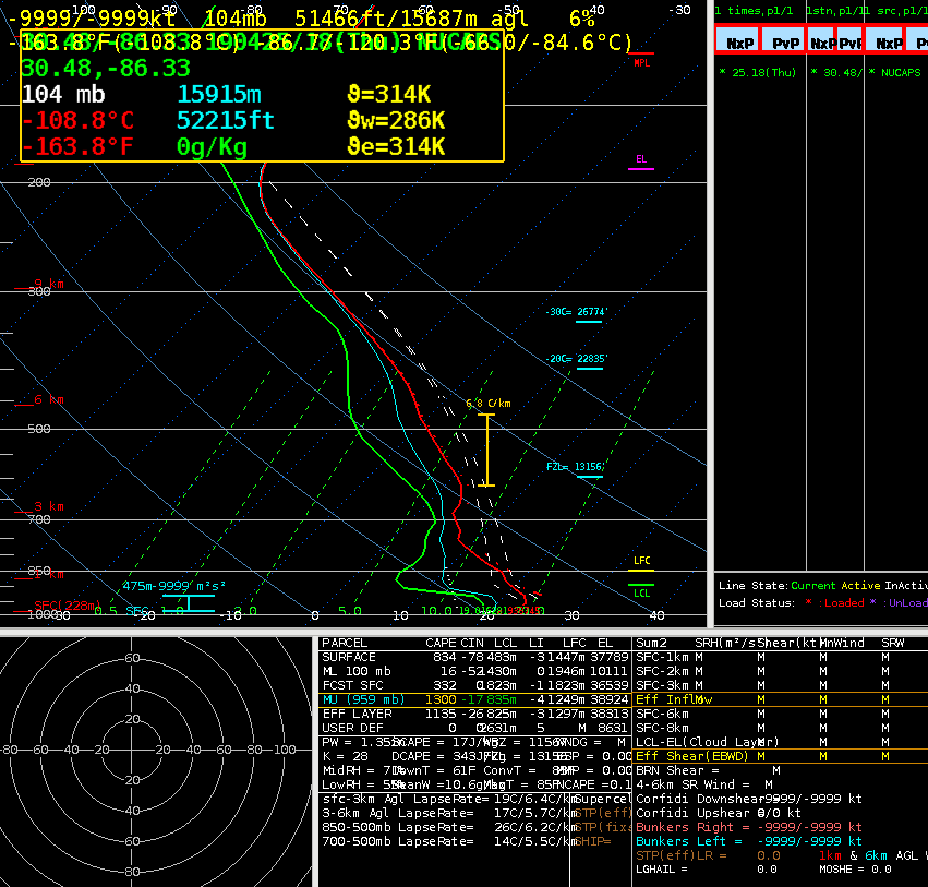
 Sandor Clegane