Daily Summary – 24 May 2010

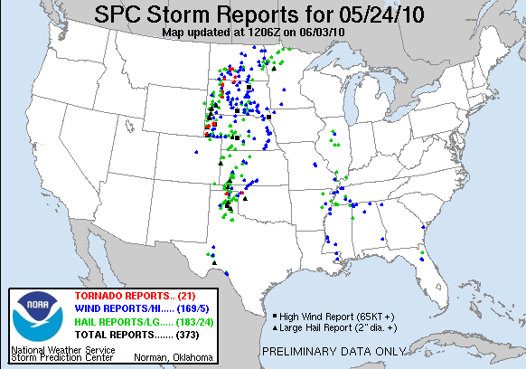
Although there was considerable severe weather today across the High Plains, today was primarily a training and orientation day.  Different from last week, the forecasters received their GOES-R training first, and then did a short IOP to look for convective initiation signals.  After dinner, we picked up with the MRMS training and a “practice” IOP over the Norman area with only one experimental SVR warning issued.

The first taste of GOES-R CI products was had over the DDC and AMA forecast areas.  There was discussion about whether the CI product should be made more liberal in its detections, but the result might be more false alarms.  If the product were probabilistic, that could be viewed completely differently, with corresponding false-alarm rates for corresponding uncertainties.  There is more information posted at the GOES-R HWT Blog.

Greg Stumpf (EWP2010 Operations Coordinator)

Tags: None

Forecaster Thoughts – David Blanchard (2010 Week 6 – MRMS/GOES-R)

[Ed. – David’s post is taken from his daily journal notes during his week at the HWT.]

2010_0517

I’m in Norman, Oklahoma, for EWP2010 to forecast severe weather scenarios using new technologies and software. This should be both exciting and challenging and I’m looking forward to the experience.

Much of the day was spent with an overview of the various products we will be using and testing and there is much that is new and potentially very useful. By early evening we switched into forecast mode and loaded up real-time data of the ongoing convection and severe weather in southwest Texas and southeast New Mexico. Not surprisingly, there were a few software glitches but there always are with these type of programs and we just worked our way through it. Eventually we were able to view the multi-radar data fields and the new satellite tools. These included convective initiation products and overshooting convective cloud tops. Because these are new tools that we have not used before, it takes some time to learn how to use them and how they can be used to improve severe weather warnings.

2010_0518

We started with a debriefing of yesterdays events over the southern High Plains. Next we briefed on todays expected weather which should include supercells with tornadoes possible over the southern and central High Plains.

We received a brief overview of some of the new satellite products including the simulated satellite data generated from model output. It uses NSSL 4km WRF data to simulate all IR bands and produces results that are very similar to true radar data. It is, however, very compute intensive and requires many hours to generate. It’s unlikely that we will see this product on any operational workstation in the near future.

After the EFP weather briefing, we began forecasting operations for the day. Our group of four broke into 2 groups of two with our group forecasting for AMA and the other for PUB. Within a short time, we had convective initiation but were unable to use the satellite CI products — or any others — because of excess cirrus cloud obscuring the low cloud. We switched to MRMS products and began the forecast. These new products are a challenge to use at first — as with any new product — but have great potential value. It requires that we load and these tools alongside the more conventional tools as we prepare our warnings.

There are simply too many products to attempt to use and view all.  One needs to judiciously choose a few and work with these during the forecast and warning session. To select too many will result in information overload. I suspect that the products that I selected today and that worked for me today may not be the same on another event. For today, I found the MESH and ROTATIONAL products to be useful as well as the REFLECTIVITY -20C for warning on large hail and tornadoes.

2010_0519

The debriefing today included comparisons between the warnings we issued and those issued by the NWS offices. Our team was warning for AMA and the other team was warning for PUX. There were only a few supercells and these quickly became severe and then tornadic so that warning was fairly easy. I’m not sure that any conclusions can be drawn from this event since we were competing against forecasters familiar with the area and consequently our warnings were usually a few minutes behind theirs in issuance time.

Today poses a Moderate to High Risk across portions of the central Plains and both teams will be forecasting for the OUN warning area. We sectorized by storms as necessary. The strongest storms of the day were generally north of the I-40 corridor and the other team handled most of these. We did warn on one storm in that area but our warning was almost 30 minutes later than that issued by the WFO and I believe ours was more timely. MRMS parameters suggested that this storm was not severe and not tornadic when initially warned. It’s possible that their upgrade to a warning was predicated upon the evolution of an earlier storm that quickly became tornadic. All or most of the storms in this area eventually became tornadic and VORTEX2 was operating in this area which allowed us to receive timely reports of large hail and tornadoes.

We warned on a storm that began near Lawton then moved towards Chickasha and eventually moved across south Norman. It was very slow to evolve and we delayed warnings until MRMS and base state data convinced us that the storm had finally evolved into a severe storm. First warnings were SVR, then extended, then finally TOR, extended, then dropped back to SVR. No tornadoes were reported by experienced chasers and spotters but large hail was reported 3S of NWC. I think holding back on the warning was an improvemnt on FAR for individual counties and cities early in the life cycle of the storm.

2010_0520

With the front now stalled across Texas we focus on that section of the country using KFTW as a localization. Severe storms form on the front and we warn on them using the new radar products. Not too different from the previous days. But there is one interesting feature and that is an outflow boundary and fine line moving westward. The AzShear and RotationTracks products both show this feature well and it could serve as an initition point for convection later in the afternoon. By the time we break, however, it has not yet done so.

In the evening we switch to KHSV so that we can use the pseudo-GLM (global lightning mapper). These are tools that we have not yet used and it maps all lightning channels including CG, CC, and IC.  The most interesting thing we notice is that there is substantial lightning being detected in the trailing stratiform region. The echo line is oriented north-south and during the evening a few low reflectivity notches develop on the rearward side followed by very strong winds on the leading edge of convection. It appears that rear inflow jets (RIJ) are developing under the mesoscale anvil. Reminds me of some Pre-STORM events.

2010_0521

Today we discuss and debrief on all the weeks activities. There is general consensus that the radar products are good tools and become more useful with use. We’re not yet certain of the value of the satellite products since they aren’t telling us much more that we can see with other products but it may be that there will be events in which they outperform the radar. So, other groups may see some value that we didn’t get to experience.

David Blanchard (Lead Forecaster, NWS Flagstaff AZ – 2010 Week 6 Evaluator)

Tags: None

Forecaster Thoughts – Darren Van Cleave (2010 Week 6 – MRMS/GOES-R)

I was privileged to be invited as a participant in the GOES-R/MRMS portion of the 2010 Experimental Warning Program, week 6 (mid-May). We had a fairly busy week with tornadoes and other severe weather occurring in the Amarillo and Pueblo WFO’s along with the hometown Norman WFO (the Amarillo and Norman experiment days happened to feature Vortex II providing live on-site data of the tornadoes). Going into the program, I was expecting to be more interested in the GOES-R side of the experiment; however, as the week progressed, it became apparent that the MRMS system was a more promising innovation at the present time. The GOES-R tools proved to be difficult to fully analyze because their namesake satellite with its quicker routine scan intervals had yet to be launched. GOES product issues and other technical glitches aside, the week was successful and I very much enjoyed my stay. Here is a brief collection of my thoughts on each of the experimental tools:

MRMS

This system was by far the most impressive tool premiered during the week. The technology has been around for several years, but this was the first I had heard of it. The concept is simple: avoid radar-data overload and simplify warning operations by combining ancillary radars (TDWR, CASA) and neighboring WFO radars into one streamlined product. This provides an excellent way to analyze multiple radars at the same time, provided a WFO has overlapping radar coverage. Traditional cell diagnostics such as POSH (probability of severe hail) can then be constructed from this base data, along with new products that take advantage of the isothermal plotting capabilities (i.e. reflectivity plotted on an isothermal surface).

One readily apparent drawback of the MRMS system we previewed was the sheer number of different analyses available. It was nearly impossible in the time allotted to adequately test or even plot all of the fifty or so products listed for us. I settled into using about 5 of the products and was able to try about 15 over the course of the experiment. Continued experimentation (such as the EWP program) should help whittle this down to a more manageable list when MRMS products are made available to WFO’s.

I found several of the MRMS products to be very helpful in forecasting severe hail. The traditional MESH and POSH algorithms available through MRMS performed well, both in highlighting the onset of severe hail and following its track. Curiously, the bias-corrected MESH performed the worst, being off-track by an appreciable margin for many of the storms. Reflectivity was available on isothermal surfaces; the reflectivity at the 0C and -20C surfaces in particular were handy for issuing warnings for severe hail. For tornado warnings, the 0-1 km azimuthal shear and 30-minute rotation tracks both provided valuable information of low-level rotation and tornadic history. I found that the rotation track tool gave a good first guess for shaping the path of the warning polygon in situations where the track forecast was more difficult.

One drawback of relying extensively on MRMS products is the slight data latency of approximately 2 minutes. Warning decisions which require up-to-the-minute radar data would be hampered by waiting on the next available data, which might be around 2 minutes late in comparison to the WFO radar itself. I suppose in this regard, MRMS data is probably more useful in tracking and updating existing warnings than in issuing new ones.  [Note:  The latency is a result of the experimental nature of the AWIPS set up.  An operational system, and hopefully our future EWP system, should have reduced latency.  -Stumpf]

Additionally, I suspect that WFO’s which lack overlapping radar coverage probably wouldn’t experience the full benefit of the MRMS system. In particular, it seems that the low-level shear products will suffer since some of required elevation scans might not be available at greater distances from the radar.  [Note:  The 0-2 km AGL azimuthal shear and rotation tracks products always use data from the 0.5 degree elevation scan even if it is above the 0-2 km AGL layer.  -Stumpf]

GOES Overshooting Top/Enhanced-V Algorithm & U. Wisc Convective Initiation Product

We were provided with an overshooting top algorithm which located the colder clouds of an overshooting cloud top along with the associated “enhanced-v” signature. We were also given a convective initiation product which provided four discrete values indicating the likelihood of convection over a given area. I’ve lumped the two tools together in this review because it was difficult to gauge the usefulness of either in warning operations, due to the current GOES scan interval of 15 minutes. New convection and even overshoots were often easily diagnosed by radar within the time required for a new scan. To make matters worse, the scheduled afternoon calibration and full disc scan created occasional 30 minute gaps in the imagery, further hampering the tools. Needless to say, these wide gaps in the imagery updates rendered the products difficult to evaluate. However, when the GOES-R satellite is launched, the algorithms will receive 5-minute imagery at all times of the day (up to 30-second imagery with rapid scan mode), which should greatly enhance the utility of these products. Until that time, I would say the jury is still out.

GOES-R Geostationary Lightning Mapper (GLM)

The GLM was one tool which was not actually available for the EWP, and was instead mimicked with other data to give a rough estimate of how it might behave. In the future, GLM data will give forecasters a unique look at storm activity by providing the total flash rate via a visible channel on the GOES-R satellite. This provides much more information than the current cloud-to-ground lightning data provided by Vaisala (NLDN), not to mention the benefits of public-use lightning data instead of Vaisala’s proprietary data. As previously mentioned, for the purposes of our experiment it was intended to use a pseudo-GLM (GLM output being imitated by real total lightning data) in warning operations. Unfortunately, this also required the operations to take place in locations which featured the total (3D) lightning-mapping instrumentation, which was rarely the case for our week of operations. On the one day we did have pseudo-GLM data available, the storms were sub-severe. Other weeks of operation probably worked better for analyzing the GLM, so I would defer to participants of those weeks for more information on this tool.

Darren Van Cleave (Meteorologist Intern, NWS Rapid City SD – 2010 Week 6 Evaluator)

I was privileged to be invited as a participant in the GOES-R/MRMS portion of the 2010 Experimental Warning Program, week 6 (mid-May). We had a fairly busy week with tornadoes and other severe weather occurring in the Amarillo and Pueblo WFO’s along with the hometown Norman WFO (the Amarillo and Norman experiment days happened to feature Vortex II providing live on-site data of the tornadoes). Going into the program, I was expecting to be more interested in the GOES-R side of the experiment; however, as the week progressed, it became apparent that the MRMS system was a more promising innovation at the present time. The GOES-R tools proved to be difficult to fully analyze because their namesake satellite with its quicker routine scan intervals had yet to be launched. GOES product issues and other technical glitches aside, the week was successful and I very much enjoyed my stay. Here is a brief collection of my thoughts on each of the experimental tools:

MRMS

This system was by far the most impressive tool premiered during the week. The technology has been around for several years, but this was the first I had heard of it. The concept is simple: avoid radar-data overload and simplify warning operations by combining ancillary radars (TDWR, CASA) and neighboring WFO radars into one streamlined product. This provides an excellent way to analyze multiple radars at the same time, provided a WFO has overlapping radar coverage. Traditional cell diagnostics such as POSH (probability of severe hail) can then be constructed from this base data, along with new products that take advantage of the isothermal plotting capabilities (i.e. reflectivity plotted on an isothermal surface).

One readily apparent drawback of the MRMS system we previewed was the sheer number of different analyses available. It was nearly impossible in the time allotted to adequately test or even plot all of the fifty or so products listed for us. I settled into using about 5 of the products and was able to try about 15 over the course of the experiment. Continued experimentation (such as the EWP program) should help whittle this down to a more manageable list when MRMS products are made available to WFO’s.

I found several of the MRMS products to be very helpful in forecasting severe hail. The traditional MESH and POSH algorithms available through MRMS performed well, both in highlighting the onset of severe hail and following its track. Curiously, the bias-corrected MESH performed the worst, being off-track by an appreciable margin for many of the storms. Reflectivity was available on isothermal surfaces; the reflectivity at the 0C and -20C surfaces in particular were handy for issuing warnings for severe hail. For tornado warnings, the 0-1 km azimuthal shear and 30-minute rotation tracks both provided valuable information of low-level rotation and tornadic history. I found that the rotation track tool gave a good first guess for shaping the path of the warning polygon in situations where the track forecast was more difficult.

One drawback of relying extensively on MRMS products is the slight data latency of approximately 2 minutes. Warning decisions which require up-to-the-minute radar data would be hampered by waiting on the next available data, which might be around 2 minutes late in comparison to the WFO radar itself. I suppose in this regard, MRMS data is probably more useful in tracking and updating existing warnings than in issuing new ones.

Additionally, I suspect that WFO’s which lack overlapping radar coverage probably wouldn’t experience the full benefit of the MRMS system. In particular, it seems that the low-level shear products will suffer since some of required elevation scans might not be available at greater distances from the radar.

GOES Overshooting Top/Enhanced-V Algorithm & UWisc Convective Initiation Product

We were provided with an overshooting top algorithm which located the colder clouds of an overshooting cloud top along with the associated “enhanced-v” signature. We were also given a convective initiation product which provided four discrete values indicating the likelihood of convection over a given area. I’ve lumped the two tools together in this review because it was difficult to gauge the usefulness of either in warning operations, due to the current GOES scan interval of 15 minutes. New convection and even overshoots were often easily diagnosed by radar within the time required for a new scan. To make matters worse, the scheduled afternoon calibration and full disc scan created occasional 30 minute gaps in the imagery, further hampering the tools. Needless to say, these wide gaps in the imagery updates rendered the products difficult to evaluate. However, when the GOES-R satellite is launched, the algorithms will receive 5-minute imagery at all times of the day (up to 30-second imagery with rapid scan mode), which should greatly enhance the utility of these products. Until that time, I would say the jury is still out.

GOES Lightning Mapper

The GLM (GOES Lightning Mapper) was one tool which was not actually available for the EWP, and was instead mimicked with other data to give a rough estimate of how it might behave. In the future, GLM data will give forecasters a unique look at storm activity by providing the total flash rate via a visible channel on the GOES-R satellite. This provides much more information than the current cloud-to-ground lightning data provided by Vaisala, not to mention the benefits of public-use lightning data instead of Vaisala’s proprietary data. As previously mentioned, for the purposes of our experiment it was intended to use a pseudo-GLM (GLM output being imitated by real lightning data) in warning operations. Unfortunately, this also required the operations to take place in locations which featured the lightning-mapping instrumentation, which was rarely the case for our week of operations. On the one day we did have pseudo-GLM data available, the storms were sub-severe. Other weeks of operation probably worked better for analyzing the GLM, so I would defer to participants of those weeks for more information on this tool.

Tags: None

Week 6 EWP Summary: 17-21 May 2010

SUMMARY:

Week #6 of EWP2010 wrapped up the first week of MRMS and GOES-R experimentation.  This week included another Central Oklahoma High Risk adventure, however our Lightning Mapping Array was down for repairs.  During this week, NSSL and the GOES-R program hosted the following National Weather Service participants:  David Blanchard (Flagstaff, AZ), Matt Kramar (Sterling, VA), Ken Pomeroy (Western Region HQ, Salt Lake City, UT), and Darren Van Cleave (Rapid City, SD) .

REAL-TIME EVENT OVERVIEW:

17 May: “Practice” IOP for some severe storms in Midland’s CWA.

18 May: Isolated TX Panhandle tornadic supercell that V2 followed, plus other supercells in Pueblo’s CWA.

19 May: First full day (6 hour) IOP, with Central OK High Risk tornadic supercells.

20 May: Early IOP in Fort Worth’s area, later IOP exploiting the Alabama LMA.

MRMS:

Forecasters felt that it was more efficient to issue the warnings using the MRMS data versus having to check storms out for three different radars.  Was easier to follow estimated hail size in SVSs.  And the tracks products were very good at aligning the polygons.

However, we learned early on this week that the initial load time for the experimental MRMS products was excruciatingly slow.  Turned out to be a product of many issues on the system, including a bad network connection on the motherboard, which was replaced with a 1 Gbit network PCI card.  But the issues intermittently persisted.  We also moved the location of the MRMS data storage to the main server, and that helped but didn’t completely solve the problem.  Looking beyond this issue, once the products were initially loaded via procedures or otherwise, they usually updated automatically with no delays.  [NOTE: It turned out that we weren’t able to find one of the major sources of the problem until the final week of EWP2010.]

One of the advantages of a MRMS system is to better diagnose storms that go directly over a single radar, into their cone-of-silence.  This happened several times during the week.  For the hail diagnosis parameters, the MRMS system did a great job of filling in the cones-of-silence from adjacent radars.  However, for the rotation tracks/azimuthal shear products, it was more problematic.  The reason was that the az shear products have a limitation close to radars due to the extreme elevation angle of some of the cuts within the 0-2 km layer, and the detection of the vertical component of the shear.  NSSL will work on this issue after the experiment.

By the end of the week, some of the forecasters commented that their familiarity with some of the MRMS products was enough to start trusting them and be more comfortable using them.

Some suggestions for new products were to 1) take care of the change in severe hail size threshold from 3/4″ to 1″ (e.g, 60 dBZ Echo Top), and 2) to deal with severe wind.  Both of these issues will be considered after the experiment.

GOES-R:

The convective initiation (CI) products were hampered by cirrus several times.  In addition, they were not very sensitive – in other words, there were usually detections after radar indicated new convection, so there wasn’t much heads up.  It was noted that their greatest value was on the very first storm of the day.

The Overshooting Tops (OT) and Thermal Couplet (TC) algorithm didn’t seem quite useful.  Storms were already known to be severe, based on radar, when an OT detection was had.  The signatures were also seen using visible satellite, and an algorithm wasn’t too useful.  However, the forecasters suggested that it might be more useful where there is a lack of radar coverage or at night when visible satellite coverage is nil.  The developers also mentioned that the increased temporal and spatial resolution of GOES-R would make for better detections.  There is also work underway to attach OT and TC info to storm cluster detections (NSSL work) in order to provide time trends of these attributes.

The 8 km resolution Pseudo Geostationary Lightning Mapper (PGLM) data were viewed during the 24 May 2008 archive event as well as the real-time Alabama event.  In both cases, the data resolution was greatly smoothed by the AWIPS volume browser.  It turns out that 1) the WDSSII grids were not being resampled to 1 km resolution as they were last year, and 2) the AWIPS volume browser had grid objective analysis (smoothing) turned on.  Both of these issues were fixed after this week.

There are more details on the GOES-R HWT Blog Weekly Summary.

OVERALL COMMENTS:

This is the first year we tried “double IOPs”, lasting more than 3 hours (more like 6-7 hours).  The forecasters were fine with this, commenting that it was more like real WFO operations.  One of our veteran forecasters once again suggested that participants really need to be here for two weeks instead of one to get more out of the experiment, and be most spun up with the new products.  Another veteran thought that having the data already in AWIPS makes the transition much easier on the forecasters.  Finally, they suggested that the training be developed prior to the start of the experiment, perhaps as 20-min Articulate presentations made in collaboration with WDTB.

A LOOK AHEAD:

Next week looks good in terms of potential for severe weather nearly anywhere in the central or eastern U. S. on each day.

Greg Stumpf, EWP2010 Operations Coordinator

17 May: “Practice” IOP for some severe storms in Midland’s CWA.

18 May: Isolated TX Panhandle tornadic supercell that V2 followed, plus other supercells in Pueblo’s CWA.

19 May: First full day (6 hour) IOP, with Central OK High Risk tornadic supercells.

20 May: Early IOP in Fort Worth’s area, later IOP exploiting the Alabama LMA.

Tags: None

Daily Summary – 20 May 2010

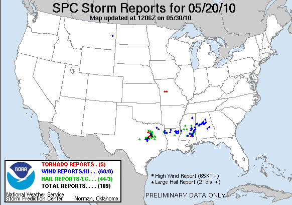
Today we had two IOPs.  The first cenetered on a few tornadic storms in the Fort Wroth (FWD) forecast area.  The second, evening IOP shifted over to the Northern AL/Southern TN Lightning Mapping Array (LMA) area where we could finally evaluate some of the pseudo-GLM data.  The second area ended up with only marginally severe storms, mostly in the southern part of the LMA domain.

The GOES-R activities focused on the PGLM data today, as we finally had an opportunity to look at those data.  There is an excellent write up of the PGLM evaluation on the GOES-R HWT Blog.  In summary, the forecasters liked being able to overlay the PGLM data on reflectivity products to determine where the most likley developing updrafts were embedded in the larger precip areas.  They also compared to the NLDN data, and noted differences between stratiform and convective parts of the precip areas.  We did note that the PGLM data was not being properly sampled in AWIPS to the 8 km grid squares, instead being smoothed.  This issue was fixed on the WDSSII end after today.

The MRMS producers were more heavily used for the FWD portion of today’s activities, and the forecasters continue to express their comfort level rising throughout the week.  Of particular note was that the rotation tracks were really starting to help with the polygon orientation for the tornado warnings.  For the Alabama IOP, the focus was mainly not on the MRMS products alone but in conjunction with the lightning products (see above).  Only one SVR warning was issued for this IOP.

Greg Stumpf (EWP2010 Operations Coordinator)

Tags: None

Daily Summary – 19 May 2010

Activities cenetered on the central Oklahoma High Risk area today, with both teams using a Norman (OUN) localization.  Unfortunately, the OK-LMA network was down, and we were unable to do an analysis of the pseudo-LMA product.   The two teams first sectorized between two supercells north of I-40 ( the westernmost storm being the V2 storm).  Later, as convection developed south of I-40, the sectors were repositioned to be one for the north of I-40 storms, and one for the south of I-40 storms.  All told, our teams issued 71 experimental warnings or severe weather statements today.

For the GOES-R products, one of the main comments from this event is that they all felt the proxy products from the current GOES satellites isn’t doing justice to the expected capabilities of GOES-R with increase temporal and spatial resolution.  For example, there were fewer overshooting top detections that one forecaster would have expected.  The CI products worked a little better today owing to less cirrus obscuration.  There is a lot more information about this in the GOES-R HWT Blog daily summary.

The forecasters are gaining even more familiarity with the MRMS products.  One comments noted that it is nice to be able to look at just one multi-radar product (e.g., 50 dBZ Echo Top) rather than having to figure it out from the many single radars and all-tilts sampling.  Once again, they are discovering that the tracks products (hail and rotation) add a lot of value in determining at a glance both the storm motion (and very stable) and the storm intensity trends.   They also found that the MESH was doing a good job at matching the actual reports, but that the bias-corrected MESH as under-doing the estimates by 1/4-1/2″.

Greg Stumpf (EWP2010 Operations Coordinator)

Tags: None

Daily Summary – 18 May 2010

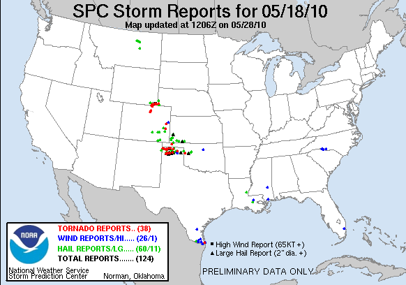
Activities got started off with two teams working two separate WFOs, Pueblo CO, and Amarillo TX.  The Pueblo team had a number of widespread severe storms to deal with, and the Amarillo team primarily had one large tornadic supercell, which also happened to be the VORTEX2 storm.  The V2 storm ended up producing a number of short-lived tornadoes and a lot of damaging hail as it tracked mainly due east across Dumas TX and beyond.

The GOES-R conviction initiation (CI) products were of little use today, owing to cirrus obscuration which tends to inhibit detection of the CI signatures.  In addition, we had a technical AWIPS issue such that the sub-regional scale satellite imagery was localized to Norman (OUN) and not the chosen WFOs, so that only the CONUS scale images could be used, which only update every 30 minutes.  [Note:  This problem ends up getting solved later.] There is more information about this day’s GOES-R activities on the GOES-R HWT Blog daily summary.

The forecasters were also getting their first real taste of using the MRMS products for warnings.  However, we had another AWIPS technical issue that was causing the MRMS grids to load up very slowly (auto-updating was fine).  Because of this, it is possible that the warning results for this, especially those comparing lead time, might be compromised.  [Note:  This problem was partially the result of a faulty network card on the server, and we changed the location of MRMS product storage.  This offered some but not all of the relief.]

Since this was the first day of a real-time IOP for 2010, we’ve learned that not all the wrinkles are ironed out.  We also had some good discussion on warning policies, including whether to issue separate SVRs on the cores of Tornado Warned storms, or to use the TOR to cover both the tornado and severe threats.  In addition, there was some discussion on the varying policies for Severe Weather Statement (SVS) issuance per WFO and per region.  The differences were interesting, and there is not a single policy NWS-wide.

Greg Stumpf (EWP2010 Operations Coordinator)

Tags: None

Daily Summary – 17 May 2010

Most of Monday 17 May 2010 was spent on training and familiarization of the new products.  A practice IOP was conducted for one hour for the Midland/Odessa, TX (MAF) forecast office, and one practice warning was issued.

Greg Stumpf (EWP2010 Operations Coordinator)

Tags: None

Forecaster Thoughts – Steve Nelson (2010 Week 5 – CASA)

Hazardous Weather Testbed in action during the 10 May 2010 tornado  outbreak.
Figure 1. Hazardous Weather Testbed in action during the 10 May 2010 tornado outbreak.

In March  2010, I was asked to participate in the CASA (Collaborative Adaptive Sensing of the Atmosphere) portion of the 2010 Spring Experimental Warning Program (EWP) in the Hazardous Weather Testbed (HWT) at the National Weather Center (NWC) in Norman, OK (Figure 1).  CASA operates a dense radar network of four X-band 3cm radars between Oklahoma City and Lawton, OK.  These radars only have a 30nm effective range but overlap to provide multiple-radar analyses of reflectivity and velocity. For more information on CASA, see http://www.casa.umass.edu/ or the CASA IP1 Wiki at http://casa.forwarn.org/wiki/. The purpose of the CASA EWP experiment is have experienced forecasters evaluate real-time and case studies of CASA radar data.

Beginning on the week before my arrival at the NWC, I became increasingly excited because of consistent model forecasts of severe weather in Oklahoma.  I even stayed up the night before my departure to view the SPC outlook for May 10 – High Risk of severe thunderstorms and large tornadoes in Oklahoma!  When I arrived at OKC airport at noon on Monday, I immediately began coordinating my arrival with Jerry Brotzge and Brenda Philips (CASA Principal Investigators) via phone and text messages.  Brenda’s flight had also landed at OKC around noon, so we drove down together.  We had just enough time to grab a quick lunch to go and arrived at the HWT around 130pm where we immediately began reviewing the latest information.  Central Oklahoma was still under the gun and storms were developing along the dryline to the northwest of the CASA testbed area.  I don’t think I had finished my lunch yet when Brenda told me it was time to make a forecast!  We used twitter and NWSChat as our primary mediums for disseminating our forecasts, warnings, and updates.  After pegging a time of 5pm for activity to reach the testbed area, I watched the event unfold with one supercell after another developing along and ahead of the dryline.  Unfortunately, all of them seemed to develop just outside of the testbed area.  Around 515pm, one left-moving supercell storm split off to the NE and moved inside the network.  This storm contained an unusually strong anticyclonic mesocyclone (mesoanticyclone?) and hook configuration (Figure 2).  When asked if I would issue a tornado warning on that storm, I replied “No, because anticyclonic mesocyclones rarely produce tornadoes.”  At 525pm, a Tornado Warning was issued by WFO OUN for this storm.  It turned out that a six mile long tracked EF1 anticyclonic tornado had touched down at 518pm near Bray, OK and another pair of tornadoes (one anticyclonic and the other cyclonic) near I-35 and Wayne, OK.  Around this time, two LP-like supercells were approaching Moore and Norman.   As the Norman storm approached, I saw SPC forecasters run to the west windows. Being a conscientious, safety-minded NWS meteorologist, I also ran to the window and observed a rapidly rotating funnel nearly over the National Weather Center (Figure 3).  The tornado grew in size as it tracked east along Highway 9 and even damaged a few of the NWC employees’ homes.  As storms moved east and away from the network that evening, we closed operations for the day.  Between 2 and 8 pm, 31 tornadoes were confirmed across the state [http://www.srh.noaa.gov/oun/?n=events-20100510-tornadotable].  An exciting start to the experiment to say the least!  In the following days, there were several close calls to observing severe storms within the network during and after operations, but none as significant as the May 10 event.

Tornado 300 yards south of the National Weather Center on 10 May  2010. Photo by Kevin Kloesel.
Figure 3. Tornado 300 yards south of the National Weather Center on 10 May 2010. Photo by Kevin Kloesel.
Anticyclonic hook depicted on 2.0 deg reflectivity from KRSP CASA  X-band radar at 2221Z 10 May 2010.
Figure 2. Anticyclonic hook depicted on 2.0 deg reflectivity from KRSP CASA X-band radar at 2221Z 10 May 2010.

The orientation planned for Monday took place on Tuesday.  During the rest of the week, I went through several displaced real-time simulations using 88D data only, then repeated using 88D and CASA radar data, multi-radar wind analyses and high-resolution model forecasts. The simulations included the Anadarko, OK tornado of 14 May 2009 and the Rush Springs, OK tornado during the early morning of 2 April 2010.  Without knowing any details of either case, I was challenged trying to issue timely warnings based on CASA radar data.  Without going into detail, CASA radars use adaptive scanning strategies that depend on the coverage and intensity of storms.  Data at any one elevation angle can be as frequent as every 30 seconds.  Trying to mentally process data from four CASA radars in the same way we do one 88D data was an exercise in futility.  I do not believe manual interrogation of such high-resolution radar data is a realistic option for warning forecasters of the future.

The Rush Springs, OK tornado case was very eye-opening and showed the tremendous potential of CASA radar technology to detect smaller tornadoes.  Figure 4 shows a side by side comparison of KTLX and the KRSP CASA reflectivity at the time of the tornado.  Many areas east of the Mississippi river are prone to these smaller tornadoes that develop more rapidly than those from supercells.  Trapp and Weismann (2005) more recently showed how tornadoes spin-up in the comma head portion and along the leading edge of quasi-linear convective systems (QLCS).  Tornado warning lead time and accuracy is lower for both QLCS and tropical cyclone storms than that of supercells.  A local study done in the Peachtree City WFO in 2009 showed that 13 out of 16 unwarned F2 or greater tornado events resulted from QLCS storms.  A Hollings Scholar is also studying  QLCS tornado climatology and warning accuracy this summer in the Peachtree City WFO.  So far we have determined that the initial lead time of tornadoes from QLCS storms across the mid-south and southeast averages about 25% of those from supercells (3-5 minutes vs 20 minutes).

Radar reflectivity from the 2 April 2010 Rush Springs, OK tornado. The image on the left is from the KTLX 88D at 1057Z, the middle and right images are from the KRSP CASA X-band radar at 1058Z and 1100Z, respectively.
Figure 4. Radar reflectivity from the 2 April 2010 Rush Springs, OK tornado. The image on the left is from the KTLX 88D at 1057Z, the middle and right images are from the KRSP CASA X-band radar at 1058Z and 1100Z, respectively.

During the week, I was able to pick the brains of some scientists. I shared presentations and concerns from the 14-15 March 2008 tornado and 21 September 2009 flash flood events in north Georgia.  I discussed research on unwarned tornadoes recently published in WAF with Jerry Brotzge, who showed how such missed events can be correlated to smaller tornadoes (as just mentioned).  I plan on collaborating further in the future.

I will certainly remember the experience I had at the EWP this year and look forward to the day when technology like this is deployed operationally.

Steve Nelson (Science and Operations Officer, NWS Peachtree City/Atlanta GA – 2010 Week 5 Evaluator)

Tags: None

Week 5 EWP Summary: 10-14 May 2010

Week #5 of EWP2010 wrapped up with continued CASA experimentation.

CASA:

During the week, CASA hosted the following National Weather Service participant:  Steve Nelson (WFO Atlanta, GA).

Steve was joined by CASA participants Ellen Bass, Jerry Brotzge, Kevin Kloesel and Brenda Philips.  During the week, several additional CASA staff and students, including Don Rude, Brendan Hogan, and Cedar League, also were in Oklahoma visiting emergency managers in the field during the real-time events.

The week got off to a fast start with a local tornado outbreak, with no time for training or preparing Steve for what to expect, how to use the WDSS-II system, or the communications protocol with emergency managers.  Monday (May 10) saw a total of at least 12 tornadoes touch down in the region, but with only one confirmed tornado within the CASA testbed.  The one tornado in the CASA domain was on the ground for ~ 10 minutes, but was unique – anticyclonic from a left-moving supercell.  The strong magnitude of the low-level velocity shear from CASA prompted Steve to issue a (in-house) warning on the storm, despite the anticyclonic rotation and unusual location relative to the parent supercell.  The rotation also was observed by KTLX and TDWR, but at a higher elevation.  The tornado was confirmed and classified as an EF-1.  Other tornadic supercells initiated within the testbed, but moved east prior to tornado formation.

Steve spent the remainder of the week reviewing both weaker real-time data as well as a series of case study events.  A strong cold front passed through the testbed at 4am Wed morning (May 12), which spawned at least one area of rotation as detected by CASA radar KCYR.  A small area of damage was reported to the NWS, which coincided with this observed vortex.  Several of the archived cases show similar results from supercell events.  Data from the May 13, 2009 event revealed several areas of rotation by CASA.  The squall line observed April 2, 2010, showed at least one supercell within the line, spawning two strong vortices, each with coincident damage at the ground.  The high spatial and temporal data provided by CASA allow the complete development and evolution of these vortices to be better tracked and warned in advance.

Additional tools, such as 3DVAR and real-time NWP (a.k.a., warn-on-forecast), were run operationally during the real-time events.  For the May 13 event, Steve first observed rotation within the 3DVAR display.  Similarly, the forecast for May 13 allowed Steve much greater insight into what mode of storms to expect.  Likewise, during the May 10 event the real-time NWP forecast predicted long-track supercells, with the location and timing very similar to what was observed.

Steve recognized a number of benefits and some challenges with the collaborative and adaptive radar network design.  The low-level scanning abilities and high space and time resolution provided significant benefits, particularly in observing and warning on strong low-level winds and tornadoes.  The greatest challenge was handling data overload.  CASA data were available on both AWIPS and WDSS-II, and Steve used both systems in real-time.  The primary need moving forward will be the development of visualization tools capable of easily displaying multiple radars and merged products.  The ability to quickly and easily move between products and radars will be critical to using the valuable information available by these new systems.

The CASA experiment has concluded for the spring.

PARISE:

PARISE has concluded its activities in the testbed for the spring.  In several weeks, an end-of-experiment quick summary will be prepared by the PARISE principle scientists.

A LOOK AHEAD:

Beginning 17 May, we will begin the second phase of our spring activities with two new experiments, a) an evaluation of experimental Multiple-Radar/Multiple-Sensor (MRMS) severe weather algorithm products, and b) an evaluation of GOES-R convective initiation and lightning mapping products.

Greg Stumpf, EWP2010 Operations Coordinator

Jerry Brotzge, CASA Scientist

Tags: None