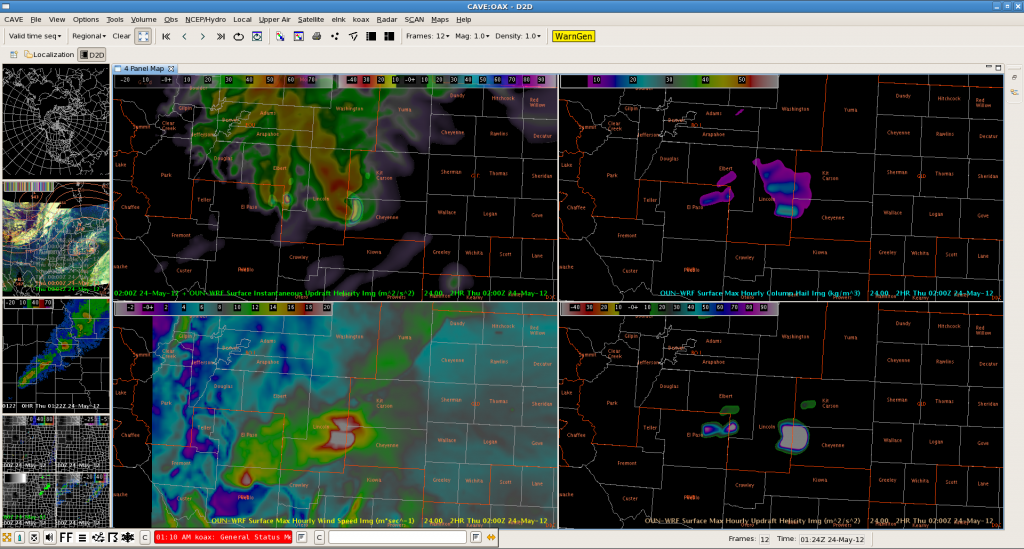
Well anticipated by OUNWRF, strong to severe storms formed over E-C Colorado (here E of Pueblo) by 0030 Z. This is the latest forecast for 0200Z, showing the supercell moving straight to the east.
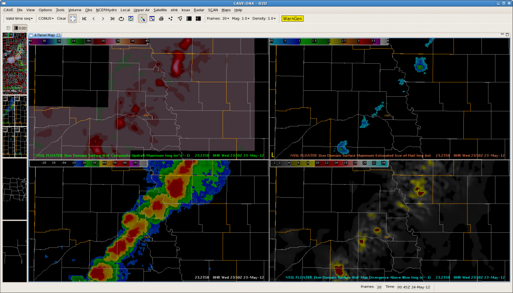
The below image illustrates once again that 3D-VAR may be best utilized as a “heads-up” display for the biggest storms on the scope. It appears the best products for this are the max composite updraft speed (upper left) and max divergence above 8km (lower right).
The cold front over NC-Kansas and SE Nebraska was monitored for further development. As expected, storms began to build SW-wards towards the KS boarder and CI products were effective in highlighting the area with highest probabilities for potential development along that boundary.
The event occurred over Clay and York counties (Nebraska). A series of images will be added to show the evolution:


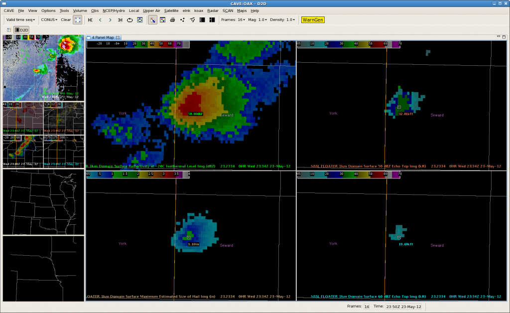
Roughly 30 min before surface reflectivity at -10C isothermal level revealed first signs of development, the CI product highlighted both counties with 50-60 % probabilities. The cloud top cooling product showed values of -15 to -25K/15 min at 2315Z (not shown) and the first significant reflectivity signal (56 dbZ ) became visible at 2330 Z. At 00Z onwards a 63 dBz cell evolved out of that NE of York.
Helge
Issued a severe thunderstorm warning strictly off of explosive CTC at 2315 UTC (previous post), with very little showing up on radar at the time. As would be expected, through the following 15-20 minutes, the storm exploded, with MRMS MESH spiking up to 1″ by 2334 UTC, and a quarter size hail report by 2336 UTC. This gave us 21 minutes of lead time from the initial warning issuance off of CTC. Would have likely issued the warning based on traditional base products by 2325 UTC, 10 minutes after the CTC-based issuance.
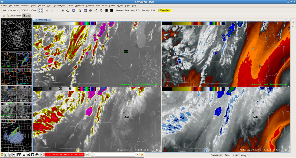
The area over E-Nebraska was monitored for initiation. The synthetic images did a pretty good job in timing of thunderstorm development. The real development occurred only slightly to the north to what the synthetic ones proposed. The model forecast however overestimated the development along the cold front over C/S Kansas, where warm mid-levels prevented DMC of developing until now (although showers finally try to form at 23Z onwards).
Helge
Latest VIS imagery indicates a rapid increase in convection along slowly SE-ward progressing cold front, namely over Hodgeman, Ness and Rush counties. UAH-CI product already showed modest probabilities (50-60 %) for CI with no reflectivity yet present in local radar data.

Latest HRRR is a bit more optimistic with SW-ward zipping convection compared to OUN WRF. Still unsure if storms can initiate in that area with warm mid-level tongue partly covering the cold front/dry line. Strong shear now gradually moving in from the west, so increasing storm organization is likely in case of initiation.
Helge
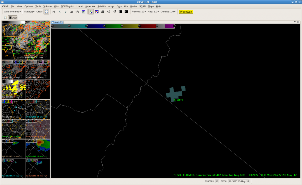
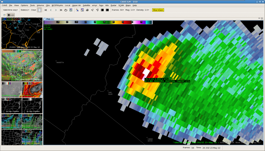
The top image is the MRMS estimate of the 60dbz echo top of a storm over Wilmington NC CWA, estimating the 60dbz echo top around 6500 ft at 2022 UTC on 5/23. However, the bottom image is the corresponding KLTX 8.0 degree slice, indicating 60-62dbz to at least 29,000 ft. At least in this instance, the MRMS 60dbz echo top algorithm did not perform well.
