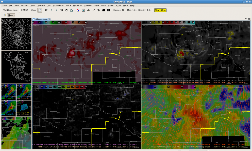
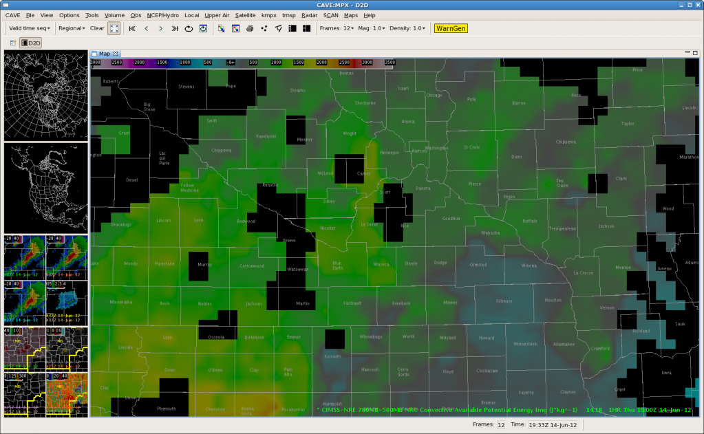
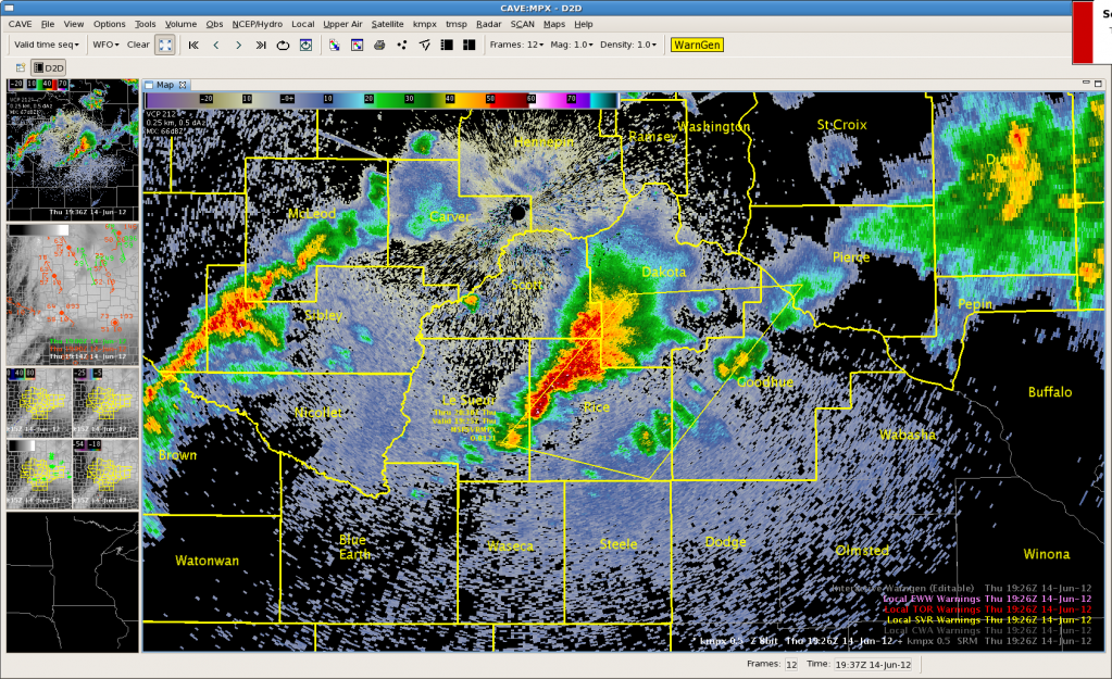
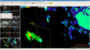
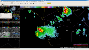
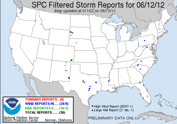
Line of storms over Dakota and Rice County has intensified with MESH increasing to 1.73 inches at 1925Z. At 1900Z, composite updraft increased to 17 while we saw an increase of upper divergence. Expect large hail although this storm is right along the instability gradient so we could start to see some wind problems soon as 1km 3dvar wind shows 25+ m/s. MRD/TY
Author: Greg Stumpf
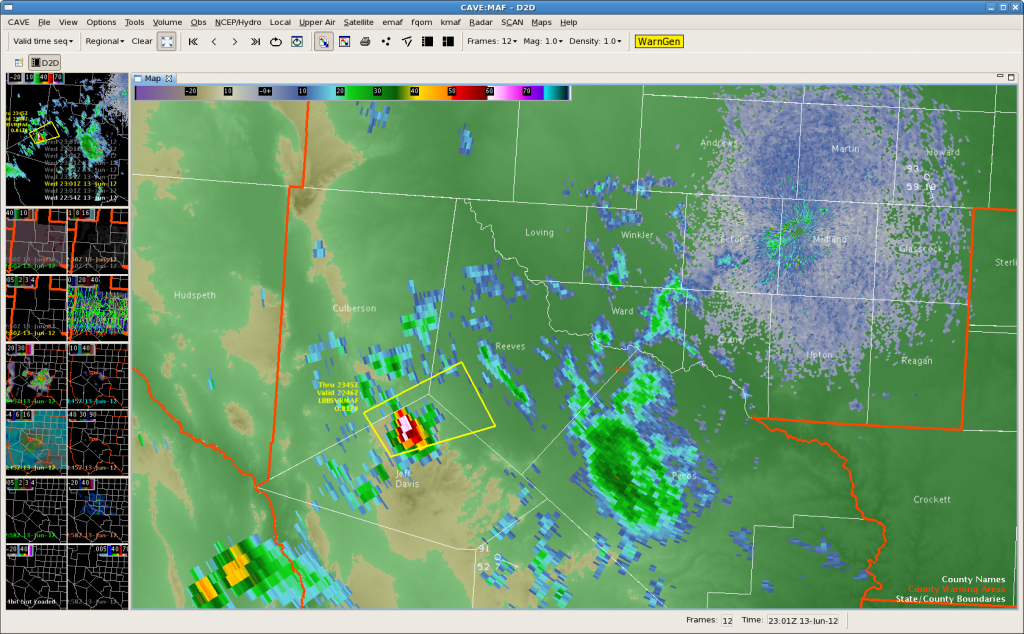
MAF Update at 00Z…A Few Warnings SW of Midland
 Watching 2 main cells that are giving some of the higher terrain areas the business. Generally seeing an increase in the coverage of storms east of the Davis Mountains now and that is what the OUNWRF has been advertising starting late afternoon/early evening. Expect areas around and south of Midland to see increase in thunderstorm activity through the early evening hours.
FSD – CIRA WRF Simulated imagery off on location but good on timing
After seeing the CIRA sim imagery do very well in ABQ, we switched to FSD where the sim imagery indicated deep convection developing between 2100-2200z, but the location of the convection was about 130mi ese of where convection developed in Tripp and Lyman counties in central SD.
CIRA WRF Simulated IR 10.4 valid at 13 Jun 2100z:
GOES IR 2100z:
GOES IR 2130z:
CTC 2132z in Tripp and Lyman Co:
GOES IR 2144z:
 CTC 2144z in Tripp and Lyman Co:
CIRA WRF Simulated IR 10.4 valid at 13 Jun 2200z:
GOES IR 2200z:
GOES IR 2230z:
CIRA WRF Simulated IR 10.4 valid at 13 Jun 2300z:
GOES IR 2300z:
CIRA WRF Simulated IR 10.4 valid at 14 Jun 0000z:
GOES IR 14 June 0014z:
Update from Team MAF…Storms Increasing in Coverage SW of Midland
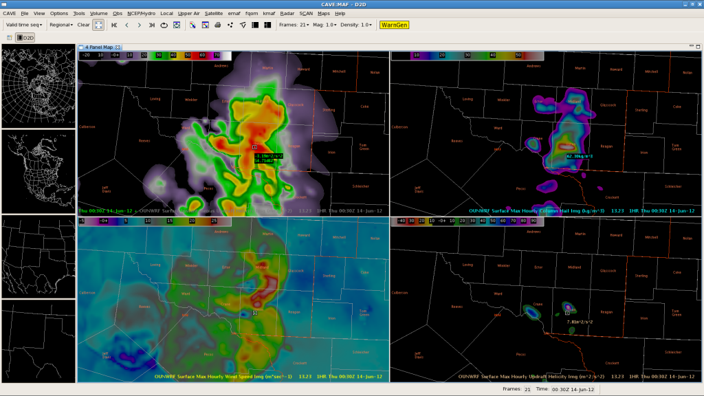
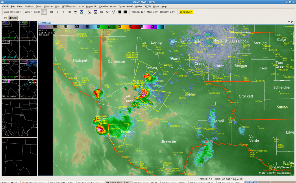 We have warnings out on a few storms to the SW of Midland. Storms have increased SW of Midland past couple of hours and this is semi-inline with the OUNWRF forecast of increasing tstm coverage over the central and eastern zones through the course of the evening hours. The model has been consistently too robust on the coverage of storms and too east with the timing of storm placement.
Latest model run still shows some strong Surface Max Hourly Wind Speeds near 30 m/s in the first 1 to 2 hours but then indicates a broad weakened wind field around 20 m/s or less in the 3 to 6 hour forecast. Radar data suggests main threat with these storms would be large hail, and the OUNWRF has Max Hourly Column Hail around 64 kg/m3 just east of where the storms currently are in the next hour…which is verifying fairly close to current radar observations…just a bit too far to the east. Most WRF parms seems to be indicating a potential for stronger storms through 9 PM then a weaker trend with tstm intensities by 11 PM as the storms move east into the eastern zones.
Tim/JeffG
MAF Update at 23Z…Could This be the Start of it???
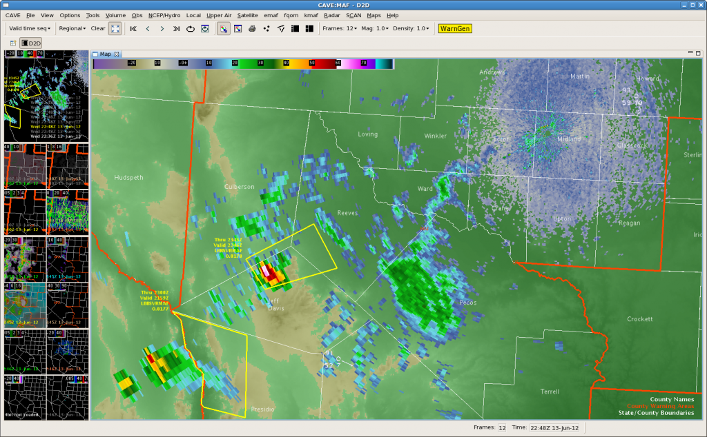
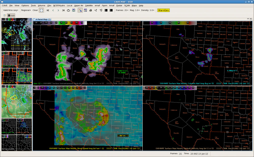 22Z OUNWRF just in still insists that we will be getting busier as storms develop farther east into the Midland area. Currently we have one warning out for Jeff Davis…southeast Culberson and Reeves Counties. We are wondering if the instability has been cut by the mid and high clouds moving across the area. It is “only” 90 degrees in Midland right now well east of the scattered light shower and isolated thunderstorm areas.
Third MAF Warning…Jeff Davis County
MAF Second Warning for Persidio County
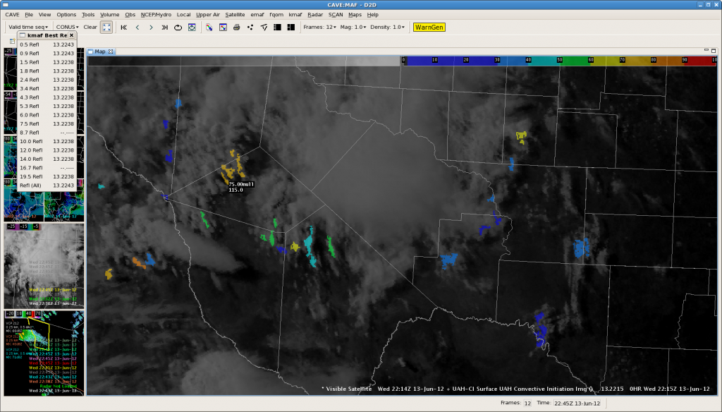
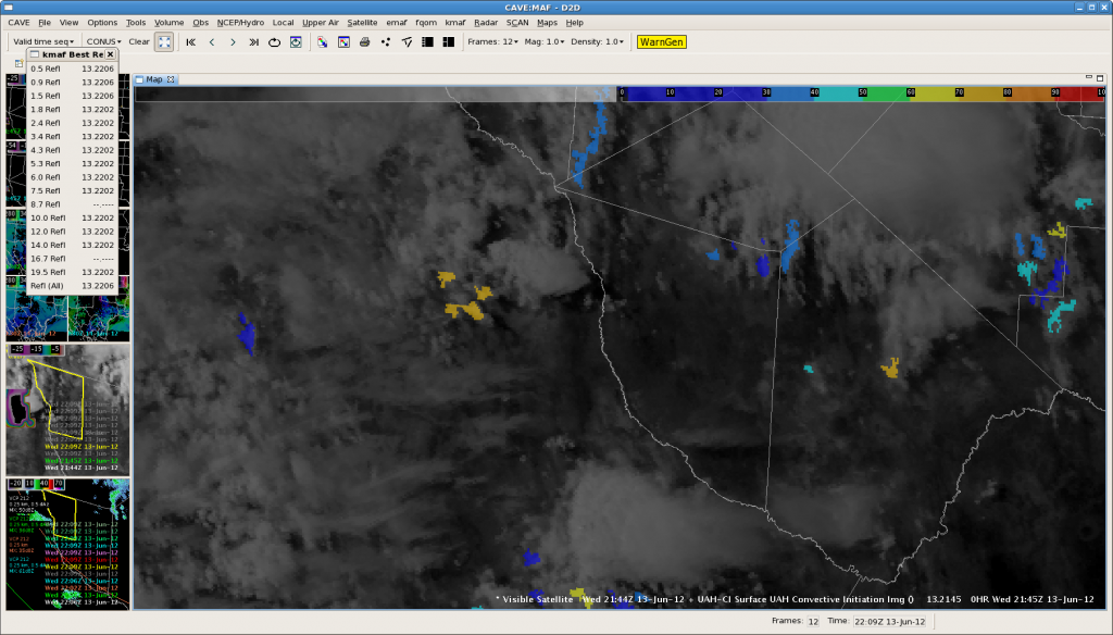
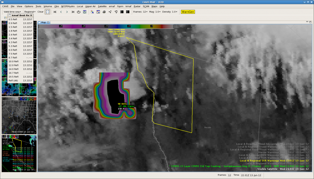 Issued our second Severe Thunderstorm Warning for Persidio County. Storm is showing strongest Cloud Top Cooling rates observed today around -37C/15 min. This cell is over northern Mexico way out towards the edge of the KMAF NexRad coverage…with 40 dBZ echo at 35 thousand feet. We will see how this one pans out as it get closer in on the radar coverage as it moves towards the Davis Mts. Here is the corresponding CI imagery…
Update…KMAF Echo Top shows storm west of the Rio Grande has increased to 54 kft at 2220z. This gave around 30 minute lead time before increase.
Update…storm over Mexico northwest of Candelaria intensified to over 64 dBZ at 2311z. The strong CTC signature gave a lead time of a little over an hour for this intense storm.
Tim/JeffG
MAF Warning
ABQ-S – Great start for CIRA WRF Simulated imagery in Lincoln Co
The simulated IR imagery for the ABQ CWA has initiated well with convection over Lincoln Co developing between 19-20z and the overall cirrus shield over the sw US.
Fcst valid at 13 Jun 20z:
GOES IR 13 Jun1959z:
FDX 0.5 Z 13 Jun 2003z
Will be watching for new convection in eastern Torrence Co and western Guadalupe co by 2100z.
CIRA Sim IR valid at 2100z:
GOES IR 13 Jun 2059z:
FDX 0.5 Z 13 Jun 2103z
CIRA Sim IR valid at 2200z:
GOES IR 13 Jun 2159z:
FDX 0.5 Z 13 Jun 2201z
Overall, CIRA Simulated imagery did very well with convection location and timing.
Daily Summary: 12 June 2012
Today, we started operations in the Albuquerque (NM), Midland (TX), and Lubbock (TX) county warning areas. An early-morning mesoscale convective system left an outflow boundary over west Texas. While the atmosphere recovered in its wake during the afternoon, storms developed in the less-capped/higher-terrain to the north. In this convective episode, multicell clusters were the dominant mode, and the Albuquerque forecasters (Mike Dutton and Jeff Garmon) issued several warnings (a few hail reports were received).
In the Midland and Lubbock CWAs, the onset of convection was delayed, compared to the expectations derived from the OUN WRF and HRRR forecasts. As a result, the decision was made to move the Lubbock forecasters (Ty Judd and Tim Tinsley) to the Amarillo CWA to assess the 3DVAR products in storms that approached the area from Colorado. However, after only a short while, the storms decreased in intensity, prompting a move back to the Lubbock CWA.
By 6:30 p.m., convection developed in earnest in the southeastern portions of the Albuquerque CWA, promising to move toward the Midland and Lubbock CWAs. The Midland forecasters (Steve Nelson and Randy Skov) issued multiple severe warnings for multicells and supercells. The Lubbock forecasters issued a few warnings for left-movers that originated with the Midland convection.
-G. Garfield, Week 5 Coordinator


