Combined Prob Severe and NearCast

mres_19_2146 near_cast19_21

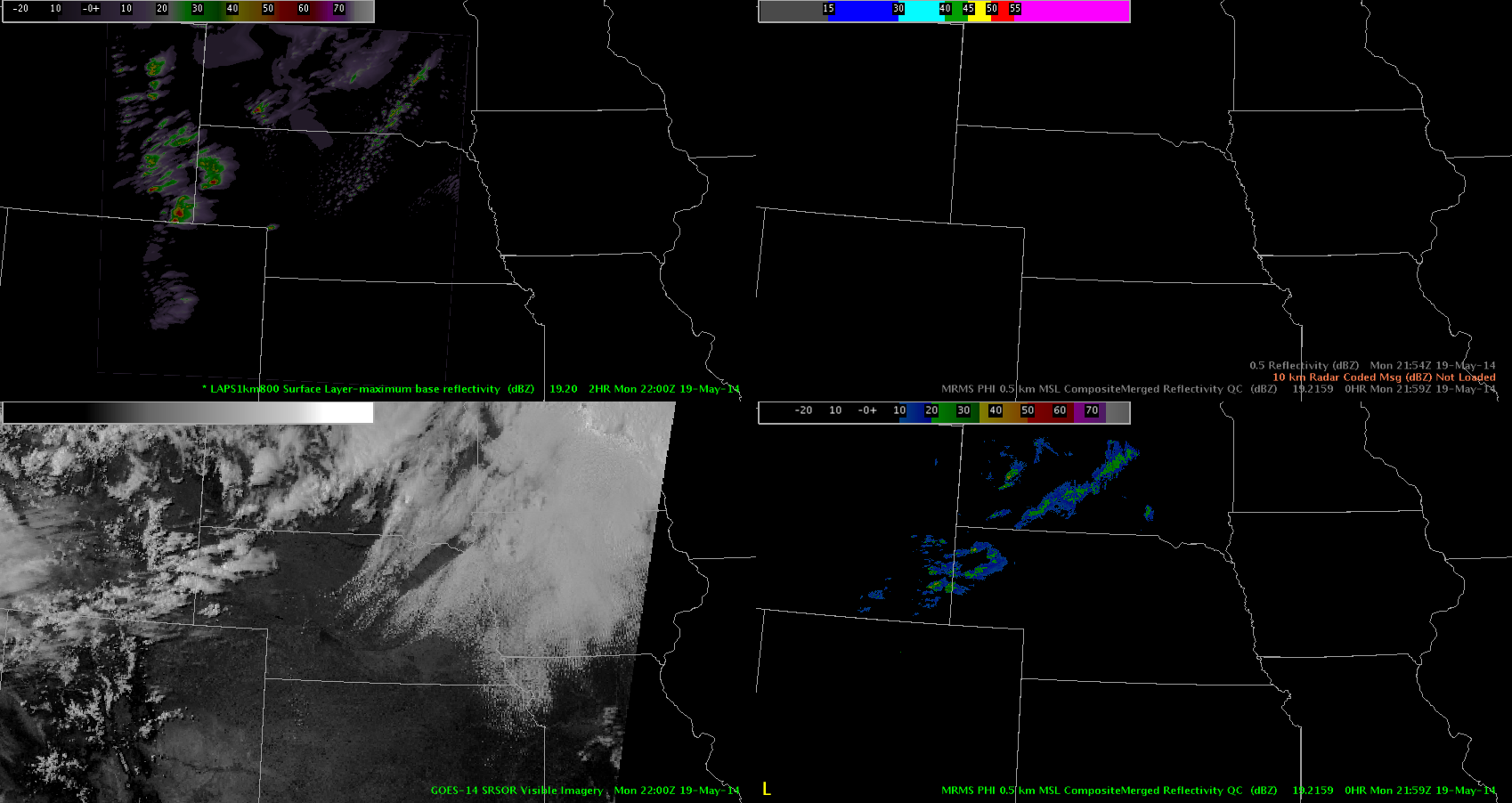
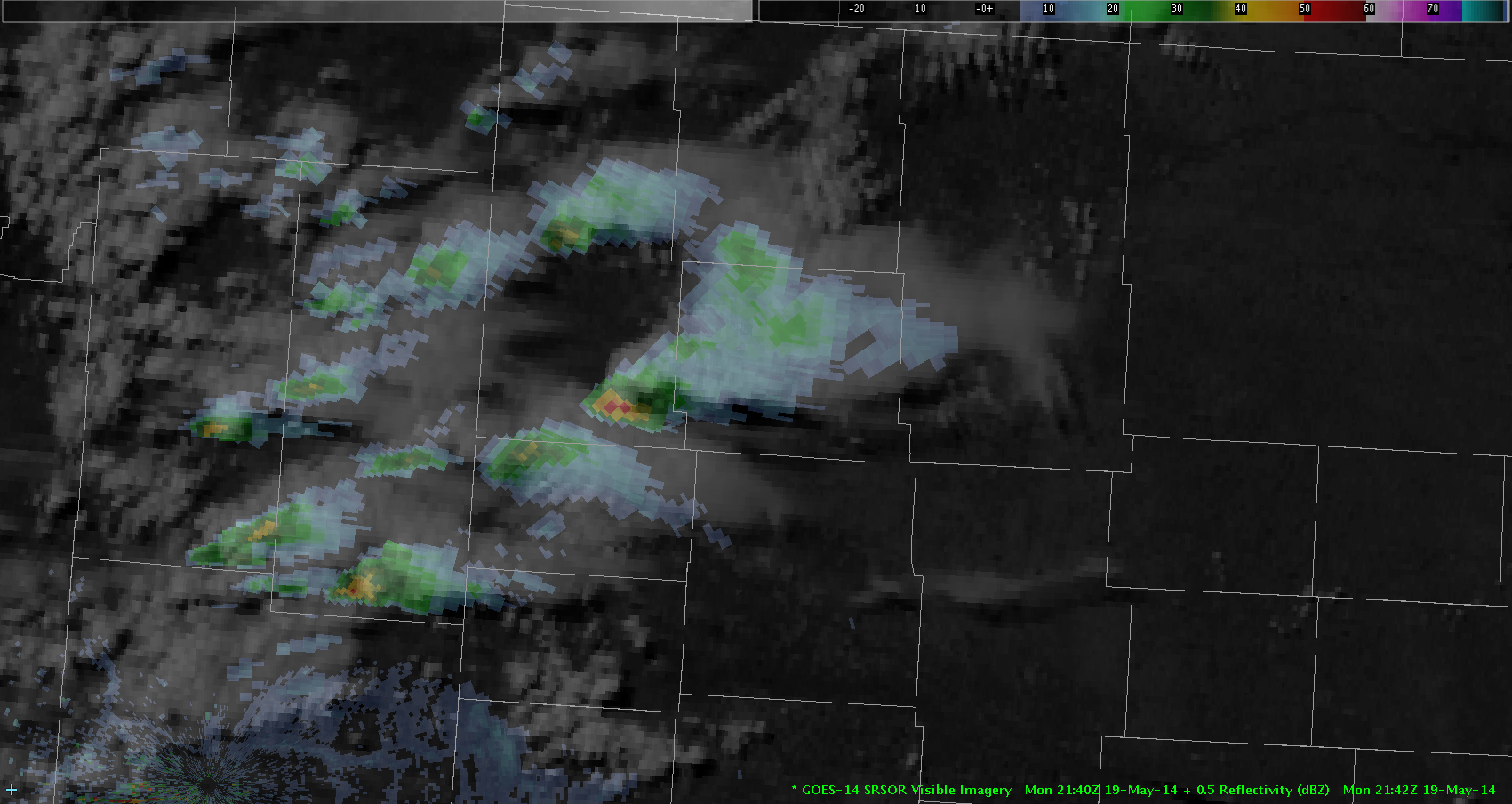
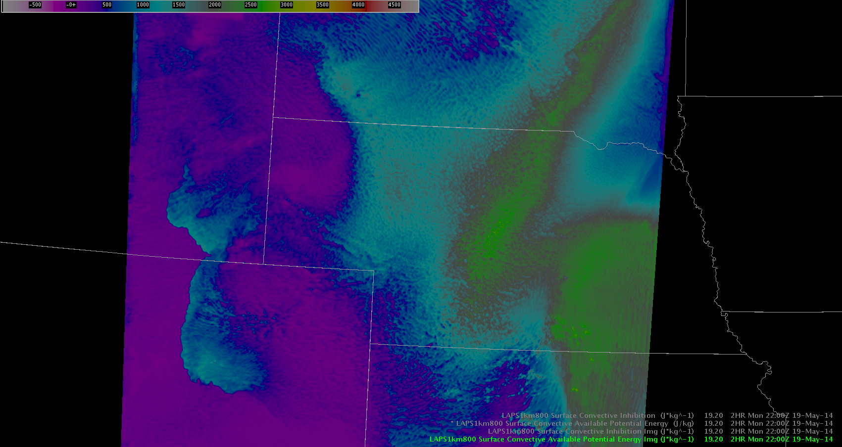
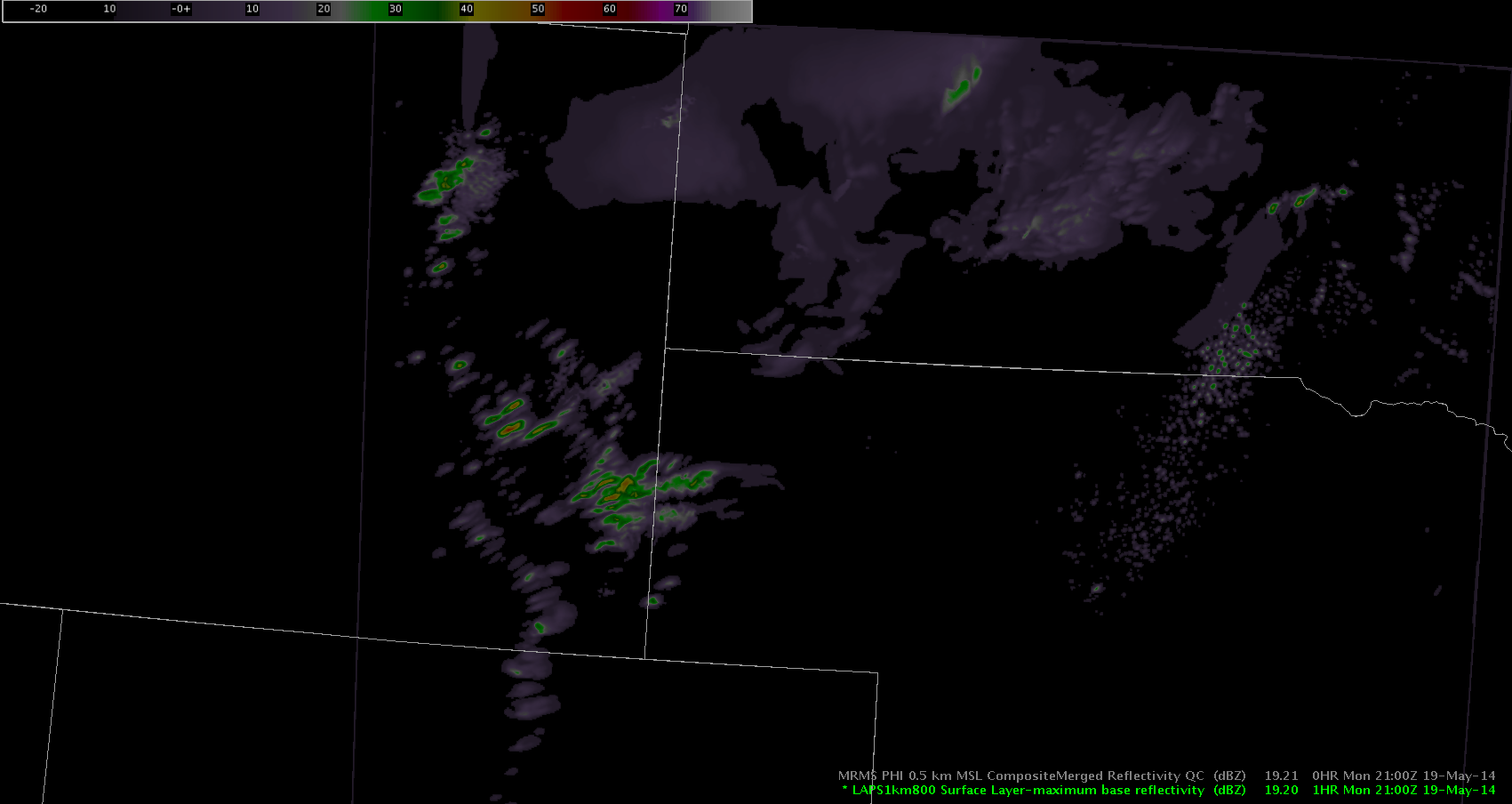
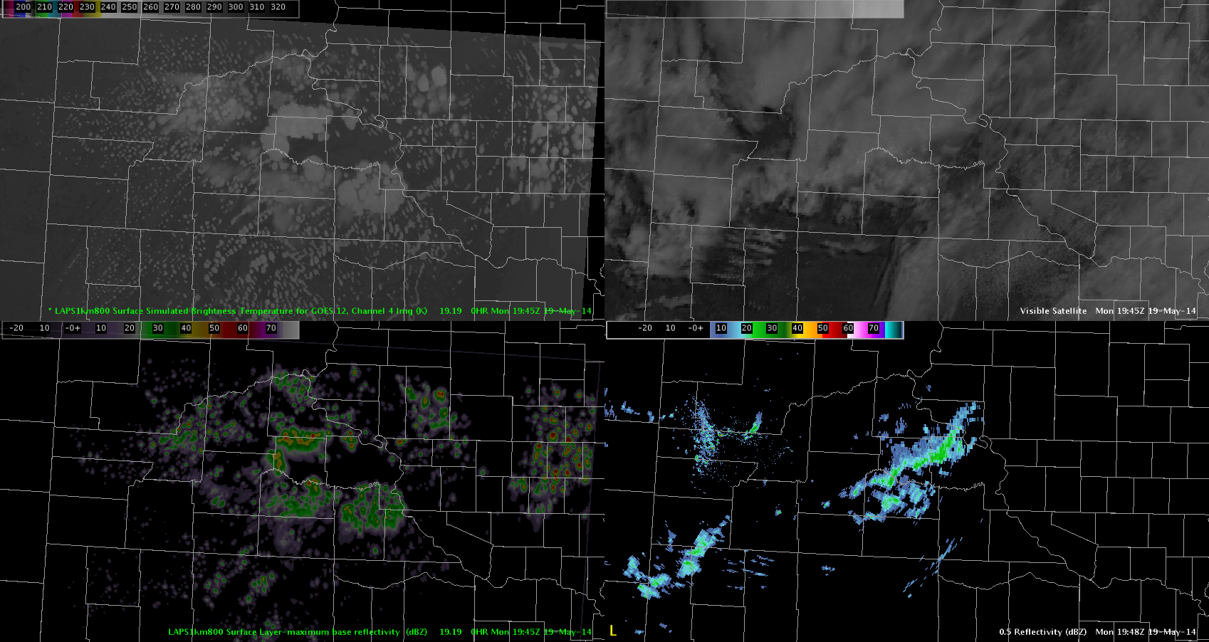
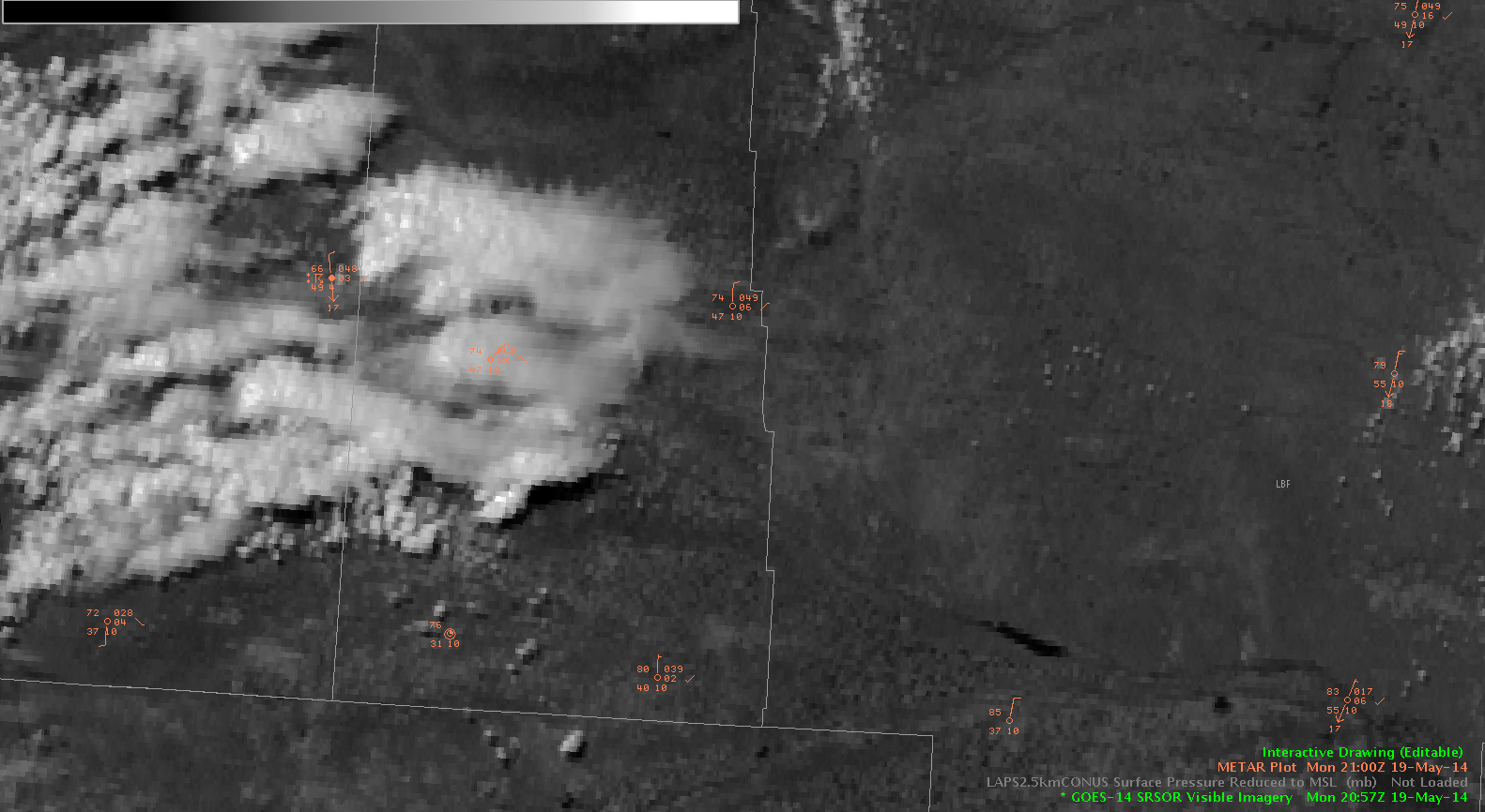
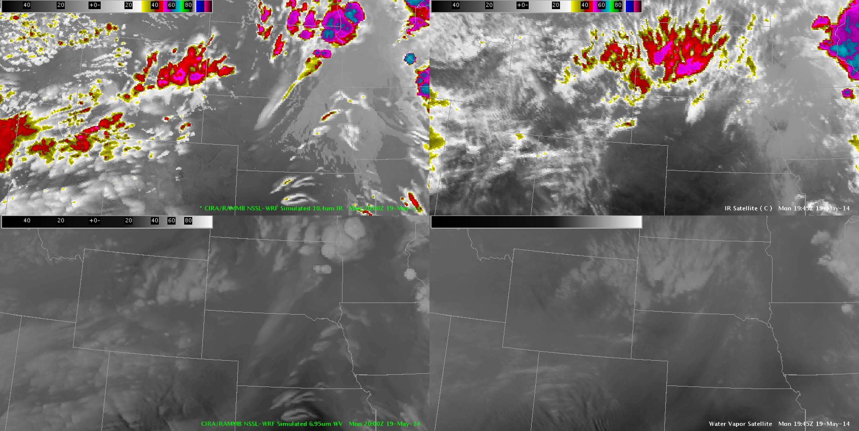
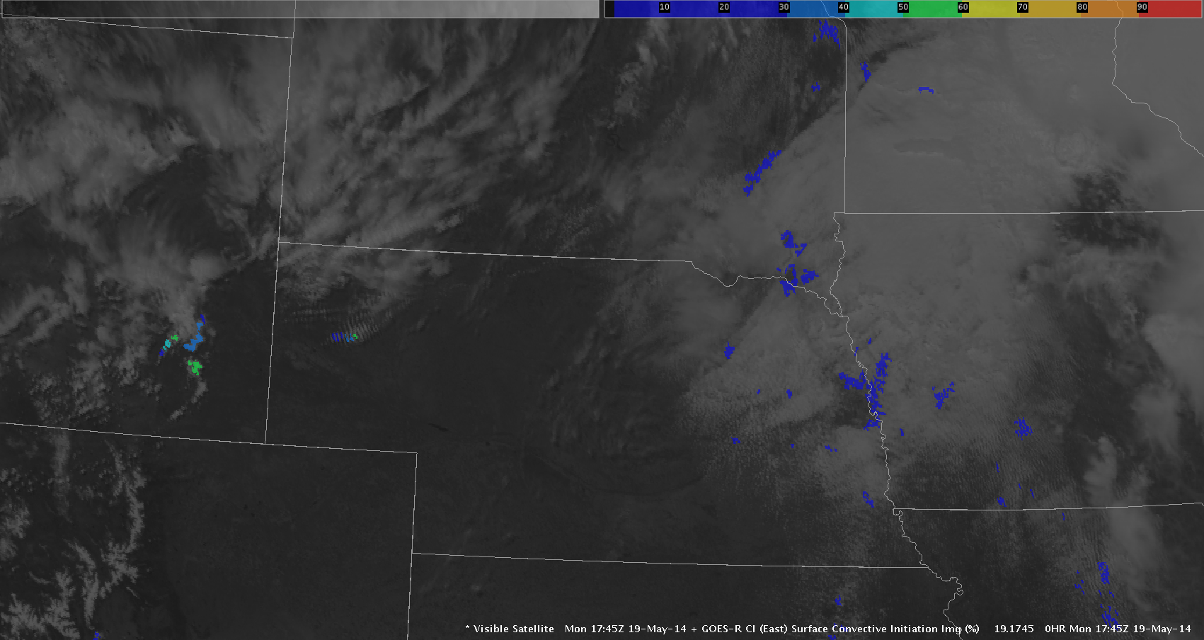
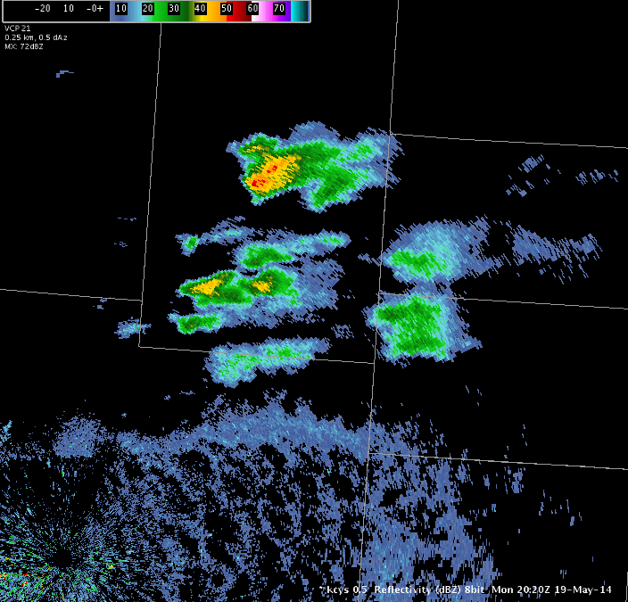
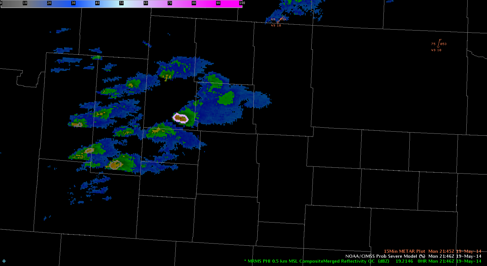
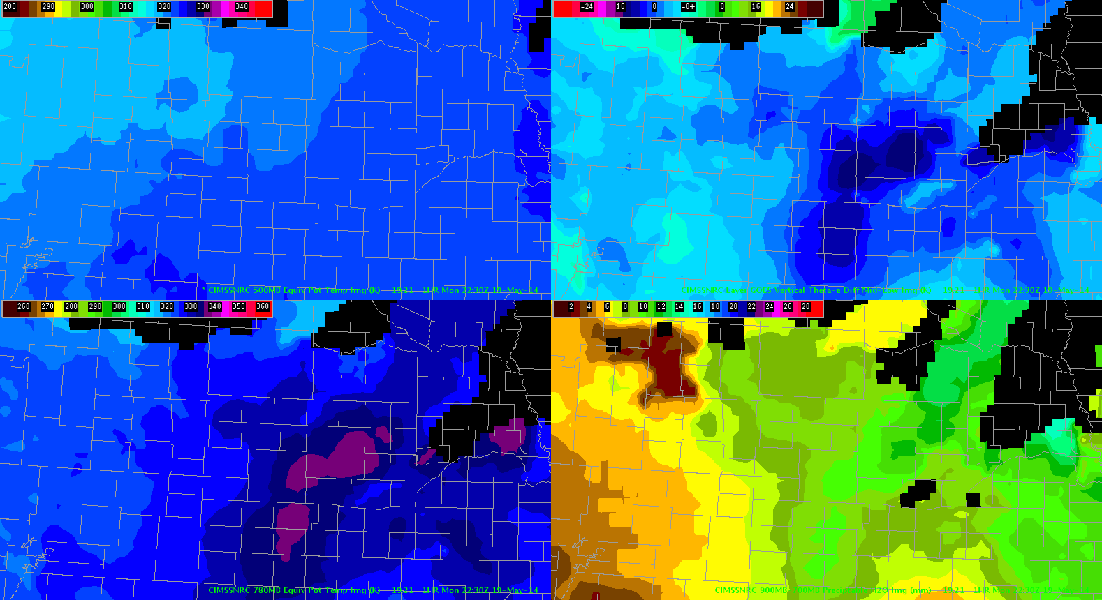
A stronger convective cell attempted to develop to the north of Scottsbluff, NE. As the radar indicated higher reflectivity the GOES Porb. Severe Model jumped to 62 percent with strong satellite growth rate. This cell quickly dissipated though and did not produce severe weather. Analysis of the NearCast System indicated that the strongest instability was located farther to the east into western and central Nebraska. While values near the cell indicated marginal instability. Using these two products in tandem may have been helpful. It will be interesting to see if this weak convection moves into the North Platte CWA as it gets into better convective instability.

-JB

Tags: None

LAPS Verification of storms with GOES-14 & MRMS PHI Radar

The panels are showing Goes-14 SRSOR Vis and MRMS PHI Radar compared to LAPS1km800 Surface Layer.  LAPS verifies right now.  The interesting thing is LAPS is trying blow up storms in W. Nebraska where storms are.  Also LAPS is trying to form storms in SE South Dakota & NE Nebraska where there are currently isn’t anything but clouds but it looks like good environment for storms to form.  We will have to see what happens and if LAPS verifies or could be overdone. -VollmarSatRad with Laps

Tags: None

Enhanced Parallax Lag Time.

May19th 2155Z

Being displayed here is the GOES-14 Super Rapid Scan overlayed with Composite Radar.  In addition to the usual parallax radar error that normally exists, there is also a time lag with many products that update at a slower rate. This actually can enhance the parallax displacement of radar from satellite and is something to be aware of; Especially for those of us that like to overlay radar products with satellite.

Grant H.

Tags: None

19 May 2014 LAPS Instability

Convection has slowly pushed eastward through eastern Wyoming into Western Nebraska.  We have tracked one storm in particular that moved east of Torrington WY into southern Sioux County NE.  To this point, convection has been fairly weak, with small hail signatures and momentary rotation tracks.  We are waiting for the convection to hit a north/south line just east of H385 where LAPS products indicate much stronger instability. If convection reaches this instability during the daytime hours, perhaps convection will become more robust.  19May2014-2200ZLAPSCAPE1HR

— JRM

Tags: None

May 19th 2110Z

May 19th 2110Z

Here we are taking a look at the LAPS 2D Surface Brightness Temperatures and Maximum Base Reflectivity. These products can probably be useful for surface analysis. However for today, when compared against products in reality, we can quickly notice that cirrus is mysteriously absence from central South Dakota which is allowing the surface layer to bake in the model in its absence. This is leading to a set of storms being set off over this area for model radar that is not evident on current radar in reality. Confidence in this model over this area is low to minimal. The other big unfortunate item is that the model is also not initiating storms over Cheyenne territory which are already occurring with no cirrus and moving into Nebraska.

Grant H.

Edit: 22:43Z  Come to find out. The LAPS domain at this time was actually located over the east coast. This was corrected with the hour and explains why radar and brightness IR from the models were so far off.

Tags: None

Watching Towers Grow

tcu

Using the 1 min GOES rapid scan to view individual towers grow is great. Being able to see individual convective attempts and failures is very useful. On radar I was not able to tell that the convective tower had failed, but with the visible imagery I was able to see that the tower had failed to mature and soon the radar echo dissipated. Pretty cool.

-JB

Tags: None

A Quick Comparison

Getting a handle on the area of interest across southwestern Wyoming and the panhandle of Nebraska, we see a few cells popping up near the WY/NB border. Taking a look at the four-panel image below, you’ll see the CIRA/RAMMB NSSL-WRF simulated satellite imagery on the left hand side (IR on top, WV on bottom) and observed on the right (time: 20Z). So far, the simulated imagery seems to have a decent handle on storm initiation near the WY/NB border in particular, which allows for increased confidence in its forecast, even if the spatial placement isn’t necessarily exactly spot-on.1945Z_Sim_Ob_Compare

The simulated satellite imagery seems to be overdoing it just a bit so it’s not as helpful if you’re trying to assess specifics but if you can compensate by interpolating down in your mind’s eye, it is still a good product to increase situational awareness.

Linda Gilbert

Tags: None

Test. First Blog Post

May19th 20:29Z First Image

Good afternoon all. Grant H. signing on for the first blog post of the first day of the HWT. In learning about the GOES Convective Initiation (CI) tool, I felt this might be a good first place to start. CI seems to be the most useful in hunting down areas where convection will begin over the first 2 hours of and event. I can see this being good from the warning coordinator/mesoscale forecaster perspective in making decisions on where/how to divide up/sectorize radar mets in ops.  The stuff off to the left over eastern Nebraska in blue has a very low probability of initiation around 10 to 20 percent. Meanwhile, the cumulus field over the southeastern Wyoming in the Cheyenne area is reaching up to 50%. This helps to force focus to the locations of interest. I do see some problems here in that the algorithm has troubles IDing areas that transition from stratus to cumulus or from cirrus with cumulus embedded underneath such as in northwestern Nebraska… very little CI color is showing up, other than the sheared area in this image.

Grant H.

Tags: None

EWP Operations Update – Monday 5/19

Forecasters are getting acclimated to AWIPS-2 as we sit and wait for convective initiation ahead of a shortwave trough in SE Wyoming and W Nebraska. We are currently operating from the Cheyenne (CYS) and North Platte (LBF) CWAs.

The downgrade of the “SLGT” risk to a “SEE TEXT” at the 20z SPC Day 1 Outlook and the “WATCH UNLIKELY” Mesoscale Discussion will not dampen our spirits.

2000z SPC Day 1 Outlook for May 19.
Mesoscale Discussion summary issued at 2012Z.
Mesoscale Discussion graphic issued at 2012Z.

KCYS is showing the first 40+ dBZ echo of the day in Goshen County, WY and with the airmass over the region continuing to destabilize, we are holding out hope that we will see some isolated convection in both CWAs in the next few hours.

First 40+ dBZ echo in Goshen County, WY.

-Darrel Kingfield
EWP Week 3 Coordinator

Tags: None