

Getting a handle on the area of interest across southwestern Wyoming and the panhandle of Nebraska, we see a few cells popping up near the WY/NB border. Taking a look at the four-panel image below, you’ll see the CIRA/RAMMB NSSL-WRF simulated satellite imagery on the left hand side (IR on top, WV on bottom) and observed on the right (time: 20Z). So far, the simulated imagery seems to have a decent handle on storm initiation near the WY/NB border in particular, which allows for increased confidence in its forecast, even if the spatial placement isn’t necessarily exactly spot-on.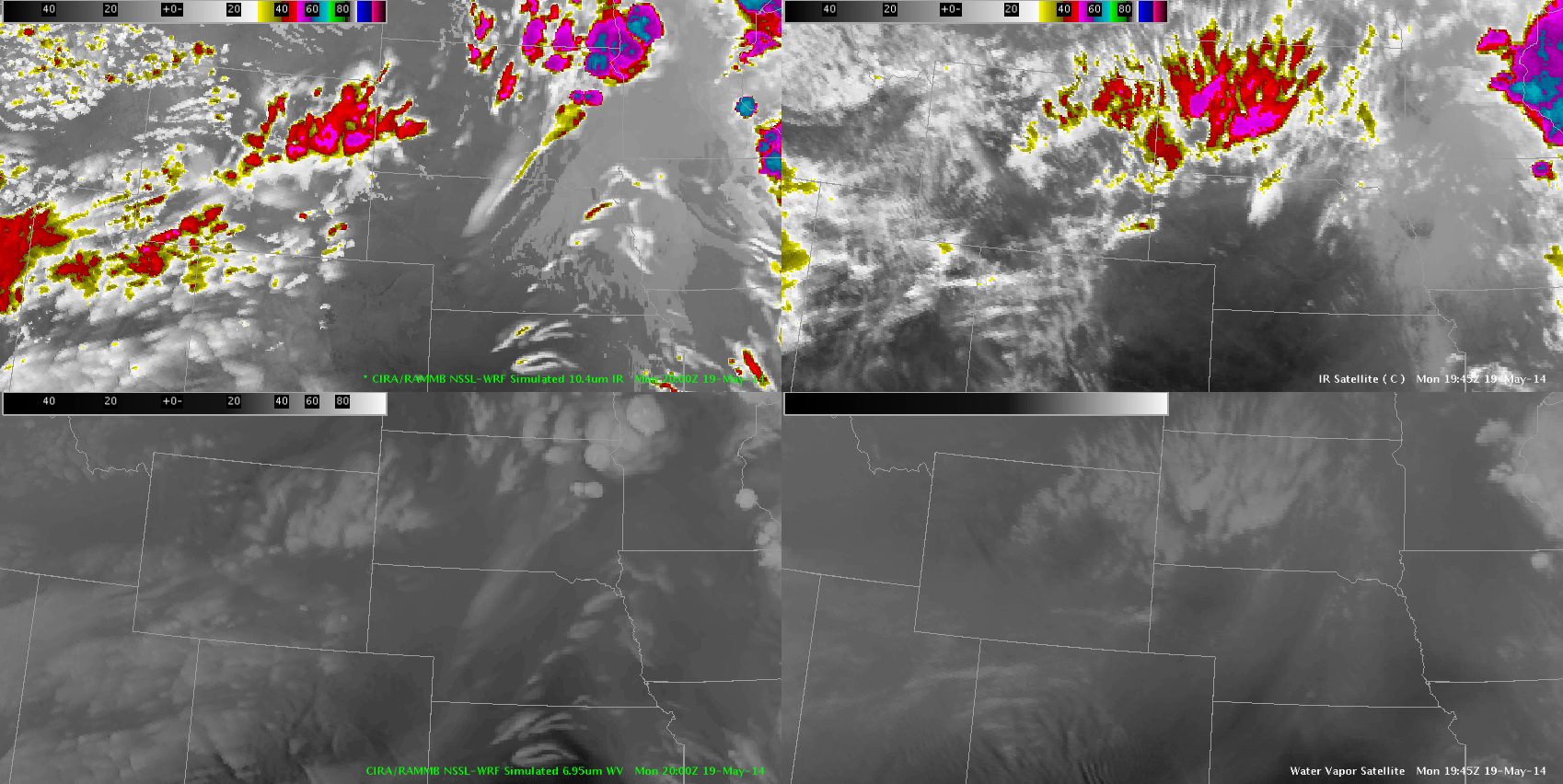
The simulated satellite imagery seems to be overdoing it just a bit so it’s not as helpful if you’re trying to assess specifics but if you can compensate by interpolating down in your mind’s eye, it is still a good product to increase situational awareness.
Linda Gilbert