Daily Summary: Week 1, Day 1

Today marked the first day of the EWP Spring Experiment in the Hazardous Weather Testbed in Norman, OK. This year, 5 NWS forecasters and 1 broadcast meteorologist will evaluate various GOES-R and JPSS algorithms, as well as Earth Networks total lightning products. Participants, working in pairs, will use the experimental products to issue area forecast discussions and severe thunderstorm/tornado warnings for their designated CWA. All of the products being demonstrated are available in AWIPS-II.

20150505_184843

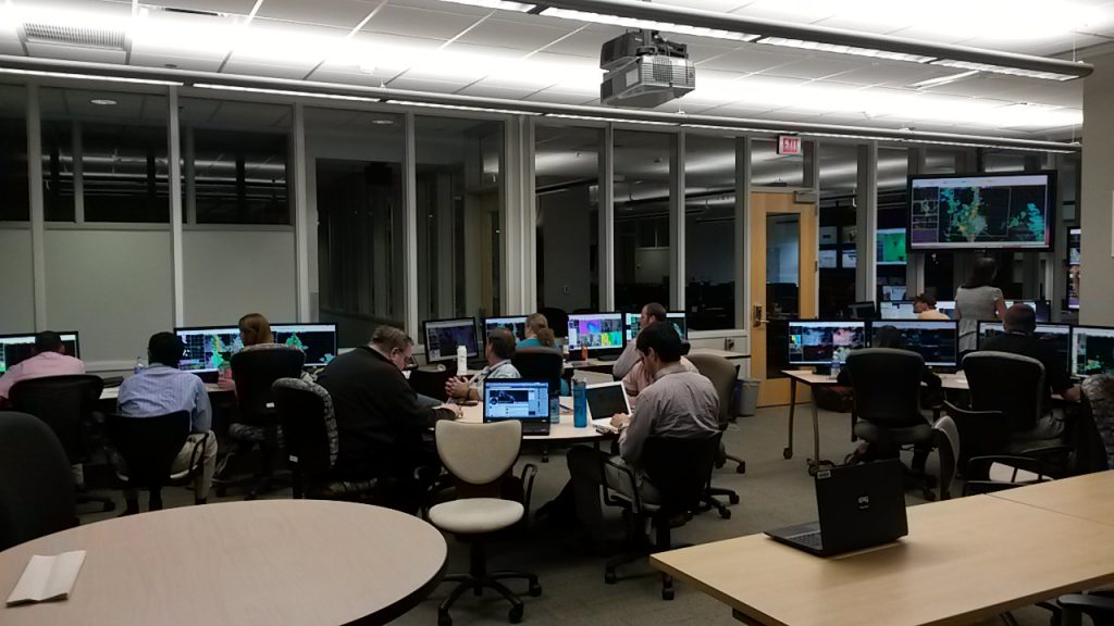
Much of the focus for the first day of the week was hands-on training for each of the products under evaluation. After some initial familiarization with AWIPS-II and procedure building, the various PI’s worked with forecasters on how to interpret the products, and what to look for during the week. Forecasters also became familiar with saving images, and posting to the blog. By the end of the day, participants had already made several informative blog posts.

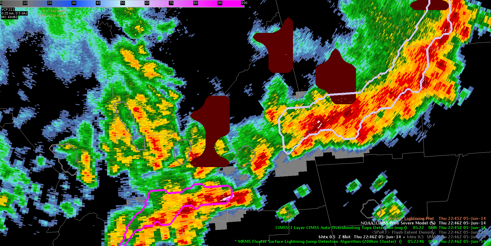
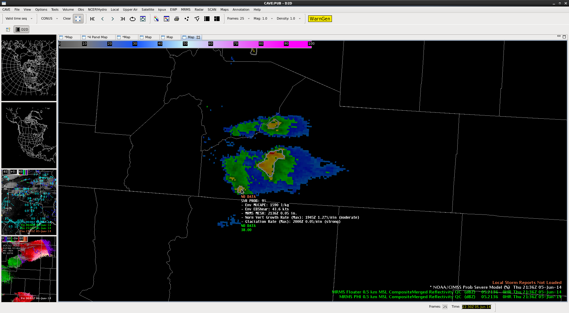
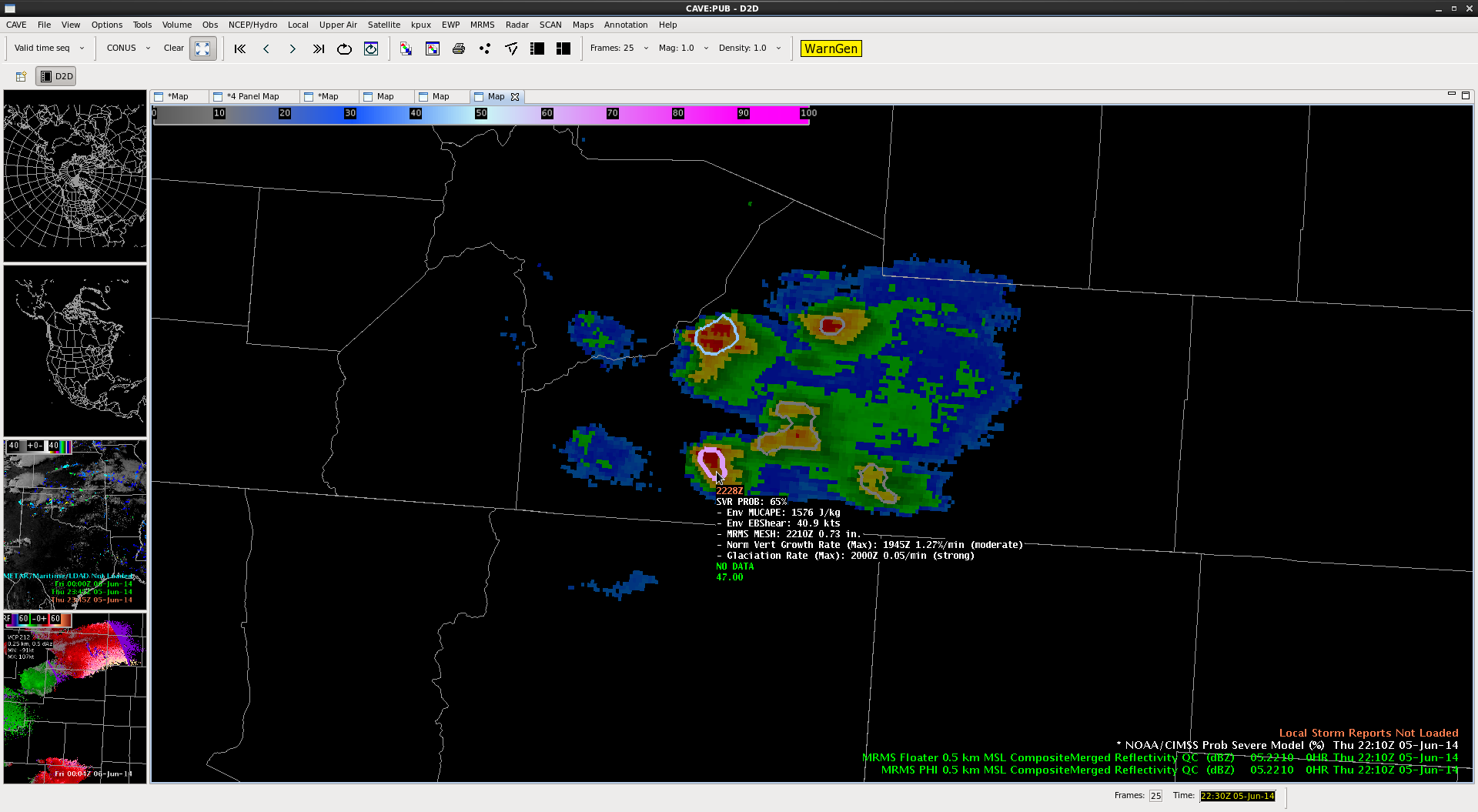
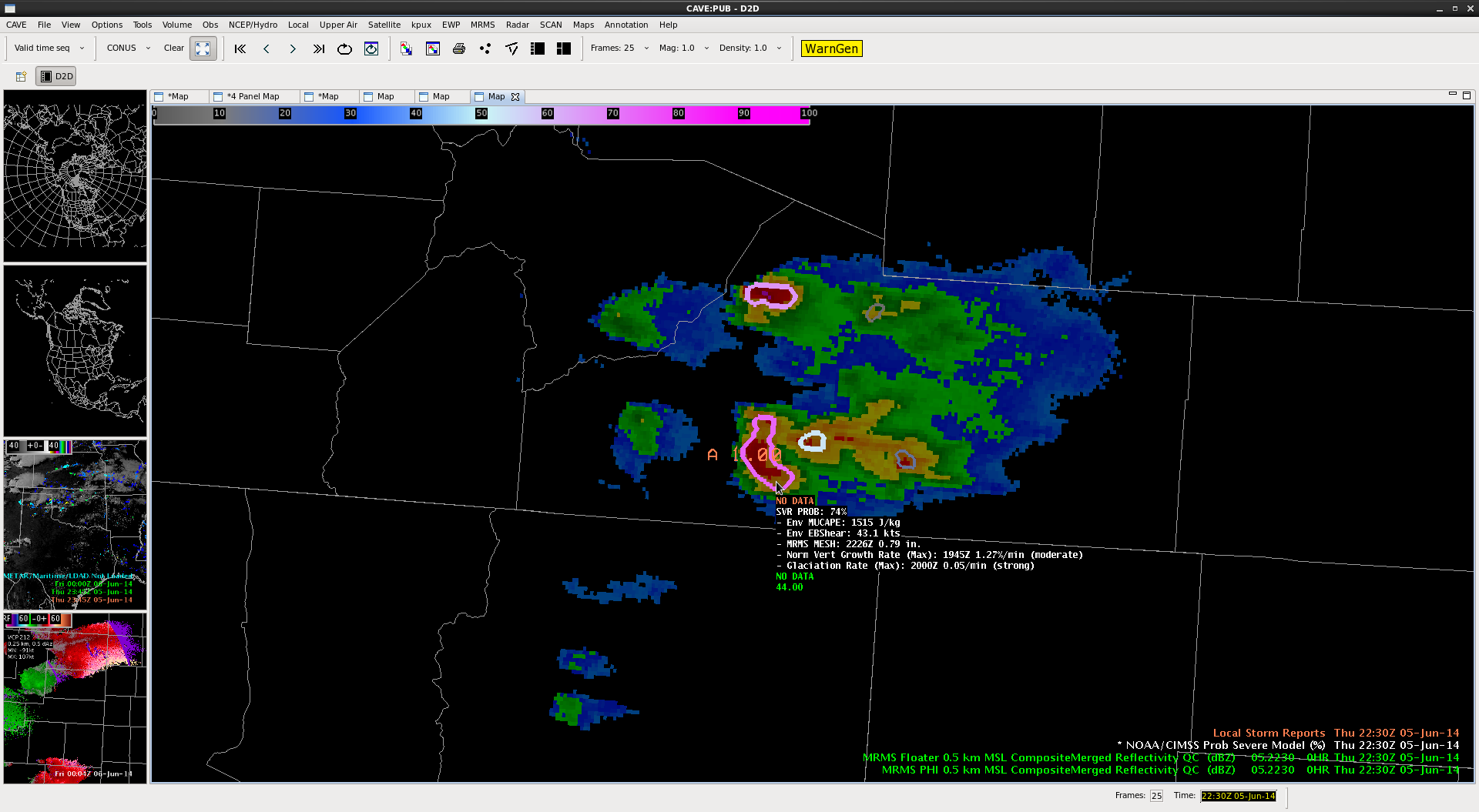
We began today’s operations in the Topeka, Omaha, and Midland CWA’s. As activity subsided in the Omaha CWA, that pair moved operations to the Wichita CWA. Participants were able to utilize all of the products today, including the PGLM total lightning from the West Texas LMA.

Tomorrow, we will start activities at 12:00 pm in the Dev Lab for the daily debrief before moving to the HWT for the 12:45 EFP briefing. Operations will likely take place in West Texas.

150504_rpts

– Bill Line, SPC/HWT Satellite Liaison and Week 1 EWP Coordinator

Tags: None

ProbSevere and S. Colorado Severe

The ProbSevere model captured the development of severe weather in southern Colorado nicely during the evening of June 5. With one cell in particular, the first probability over 50% provided 20 min lead time to the first reported severe weather (1″ hail).

The algorithm started tracking the cell at 2136 UTC giving it an initial probability of 9% (to the first severe, Fig 1). At 2210 UTC, the algorithm had its first probability over 50% with a prob of 65%, indicating the cell was more likely than not to produce severe weather (Fig 2). The first severe weather of 1″ hail was reported with this storm 20 minutes later at 2230 UTC (Fig 3). The probability had maxed out at 85% at 2216 UTC.

ps_co_1

ps_co_2

ps_co_3

– Bill Line, SPC/HWT Satellite Liaison


Tags: None

Blog 12 June 5 HSV Area Cherokee County AL

In the last post I mentioned the prob severe as not as helpful today. We now have a cell in Cherokee county ahead of the MCS that has an OT Top detect and a 4 sigma jump in lightning. Prob Severe now at 80% with strong flash density. HUN has warned and with all of these present expect severe reports. In this case it was warned because of history of these storms but all of this increases confidence in the warning and that this storm is still likely getting stronger.. was not as impressive 30 mins ago.

DSatterfield 2255Z

Cherokee AL Cell2250

Tags: None

CI tool not showing anything of real value here

060514_2215Z_cirrusCIThe CI tool is really only keying in on the developing cumulus, which is seen easily in the visible satellite imagery. Since CI doesn’t work as well at night when the visible satellite is also not useable, it doesn’t appear to be adding value here. I think that perhaps having a lower limit on the percentages that show up would be best, especially if we are worried about potential for severe storms to develop. All in all I’ve found it somewhat useless today. As far as the location of the highlighted areas with respect to the actual clouds and increased reflectivities, they are slightly displaced to the west of center. A lot of the lower values don’t even result in any enhanced reflectivities.

-KP

-D. Satterfield

Tags: None

Blog 11 June 5 HSV Area Prob Severe Evaluation

Screenshot-CAVE:HUN - D2D -1Interestingly, today the prob severe with the large MCS that produced lots of storm reports including wind gusts to over 50 knots, and enough lightning to start fires, was not that helpful. I have circled a bow echo moving into GA from AL and also a line near the HTX radar (This storm was quite severe with high winds extreme lightning). OT top detection and flash extent density and light jump all worked well and were valuable members of the severe warn decision tree.

Not the case for prob severe, which could lead the forecaster to hold off on a warning if they overvalued it. I have used prob severe all week and had growing confidence in it for storm trends etc., but this is a lesson learned to consider its limitations.


D Satterfield 2251Z 5 June 2014

Tags: None

Prob Severe Tool Fail

Below are numerous images of the Prob Severe tool doing a poor job with severe winds in the Huntsville area and it had inaccurate location placement of the Prob Severe area as well. Perhaps the Prob Severe tool is best utilized for severe hail and possibly tornadoes, but it definitely did a poor job with winds.

060514_2226Z_probSevereFail 060514_2221Z_probSvrFail  060514_2211Z_probSvrNoBueno_metar 060514_2216Z_probSvrNoBueno 060514_2211Z_proSvrNoBueno 060514_2206Z_probSvrNoBueno 060514_2156Z_svrWindProbSvr7-KP

Tags: None

Blog 10 June 5 HSV Area

Looking at the severe storms over North AL with 1km vis and OT detect overlaid.

The cell which has produced a lot of severe storm reports on the TN AL border is detected Storm near Chattooga Cty. GA (which moved out of Jackson AL) also has OT detected.

I have circled some obvious misses that are visible on the 1km vis. Storm near Boaz in Marshall AL has produced minor damage and high wind gusts and is also missed.

D Satterfield 2240Z 5 June

OT Tops hit misses*

Tags: None

Blog 9 June 5 HSV Area

Image lost do to network issues-

Have spent time tracking a cell ahead of the MCS over NE Al. Mainly in Jackson Cty. Little storm damage reports from it in-spite of lightning jump, and only a so-so reflectivity presentation. At 2130Z we do now have an OT top detection on this cell and it looks rather  impressive on vis imagery.

Did a 64 frame tracking tool analysis on the cell moving through Limestone AL and into Madison. This cluster produced 59 mph winds at KHUN and reports of lightning induced fires in Decatur area. Many reports of damage, trees down, and some building damage from strong winds. While the radar presentation was not impressive the track tool shows overshooting top detection at 2140Z with 5 sigma lightning jump at 2202Z. Flash density peaks at 2145 then diminished but then steadily rises to 60 at 2204.

Prob severe not much above 25- See post by KP for more on this. Good example here of flash extent and OT and lightning jump being a clue that this storm was severe. Radar look alone would be of little initial value, esp with no storm reports (late night hours for instance)

DSatterfield

Tags: None

Example of cirrus obscuring CI

060514_highCloudsObscureCI_exampleThis loop provides an example of how the thin high cirrus clouds from the MCS to the northwest are obscuring the CI output for the cumulus clouds over Alabama. The edge of the cirrus shield is shown in the zig zagged line within the bubble.

-KP

Tags: None